Tucker County, West Virginia
Coordinates: 39°06′N 79°34′W / 39.10°N 79.57°W
| Tucker County, West Virginia | |
|---|---|
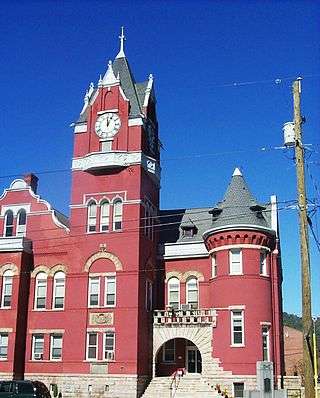 Tucker County Courthouse in Parsons | |
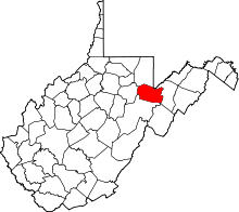 Location in the U.S. state of West Virginia | |
 West Virginia's location in the U.S. | |
| Founded | March 7, 1856 |
| Named for | Henry St. George Tucker, Sr. |
| Seat | Parsons |
| Largest city | Parsons |
| Area | |
| • Total | 421 sq mi (1,090 km2) |
| • Land | 419 sq mi (1,085 km2) |
| • Water | 2.1 sq mi (5 km2), 0.5% |
| Population (est.) | |
| • (2017) | 6,915 |
| • Density | 17/sq mi (7/km2) |
| Congressional district | 1st |
| Time zone | Eastern: UTC−5/−4 |
| Website |
www |
Tucker County is a county in the U.S. state of West Virginia. As of the 2010 census, the population was 7,141,[1] making it West Virginia's second-least populous county. Its county seat is Parsons.[2] The county was created in 1856 from a part of Randolph County, then part of Virginia. In 1871, a small part of Barbour County, was transferred to Tucker County.[3] The county was named after Henry St. George Tucker, Sr., a judge and Congressman from Williamsburg, Virginia.[4][5]
History
Tucker county was created in 1856 from a part of Randolph County, then part of Virginia. In 1861, as a result of the Wheeling Convention, Tucker County joined the rest of West Virginia in breaking away from Virginia to remain a part of the Union.
Between 1889 and 1893, a dispute known as the Tucker County Seat War took place between the people in the town of Parsons and that of St. George, over the location of the county seat. Although nobody was killed in the "war", the situation came to a climax when a mob of armed men from Parsons marched on St. George and took the county records by force.[6][7][8]
Beginning in 1907, the Babcock Lumber Company of Pittsburgh, Pennsylvania, while operating out of Davis, West Virginia, clear cut the mountain ridges throughout Tucker Country. This clear cutting, with its residual slashings, converted the landscape into a "tinderbox". By 1910, fires burned continuously — in some areas for years on end, from spring until the first snows — leaving little other than thin mineral soil and bare rock. In 1914, with the county virtually denuded of standing trees, the ground burned continually for 6 months. As a result, top soils that once produced huge timbers on the mountainsides — including the largest tree ever harvested in West Virginia, a white oak some 13 feet in diameter just 10 feet from the ground — washed down into the narrow valleys and bottom lands, which had always been too narrow for harvesting productive crops or livestock. Uncontrollable soil erosion and flooding further degraded and depopulated the region. To this day, Tucker County and surrounding regions bear the scars of this remarkable conflagration.[9]
Geography
According to the U.S. Census Bureau, the county has a total area of 421 square miles (1,090 km2), of which 419 square miles (1,090 km2) is land and 2.1 square miles (5.4 km2) (0.5%) is water.[10]
Major highways


WV 48
Adjacent counties
- Preston County (north)
- Garrett County, Maryland (northeast)
- Grant County (east)
- Randolph County (south)
- Barbour County (west)
State protected areas
National protected areas
- Big Run Bog
- Canaan Valley
- Canaan Valley National Wildlife Refuge U.S. Fish and Wildlife Service web site
- Dolly Sods Wilderness U.S. Forest Service web site
- Fernow Experimental Forest U.S. Department of Agriculture web site
- Fisher Spring Run Bog
- Monongahela National Forest U.S. Forest Service web site
Demographics
| Historical population | |||
|---|---|---|---|
| Census | Pop. | %± | |
| 1860 | 1,428 | — | |
| 1870 | 1,907 | 33.5% | |
| 1880 | 3,151 | 65.2% | |
| 1890 | 6,459 | 105.0% | |
| 1900 | 13,433 | 108.0% | |
| 1910 | 18,675 | 39.0% | |
| 1920 | 16,791 | −10.1% | |
| 1930 | 13,374 | −20.4% | |
| 1940 | 13,173 | −1.5% | |
| 1950 | 10,600 | −19.5% | |
| 1960 | 7,750 | −26.9% | |
| 1970 | 7,447 | −3.9% | |
| 1980 | 8,675 | 16.5% | |
| 1990 | 7,728 | −10.9% | |
| 2000 | 7,231 | −6.4% | |
| 2010 | 7,141 | −1.2% | |
| Est. 2017 | 6,915 | [11] | −3.2% |
| U.S. Decennial Census[12] 1790–1960[13] 1900–1990[14] 1990–2000[15] 2010–2015[1] | |||
2000 census
As of the census[16] of 2000, there were 7,321 people, 3,052 households, and 2,121 families residing in the county. The population density was 18 people per square mile (7/km²). There were 4,634 housing units at an average density of 11 per square mile (4/km²). The racial makeup of the county was 98.85% White, 0.07% Black or African American, 0.19% Native American, 0.01% Asian, 0.12% Pacific Islander, 0.10% from other races, and 0.66% from two or more races. 0.25% of the population were Hispanic or Latino of any race.
There were 3,052 households out of which 27.00% had children under the age of 18 living with them, 58.00% were married couples living together, 7.80% had a female householder with no husband present, and 30.50% were non-families. 27.20% of all households were made up of individuals and 13.60% had someone living alone who was 65 years of age or older. The average household size was 2.35 and the average family size was 2.84.
In the county, the population was spread out with 21.30% under the age of 18, 6.70% from 18 to 24, 26.40% from 25 to 44, 27.70% from 45 to 64, and 17.90% who were 65 years of age or older. The median age was 42 years. For every 100 females there were 95.20 males. For every 100 females age 18 and over, there were 94.10 males.
The median income for a household in the county was $26,250, and the median income for a family was $32,574. Males had a median income of $24,149 versus $17,642 for females. The per capita income for the county was $16,349. About 14.90% of families and 18.10% of the population were below the poverty line, including 24.30% of those under age 18 and 15.50% of those age 65 or over.
2010 census
As of the 2010 United States Census, there were 7,141 people, 3,057 households, and 2,052 families residing in the county.[17] The population density was 17.0 inhabitants per square mile (6.6/km2). There were 5,346 housing units at an average density of 12.8 per square mile (4.9/km2).[18] The racial makeup of the county was 98.7% white, 0.2% American Indian, 0.2% black or African American, 0.1% Asian, 0.1% from other races, and 0.6% from two or more races. Those of Hispanic or Latino origin made up 0.6% of the population.[17] In terms of ancestry, 30.3% were German, 15.7% were Irish, 8.1% were American, 7.9% were English, and 5.8% were Dutch.[19]
Of the 3,057 households, 25.3% had children under the age of 18 living with them, 55.1% were married couples living together, 7.5% had a female householder with no husband present, 32.9% were non-families, and 28.3% of all households were made up of individuals. The average household size was 2.29 and the average family size was 2.77. The median age was 46.3 years.[17]
The median income for a household in the county was $32,712 and the median income for a family was $43,307. Males had a median income of $34,321 versus $22,938 for females. The per capita income for the county was $20,020. About 12.9% of families and 17.7% of the population were below the poverty line, including 20.3% of those under age 18 and 20.7% of those age 65 or over.[20]
Politics
Tucker County was divided at the time of the Virginia Secession Convention,[21] and has been a consistent statewide bellwether since, voting for the winner of West Virginia in every election since the state's formation except that of 1912 when it voted for Theodore Roosevelt.[22]
| Year | Republican | Democratic | Third parties |
|---|---|---|---|
| 2016 | 73.3% 2,565 | 21.5% 751 | 5.3% 185 |
| 2012 | 69.3% 2,176 | 28.0% 880 | 2.6% 82 |
| 2008 | 60.5% 2,123 | 36.7% 1,288 | 2.7% 96 |
| 2004 | 60.5% 2,179 | 38.9% 1,400 | 0.6% 21 |
| 2000 | 57.8% 1,935 | 39.4% 1,319 | 2.8% 92 |
| 1996 | 36.8% 1,217 | 49.8% 1,649 | 13.5% 446 |
| 1992 | 34.8% 1,261 | 49.8% 1,805 | 15.4% 559 |
| 1988 | 47.5% 1,699 | 52.3% 1,869 | 0.3% 9 |
| 1984 | 55.8% 2,240 | 44.0% 1,766 | 0.2% 8 |
| 1980 | 46.6% 1,798 | 48.3% 1,862 | 5.1% 195 |
| 1976 | 37.5% 1,396 | 62.5% 2,323 | |
| 1972 | 59.8% 2,163 | 40.3% 1,457 | |
| 1968 | 42.0% 1,511 | 48.8% 1,758 | 9.2% 332 |
| 1964 | 33.0% 1,314 | 67.0% 2,664 | |
| 1960 | 47.5% 1,887 | 52.6% 2,090 | |
| 1956 | 52.2% 2,326 | 47.8% 2,129 | |
| 1952 | 46.5% 2,235 | 53.6% 2,577 | |
| 1948 | 44.8% 2,102 | 54.5% 2,557 | 0.7% 34 |
| 1944 | 45.4% 2,220 | 54.6% 2,673 | |
| 1940 | 44.3% 2,654 | 55.7% 3,332 | |
| 1936 | 37.9% 2,335 | 61.6% 3,801 | 0.5% 33 |
| 1932 | 39.7% 2,204 | 58.5% 3,244 | 1.8% 102 |
| 1928 | 51.8% 2,525 | 46.5% 2,263 | 1.7% 84 |
| 1924 | 45.6% 2,277 | 42.6% 2,127 | 11.8% 588 |
| 1920 | 53.3% 2,498 | 41.9% 1,961 | 4.8% 224 |
| 1916 | 49.8% 1,531 | 45.1% 1,388 | 5.1% 158 |
| 1912 | 16.7% 548 | 37.2% 1,221 | 46.2% 1,518 |
Communities
Cities
Towns
Census-designated place
Unincorporated communities
Notable people
- Amerigio "Tony" Tonelli - Shunned because of his Italian heritage by the WVU football program Tonelli became a three time letterman for the USC Trojans.[24] In his final season Tonelli blocked a punt deep in Duke territory that led to the winning touchdown in the 1939 Rose Bowl.[25] The first player ever drafted out of USC he played an entire season for the Detroit Lions in 1939.[26][27] Picked up nickname, "Two Ton" Tonelli, while growing up in Thomas, WV.
See also
References
Specific
- 1 2 "State & County QuickFacts". United States Census Bureau. Retrieved January 11, 2014.
- ↑ "Find a County". National Association of Counties. Retrieved 2011-06-07.
- ↑ Tucker County WVGenWeb Page, accessed August 25, 2006.
- ↑ West Virginia Division of Culture and History - Tucker County History web page, accessed August 25, 2006 Archived February 20, 2010, at the Wayback Machine.
- ↑ Origins of West Virginia Place Names web site, accessed August 25, 2006. Archived February 24, 2008, at the Wayback Machine.
- ↑ "Tucker County History - The Tucker County Seat". Retrieved 2014-04-11.
- ↑ "Living Places - Tucker County Courthouse and Jail". Retrieved 2014-04-11.
- ↑ http://www.wvculture.org/history/thisdayinwvhistory/0801.html
- ↑ Brooks, Maurice (1965), The Appalachians (Series: The Naturalist's America), Illustrated by Lois Darling and Lo Brooks, Boston: Houghton Mifflin Company, pp 127-128.
- ↑ "2010 Census Gazetteer Files". United States Census Bureau. August 22, 2012. Retrieved July 31, 2015.
- ↑ "Population and Housing Unit Estimates". Retrieved Apr 7, 2018.
- ↑ "U.S. Decennial Census". United States Census Bureau. Retrieved January 11, 2014.
- ↑ "Historical Census Browser". University of Virginia Library. Retrieved January 11, 2014.
- ↑ "Population of Counties by Decennial Census: 1900 to 1990". United States Census Bureau. Retrieved January 11, 2014.
- ↑ "Census 2000 PHC-T-4. Ranking Tables for Counties: 1990 and 2000" (PDF). United States Census Bureau. Retrieved January 11, 2014.
- ↑ "American FactFinder". United States Census Bureau. Retrieved 2011-05-14.
- 1 2 3 "DP-1 Profile of General Population and Housing Characteristics: 2010 Demographic Profile Data". United States Census Bureau. Retrieved 2016-04-03.
- ↑ "Population, Housing Units, Area, and Density: 2010 - County". United States Census Bureau. Retrieved 2016-04-03.
- ↑ "DP02 SELECTED SOCIAL CHARACTERISTICS IN THE UNITED STATES – 2006-2010 American Community Survey 5-Year Estimates". United States Census Bureau. Retrieved 2016-04-03.
- ↑ "DP03 SELECTED ECONOMIC CHARACTERISTICS – 2006-2010 American Community Survey 5-Year Estimates". United States Census Bureau. Retrieved 2016-04-03.
- ↑ Hinkle, Harlan H.; Grayback Mountaineers: The Confederate Face Of Western Virginia, p. 203 ISBN 0595268404
- ↑ Menendez, Albert J.; The Geography of Presidential Elections in the United States, 1868-2004, pp. 334-337 ISBN 0786422173
- ↑ Leip, David. "Dave Leip's Atlas of U.S. Presidential Elections". uselectionatlas.org. Retrieved 2018-03-28.
- ↑ USC Football Program http://www.usctrojans.com/sports/m-footbl/archive/usc-m-fb-a-lett-tuv.html
- ↑ "Former Trojan Tony Tonelli Dies". Los Angeles Times. February 1, 1987.
- ↑ http://dailytrojan.com/2012/02/22/trojans-annually-dominate-nfl-draft/
- ↑ https://www.pro-football-reference.com/players/T/ToneTo20.htm
General
- Fansler, Homer Floyd (1962), History of Tucker County, West Virginia, Parsons, West Virginia: McClain Printing Company.
- Maxwell, Hu, History of Tucker County, West Virginia, from the Earliest Explorations and Settlements to the Present Time; with Biographical Sketches of more than Two Hundred and Fifty of the Leading Men, and a Full Appendix of Official and Electoral History; Also, an Account of the Rivers, Forests and Caves of the County, Preston Publishing Company: Kingwood, West Virginia, 1884. (Reprinted by McClain Printing Company, Parsons, W.Va., 1971 and 1993.)
External links

Places adjacent to Tucker County, West Virginia | ||||||||||
|---|---|---|---|---|---|---|---|---|---|---|
| ||||||||||
Municipalities and communities of Tucker County, West Virginia, United States | ||
|---|---|---|
| Cities | | |
| Towns | ||
| Unincorporated communities | ||
| Ghost towns | ||
