Ravenswood, West Virginia
| Ravenswood, West Virginia | |
|---|---|
| City | |
 Intersection of Washington and Walnut Streets | |
| Nickname(s): Red Devils | |
 Location of Ravenswood in Jackson County, West Virginia. | |
| Coordinates: 38°57′11″N 81°45′41″W / 38.95306°N 81.76139°WCoordinates: 38°57′11″N 81°45′41″W / 38.95306°N 81.76139°W | |
| Country | United States |
| State | West Virginia |
| County | Jackson |
| Government | |
| • Mayor | Joshua Miller |
| Area[1] | |
| • Total | 1.90 sq mi (4.92 km2) |
| • Land | 1.83 sq mi (4.74 km2) |
| • Water | 0.07 sq mi (0.18 km2) |
| Elevation | 607 ft (185 m) |
| Population (2010)[2] | |
| • Total | 3,876 |
| • Estimate (2016)[3] | 3,825 |
| • Density | 2,118.0/sq mi (817.8/km2) |
| Time zone | UTC-5 (Eastern (EST)) |
| • Summer (DST) | UTC-4 (EDT) |
| ZIP code | 26164 |
| Area code(s) | 304 |
| FIPS code | 54-67108[4] |
| GNIS feature ID | 1555445[5] |
| Website |
cityofravenswood |
| Colors are Red, Black, and White | |

Ravenswood is a city in Jackson County, West Virginia, United States, along the Ohio River. The population was 3,876 at the 2010 census.
Geography
Ravenswood is located at 38°57′11″N 81°45′41″W / 38.95306°N 81.76139°W (38.952922, -81.761357),[6] along the Ohio River at the mouth of Sandy Creek.[7]
According to the United States Census Bureau, the city has a total area of 1.90 square miles (4.92 km2), of which, 1.83 square miles (4.74 km2) is land and 0.07 square miles (0.18 km2) is water.[1]
Demographics
| Historical population | |||
|---|---|---|---|
| Census | Pop. | %± | |
| 1870 | 362 | — | |
| 1880 | 681 | 88.1% | |
| 1890 | 817 | 20.0% | |
| 1900 | 1,074 | 31.5% | |
| 1910 | 1,081 | 0.7% | |
| 1920 | 1,284 | 18.8% | |
| 1930 | 1,189 | −7.4% | |
| 1940 | 1,061 | −10.8% | |
| 1950 | 1,175 | 10.7% | |
| 1960 | 3,410 | 190.2% | |
| 1970 | 4,240 | 24.3% | |
| 1980 | 4,126 | −2.7% | |
| 1990 | 4,189 | 1.5% | |
| 2000 | 4,031 | −3.8% | |
| 2010 | 3,876 | −3.8% | |
| Est. 2016 | 3,825 | [3] | −1.3% |
| U.S. Decennial Census[8] | |||
2010 census
As of the census[2] of 2010, there were 3,876 people, 1,657 households, and 1,061 families residing in the city. The population density was 2,118.0 inhabitants per square mile (817.8/km2). There were 1,807 housing units at an average density of 987.4 per square mile (381.2/km2). The racial makeup of the city was 97.4% White, 0.2% African American, 0.1% Native American, 0.7% Asian, 0.2% from other races, and 1.3% from two or more races. Hispanic or Latino of any race were 1.0% of the population.
There were 1,657 households of which 29.3% had children under the age of 18 living with them, 45.7% were married couples living together, 14.3% had a female householder with no husband present, 4.0% had a male householder with no wife present, and 36.0% were non-families. 32.0% of all households were made up of individuals and 17.8% had someone living alone who was 65 years of age or older. The average household size was 2.30 and the average family size was 2.90.
The median age in the city was 42.4 years. 23% of residents were under the age of 18; 8.4% were between the ages of 18 and 24; 21.4% were from 25 to 44; 23.9% were from 45 to 64; and 23.1% were 65 years of age or older. The gender makeup of the city was 46.6% male and 53.4% female.
2000 census
As of the census[4] of 2000, there were 4,031 people, 1,692 households, and 1,135 families residing in the city. The population density was 2,190.1 people per square mile (845.9/km²). There were 1,832 housing units at an average density of 995.4 per square mile (384.4/km²). The racial makeup of the city was 98.04% White, 0.25% African American, 0.05% Native American, 0.74% Asian, 0.15% from other races, and 0.77% from two or more races. Hispanic or Latino of any race were 0.60% of the population.
There were 1,692 households out of which 29.3% had children under the age of 18 living with them, 52.5% were married couples living together, 12.4% had a female householder with no husband present, and 32.9% were non-families. 30.4% of all households were made up of individuals and 15.1% had someone living alone who was 65 years of age or older. The average household size was 2.29 and the average family size was 2.83.
In the city, the population was spread out with 23.6% under the age of 18, 6.6% from 18 to 24, 23.5% from 25 to 44, 22.7% from 45 to 64, and 23.5% who were 65 years of age or older. The median age was 42 years. For every 100 females, there were 84.2 males. For every 100 females age 18 and over, there were 77.1 males.
The median income for a household in the city was $30,308, and the median income for a family was $37,416. Males had a median income of $34,417 versus $21,134 for females. The per capita income for the city was $15,696. About 15.4% of families and 17.6% of the population were below the poverty line, including 26.4% of those under age 18 and 9.7% of those age 65 or over.
Education
Primary and secondary public education is provided by Jackson County Schools. Ravenswood public schools include Henry J. Kaiser Elementary School (Grades K-2), Ravenswood Grade School (Grades 3-5), Ravenswood Middle School (Grades 6-8), and Ravenswood High School (9-12). Ravenswood Grade School is located about 1-1/2 miles outside of the town limits. The other schools are located within the town boundaries. The official mascot of Ravenswood High School is the Red Devil. Lower level schools are referred to as Demons.[9] Private school education is provided by the Heritage Christian Academy (Grades K-12).[10]
History
Ravenswood is sited on land once owned by George Washington. Washington acquired the 2,448-acre (10 km2) parcel in 1770, and designated Colonel William Crawford to survey the lands in 1771. A permanent settlement was first established in 1810, and the town streets and lots were laid out in their current pattern by descendants of George Washington in 1835.[11]
When Kaiser Aluminum planned a new facility with 12,000 workers, Bill Finley was hired planned "Company Town" of 25,000. He went on to become a planner with the National Capital Planning Commission, and develop the community of Columbia, Maryland for the Rouse Company.[12] The Kaiser facility is now owned by Constellium and Century Aluminum.[13]
In February 2010, USA Today referred to Ravenswood as "teetering on a ghost town" (1). Mayor Lucy Harbert responded by bringing in sponsorships from several Silicon Valley-based companies like ScanCafe.com and StartUps.com (2). On March 26, 2010, Mike Ruben, a reporter with the State Journal newspaper, announced that Ravenswood was "transforming" the town into "Aluminum City, U.S.A." to help attract local tourism revenue: "L.A. Promoter Plans to Market 'Aluminum City'." Unfortunately, none of these developments came to fruition.
Other significant dates
- 1840 First Election held in the home of Bartholomew Fleming.[14]
- 1852 Ravenswood incorporated in the state of Virginia.
- 1863 Ravenswood becomes part of West Virginia when a proclamation by President Abraham Lincoln admits West Virginia to the Union.
- 1863 The Battle of Buffington Island, the only major battle of the American Civil War fought in Ohio, takes place one mile (1.6 km) north of Ravenswood.[15]
- 1886 The Ohio River Rail Road reaches Ravenswood.[16]
- 1892 The Ravenswood, Spencer and Glenville Railroad is completed to Spencer.
- 1931 Opening of the Ravenswood Glass Novelty Company ("The Marble Factory").[17]
- 1957 Henry J. Kaiser opens the world's largest aluminum refinery six miles south of Ravenswood.[11]
- 1960 Presidential Candidate John F. Kennedy visits Ravenswood during the Primary Election campaign.
- 1964 The Ravenswood exit of Interstate 77 opens
- 1990 Robert L. Dittmar, resident and former mayor of Ravenswood, gets elected to West Virginia state senate.
History museum
- Washington's Lands Museum[18]
- (Operated by the Jackson County Historical Society)
Climate
The climate in this area is characterized by relatively high temperatures and evenly distributed precipitation throughout the year. According to the Köppen Climate Classification system, Ravenswood has a Humid subtropical climate, abbreviated "Cfa" on climate maps.[19]
| Climate data for Ravenswood, West Virginia | |||||||||||||
|---|---|---|---|---|---|---|---|---|---|---|---|---|---|
| Month | Jan | Feb | Mar | Apr | May | Jun | Jul | Aug | Sep | Oct | Nov | Dec | Year |
| Average high °C (°F) | 7 (44) |
8 (47) |
13 (56) |
20 (68) |
25 (77) |
29 (84) |
31 (87) |
30 (86) |
27 (81) |
22 (71) |
14 (57) |
9 (48) |
19 (67) |
| Average low °C (°F) | −4 (24) |
−4 (25) |
0 (32) |
5 (41) |
10 (50) |
14 (58) |
17 (62) |
16 (61) |
13 (55) |
6 (43) |
1 (34) |
−3 (27) |
6 (43) |
| Average precipitation mm (inches) | 84 (3.3) |
71 (2.8) |
94 (3.7) |
81 (3.2) |
91 (3.6) |
94 (3.7) |
112 (4.4) |
91 (3.6) |
69 (2.7) |
64 (2.5) |
69 (2.7) |
80 (3) |
998 (39.3) |
| Source: Weatherbase [20] | |||||||||||||
Place name lore
Two differing stories tell of the naming of Ravenswood. One story tells that the town was originally named Ravensworth, after the English relatives of a founding family. But somewhere between the Ohio River wilderness and the mapmaker in Richmond, the name was changed to Ravenswood. The second story says that Henrietta Fitzhugh, wife of one of the town founders, Henry Fitzhugh, named the town after the hero in Walter Scott's novel The Bride of Lammermoor (1819).[14]
See also
References
- 1 2 "US Gazetteer files 2010". United States Census Bureau. Archived from the original on 2012-01-24. Retrieved 2013-01-24.
- 1 2 "American FactFinder". United States Census Bureau. Retrieved 2013-01-24.
- 1 2 "Population and Housing Unit Estimates". Retrieved June 9, 2017.
- 1 2 "American FactFinder". United States Census Bureau. Retrieved 2008-01-31.
- ↑ "US Board on Geographic Names". United States Geological Survey. 2007-10-25. Retrieved 2008-01-31.
- ↑ "US Gazetteer files: 2010, 2000, and 1990". United States Census Bureau. 2011-02-12. Retrieved 2011-04-23.
- ↑ West Virginia Atlas & Gazetteer. Yarmouth, Me.: DeLorme. 1997. p. 33. ISBN 0-89933-246-3.
- ↑ "Census of Population and Housing". Census.gov. Retrieved June 4, 2015.
- ↑ Jackson County Schools web site, retrieved November 30, 2006
- ↑ Private School Report web site, Ravenswood web page, retrieved on December 20, 2006
- 1 2 City of Ravenswood web site, retrieved November 30, 2006.
- ↑ Joseph Rocco Mitchell, David L. Stebenne. New City Upon a Hill. p. 66.
- ↑ "Ravenswood deals with open plant, closed plant". Charleston Gazette-Mail. Retrieved 2016-08-02.
- 1 2 House, John A, "Pioneers of Jackson County", unpublished, retrieved November 30, 2006
- ↑ Buffington Island Battle Summary, American Battlefield Protection Program, National Park Service, retrieved November 30, 2006
- ↑ Mountain State Rails website, B&O page, retrieved November 30, 2006.
- ↑ The Marble Museum web site, Ravenswood Glass Novelty web page, retrieved November 30, 2006.
- ↑ Museums of West Virginia web site, retrieved November 30, 2006.
- ↑ Climate Summary for Ravenswood, West Virginia
- ↑ "Weatherbase.com". Weatherbase. 2013. Retrieved on September 13, 2013.
External links
Municipalities and communities of Jackson County, West Virginia, United States | ||
|---|---|---|
| Cities | 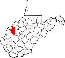 | |
| Unincorporated communities |
| |
| Ghost towns | ||
| Footnotes | ‡This populated place also has portions in an adjacent county or counties | |