Greenbrier County, West Virginia
| Greenbrier County, West Virginia | ||
|---|---|---|
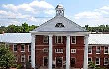 Greenbrier County Courthouse in Lewisburg | ||
| ||
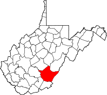 Location in the U.S. state of West Virginia | ||
 West Virginia's location in the U.S. | ||
| Founded | October 20, 1778 | |
| Seat | Lewisburg | |
| Largest city | Lewisburg | |
| Area | ||
| • Total | 1,025 sq mi (2,655 km2) | |
| • Land | 1,020 sq mi (2,642 km2) | |
| • Water | 4.9 sq mi (13 km2), 0.5% | |
| Population (est.) | ||
| • (2015) | 35,516 | |
| • Density | 35/sq mi (14/km2) | |
| Congressional district | 3rd | |
| Time zone | Eastern: UTC−5/−4 | |
| Website |
www | |

Greenbrier County (/ˈɡriːnbraɪ.ər/) is a county in the U.S. state of West Virginia. As of the 2010 census, the population was 35,480.[1] Its county seat is Lewisburg.[2] The county was formed in 1778 from Botetourt and Montgomery counties in Virginia.[3][4]
History
Prior to the arrival of European-American settlers around 1740, Greenbrier County, like most of West Virginia, was used as a hunting ground by the Shawnee and Cherokee nations. They called this land Can-tuc-kee.
Shawnee leaders, including Pucksinwah and later his son Tecumseh, were alarmed by the arrival of the European settlers, who by 1771 had set up extensive trade in the area. The day books of early merchants Sampson and George Mathews recorded sales to the Shawnee that included such luxury items as silk, hats, silver, and tailor-made suits.[5] Shawnee leaders feared the loss of their hunting lands, which were vital to their survival. They believed the white settlers would continue to encroach on their territory downriver on the Ohio.
Confrontations, sometimes, violent, increased between the Native Americans and settlers. In 1774, the Earl of Dunmore, then governor of the colonies of New York and Virginia, decided to raise an army of 3,000 men to attack the Shawnees in their homeland in present-day Ohio. Half of these men were inducted at Fort Pitt, while the other half assembled at Fort Union under the command of General Andrew Lewis. The town of present-day Lewisburg developed around the fort and was named for that commander. By early October of that year, Lewis' force had marched downstream to the mouth of the Kanawha River. They fought the Battle of Point Pleasant against a Shawnee force led by Hokoleskwa, also known as Cornstalk. This site later developed as the town of Point Pleasant, West Virginia.
European settlers were subjected to a number of raids by Native Americans during the colonial period, including a raid on Fort Randolph and later on Fort Donnally, then inhabited by 25 men and 60 women and children. One of the heroic defenders of Fort Donnally was an African American slave named Dick Pointer. Pointer, said to have been nearly 7 feet (2.1 m) tall, defended the log door with Philip Hamman, giving the settlers enough time to awaken and defend themselves. Pointer later addressed the Virginia General Assembly and gave a moving appeal that "in the decline of life" he requested to be freed for his defense of Fort Donnally. Historic accounts differ as to whether the legislature granted his wish. His grave is marked beside Carnegie Hall in the county seat of Lewisburg, and a historical marker stands prominently in the midst of the Lewisburg Cemetery. Pointer’s gun is on permanent display at The Greenbrier Historical Society and John A. North House Museum in Lewisburg.
During the secession crisis of 1861 Greenbrier citizens chose Samuel Price as their delegate to the Richmond convention. On April 17, 1861, the day Virginia's secession ordinance was passed he voted against it, but later changed his mind and signed the official document.[6] When the public vote on the secession ordinance was held on May 23, 1861, Greenbrier county voted 1,000 to 100 in favor of secession.[7] The Civil War came to the county in mid 1861, and several battles were fought in the area, including Lewisburg in May 1862 and White Sulphur Springs in August 1863. Both battles were Union victories. Greenbrier County became part of the new state of West Virginia although it never participated in any of the votes held by the Restored Government in Wheeling. During the war approximately 2,000 men from Greenbrier county joined the Confederate army.[8]
What is claimed to be the oldest golf course in the United States was founded in 1884 just north of White Sulphur Springs by the Montague family.
During the decade prior to World War II, several Civilian Conservation Corps (CCC) camps were located along the Greenbrier River.
For most of the 20th century, the Meadow River Lumber Company operated the world's largest hardwood sawmill in Rainelle.
During World War II The Greenbrier hotel was used as a military hospital. Sections were used as an internment center for Axis diplomats who were stranded in the United States during the war. When the war ended, the military returned the hotel to private control, and it re-opened as a hotel. During the years of the Cold War, a large underground bunker was built beneath a section of new construction at the hotel, to serve as a secret Congressional refuge in case of nuclear attack. It was one of the sites to be used as part of the United States Continuity of Operations Plan. After it was reported in a 1992 article, following the fall of the Soviet Union, the US government decommissioned it as a government site.
In the June 2016 floods that affected the state of West Virginia, Greenbrier County suffered 16 casualties, the most of any county. [9]
Geography
According to the U.S. Census Bureau, the county has a total area of 1,025 square miles (2,650 km2), of which 1,020 square miles (2,600 km2) is land and 4.9 square miles (13 km2) (0.5%) is water.[10] It is the second-largest county in West Virginia by area.
Much of the area of the northern and western parts of the county is either public (Monongahela National Forest), coal land, or private forest, owned by companies such as MeadWestvaco and CSX.
In 2005, Invenergy, LLC of Chicago Illinois announced plans to build the $300 million, 124-turbine Beech Ridge Wind Farm along the tops of several Greenbrier County mountains. The wind farm would produce 186 megawatts of electricity. Development, which was originally expected to begin in late 2007, was stalled when the state Supreme Court agreed to hear the case brought by opponents of the project.[11] Ultimately, The Supreme Court ruled in favor of the developers, clearing the way for construction to begin in the summer of 2009. However, in July of that year, a U.S. District Court in Maryland agreed to hear a case filed by opponents.[12]
Adjacent counties
- Webster County (north)
- Pocahontas County (northeast)
- Bath County, Virginia (east)
- Alleghany County, Virginia (southeast)
- Monroe County (south)
- Summers County (southwest)
- Fayette County (west)
- Nicholas County (northwest)
National protected areas
- Lost World Caverns
- Monongahela National Forest (part)
- Organ Cave System
- Greenbrier State Forest
- Washington/Jefferson National Forest (WV/VA Line)
Demographics
| Historical population | |||
|---|---|---|---|
| Census | Pop. | %± | |
| 1790 | 6,015 | — | |
| 1800 | 4,345 | −27.8% | |
| 1810 | 5,914 | 36.1% | |
| 1820 | 7,041 | 19.1% | |
| 1830 | 9,006 | 27.9% | |
| 1840 | 8,695 | −3.5% | |
| 1850 | 10,022 | 15.3% | |
| 1860 | 12,211 | 21.8% | |
| 1870 | 11,417 | −6.5% | |
| 1880 | 15,060 | 31.9% | |
| 1890 | 18,034 | 19.7% | |
| 1900 | 20,683 | 14.7% | |
| 1910 | 24,833 | 20.1% | |
| 1920 | 26,242 | 5.7% | |
| 1930 | 35,878 | 36.7% | |
| 1940 | 38,520 | 7.4% | |
| 1950 | 39,295 | 2.0% | |
| 1960 | 34,446 | −12.3% | |
| 1970 | 32,090 | −6.8% | |
| 1980 | 37,665 | 17.4% | |
| 1990 | 34,693 | −7.9% | |
| 2000 | 34,453 | −0.7% | |
| 2010 | 35,480 | 3.0% | |
| Est. 2016 | 35,279 | [13] | −0.6% |
| U.S. Decennial Census[14] 1790–1960[15] 1900–1990[16] 1990–2000[17] 2010–2015[1] | |||
2000 census
As of the census[18] of 2000, there were 34,453 people, 14,571 households, and 9,922 families residing in the county. The population density was 34 people per square mile (13/km²). There were 17,644 housing units at an average density of 17 per square mile (7/km²). The racial makeup of the county was 95.23% White, 3.04% Black or African American, 0.34% Native American, 0.19% Asian, 0.01% Pacific Islander, 0.15% from other races, and 1.04% from two or more races. 0.68% of the population were Hispanic or Latino of any race.
There were 14,571 households out of which 27.60% had children under the age of 18 living with them, 54.20% were married couples living together, 10.70% had a female householder with no husband present, and 31.90% were non-families. 28.60% of all households were made up of individuals and 13.40% had someone living alone who was 65 years of age or older. The average household size was 2.32 and the average family size was 2.83.
In the county, the population was spread out with 21.60% under the age of 18, 7.70% from 18 to 24, 26.10% from 25 to 44, 26.90% from 45 to 64, and 17.70% who were 65 years of age or older. The median age was 42 years. For every 100 females there were 92.50 males. For every 100 females age 18 and over, there were 88.80 males.
The median income for a household in the county was $26,927, and the median income for a family was $33,292. Males had a median income of $26,157 versus $19,620 for females. The per capita income for the county was $16,247. About 14.50% of families and 18.20% of the population were below the poverty line, including 23.70% of those under age 18 and 16.00% of those age 65 or over.
2010 census
As of the 2010 United States Census, there were 35,480 people, 15,443 households, and 9,903 families residing in the county.[19] The population density was 34.8 inhabitants per square mile (13.4/km2). There were 18,980 housing units at an average density of 18.6 per square mile (7.2/km2).[20] The racial makeup of the county was 94.6% white, 2.8% black or African American, 0.4% Asian, 0.3% American Indian, 0.4% from other races, and 1.5% from two or more races. Those of Hispanic or Latino origin made up 1.2% of the population.[19] In terms of ancestry, 17.8% were Irish, 17.0% were German, 12.0% were English, and 10.0% were American.[21]
Of the 15,443 households, 26.1% had children under the age of 18 living with them, 48.9% were married couples living together, 10.8% had a female householder with no husband present, 35.9% were non-families, and 30.6% of all households were made up of individuals. The average household size was 2.26 and the average family size was 2.79. The median age was 45.0 years.[19]
The median income for a household in the county was $33,732 and the median income for a family was $43,182. Males had a median income of $34,845 versus $27,254 for females. The per capita income for the county was $20,044. About 14.7% of families and 19.4% of the population were below the poverty line, including 23.5% of those under age 18 and 13.6% of those age 65 or over.[22]
Politics
| Year | Republican | Democratic | Third parties |
|---|---|---|---|
| 2016 | 67.2% 9,556 | 26.5% 3,765 | 6.4% 903 |
| 2012 | 61.0% 7,930 | 36.2% 4,710 | 2.8% 365 |
| 2008 | 55.1% 7,567 | 42.8% 5,881 | 2.1% 284 |
| 2004 | 57.4% 8,358 | 41.8% 6,084 | 0.8% 111 |
| 2000 | 53.6% 6,866 | 43.9% 5,627 | 2.5% 315 |
| 1996 | 36.4% 4,434 | 51.6% 6,286 | 12.1% 1,474 |
| 1992 | 36.5% 4,442 | 47.5% 5,784 | 16.1% 1,961 |
| 1988 | 46.8% 5,395 | 52.9% 6,091 | 0.3% 35 |
| 1984 | 56.6% 7,337 | 43.2% 5,599 | 0.3% 38 |
| 1980 | 44.4% 6,221 | 50.9% 7,128 | 4.7% 655 |
| 1976 | 41.4% 5,862 | 58.6% 8,291 | |
| 1972 | 66.6% 8,827 | 33.4% 4,423 | |
| 1968 | 40.9% 5,559 | 46.5% 6,318 | 12.7% 1,722 |
| 1964 | 31.0% 4,549 | 69.0% 10,112 | |
| 1960 | 44.3% 6,633 | 55.7% 8,343 | |
| 1956 | 53.0% 7,684 | 47.0% 6,817 | |
| 1952 | 47.7% 7,374 | 52.3% 8,086 | |
| 1948 | 39.3% 4,935 | 60.5% 7,598 | 0.2% 29 |
| 1944 | 39.9% 4,790 | 60.2% 7,231 | |
| 1940 | 38.8% 6,451 | 61.2% 10,164 | |
| 1936 | 35.3% 5,881 | 64.4% 10,738 | 0.3% 53 |
| 1932 | 34.8% 5,111 | 64.5% 9,467 | 0.7% 106 |
| 1928 | 50.9% 6,423 | 48.7% 6,141 | 0.5% 60 |
| 1924 | 42.2% 4,768 | 53.6% 6,048 | 4.2% 472 |
| 1920 | 49.0% 4,850 | 50.5% 4,994 | 0.6% 55 |
| 1916 | 44.4% 2,601 | 54.1% 3,170 | 1.5% 86 |
| 1912 | 11.9% 622 | 52.0% 2,707 | 36.1% 1,881 |
Law and government
Like all West Virginia Counties, Greenbrier County is governed by a three-person, elected County Commission. Other elected officers include the Sheriff, County Clerk, Circuit Clerk, Assessor, Prosecuting Attorney, Surveyor, and three Magistrates.
Education
Public schools
Greenbrier County's public schools are operated by the Greenbrier County Board of Education, which is elected on a non-partisan basis. The Superintendent of Schools, who is appointed by the Board, provides administrative supervision for the system. Each school is administered by a Principal and, in some cases, one or more Assistant Principals. The School Board Office is located on Chestnut Street in Lewisburg. Following a trend in West Virginia, schools at the secondary level are consolidated, while elementary schools continue to be located within small communities.
- Alderson Elementary School
- Crichton Elementary School
- Eastern Greenbrier Middle School
- Frankford Elementary School
- Greenbrier East High School
- Greenbrier West High School
- Lewisburg Elementary School
- Rainelle Elementary School
- Ronceverte Elementary School
- Rupert Elementary School
- Smoot Elementary School
- Western Greenbrier Middle School
- White Sulphur Springs Elementary School
Former Schools
- Alderson High/Jr. High School
- Alvon/Neola School (Near White Sulphur Springs)
- Boling School (Caldwell)
- Charmco School
- Crichton High/Jr. High (Quinwood)
- Crawley School
- East Rainelle School
- Frankford High/Jr. High School
- Greenbrier Church/School (Bingham Mountain)
- Greenbrier High/Jr.High School (Ronceverte)
- Lewisburg Intermediate School
- Lewisburg Elem./Jr. High School (Lewisburg High/Jr./Elem.)
- Rainelle Christian Academy (RCA)
- Rainelle High/Jr. High School
- Renick High/Jr. High School
- Renick Elementary School
- Rupert High/Jr. High School
- Smoot High/Jr. High School
- White Sulphur Springs High/Jr. High School (Now Greenbrier Episcopal School)
- Williamsburg High/Jr. High School
- Williamsburg Elementary School
Private Schools
- Greenbrier Episcopal School
- Seneca Trail Academy
- Renick Christian School
- Lewisburg Baptist Academy
Other
- Alternative/Home Schooling (County-wide)
- Greenbrier Nursing School (Located at Greenbrier East High School)
Colleges and universities
- New River Community and Technical College (NRCTC), Lewisburg Branch
- West Virginia School of Osteopathic Medicine (WVSOM)
Transportation
Airports
Greenbrier Valley Airport is a single runway airport 3 miles north of Lewisburg, West Virginia. Scheduled flights to Washington Dulles International Airport are provided by United Express.
Railroads
Amtrak, the national passenger rail service, provides service to White Sulphur Springs and Alderson under the Cardinal route.
Major highways
Communities
Cities
- Lewisburg (county seat)
- Ronceverte
- White Sulphur Springs
Towns
Census-designated place
See also
References
- 1 2 "State & County QuickFacts". United States Census Bureau. Archived from the original on July 11, 2011. Retrieved January 10, 2014.
- ↑ "Find a County". National Association of Counties. Archived from the original on 2011-05-31. Retrieved 2011-06-07.
- ↑ "Archived copy". Archived from the original on 2013-03-20. Retrieved 2013-01-29.
- ↑ "West Virginia: Individual County Chronologies". West Virginia Atlas of Historical County Boundaries. The Newberry Library. 2003. Retrieved August 10, 2015.
- ↑ Handley, Harry E. (1963), "The Mathews Trading Post", published in The Journal of the Greenbrier Historical Society: Volume 1, Number 1 (Lewisburg, West Virginia: Greenbrier Historical Society, August 1963) "Archived copy". Archived from the original on 2012-03-18. Retrieved 2012-11-30. Retrieved October 28, 2012
- ↑ "Virginia Convention of 1861 and Delegate Records" (PDF). virginiamemory.com. Retrieved 23 March 2018.
- ↑ Curry, Richard Orr, A House Divided, A study of Statehood Politics and the Copperhead Movement in West Virginia, Univ. of Pittsburgh Press, 1964, pg. 146
- ↑ McKinney, Tim, The Civil War in Greenbrier County, West Virginia, Quarrier Press, 2004, pg. xiii
- ↑
- ↑ "2010 Census Gazetteer Files". United States Census Bureau. August 22, 2012. Retrieved July 24, 2015.
- ↑ Wolford, Lindsey (2007). "Winds of Change: Supreme Court to Hear Appeal". West Virginia Daily News. 110 (78). pp. 1, 14.
- ↑ Beech Ridge Wind Farm
- ↑ "Population and Housing Unit Estimates". Retrieved June 9, 2017.
- ↑ "U.S. Decennial Census". United States Census Bureau. Archived from the original on May 12, 2015. Retrieved January 10, 2014.
- ↑ "Historical Census Browser". University of Virginia Library. Retrieved January 10, 2014.
- ↑ "Population of Counties by Decennial Census: 1900 to 1990". United States Census Bureau. Retrieved January 10, 2014.
- ↑ "Census 2000 PHC-T-4. Ranking Tables for Counties: 1990 and 2000" (PDF). United States Census Bureau. Retrieved January 10, 2014.
- ↑ "American FactFinder". United States Census Bureau. Archived from the original on 2013-09-11. Retrieved 2011-05-14.
- 1 2 3 "DP-1 Profile of General Population and Housing Characteristics: 2010 Demographic Profile Data". United States Census Bureau. Retrieved 2016-04-03.
- ↑ "Population, Housing Units, Area, and Density: 2010 - County". United States Census Bureau. Retrieved 2016-04-03.
- ↑ "DP02 SELECTED SOCIAL CHARACTERISTICS IN THE UNITED STATES – 2006-2010 American Community Survey 5-Year Estimates". United States Census Bureau. Retrieved 2016-04-03.
- ↑ "DP03 SELECTED ECONOMIC CHARACTERISTICS – 2006-2010 American Community Survey 5-Year Estimates". United States Census Bureau. Retrieved 2016-04-03.
- ↑ Leip, David. "Dave Leip's Atlas of U.S. Presidential Elections". uselectionatlas.org. Retrieved 23 March 2018.
External links
| Wikimedia Commons has media related to Greenbrier County, West Virginia. |
- Greenbrier County Official Website
- Greenbrier County Convention & Visitors Bureau
- Greenbrier Valley Economic Development Corporation
- Greenbrier County Schools
- Greenbrier State Forest
- WVGenWeb Greenbrier County
Places adjacent to Greenbrier County, West Virginia | ||||||||||
|---|---|---|---|---|---|---|---|---|---|---|
| ||||||||||
