Sylvester, West Virginia
| Sylvester, West Virginia | |
|---|---|
| Town | |
 Houses in Sylvester | |
 Location of Sylvester in Boone County, West Virginia. | |
| Coordinates: 38°0′37″N 81°33′35″W / 38.01028°N 81.55972°WCoordinates: 38°0′37″N 81°33′35″W / 38.01028°N 81.55972°W | |
| Country | United States |
| State | West Virginia |
| County | Boone |
| Area[1] | |
| • Total | 0.26 sq mi (0.67 km2) |
| • Land | 0.25 sq mi (0.65 km2) |
| • Water | 0.01 sq mi (0.03 km2) |
| Elevation | 863 ft (263 m) |
| Population (2010)[2] | |
| • Total | 160 |
| • Estimate (2016)[3] | 149 |
| • Density | 640.0/sq mi (247.1/km2) |
| Time zone | UTC-5 (Eastern (EST)) |
| • Summer (DST) | UTC-4 (EDT) |
| ZIP code | 25193 |
| Area code(s) | 304 |
| FIPS code | 54-78964[4] |
| GNIS feature ID | 1555775[5] |
| Website |
local |
Sylvester is a town in Boone County, West Virginia, United States, along the Big Coal River. The population was 160 at the 2010 census. Sylvester was incorporated on April 11, 1952 by the Boone County Circuit Court. Sylvester bears the name of a family of settlers.[6]
Geography
Sylvester is located at 38°0′37″N 81°33′35″W / 38.01028°N 81.55972°W (38.010370, -81.559626).[7] The town's municipal boundaries extend to both sides of the river, though its business district and residential areas lie primarily on the river's eastern bank. The town of Whitesville lies just to the southeast, and the communities of Orgas and Seth lie just to the north. West Virginia Route 3 (Coal River Road) traverses Sylvester.
According to the United States Census Bureau, the town has a total area of 0.26 square miles (0.67 km2), of which, 0.25 square miles (0.65 km2) is land and 0.01 square miles (0.03 km2) is water.[1]
Demographics
| Historical population | |||
|---|---|---|---|
| Census | Pop. | %± | |
| 1960 | 316 | — | |
| 1970 | 245 | −22.5% | |
| 1980 | 256 | 4.5% | |
| 1990 | 191 | −25.4% | |
| 2000 | 195 | 2.1% | |
| 2010 | 160 | −17.9% | |
| Est. 2016 | 149 | [3] | −6.9% |
| U.S. Decennial Census[8] | |||
2010 census
As of the census[2] of 2010, there were 160 people, 67 households, and 44 families residing in the town. The population density was 640.0 inhabitants per square mile (247.1/km2). There were 78 housing units at an average density of 312.0 per square mile (120.5/km2). The racial makeup of the town was 98.8% White and 1.3% from two or more races.
There were 67 households of which 31.3% had children under the age of 18 living with them, 58.2% were married couples living together, 6.0% had a female householder with no husband present, 1.5% had a male householder with no wife present, and 34.3% were non-families. 32.8% of all households were made up of individuals and 17.9% had someone living alone who was 65 years of age or older. The average household size was 2.39 and the average family size was 3.05.
The median age in the town was 42 years. 21.9% of residents were under the age of 18; 8.1% were between the ages of 18 and 24; 22.5% were from 25 to 44; 24.4% were from 45 to 64; and 23.1% were 65 years of age or older. The gender makeup of the town was 49.4% male and 50.6% female.
2000 census
As of the census[4] of 2000, there were 195 people, 84 households, and 66 families residing in the town. The population density was 761.4 inhabitants per square mile (289.6/km²). There were 94 housing units at an average density of 367.0 per square mile (139.6/km²). The racial makeup of the town was 98.46% White, 1.03% African American, and 0.51% from two or more races. Hispanic or Latino of any race were 0.51% of the population.
There were 84 households out of which 26.2% had children under the age of 18 living with them, 63.1% were married couples living together, 8.3% had a female householder with no husband present, and 21.4% were non-families. 20.2% of all households were made up of individuals and 15.5% had someone living alone who was 65 years of age or older. The average household size was 2.32 and the average family size was 2.65.
In the town, the population was spread out with 18.5% under the age of 18, 4.6% from 18 to 24, 23.1% from 25 to 44, 29.7% from 45 to 64, and 24.1% who were 65 years of age or older. The median age was 48 years. For every 100 females, there were 84.0 males. For every 100 females age 18 and over, there were 82.8 males.
The median income for a household in the town was $35,625, and the median income for a family was $47,000. Males had a median income of $41,667 versus $25,000 for females. The per capita income for the town was $24,420. About 10.7% of families and 7.7% of the population were below the poverty line, including 8.3% of those under the age of eighteen and 3.9% of those sixty five or over.
References
- 1 2 "US Gazetteer files 2010". United States Census Bureau. Archived from the original on 2012-01-24. Retrieved 2013-01-24.
- 1 2 "American FactFinder". United States Census Bureau. Retrieved 2013-01-24.
- 1 2 "Population and Housing Unit Estimates". Retrieved June 9, 2017.
- 1 2 "American FactFinder". United States Census Bureau. Retrieved 2008-01-31.
- ↑ "US Board on Geographic Names". United States Geological Survey. 2007-10-25. Retrieved 2008-01-31.
- ↑ Capace, Nancy (1999). Encyclopedia of West Virginia. North American Book Dist LLC. p. 193. ISBN 978-0-403-09843-9.
- ↑ "US Gazetteer files: 2010, 2000, and 1990". United States Census Bureau. 2011-02-12. Retrieved 2011-04-23.
- ↑ "Census of Population and Housing". Census.gov. Retrieved June 4, 2015.
External links

Municipalities and communities of Boone County, West Virginia, United States | ||
|---|---|---|
| City | 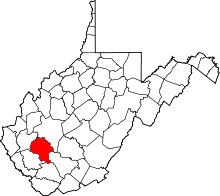 | |
| Towns | ||
| CDPs | ||
| Unincorporated communities |
| |
| Footnotes | ‡This populated place also has portions in an adjacent county or counties | |