Lumberport, West Virginia
| Lumberport, West Virginia | |
|---|---|
| Town | |
 Main Street (West Virginia Route 20) in Lumberport in 2006 | |
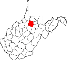
 Location of Lumberport in Harrison County, West Virginia. | |
| Coordinates: 39°22′30″N 80°20′54″W / 39.37500°N 80.34833°WCoordinates: 39°22′30″N 80°20′54″W / 39.37500°N 80.34833°W | |
| Country | United States |
| State | West Virginia |
| County | Harrison |
| Area[1] | |
| • Total | 0.50 sq mi (1.29 km2) |
| • Land | 0.50 sq mi (1.29 km2) |
| • Water | 0 sq mi (0 km2) |
| Elevation | 925 ft (282 m) |
| Population (2010)[2] | |
| • Total | 876 |
| • Estimate (2016)[3] | 859 |
| • Density | 1,752.0/sq mi (676.5/km2) |
| Time zone | UTC-5 (Eastern (EST)) |
| • Summer (DST) | UTC-4 (EDT) |
| ZIP code | 26386 |
| Area code(s) | 304 |
| FIPS code | 54-49252[4] |
| GNIS feature ID | 1542612[5] |
Lumberport is a town in Harrison County, located in northern West Virginia, United States. The population was 876 at the 2010 census.
The rural town was so named on account of the extensive lumber industry conducted there in the early 20th century.[6] With changes in the lumber industry, the number of jobs declined, leading to a loss in population after the 1950s.
The town is in close vicinity to the Harrison Power Station, a 1.9-gigawatt coal-fired electricity-generating power station located in Haywood, West Virginia, owned and operated by FirstEnergy.
History
Early History 1770-1800
The first man to settle in the area now known as Lumberport, was Major Benjamin Robinson in 1770. He was a descendant of the Robinson's in England. His father was forced to leave England due to a burlesque he had written against the King. Major Ben, as he was commonly called, bought 3,000 acres of land from the Native Americans in the vicinity of Lumberport, for which he gave them a gun, tomahawk, and a gun. He later received a large tract of land from the United States government for his service in the Revolutionary War.
Among the names of early settlers in the community are those of Thomas Cunningham, John Hull, Captain Thomas Harbert, John Wood, Major Benjamin Robinson, Samuel Harbert, Nathen Reece, Peter Cornelius, John Cornelius, and Elizabeth Cornelius.
The Native Americans left the Eagle District, of which Lumberport is apart of, in the 1780's and only returned once. Slaves were brought to Lumberport by David Wamsley around the same time.
Industrial Beginning 1800-1838
In 1802, Major Robinson was granted permission by the county court to construct a dam across the mouth of the Ten Mile Creek and to construct a saw and grist mill. The mill was constructed not long after and industry soon began in Lumberport. Large amounts of lumber were rafted from Lumberport to Pittsburgh, Pennsylvania to be sold at market. The town derived it's name from this practice of taking timber from the surrounding area to marketable areas. Most of the men who engaged in this work were farmers whom during the colder months would become lumberjacks. They would slide the trees down the steep hills, and onto the dam at Lumberport. It was here that they built rafts, many with shelters, and rode the rafts down the West Fork River to Fairmont, and then on the Monongahela to Pittsburgh. Once they sold their lumber off, some would take horses all the way back home while others would walk. Spring plowing and planting awaited them on their arrival home. This line of work increased their standards of living as well as income, considerably.
In 1833, a failure of crops in Eastern Virginia caused many families to seek home over the mountains. Such families that settled in Lumberport included the Hornor, Hawker, Harter, Shannon, Israel, Ferguson, Bowman, Gifford, and Robey families.
The Lumberport Mill was closed down in 1910, after changing owners numerous times. Dr. L. C. Oyster then used the building as storage for his nearby shop. The mill was eventually torn down at a later date.
1836-1931
In 1836, the first survey of the town was made by Dr. James Denham. According to this survey, the principle part of the town was on the East side of the Ten Mile Creek.
In the Spring of 1852, the Ten Mile Creek became a raging torrent, overflowing it's banks, and causing much damage to the town. At the time, the town proper was still in it's infancy, with only 10 houses.
The first school built in Lumberport was a subscription school, and was held in a one-room school and meeting place. In 1861, the first public school was held in a one-room building which was the "nucleus" of the Old School House. The building served until 1905, when a more modern 4 room building was constructed. The old building continued to stand until 1920. In 1912, a high school was erected in Lumberport which was a first class high school from 1916 until it's mending with Shinnston High School in Shinnston, West Virginia in 1978 to form Lincoln High School. On January 23, 1924, the Lumberport High School building, along with the Lumberport Elementary building, both burned. A new high school building was built in 1931 and served as Lumberport High from that time until 1978 when it became Lumberport Middle. Lumberport Middle served the area of Lumberport (and eventually Shinnston after the closure of Shinnston Middle) until 2015, when the building was closed, and Lincoln Middle School was officially opened. The Lumberport Elementary building, built after the fire, served the community until 2011, when a brand new school building was erected on the same grounds as the old one.
On September 18, 1901, the Town of Lumberport was incorporated, with the first mayor being J.W. Wadsworth. Also in 1901, the "Shortline Railroad" was completed from Clarksburg, West Virginia to New Martinsville, West Virginia. This new railroad offered Lumberport an excellent opportunity for transportation and communication facilities with great markets east and west. The railroad offered two round trips from Clarksburg to New Martinsville and back every day, except Sunday's, when it would only travel to New Martinsville once.
By the early 1900's, Lumberport had the best transportation, when it came to freights and passenger service. The Monongahela Valley Traction Company had built the Clarksburg-Fairmont interurban electric street car line with a branch leading into Lumberport in 1912. An office building with an opera house and bank included among a barber shop and grocery store was erected in 1904. The Mound City Glass Company moved it's headquarters from Moundsville to Lumberport in 1917, opening work for men, women, and youth in the town. They later sold to Peterson Glass Company, which eventually closed the plant in 1931. Dr. Oyster's store was known as the "Big Little Town Store", and was known as far away as New York City, as he had billboards there.
Golden Years 1920-1955
By the year 1920, there were at least 15 coal mines in the vicinity of the town. Laura Lee, Cambria, and Robey Mines, along with the Mound City Glass Company, all offered jobs to citizens of the town. In 1928, the town voted $30,000 to go towards a dam on Jones Run as well as a filtration device to give the town a water supply. The Lumberport Bank eventually closed it's doors in 1929, and a Volunteer Fire Department was formed on January 18, 1935. Following the depression and closing of the glass factory, the population of the town began to decrease. Many boys just out of high school would go to Ohio or Pennsylvania to secure jobs within the factories. Two vehicle dealerships were opened in the town, as well as a theater, hardware store, donut and coffee shop, and diner called "Roger's Country Kitchen". All of these businesses were eventually closed after the population decrease in the 1970's and 1980's.
1955-Present
Mines in the area began to shut down in the late 50's. The population of the town continued to decrease in the following years from many families moving to larger cities for work. Many businesses shut down and their buildings were either torn down, or are now abandoned reminders of the "golden" times. Businesses still in the area in the 2010's include only a dairy mart, a pharmacy, a barber shop, and a feed store. A Marathon/7-Eleven gas station situated at the bottom of Jones Run and Jack Run closed it's doors in the early 2010's due to a large sinkhole forming under it. A video store, Rick's Classic Video, also closed in the early 2010's. Most of the remaining buildings on Main Street (Route 20) are used as cheap apartments[7]
Geography
Lumberport is located at 39°22′30″N 80°20′54″W / 39.37500°N 80.34833°W (39.375041, -80.348213),[8] at the confluence of Tenmile Creek and the West Fork River in northern Harrison County.[9]
According to the United States Census Bureau, the town has a total area of 0.50 square miles (1.29 km2), all of it land.[1]
Demographics
| Historical population | |||
|---|---|---|---|
| Census | Pop. | %± | |
| 1910 | 656 | — | |
| 1920 | 900 | 37.2% | |
| 1930 | 1,298 | 44.2% | |
| 1940 | 1,285 | −1.0% | |
| 1950 | 1,198 | −6.8% | |
| 1960 | 1,031 | −13.9% | |
| 1970 | 957 | −7.2% | |
| 1980 | 939 | −1.9% | |
| 1990 | 1,014 | 8.0% | |
| 2000 | 937 | −7.6% | |
| 2010 | 876 | −6.5% | |
| Est. 2016 | 859 | [3] | −1.9% |
| U.S. Decennial Census[10] | |||
2010 census
As of the census of 2010,[11] there were 876 people, 350 households, and 241 families residing in the town. There were 384 housing units. The racial makeup of the town was 98.4% White, 0.5% African American, 0% Native American, 0% Asian, and 0.9% from two or more races. Hispanic or Latino of any race were 1.0% of the population.
There were 350 households of which 32.6% had children under the age of 18 living with them, 49.7% were married couples living together, 14.6% had a female householder with no husband present, and 31.1% were non-families. 32.6% of all households had individuals under 18 years and 30.0% had someone who was 65 years of age or older. The average household size was 2.50 and the average family size was 3.01.
In the town, the population was spread out with 26.3% under the age of 20, 31.8% from 20 to 44, 27.2% from 45 to 64, and 14.8% who were 65 years of age or older. The median age was 39.8 years. 50.8 percent of the population was male and 49.2 female.
The median income for a household in the town was $38,625, and the median income for a family was $44,231. The per capita income for the town was $19,710. About 11.0% of the population was below the poverty line, including 14.1% of those under age 18 and 6% of those age 65 or over.
2000 census
As of the census[4] of 2000, there were 937 people, 353 households, and 273 families residing in the town. The population density was 1,855.1 inhabitants per square mile (709.4/km²). There were 388 housing units at an average density of 768.2 per square mile (293.7/km²). The racial makeup of the town was 98.93% White, 0.43% African American, 0.32% Native American, 0.11% Asian, and 0.21% from two or more races. Hispanic or Latino of any race were 0.21% of the population.
There were 353 households out of which 33.7% had children under the age of 18 living with them, 58.1% were married couples living together, 14.4% had a female householder with no husband present, and 22.4% were non-families. 21.8% of all households were made up of individuals and 9.9% had someone living alone who was 65 years of age or older. The average household size was 2.63 and the average family size was 3.03.
In the town, the population was spread out with 26.6% under the age of 18, 6.1% from 18 to 24, 29.9% from 25 to 44, 22.4% from 45 to 64, and 15.0% who were 65 years of age or older. The median age was 37 years. For every 100 females, there were 92.0 males. For every 100 females age 18 and over, there were 85.4 males.
The median income for a household in the town was $33,750, and the median income for a family was $38,462. Males had a median income of $27,500 versus $21,719 for females. The per capita income for the town was $13,904. About 8.7% of families and 12.8% of the population were below the poverty line, including 17.8% of those under age 18 and 10.1% of those age 65 or over.
References
- 1 2 "US Gazetteer files 2010". United States Census Bureau. Archived from the original on 2012-01-24. Retrieved 2013-01-24.
- ↑ "American FactFinder". United States Census Bureau. Retrieved 2013-01-24.
- 1 2 "Population and Housing Unit Estimates". Retrieved June 9, 2017.
- 1 2 "American FactFinder". United States Census Bureau. Retrieved 2008-01-31.
- ↑ "US Board on Geographic Names". United States Geological Survey. 2007-10-25. Retrieved 2008-01-31.
- ↑ Kenny, Hamill (1945). West Virginia Place Names: Their Origin and Meaning, Including the Nomenclature of the Streams and Mountains. Piedmont, WV: The Place Name Press. p. 389.
- ↑ "History of Lumberport & Surrounding Communities". brian-harbert.com. Retrieved 2018-10-08.
- ↑ "US Gazetteer files: 2010, 2000, and 1990". United States Census Bureau. 2011-02-12. Retrieved 2011-04-23.
- ↑ DeLorme (1997). West Virginia Atlas & Gazetteer. Yarmouth, Maine: DeLorme. p.25. ISBN 0-89933-246-3.
- ↑ "Census of Population and Housing". Census.gov. Retrieved June 4, 2015.
- ↑ "2010 Census Data".