Wyoming County, West Virginia
| Wyoming County, West Virginia | |
|---|---|
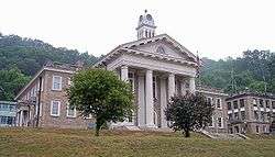 Wyoming County Courthouse and Jail in Pineville | |
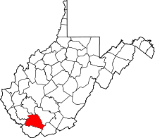 Location in the U.S. state of West Virginia | |
 West Virginia's location in the U.S. | |
| Founded | January 26, 1850 |
| Seat | Pineville |
| Largest city | Mullens |
| Area | |
| • Total | 502 sq mi (1,300 km2) |
| • Land | 499 sq mi (1,292 km2) |
| • Water | 2.4 sq mi (6 km2), 0.5% |
| Population (est.) | |
| • (2017) | 21,210 |
| • Density | 45/sq mi (17/km2) |
| Congressional district | 3rd |
| Time zone | Eastern: UTC−5/−4 |
| Website |
www |
Wyoming County is a county in the U.S. state of West Virginia. As of the 2010 census, the population was 23,796.[1] Its county seat is Pineville.[2] The county was created in 1850 from Logan County and named for the Delaware Indian word meaning "large plains".[3]
Geography
According to the U.S. Census Bureau, the county has a total area of 502 square miles (1,300 km2), of which 499 square miles (1,290 km2) is land and 2.4 square miles (6.2 km2) (0.5%) is water.[4] The county is drained by the branches of Sandy and Guyandotte rivers. The land surface is mountainous.[5]
Major highways
|
Adjacent counties
- Boone County (north)
- Raleigh County (northeast)
- Mercer County (southeast)
- McDowell County (south)
- Mingo County (west)
- Logan County (northwest)
Demographics
| Historical population | |||
|---|---|---|---|
| Census | Pop. | %± | |
| 1850 | 1,645 | — | |
| 1860 | 2,861 | 73.9% | |
| 1870 | 3,171 | 10.8% | |
| 1880 | 4,322 | 36.3% | |
| 1890 | 6,247 | 44.5% | |
| 1900 | 8,380 | 34.1% | |
| 1910 | 10,392 | 24.0% | |
| 1920 | 15,180 | 46.1% | |
| 1930 | 20,926 | 37.9% | |
| 1940 | 29,774 | 42.3% | |
| 1950 | 37,540 | 26.1% | |
| 1960 | 34,836 | −7.2% | |
| 1970 | 30,095 | −13.6% | |
| 1980 | 35,993 | 19.6% | |
| 1990 | 28,990 | −19.5% | |
| 2000 | 25,708 | −11.3% | |
| 2010 | 23,796 | −7.4% | |
| Est. 2017 | 21,210 | [6] | −10.9% |
| U.S. Decennial Census[7] 1790–1960[8] 1900–1990[9] 1990–2000[10] 2010–2015[1] | |||
2000 census
As of the census[11] of 2000, there were 25,709 people, 10,454 households, and 7,704 families residing in the county. The population density was 51 people per square mile (20/km²). There were 11,698 housing units at an average density of 23 per square mile (9/km²). The racial makeup of the county was 98.59% White, 0.63% Black or African American, 0.12% Native American, 0.08% Asian, 0.07% from other races, and 0.51% from two or more races. 0.53% of the population were Hispanic or Latino of any race.
There were 10,454 households out of which 31.00% had children under the age of 18 living with them, 59.30% were married couples living together, 10.50% had a female householder with no husband present, and 26.30% were non-families. 24.40% of all households were made up of individuals and 11.50% had someone living alone who was 65 years of age or older. The average household size was 2.45 and the average family size was 2.89.
In the county, the population was spread out with 22.40% under the age of 18, 8.70% from 18 to 24, 27.50% from 25 to 44, 27.40% from 45 to 64, and 13.90% who were 65 years of age or older. The median age was 40 years. For every 100 females there were 96.90 males. For every 100 females age 18 and over, there were 93.20 males.
The median income for a household in the county was $23,932, and the median income for a family was $29,709. Males had a median income of $32,493 versus $18,812 for females. The per capita income for the county was $14,220. About 20.20% of families and 25.10% of the population were below the poverty line, including 36.90% of those under age 18 and 13.50% of those age 65 or over.
2010 census
As of the 2010 United States Census, there were 23,796 people, 9,687 households, and 6,947 families residing in the county.[12] The population density was 47.6 inhabitants per square mile (18.4/km2). There were 10,958 housing units at an average density of 21.9 per square mile (8.5/km2).[13] The racial makeup of the county was 98.2% white, 0.5% black or African American, 0.1% Asian, 0.1% American Indian, 0.1% from other races, and 1.0% from two or more races. Those of Hispanic or Latino origin made up 0.4% of the population.[12] The largest ancestry groups were:
![]()
![]()
![]()
![]()
![]()
![]()
![]()
![]()
Of the 9,687 households, 30.8% had children under the age of 18 living with them, 56.3% were married couples living together, 10.3% had a female householder with no husband present, 28.3% were non-families, and 25.1% of all households were made up of individuals. The average household size was 2.45 and the average family size was 2.90. The median age was 42.6 years.[12]
The median income for a household in the county was $36,343 and the median income for a family was $46,221. Males had a median income of $43,942 versus $26,428 for females. The per capita income for the county was $17,662. About 13.4% of families and 17.3% of the population were below the poverty line, including 24.4% of those under age 18 and 8.9% of those age 65 or over.[15]
Politics
| Year | Republican | Democratic | Third parties |
|---|---|---|---|
| 2016 | 83.1% 6,547 | 13.5% 1,062 | 3.4% 271 |
| 2012 | 76.7% 5,769 | 21.0% 1,583 | 2.3% 174 |
| 2008 | 61.4% 4,621 | 36.3% 2,735 | 2.3% 174 |
| 2004 | 57.2% 4,985 | 42.4% 3,694 | 0.5% 39 |
| 2000 | 44.1% 3,473 | 54.4% 4,289 | 1.5% 116 |
| 1996 | 25.2% 2,155 | 64.9% 5,550 | 9.9% 844 |
| 1992 | 29.4% 2,821 | 60.2% 5,782 | 10.5% 1,004 |
| 1988 | 36.3% 3,516 | 63.4% 6,138 | 0.3% 30 |
| 1984 | 48.5% 5,379 | 51.3% 5,691 | 0.2% 25 |
| 1980 | 39.4% 4,537 | 57.5% 6,624 | 3.1% 351 |
| 1976 | 35.5% 4,286 | 64.5% 7,775 | |
| 1972 | 64.0% 7,926 | 36.1% 4,468 | |
| 1968 | 34.0% 3,947 | 57.3% 6,641 | 8.7% 1,007 |
| 1964 | 26.9% 3,377 | 73.1% 9,188 | |
| 1960 | 37.1% 5,083 | 62.9% 8,603 | |
| 1956 | 49.7% 7,044 | 50.3% 7,118 | |
| 1952 | 40.4% 6,124 | 59.6% 9,029 | |
| 1948 | 38.3% 4,198 | 61.4% 6,725 | 0.2% 25 |
| 1944 | 38.7% 4,253 | 61.3% 6,748 | |
| 1940 | 35.9% 4,378 | 64.1% 7,802 | |
| 1936 | 34.8% 3,601 | 65.2% 6,734 | |
| 1932 | 47.7% 4,007 | 52.3% 4,396 | |
| 1928 | 56.7% 3,987 | 43.3% 3,047 | |
| 1924 | 54.7% 3,327 | 38.8% 2,358 | 6.5% 398 |
| 1920 | 61.8% 2,950 | 38.2% 1,825 | |
| 1916 | 55.2% 1,484 | 44.6% 1,199 | 0.3% 7 |
| 1912 | 27.4% 569 | 42.4% 881 | 30.2% 628 |
Communities
City
Towns
Census-designated places
Unincorporated communities
- Allen Junction
- Alpoca
- Amigo
- Baileysville
- Beechwood
- Black Eagle
- Clear Fork
- Coal Mountain
- Cyclone
- Fanny
- Fanrock
- Garwood
- Glen Rogers
- Glover
- Hanover
- Herndon
- Ikes Fork
- Jesse
- Key Rock
- Lynco
- Maben
- Marianna
- McGraws-Tipple
- Milam
- North Spring
- Otsego
- Pierpont
- Ravencliff
- Rock View
- Sabine
- Saulsville
- Simon
- Stephenson
- Tralee
- Windom
- Wolf Pen
- Wyco
- Wyoming
Notable people
- Bernie Casey, football player and actor
- Mike D'Antoni, NBA coach
- William C. Marland, West Virginia Governor
- Christy Martin, professional boxer
- Jamie Noble, professional wrestler
- Joe Pendry, NFL coach
- Heath Slater, professional wrestler
- Curt Warner, football player
- Greg White, college basketball coach and motivational speaker
See also
References
- 1 2 "State & County QuickFacts". United States Census Bureau. Retrieved January 16, 2014.
- ↑ "Find a County". National Association of Counties. Archived from the original on May 31, 2011. Retrieved June 7, 2011.
- ↑ "Archived copy". Archived from the original on June 29, 2013. Retrieved January 29, 2013.
- ↑ "2010 Census Gazetteer Files". United States Census Bureau. August 22, 2012. Retrieved July 31, 2015.
- ↑

- ↑ "Population and Housing Unit Estimates". Retrieved Apr 7, 2018.
- ↑ "U.S. Decennial Census". United States Census Bureau. Archived from the original on May 12, 2015. Retrieved January 16, 2014.
- ↑ "Historical Census Browser". University of Virginia Library. Retrieved January 16, 2014.
- ↑ "Population of Counties by Decennial Census: 1900 to 1990". United States Census Bureau. Retrieved January 16, 2014.
- ↑ "Census 2000 PHC-T-4. Ranking Tables for Counties: 1990 and 2000" (PDF). United States Census Bureau. Retrieved January 16, 2014.
- ↑ "American FactFinder". United States Census Bureau. Archived from the original on September 11, 2013. Retrieved May 14, 2011.
- 1 2 3 "DP-1 Profile of General Population and Housing Characteristics: 2010 Demographic Profile Data". United States Census Bureau. Retrieved 2016-04-03.
- ↑ "Population, Housing Units, Area, and Density: 2010 - County". United States Census Bureau. Retrieved 2016-04-03.
- ↑ "DP02 SELECTED SOCIAL CHARACTERISTICS IN THE UNITED STATES – 2006-2010 American Community Survey 5-Year Estimates". United States Census Bureau. Retrieved 2016-04-03.
- ↑ "DP03 SELECTED ECONOMIC CHARACTERISTICS – 2006-2010 American Community Survey 5-Year Estimates". United States Census Bureau. Retrieved 2016-04-03.
- ↑ Leip, David. "Dave Leip's Atlas of U.S. Presidential Elections". uselectionatlas.org. Retrieved 2018-03-28.
External links
Places adjacent to Wyoming County, West Virginia | ||||||||||
|---|---|---|---|---|---|---|---|---|---|---|
| ||||||||||
Municipalities and communities of Wyoming County, West Virginia, United States | ||
|---|---|---|
| City | | |
| Towns | ||
| CDPs | ||
| Unincorporated communities |
| |
| Footnotes | ‡This populated place also has portions in an adjacent county or counties | |
