Mercer County, West Virginia
| Mercer County, West Virginia | |
|---|---|
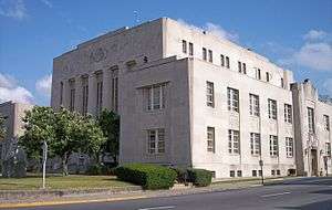 The Mercer County Courthouse in Princeton in 2007 | |
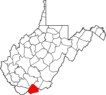 Location in the U.S. state of West Virginia | |
 West Virginia's location in the U.S. | |
| Founded | March 17, 1837 |
| Seat | Princeton |
| Largest city | Bluefield |
| Area | |
| • Total | 421 sq mi (1,090 km2) |
| • Land | 419 sq mi (1,085 km2) |
| • Water | 1.7 sq mi (4 km2), 0.4% |
| Population (est.) | |
| • (2017) | 59,753 |
| • Density | 147/sq mi (57/km2) |
| Congressional district | 3rd |
| Time zone | Eastern: UTC−5/−4 |
| Website |
www |
Mercer County is a county on the southwestern border of the U.S. state of West Virginia. At the 2010 census, the population was 62,264.[1] Its county seat is Princeton.[2] The county was originally established in the state of Virginia by act of its General Assembly on 17 March 1837,[3][4] using lands taken from Giles and Tazewell counties.
Mercer County is part of the Bluefield, WV-VA Micropolitan Statistical Area.
Geography
According to the U.S. Census Bureau, the county has a total area of 421 square miles (1,090 km2), of which 419 square miles (1,090 km2) is land and 1.7 square miles (4.4 km2) (0.4%) is water.[5]
Major highways
|
The West Virginia Turnpike, now part of Interstate 77, begins in Princeton.
Adjacent counties
- Raleigh County (north)
- Summers County (northeast)
- Giles County, Virginia (east)
- Bland County, Virginia (south)
- Tazewell County, Virginia (southwest)
- McDowell County (west)
- Wyoming County (northwest)
National protected area
Demographics
| Historical population | |||
|---|---|---|---|
| Census | Pop. | %± | |
| 1840 | 2,233 | — | |
| 1850 | 4,222 | 89.1% | |
| 1860 | 6,819 | 61.5% | |
| 1870 | 7,064 | 3.6% | |
| 1880 | 7,467 | 5.7% | |
| 1890 | 16,002 | 114.3% | |
| 1900 | 23,023 | 43.9% | |
| 1910 | 38,371 | 66.7% | |
| 1920 | 49,558 | 29.2% | |
| 1930 | 61,323 | 23.7% | |
| 1940 | 68,289 | 11.4% | |
| 1950 | 75,013 | 9.8% | |
| 1960 | 68,206 | −9.1% | |
| 1970 | 63,206 | −7.3% | |
| 1980 | 73,942 | 17.0% | |
| 1990 | 64,980 | −12.1% | |
| 2000 | 62,980 | −3.1% | |
| 2010 | 62,264 | −1.1% | |
| Est. 2017 | 59,753 | [6] | −4.0% |
| U.S. Decennial Census[7] 1790–1960[8] 1900–1990[9] 1990–2000[10] 2010–2015[1] | |||
2000 census
At the census[11] of 2000, there were 62,980 people, 26,509 households, and 17,946 families residing in the county. The population density was 150 people per square mile (58/km²). There were 30,143 housing units at an average density of 72 per square mile (28/km²). The racial makeup of the county was 92.56% White, 5.82% Black or African American, 0.19% Native American, 0.46% Asian, 0.01% Pacific Islander, 0.10% from other races, and 0.85% from two or more races. 0.45% of the population were Hispanic or Latino of any race.
There were 26,509 households out of which 26.70% had children under the age of 18 living with them, 53.00% were married couples living together, 11.20% had a female householder with no husband present, and 32.30% were non-families. 28.70% of all households were made up of individuals and 13.60% had someone living alone who was 65 years of age or older. The average household size was 2.33 and the average family size was 2.85.
In the county, the population was spread out with 21.10% under the age of 18, 9.80% from 18 to 24, 26.20% from 25 to 44, 25.50% from 45 to 64, and 17.40% who were 65 years of age or older. The median age was 40 years. For every 100 females, there were 91.10 males. For every 100 females age 18 and over, there were 87.70 males.
The median income for a household in the county was $26,628, and the median income for a family was $33,524. Males had a median income of $29,243 versus $19,013 for females. The per capita income for the county was $15,564. About 14.70% of families and 19.70% of the population were below the poverty line, including 28.90% of those under age 18 and 12.70% of those age 65 or over.
The county is part of the Bluefield, WV-VA micropolitan area.
2010 census
As of the 2010 United States Census, there were 62,264 people, 26,603 households, and 17,313 families residing in the county.[12] The population density was 148.6 inhabitants per square mile (57.4/km2). There were 30,115 housing units at an average density of 71.9 per square mile (27.8/km2).[13] The racial makeup of the county was 91.6% white, 6.1% black or African American, 0.5% Asian, 0.2% American Indian, 0.2% from other races, and 1.4% from two or more races. Those of Hispanic or Latino origin made up 0.8% of the population.[12] In terms of ancestry, 16.4% were Irish, 14.2% were German, 12.0% were English, and 11.2% were American.[14]
Of the 26,603 households, 27.8% had children under the age of 18 living with them, 47.6% were married couples living together, 12.9% had a female householder with no husband present, 34.9% were non-families, and 30.1% of all households were made up of individuals. The average household size was 2.30 and the average family size was 2.83. The median age was 42.5 years.[12]
The median income for a household in the county was $32,131 and the median income for a family was $42,517. Males had a median income of $37,423 versus $25,778 for females. The per capita income for the county was $18,431. About 16.0% of families and 22.8% of the population were below the poverty line, including 32.5% of those under age 18 and 11.4% of those age 65 or over.[15]
Politics
Mercer County's political history is largely typical of West Virginia. It was supportive of remaining with Confederate Virginia when the state was created and voted Democratic in the first few postwar elections. But the influence of coal industry executives would turn the county towards the GOP during the "System of 1896".[16] As with most of West Virginia, extensive unionization would cause the county to swing to the Democratic Party during most of the twentieth century, but an extremely rapid swing towards the Republican Party has occurred since 2000 due to declining unionization,[17] along with regional views on environmental, social and cultural issues that are increasingly at odds with the national Democratic party.[18]
| Year | Republican | Democratic | Third parties |
|---|---|---|---|
| 2016 | 75.0% 17,404 | 20.3% 4,704 | 4.7% 1,089 |
| 2012 | 72.5% 15,450 | 25.5% 5,432 | 2.0% 431 |
| 2008 | 62.8% 13,246 | 35.3% 7,450 | 1.9% 393 |
| 2004 | 58.3% 13,057 | 41.0% 9,178 | 0.6% 144 |
| 2000 | 54.1% 10,206 | 44.2% 8,347 | 1.7% 322 |
| 1996 | 41.5% 7,768 | 46.6% 8,721 | 11.8% 2,211 |
| 1992 | 38.9% 7,888 | 46.9% 9,511 | 14.2% 2,876 |
| 1988 | 50.0% 10,221 | 49.7% 10,152 | 0.3% 57 |
| 1984 | 60.1% 13,910 | 39.6% 9,164 | 0.4% 81 |
| 1980 | 49.6% 12,273 | 47.7% 11,804 | 2.7% 664 |
| 1976 | 42.2% 10,791 | 57.8% 14,761 | |
| 1972 | 69.5% 17,846 | 30.5% 7,826 | |
| 1968 | 38.3% 9,985 | 48.8% 12,739 | 12.9% 3,363 |
| 1964 | 32.7% 8,905 | 67.3% 18,298 | |
| 1960 | 40.4% 11,719 | 59.6% 17,289 | |
| 1956 | 52.5% 14,648 | 47.5% 13,236 | |
| 1952 | 46.1% 14,267 | 53.9% 16,694 | |
| 1948 | 39.7% 10,065 | 60.0% 15,201 | 0.3% 82 |
| 1944 | 40.3% 10,034 | 59.7% 14,861 | |
| 1940 | 38.6% 11,395 | 61.5% 18,163 | |
| 1936 | 36.9% 10,762 | 63.0% 18,391 | 0.1% 30 |
| 1932 | 40.9% 11,088 | 58.7% 15,900 | 0.4% 105 |
| 1928 | 55.5% 12,887 | 44.3% 10,273 | 0.2% 50 |
| 1924 | 42.9% 9,159 | 47.1% 10,058 | 10.1% 2,153 |
| 1920 | 51.7% 8,613 | 47.9% 7,981 | 0.3% 56 |
| 1916 | 49.5% 4,788 | 50.0% 4,836 | 0.6% 55 |
| 1912 | 18.6% 1,507 | 43.1% 3,497 | 38.4% 3,116 |
Education
The Mercer County Public School System has nineteen elementary schools, including Athens, Bluefield Intermediate, Bluewell, Brushfork, Ceres, Glenwood Elementary, Lashmeet-Matoaka, Melrose, Memorial, Mercer County Early Learning - Bluefield and Princeton sites, Mercer, Montcalm, Oakvale (funding for constructing a new Oakvale school has been approved), Princeton Primary, Spanishburg, Straley, Sun Valley and Whitethorne. There are six middle school facilities including Princeton Middle, Bluefield Middle, Montcalm Middle, PikeView Middle, and Glenwood Middle. There are also four high school facilities, including Princeton Senior (AAA), Bluefield High (AA), Montcalm High (A) and PikeView High (AA). The Mercer County Technical Education Center, which is being transitioned into a comprehensive technical high school. Mercer County Schools educates approximately 9200 students. The professional and service staff are about 1200.
Higher educational institutions include Bluefield State College, located in Bluefield; Concord University, located in Athens; and New River Community and Technical College, located in Princeton, West Virginia.
Law enforcement
Mercer County is protected by seven agencies. Five agencies protect the incorporated areas of the county, but the non-incorporated area is the primary responsibility of the Mercer County Sheriff's Department. The Mercer County Sheriff's Department consists of 30 sworn law enforcement officers and a number of civilian employees. Within the Mercer County Sheriff's Department are several specialized units to better serve the citizens.
K-9 Unit: Deputy Ballard (Quando), Deputy Parks (Arrow), Deputy Rose (Mitis), & Deputy Ellsion (Max).
Detective Bureau: Cpl. Murphy, Detective Sparks, & Detective Combs.
SWAT: Sgt. G. W. Woods, Cpl. J. J. Ruble, Cpl. S. A. Sommers, & Detective Combs; The rest of the team consists of other agencies within the County, excluding the State Police.
The Sheriff's Department has one dedicated Deputy who serves on the Southern Regional Drug and Violent Crime Task Force.
Mercer County is also home to the Princeton Detachment of the West Virginia State Police and a Turnpike Detachment (Highway Patrol).
Communities
Cities
Towns
Census-designated places
See also
References
- 1 2 "State & County QuickFacts". United States Census Bureau. Archived from the original on July 14, 2011. Retrieved January 10, 2014.
- ↑ "Find a County". National Association of Counties. Retrieved 2011-06-07.
- ↑ "West Virginia Counties". West Virginia Division of Culture and History. Archived from the original on September 23, 2001. Retrieved February 24, 2014. (WV County Etymology)
- ↑ "Archived copy". Archived from the original on 2001-09-23. Retrieved 2013-07-23.
- ↑ "2010 Census Gazetteer Files". United States Census Bureau. August 22, 2012. Retrieved July 30, 2015.
- ↑ "Population and Housing Unit Estimates". Retrieved Apr 7, 2018.
- ↑ "U.S. Decennial Census". United States Census Bureau. Retrieved January 10, 2014.
- ↑ "Historical Census Browser". University of Virginia Library. Retrieved January 10, 2014.
- ↑ "Population of Counties by Decennial Census: 1900 to 1990". United States Census Bureau. Retrieved January 10, 2014.
- ↑ "Census 2000 PHC-T-4. Ranking Tables for Counties: 1990 and 2000" (PDF). United States Census Bureau. Retrieved January 10, 2014.
- ↑ "American FactFinder". United States Census Bureau. Retrieved 2011-05-14.
- 1 2 3 "DP-1 Profile of General Population and Housing Characteristics: 2010 Demographic Profile Data". United States Census Bureau. Retrieved 2016-04-03.
- ↑ "Population, Housing Units, Area, and Density: 2010 - County". United States Census Bureau. Retrieved 2016-04-03.
- ↑ "DP02 SELECTED SOCIAL CHARACTERISTICS IN THE UNITED STATES – 2006-2010 American Community Survey 5-Year Estimates". United States Census Bureau. Retrieved 2016-04-03.
- ↑ "DP03 SELECTED ECONOMIC CHARACTERISTICS – 2006-2010 American Community Survey 5-Year Estimates". United States Census Bureau. Retrieved 2016-04-03.
- ↑ Drake, Richard B.; A History of Appalachia ISBN 0813137934
- ↑ Schwartzman, Gabe; ‘How Central Appalachia Went Right’; Daily Yonder, January 13, 2015
- ↑ Cohn, Nate; "Demographic Shift: Southern Whites’ Loyalty to G.O.P. Nearing That of Blacks to Democrats", New York Times, April 24, 2014
- ↑ Leip, David. "Dave Leip's Atlas of U.S. Presidential Elections". uselectionatlas.org. Retrieved 2018-03-27.
External links
- Community Foundation of the Virginias, Inc.
- Mercer County Convention and Visitors Bureau
- Mercer County Public Schools
- Bluefield State College
- Concord University
- Mercer County
- Early History of Mercer County
[www.mercercountywv.org]
Places adjacent to Mercer County, West Virginia | ||||||||||
|---|---|---|---|---|---|---|---|---|---|---|
| ||||||||||
Municipalities and communities of Mercer County, West Virginia, United States | ||
|---|---|---|
| Cities | | |
| Towns | ||
| CDPs | ||
| Other communities |
| |
| Ghost town | ||
| Footnotes | ‡This populated place also has portions in an adjacent county or counties | |
