Paw Paw, West Virginia
| Paw Paw | |
|---|---|
| Town | |
_at_Depot_Street_in_Paw_Paw%2C_Morgan_County%2C_West_Virginia.jpg) WV 9 in Paw Paw | |
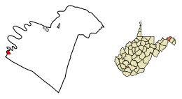 Location of Paw Paw in Morgan County, West Virginia. | |
| Coordinates: 39°31′52″N 78°27′25″W / 39.53111°N 78.45694°WCoordinates: 39°31′52″N 78°27′25″W / 39.53111°N 78.45694°W | |
| Country | United States |
| State | West Virginia |
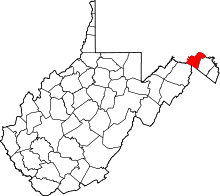
| County | Morgan |
| Area[1] | |
| • Total | 0.53 sq mi (1.37 km2) |
| • Land | 0.53 sq mi (1.37 km2) |
| • Water | 0 sq mi (0 km2) |
| Elevation | 571 ft (174 m) |
| Population (2010)[2] | |
| • Total | 508 |
| • Estimate (2016)[3] | 493 |
| • Density | 958.5/sq mi (370.1/km2) |
| Time zone | UTC-5 (Eastern (EST)) |
| • Summer (DST) | UTC-4 (EDT) |
| ZIP code | 25434 |
| Area code(s) | 304 |
| FIPS code | 54-62332[4] |
| GNIS feature ID | 1544641[5] |

Paw Paw is a town in Morgan County, West Virginia, United States. The population was 508 at the 2010 census. The town is known for the nearby Paw Paw Tunnel. Paw Paw was incorporated by the Circuit Court of Morgan County on April 8, 1891 and named for the pawpaw,[6] a wild fruit which grows in abundance throughout this region. Paw Paw is the westernmost incorporated community in the Hagerstown-Martinsburg, MD-WV Metropolitan Statistical Area.
Geography
Paw Paw is located at 39°31′52″N 78°27′25″W / 39.53111°N 78.45694°W (39.531140, -78.456920).[7]
According to the United States Census Bureau, the town has a total area of 0.53 square miles (1.37 km2), all of it land.[1]
Demographics
| Historical population | |||
|---|---|---|---|
| Census | Pop. | %± | |
| 1890 | 772 | — | |
| 1900 | 693 | −10.2% | |
| 1910 | 725 | 4.6% | |
| 1920 | 698 | −3.7% | |
| 1930 | 781 | 11.9% | |
| 1940 | 990 | 26.8% | |
| 1950 | 820 | −17.2% | |
| 1960 | 789 | −3.8% | |
| 1970 | 706 | −10.5% | |
| 1980 | 644 | −8.8% | |
| 1990 | 538 | −16.5% | |
| 2000 | 524 | −2.6% | |
| 2010 | 508 | −3.1% | |
| Est. 2016 | 493 | [3] | −3.0% |
| U.S. Decennial Census[8] | |||
2010 census
As of the census[2] of 2010, there were 508 people, 223 households, and 131 families residing in the town. The population density was 958.5 inhabitants per square mile (370.1/km2). There were 262 housing units at an average density of 494.3 per square mile (190.9/km2). The racial makeup of the town was 92.9% White, 2.4% African American, 2.0% Native American, 0.4% Asian, 0.4% from other races, and 2.0% from two or more races. Hispanic or Latino of any race were 2.6% of the population.
There were 223 households of which 30.0% had children under the age of 18 living with them, 41.3% were married couples living together, 12.6% had a female householder with no husband present, 4.9% had a male householder with no wife present, and 41.3% were non-families. 37.7% of all households were made up of individuals and 19.7% had someone living alone who was 65 years of age or older. The average household size was 2.28 and the average family size was 2.96.
The median age in the town was 38.6 years. 23.6% of residents were under the age of 18; 7.5% were between the ages of 18 and 24; 27.6% were from 25 to 44; 25% were from 45 to 64; and 16.3% were 65 years of age or older. The gender makeup of the town was 49.0% male and 51.0% female.
2000 census
As of the census[4] of 2000, there were 524 people, 224 households, and 144 families residing in the town. The population density was 999.4 inhabitants per square mile (389.1/km²). There were 249 housing units at an average density of 474.9 per square mile (184.9/km²). The racial makeup of the town was 89.50% White, 7.63% African American, 2.29% from other races, and 0.57% from two or more races. Hispanic or Latino of any race were 3.44% of the population.
There were 224 households out of which 27.7% had children under the age of 18 living with them, 43.8% were married couples living together, 14.7% had a female householder with no husband present, and 35.3% were non-families. 28.6% of all households were made up of individuals and 17.4% had someone living alone who was 65 years of age or older. The average household size was 2.32 and the average family size was 2.87.
In the town, the population was spread out with 22.5% under the age of 18, 10.1% from 18 to 24, 25.2% from 25 to 44, 23.3% from 45 to 64, and 18.9% who were 65 years of age or older. The median age was 40 years. For every 100 females, there were 90.5 males. For every 100 females age 18 and over, there were 82.9 males.
The median income for a household in the town was $25,625, and the median income for a family was $30,250. Males had a median income of $27,500 versus $23,125 for females. The per capita income for the town was $17,377. About 14.9% of families and 18.1% of the population were below the poverty line, including 25.7% of those under age 18 and 14.0% of those age 65 or over.
History
On George Washington's many trips west, he usually took the Winchester-Cumberland Road which closely parallels today's CR 29/51 through Paw Paw. The Potomac River, which embraces the old town in one of its bends, was navigated as early as 1750. Travelers heading west often crossed the gap in the mountains here, some settling to farm land along the river.
The town is the namesake of the Paw Paw Tunnel, an important part of the Chesapeake and Ohio Canal. The tunnel and the nearby canal is now part of the Chesapeake and Ohio Canal National Historical Park.
Paul "Oz" Bach, founder and bass player for the popular musical group Spanky and Our Gang, was born in Paw Paw on June 24, 1939.[9]
The Texas swing band Asleep at the Wheel got its start in Paw Paw, according to founder Ray Benson.[10]
References
- 1 2 "US Gazetteer files 2010". United States Census Bureau. Archived from the original on January 24, 2012. Retrieved 2013-01-24.
- 1 2 "American FactFinder". United States Census Bureau. Retrieved 2013-01-24.
- 1 2 "Population and Housing Unit Estimates". Retrieved June 9, 2017.
- 1 2 "American FactFinder". United States Census Bureau. Retrieved 2008-01-31.
- ↑ "US Board on Geographic Names". United States Geological Survey. 2007-10-25. Retrieved 2008-01-31.
- ↑ Kenny, Hamill (1945). West Virginia Place Names: Their Origin and Meaning, Including the Nomenclature of the Streams and Mountains. Piedmont, WV: The Place Name Press. p. 476.
- ↑ "US Gazetteer files: 2010, 2000, and 1990". United States Census Bureau. 2011-02-12. Retrieved 2011-04-23.
- ↑ "Census of Population and Housing". Census.gov. Archived from the original on May 12, 2015. Retrieved June 4, 2015.
- ↑ "Oz Bach Tribute".
- ↑ "Home". morganmessenger.com. Retrieved 10 April 2018.
External links
| Wikimedia Commons has media related to Paw Paw, West Virginia. |