Gilmer County, West Virginia
| Gilmer County, West Virginia | |
|---|---|
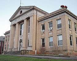 The Gilmer County Courthouse in Glenville | |
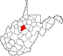 Location in the U.S. state of West Virginia | |
 West Virginia's location in the U.S. | |
| Founded | February 3, 1845 |
| Named for | Thomas Walker Gilmer |
| Seat | Glenville |
| Largest town | Glenville |
| Area | |
| • Total | 340 sq mi (881 km2) |
| • Land | 339 sq mi (878 km2) |
| • Water | 1.6 sq mi (4 km2), 0.5% |
| Population (est.) | |
| • (2015) | 8,518 |
| • Density | 25/sq mi (10/km2) |
| Congressional district | 1st |
| Time zone | Eastern: UTC−5/−4 |
| Website |
www |
Gilmer County is a county in the U.S. state of West Virginia. As of the 2010 census, the population was 8,693.[1] Its county seat is Glenville.[2] The county was formed in 1845 from parts of Lewis and Kanawha Counties, and named for Thomas Walker Gilmer, Governor of Virginia from 1840 to 1841.[3][4] Gilmer was later a representative in the United States Congress and Secretary of the Navy in President John Tyler's cabinet.
Cedar Creek State Park offers camping, hunting, fishing and hiking. The West Virginia State Folk Festival is held each June. Glenville State College has a community activity center, a state-of-the-art library, and a complete collection of hand-carved, West Virginia–native birds on public display. The Gilmer County Recreation Center Complex includes a small golf course, a convention / reunion hall, and bunk houses. Gilmer County is home to ten nationally registered historic landmarks, the Cedar Creek Backway, and the annual West Virginia Folk Festival. Media outlets for the community include The Glenville Democrat and The Glenville Pathfinder, the county's two newspapers, and Two-Lane Livin', a regional magazine.
Gilmer County is also the site of Federal Correctional Institution, Gilmer, a federal medium security prison for men and the county's largest employer.
As of 2017, Gilmer County has one permanent traffic light. It is located in the town of Glenville.[5]
Geography
According to the U.S. Census Bureau, the county has a total area of 340 square miles (880 km2), of which 339 square miles (880 km2) is land and 1.6 square miles (4.1 km2) (0.5%) is water.[6]
Major highways
Adjacent counties
- Doddridge County (north)
- Lewis County (east)
- Braxton County (south)
- Calhoun County (west)
- Ritchie County (northwest)
Demographics
| Historical population | |||
|---|---|---|---|
| Census | Pop. | %± | |
| 1850 | 3,475 | — | |
| 1860 | 3,759 | 8.2% | |
| 1870 | 4,338 | 15.4% | |
| 1880 | 7,108 | 63.9% | |
| 1890 | 9,746 | 37.1% | |
| 1900 | 11,762 | 20.7% | |
| 1910 | 11,379 | −3.3% | |
| 1920 | 10,668 | −6.2% | |
| 1930 | 10,641 | −0.3% | |
| 1940 | 12,046 | 13.2% | |
| 1950 | 9,746 | −19.1% | |
| 1960 | 8,050 | −17.4% | |
| 1970 | 7,782 | −3.3% | |
| 1980 | 8,334 | 7.1% | |
| 1990 | 7,669 | −8.0% | |
| 2000 | 7,160 | −6.6% | |
| 2010 | 8,693 | 21.4% | |
| Est. 2016 | 8,249 | [7] | −5.1% |
| U.S. Decennial Census[8] 1790–1960[9] 1900–1990[10] 1990–2000[11] 2010–2015[1] | |||
2000 census
As of the census[12] of 2000, there were 7,160 people, 2,768 households, and 1,862 families residing in the county. The population density was 21 people per square mile (8/km²). There were 3,621 housing units at an average density of 11 per square mile (4/km²). The racial makeup of the county was 97.33% White, 0.91% Black or African American, 0.20% Native American, 0.57% Asian, 0.01% Pacific Islander, 0.10% from other races, and 0.88% from two or more races. 0.70% of the population were Hispanic or Latino of any race.
There were 2,768 households out of which 28.20% had children under the age of 18 living with them, 54.40% were married couples living together, 8.60% had a female householder with no husband present, and 32.70% were non-families. 25.50% of all households were made up of individuals and 12.30% had someone living alone who was 65 years of age or older. The average household size was 2.43 and the average family size was 2.92.
In the county, the population was spread out with 20.30% under the age of 18, 16.40% from 18 to 24, 24.50% from 25 to 44, 23.50% from 45 to 64, and 15.30% who were 65 years of age or older. The median age was 37 years. For every 100 females there were 101.10 males. For every 100 females age 18 and over, there were 101.40 males.
The median income for a household in the county was $22,857, and the median income for a family was $28,685. Males had a median income of $25,497 versus $15,353 for females. The per capita income for the county was $12,498. About 20.20% of families and 25.90% of the population were below the poverty line, including 27.70% of those under age 18 and 8.90% of those age 65 or over.
2010 census
As of the 2010 United States Census, there were 8,693 people, 2,753 households, and 1,806 families residing in the county.[13] The population density was 25.7 inhabitants per square mile (9.9/km2). There were 3,448 housing units at an average density of 10.2 per square mile (3.9/km2).[14] The racial makeup of the county was 82.5% white, 12.3% black or African American, 0.5% American Indian, 0.4% Asian, 0.1% Pacific islander, 2.4% from other races, and 1.7% from two or more races. Those of Hispanic or Latino origin made up 5.7% of the population.[13] In terms of ancestry, 23.1% were German, 14.9% were Irish, 9.6% were American, and 6.1% were English.[15]
Of the 2,753 households, 25.9% had children under the age of 18 living with them, 49.8% were married couples living together, 10.1% had a female householder with no husband present, 34.4% were non-families, and 27.6% of all households were made up of individuals. The average household size was 2.34 and the average family size was 2.83. The median age was 38.0 years.[13]
The median income for a household in the county was $29,706 and the median income for a family was $38,044. Males had a median income of $30,654 versus $16,834 for females. The per capita income for the county was $13,899. About 25.1% of families and 30.3% of the population were below the poverty line, including 39.4% of those under age 18 and 13.1% of those age 65 or over.[16]
Politics
Historically, Gilmer County was the northwesternmost of the fiercely Democratic, secessionist counties of West Virginia. It voted Democratic in every election from 1872 to 1968 – in 1928 when there was large-scale anti-Catholic voting throughout Appalachian West Virginia it was Al Smith’s strongest county in the state.[17] In 1972, against the strongly left-wing George McGovern, Richard Nixon became the first Republican to carry the county in 104 years, and in a similar landslide Ronald Reagan repeated this in 1984. Like all of West Virginia, since 2000 Gilmer County has seen a powerful swing towards the Republican Party due to declining unionization[18] and differences with the Democratic Party’s liberal views.[19]
| Year | Republican | Democratic | Third parties |
|---|---|---|---|
| 2016 | 73.5% 1,896 | 21.1% 545 | 5.4% 138 |
| 2012 | 63.2% 1,595 | 33.3% 840 | 3.5% 87 |
| 2008 | 57.3% 1,445 | 39.8% 1,004 | 2.9% 72 |
| 2004 | 58.4% 1,665 | 40.6% 1,159 | 1.0% 28 |
| 2000 | 56.9% 1,560 | 39.9% 1,092 | 3.2% 88 |
| 1996 | 35.2% 933 | 52.5% 1,390 | 12.3% 326 |
| 1992 | 34.4% 1,085 | 50.0% 1,576 | 15.6% 493 |
| 1988 | 45.3% 1,387 | 54.2% 1,661 | 0.5% 16 |
| 1984 | 56.6% 1,953 | 43.3% 1,494 | 0.1% 5 |
| 1980 | 41.7% 1,452 | 53.2% 1,854 | 5.2% 180 |
| 1976 | 37.9% 1,371 | 62.1% 2,245 | |
| 1972 | 60.2% 2,056 | 39.8% 1,359 | |
| 1968 | 43.8% 1,401 | 49.5% 1,582 | 6.7% 214 |
| 1964 | 28.3% 1,116 | 71.7% 2,832 | |
| 1960 | 41.1% 1,446 | 58.9% 2,075 | |
| 1956 | 46.8% 1,774 | 53.2% 2,016 | |
| 1952 | 44.2% 1,813 | 55.8% 2,291 | |
| 1948 | 37.6% 1,421 | 62.4% 2,355 | |
| 1944 | 39.7% 1,651 | 60.3% 2,509 | |
| 1940 | 38.7% 2,067 | 61.3% 3,276 | |
| 1936 | 35.1% 1,858 | 64.9% 3,433 | |
| 1932 | 30.1% 1,530 | 69.1% 3,511 | 0.7% 37 |
| 1928 | 42.2% 1,705 | 57.2% 2,313 | 0.6% 26 |
| 1924 | 36.1% 1,570 | 63.2% 2,750 | 0.7% 30 |
| 1920 | 46.6% 1,635 | 52.8% 1,854 | 0.6% 21 |
| 1916 | 35.6% 943 | 64.0% 1,695 | 0.3% 9 |
| 1912 | 18.8% 469 | 59.7% 1,493 | 21.5% 538 |
Communities
Towns
Unincorporated communities
See also
References
- 1 2 "State & County QuickFacts". United States Census Bureau. Archived from the original on July 10, 2011. Retrieved January 10, 2014.
- ↑ "Find a County". National Association of Counties. Archived from the original on 2011-05-31. Retrieved 2011-06-07.
- ↑ "Archived copy". Archived from the original on 2013-05-07. Retrieved 2013-01-29.
- ↑ Gannett, Henry (1905). The Origin of Certain Place Names in the United States. Govt. Print. Off. p. 137.
- ↑ "The Glenville Democrat (July 5, 2012) Page 1". Retrieved 2018-03-27.
- ↑ "2010 Census Gazetteer Files". United States Census Bureau. August 22, 2012. Retrieved July 24, 2015.
- ↑ "Population and Housing Unit Estimates". Retrieved June 9, 2017.
- ↑ "U.S. Decennial Census". United States Census Bureau. Archived from the original on May 12, 2015. Retrieved January 10, 2014.
- ↑ "Historical Census Browser". University of Virginia Library. Retrieved January 10, 2014.
- ↑ "Population of Counties by Decennial Census: 1900 to 1990". United States Census Bureau. Retrieved January 10, 2014.
- ↑ "Census 2000 PHC-T-4. Ranking Tables for Counties: 1990 and 2000" (PDF). United States Census Bureau. Retrieved January 10, 2014.
- ↑ "American FactFinder". United States Census Bureau. Archived from the original on 2013-09-11. Retrieved 2011-05-14.
- 1 2 3 "DP-1 Profile of General Population and Housing Characteristics: 2010 Demographic Profile Data". United States Census Bureau. Retrieved 2016-04-03.
- ↑ "Population, Housing Units, Area, and Density: 2010 - County". United States Census Bureau. Retrieved 2016-04-03.
- ↑ "DP02 SELECTED SOCIAL CHARACTERISTICS IN THE UNITED STATES – 2006-2010 American Community Survey 5-Year Estimates". United States Census Bureau. Retrieved 2016-04-03.
- ↑ "DP03 SELECTED ECONOMIC CHARACTERISTICS – 2006-2010 American Community Survey 5-Year Estimates". United States Census Bureau. Retrieved 2016-04-03.
- ↑ Scammon, Richard M. (compiler); America at the Polls: A Handbook of Presidential Election Statistics 1920-1964; pp. 494-498 ISBN 0405077114
- ↑ Schwartzman, Gabe; ‘How Central Appalachia Went Right’; Daily Yonder, January 13, 2015
- ↑ Cohn, Nate; ‘Demographic Shift: Southern Whites’ Loyalty to G.O.P. Nearing That of Blacks to Democrats’, New York Times, April 24, 2014
- ↑ Leip, David. "Dave Leip's Atlas of U.S. Presidential Elections". uselectionatlas.org. Retrieved 2018-03-27.
External links
- Gilmer County official Site
- Virtual Visit to Gilmer County
- WVGenWeb Gilmer County
- The November 2003 Flood
- Two-Lane Livin' Magazine
- West Virginia State Folk Festival
Places adjacent to Gilmer County, West Virginia | ||||||||||
|---|---|---|---|---|---|---|---|---|---|---|
| ||||||||||
Municipalities and communities of Gilmer County, West Virginia, United States | ||
|---|---|---|
| Towns | | |
| Unincorporated communities | ||
| Footnotes | ‡This populated place also has portions in an adjacent county or counties | |
