Hedgesville, West Virginia
| Hedgesville, West Virginia | |
|---|---|
| Town | |
_between_Zion_Street_and_West_Virginia_State_Route_901_(Mary_Street)_in_Hedgesville%2C_Berkeley_County%2C_West_Virginia.jpg) Central Hedgesville | |
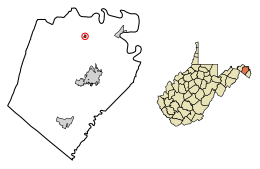 Location of Hedgesville in Berkeley County, West Virginia. | |
| Coordinates: 39°33′15″N 77°59′42″W / 39.55417°N 77.99500°WCoordinates: 39°33′15″N 77°59′42″W / 39.55417°N 77.99500°W | |
| Country | United States |
| State | West Virginia |
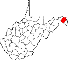
| County | Berkeley |
| Government | |
| • Mayor | Mary Sue Catlett |
| Area[1] | |
| • Total | 0.19 sq mi (0.50 km2) |
| • Land | 0.19 sq mi (0.50 km2) |
| • Water | 0.00 sq mi (0.00 km2) |
| Elevation | 640 ft (195 m) |
| Population (2010)[2] | |
| • Total | 318 |
| • Estimate (2016)[3] | 320 |
| • Density | 1,658.03/sq mi (640.83/km2) |
| Time zone | UTC-5 (Eastern (EST)) |
| • Summer (DST) | UTC-4 (EDT) |
| ZIP code | 25427 |
| Area code(s) | 304 |
| FIPS code | 54-36220[4] |
| GNIS feature ID | 1554676[5] |
Hedgesville is a town in Berkeley County, West Virginia, in the state's Eastern Panhandle region. The population was 318 at the 2010 census.
History
Established by an act of the Virginia General Assembly on February 11, 1836,[6] the Town of Hedgesville was laid out in 1832 along the old Warm Springs Road (now West Virginia Route 9) and named for the prominent local Hedges family.[7] In 1854, Hedgesville was officially incorporated by the General Assembly. The act of incorporation provided for a town council consisting of seven trustees, but the act was amended in 1858 so that a mayor could be added to the council.[8] Hedgesville is a National Register Historic District.
On August 17, 2004, President George W. Bush made a re-election campaign stop and photo-op at Hedgesville High School.[9]
Geography
Hedgesville is located at 39°33′15″N 77°59′42″W / 39.55417°N 77.99500°W (39.554188, -77.994967).[10]
According to the United States Census Bureau, the town has a total area of 0.13 square miles (0.34 km2), all of it land.[11]
Demographics
| Historical population | |||
|---|---|---|---|
| Census | Pop. | %± | |
| 1880 | 383 | — | |
| 1890 | 448 | 17.0% | |
| 1900 | 342 | −23.7% | |
| 1910 | 328 | −4.1% | |
| 1920 | 379 | 15.5% | |
| 1930 | 361 | −4.7% | |
| 1940 | 403 | 11.6% | |
| 1950 | 419 | 4.0% | |
| 1960 | 342 | −18.4% | |
| 1970 | 274 | −19.9% | |
| 1980 | 217 | −20.8% | |
| 1990 | 227 | 4.6% | |
| 2000 | 240 | 5.7% | |
| 2010 | 318 | 32.5% | |
| Est. 2016 | 320 | [3] | 0.6% |
| U.S. Decennial Census[12] | |||
2010 census
As of the census[2] of 2010, there were 318 people, 119 households, and 82 families residing in the town. The population density was 2,446.2 inhabitants per square mile (944.5/km2). There were 135 housing units at an average density of 1,038.5 per square mile (401.0/km2). The racial makeup of the town was 90.3% White, 5.3% African American, 0.3% Native American, 0.3% Asian, 1.6% from other races, and 2.2% from two or more races. Hispanic or Latino of any race were 3.1% of the population.
There were 119 households, of which 46.2% had children under the age of 18 living with them, 42.9% were married couples living together, 21.0% had a female householder with no husband present, 5.0% had a male householder with no wife present, and 31.1% were non-families. 16.0% of all households were made up of individuals and 5.9% had someone living alone who was 65 years of age or older. The average household size was 2.67 and the average family size was 3.07.
The median age in the town was 31.2 years. 29.6% of residents were under the age of 18; 9% were between the ages of 18 and 24; 32.4% were from 25 to 44; 20.1% were from 45 to 64; and 8.8% were 65 years of age or older. The gender makeup of the town was 47.2% male and 52.8% female.
2000 census
As of the census[4] of 2000, there were 240 people, 88 households, and 65 families residing in the town. The population density was 772.2/km² (1,980.4/mi²). There were 99 housing units at an average density of 816.9 per square mile (318.5/km²). The racial makeup of the town was 92.08% White, 3.75% African American, 0.42% Native American, 0.42% Pacific Islander, and 3.33% from two or more races. Hispanic or Latino of any race were 0.83% of the population.
There were 88 households, of which 43.2% had children under the age of 18 living with them, 46.6% were married couples living together, 20.5% had a female householder with no husband present, and 26.1% were non-families. 20.5% of all households were made up of individuals and 5.7% had someone living alone who was 65 years of age or older. The average household size was 2.73 and the average family size was 3.18.
In the town, the population was spread out with 34.6% under the age of 18, 6.3% from 18 to 24, 27.5% from 25 to 44, 24.6% from 45 to 64, and 7.1% who were 65 years of age or older. The median age was 34 years. For every 100 females, there were 75.2 males. For every 100 females age 18 and over, there were 80.5 males.
The median income for a household in the town was $49,375, and the median income for a family was $46,563. Males had a median income of $31,042 versus $21,985 for females. The per capita income for the town was $17,772. About 2.8% of families and 5.4% of the population were below the poverty line, including 9.3% of those under the age of eighteen and 9.7% of those sixty five or over.
Notable people
- Gale Catlett, American basketball player and coach
- David O'Brien Martin, former US Congressman
- Andy Boarman, Bluegrass and Folk musician
References
- ↑ "2016 U.S. Gazetteer Files". United States Census Bureau. Retrieved Jul 14, 2017.
- 1 2 "American FactFinder". United States Census Bureau. Retrieved 2013-01-24.
- 1 2 "Population and Housing Unit Estimates". Retrieved June 9, 2017.
- 1 2 "American FactFinder". United States Census Bureau. Retrieved 2008-01-31.
- ↑ "US Board on Geographic Names". United States Geological Survey. 2007-10-25. Retrieved 2008-01-31.
- ↑ Acts of the General Assembly of the State of Virginia. J. E. Goode. 1836-01-01. p. 360.
- ↑ Kenny, Hamill (1945). "West Virginia Place Names: Their Origin and Meaning, Including the Nomenclature of the Streams and Mountains". Chronicles of Old Berkeley: A Narrative History of a Virginia County from Its Beginnings to 1926. Piedmont, WV: The Place Name Press. p. 304.
- ↑ Gardiner, Ann (1938). Chronicles of Old Berkeley: A Narrative History of a Virginia County from Its Beginnings to 1926. The Seeman Press. pp. 41–42.
- ↑ Smith, Vicki (2004-08-18). "Supporters in Hedgesville cite Bush's faith". The Charleston Gazette. Retrieved 2015-01-05.
- ↑ "US Gazetteer files: 2010, 2000, and 1990". United States Census Bureau. 2011-02-12. Retrieved 2011-04-23.
- ↑ "US Gazetteer files 2010". United States Census Bureau. Archived from the original on 2012-01-24. Retrieved 2013-01-24.
- ↑ "Census of Population and Housing". Census.gov. Archived from the original on May 12, 2015. Retrieved June 4, 2015.
4. https://www.gutenberg.org/files/15263/15263-h/15263-h.htm The Underground Railroad, by William Still, digitized online.
External links
| Wikimedia Commons has media related to Hedgesville, West Virginia. |
| Wikivoyage has a travel guide for Hedgesville. |