Wetzel County, West Virginia
| Wetzel County, West Virginia | |
|---|---|
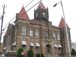 Wetzel County Courthouse | |
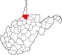 Location in the U.S. state of West Virginia | |
 West Virginia's location in the U.S. | |
| Founded | January 10, 1846 |
| Named for | Lewis Wetzel |
| Seat | New Martinsville |
| Largest city | New Martinsville |
| Area | |
| • Total | 361 sq mi (935 km2) |
| • Land | 358 sq mi (927 km2) |
| • Water | 3.3 sq mi (9 km2), 0.9% |
| Population (est.) | |
| • (2017) | 15,437 |
| • Density | 45/sq mi (17/km2) |
| Congressional district | 1st |
| Time zone | Eastern: UTC−5/−4 |
| Website |
www |
Wetzel County is a county in the U.S. state of West Virginia. As of the 2010 census, the population was 16,583.[1] Its county seat is New Martinsville.[2] The county, founded in 1846, is named for Lewis Wetzel, a famous frontiersman and Indian fighter.[3] Its northern border aligns with the Mason-Dixon line but is to the west of the actual Mason-Dixon line.
History
Wetzel County was formed in 1846 out of Tyler County, Virginia. The county had a number of districts:[4] Proctor, Magnolia, Center Church, Clay, Green,[5] and Grant Districts. The community of Martinsville may have been within one of the districts.
Geography
According to the U.S. Census Bureau, the county has a total area of 361 square miles (930 km2), of which 358 square miles (930 km2) is land and 3.3 square miles (8.5 km2) (0.9%) is water.[6]
Major highways
Adjacent counties
- Marshall County (north)
- Greene County, Pennsylvania (northeast)
- Monongalia County (east)
- Marion County (east)
- Harrison County (southeast)
- Doddridge County (south)
- Tyler County (southwest)
- Monroe County, Ohio (west)
National protected area
Demographics
| Historical population | |||
|---|---|---|---|
| Census | Pop. | %± | |
| 1850 | 4,284 | — | |
| 1860 | 6,703 | 56.5% | |
| 1870 | 8,595 | 28.2% | |
| 1880 | 13,896 | 61.7% | |
| 1890 | 16,841 | 21.2% | |
| 1900 | 22,880 | 35.9% | |
| 1910 | 23,855 | 4.3% | |
| 1920 | 23,069 | −3.3% | |
| 1930 | 22,334 | −3.2% | |
| 1940 | 22,342 | 0.0% | |
| 1950 | 20,154 | −9.8% | |
| 1960 | 19,347 | −4.0% | |
| 1970 | 20,314 | 5.0% | |
| 1980 | 21,874 | 7.7% | |
| 1990 | 19,258 | −12.0% | |
| 2000 | 17,693 | −8.1% | |
| 2010 | 16,583 | −6.3% | |
| Est. 2017 | 15,437 | [7] | −6.9% |
| U.S. Decennial Census[8] 1790–1960[9] 1900–1990[10] 1990–2000[11] 2010–2015[1] | |||
2000 census
As of the census[12] of 2000, there were 17,693 people, 7,164 households, and 5,079 families residing in the county. The population density was 49 people per square mile (19/km²). There were 8,313 housing units at an average density of 23 per square mile (9/km²). The racial makeup of the county was 98.92% White, 0.08% Black or African American, 0.10% Native American, 0.32% Asian, 0.02% Pacific Islander, 0.03% from other races, and 0.53% from two or more races. 0.42% of the population were Hispanic or Latino of any race.
There were 7,164 households out of which 30.20% had children under the age of 18 living with them, 57.70% were married couples living together, 9.30% had a female householder with no husband present, and 29.10% were non-families. 25.70% of all households were made up of individuals and 12.80% had someone living alone who was 65 years of age or older. The average household size was 2.45 and the average family size was 2.92.
In the county, the population was spread out with 23.80% under the age of 18, 6.80% from 18 to 24, 26.50% from 25 to 44, 26.80% from 45 to 64, and 16.20% who were 65 years of age or older. The median age was 40 years. For every 100 females there were 94.30 males. For every 100 females age 18 and over, there were 91.20 males.
The median income for a household in the county was $30,935, and the median income for a family was $36,793. Males had a median income of $37,296 versus $19,339 for females. The per capita income for the county was $16,818. About 15.30% of families and 19.80% of the population were below the poverty line, including 26.60% of those under age 18 and 15.20% of those age 65 or over.
2010 census
As of the 2010 United States Census, there were 16,583 people, 6,968 households, and 4,768 families residing in the county.[13] The population density was 46.3 inhabitants per square mile (17.9/km2). There were 8,173 housing units at an average density of 22.8 per square mile (8.8/km2).[14] The racial makeup of the county was 98.7% white, 0.2% Asian, 0.1% American Indian, 0.1% black or African American, 0.2% from other races, and 0.6% from two or more races. Those of Hispanic or Latino origin made up 0.5% of the population.[13] In terms of ancestry, 27.5% were German, 16.0% were Irish, 12.8% were American, and 12.4% were English.[15]
Of the 6,968 households, 28.1% had children under the age of 18 living with them, 53.4% were married couples living together, 10.4% had a female householder with no husband present, 31.6% were non-families, and 27.4% of all households were made up of individuals. The average household size was 2.36 and the average family size was 2.83. The median age was 44.8 years.[13]
The median income for a household in the county was $36,636 and the median income for a family was $48,523. Males had a median income of $45,833 versus $25,033 for females. The per capita income for the county was $19,899. About 13.1% of families and 17.5% of the population were below the poverty line, including 26.5% of those under age 18 and 13.7% of those age 65 or over.[16]
Politics
Wetzel County was a rarity among northern West Virginia counties in supporting secession at the Virginia Secession Convention,[17] and thus consequently reliably supporting Democratic presidential candidates for the next ninety years.[18] The first Republican to carry Wetzel County was Herbert Hoover in 1928 due to anti-Catholicism, but the county afterwards stayed Democratic until 1952.[18] Since that time Wetzel County has followed the politics of West Virginia: a Democratic-leaning state up to the Clinton Era, after which Democratic party consistent shift to social-liberal positions and its support of green policies – an antithesis to the region's traditional economy – have caused extremely rapid trends toward the Republican Party.
| Year | Republican | Democratic | Third parties |
|---|---|---|---|
| 2016 | 71.6% 4,519 | 21.5% 1,359 | 6.9% 434 |
| 2012 | 59.1% 3,473 | 37.7% 2,217 | 3.2% 185 |
| 2008 | 51.8% 3,342 | 45.6% 2,942 | 2.6% 170 |
| 2004 | 52.0% 3,656 | 47.3% 3,330 | 0.7% 52 |
| 2000 | 51.5% 3,239 | 45.3% 2,849 | 3.2% 200 |
| 1996 | 32.5% 2,037 | 51.1% 3,209 | 16.4% 1,031 |
| 1992 | 29.9% 2,271 | 49.4% 3,753 | 20.7% 1,573 |
| 1988 | 46.0% 3,381 | 53.4% 3,928 | 0.6% 41 |
| 1984 | 56.4% 4,626 | 43.2% 3,549 | 0.4% 32 |
| 1980 | 44.8% 3,588 | 50.3% 4,035 | 4.9% 392 |
| 1976 | 42.9% 3,793 | 57.1% 5,042 | |
| 1972 | 64.9% 6,046 | 35.1% 3,276 | |
| 1968 | 46.1% 4,122 | 45.1% 4,038 | 8.8% 789 |
| 1964 | 34.0% 3,215 | 66.0% 6,239 | |
| 1960 | 54.3% 5,149 | 45.7% 4,338 | |
| 1956 | 56.9% 5,024 | 43.1% 3,809 | |
| 1952 | 50.6% 4,476 | 49.4% 4,375 | |
| 1948 | 42.5% 3,326 | 57.2% 4,477 | 0.3% 26 |
| 1944 | 45.4% 3,604 | 54.6% 4,335 | |
| 1940 | 44.3% 4,443 | 55.7% 5,590 | |
| 1936 | 36.7% 3,770 | 63.0% 6,463 | 0.3% 29 |
| 1932 | 35.1% 3,351 | 64.1% 6,118 | 0.8% 78 |
| 1928 | 51.9% 4,428 | 47.5% 4,052 | 0.7% 59 |
| 1924 | 39.6% 3,458 | 57.2% 4,998 | 3.2% 276 |
| 1920 | 46.4% 3,619 | 52.6% 4,103 | 1.1% 82 |
| 1916 | 39.9% 1,910 | 58.5% 2,797 | 1.6% 77 |
| 1912 | 23.2% 1,092 | 57.7% 2,710 | 19.1% 896 |
Local lore
In the mid-to-late 19th century a band similar to the James Gang of legend existed that was known as the Jennings Gang. A number of robberies and murders were accounted to this gang. They were known to be located near the head of Doolin Run near Tarpan Ridge. The home they occupied was found to have an escape tunnel that had been used to escape capture on several occasions. A local group of citizens known as the "Redmen" ultimately cornered the gang at this home and a number of the members were killed. A detailed description exists in the Wetzel County History written approximately in 1900.
The oldest oil well location known is of one drilled on Long Run near Doolin Run which reached oil at a depth about 360 ft.
Wetzel County has a long history in the Oil and Gas producing industry. During the Oil boom of the 19th century it is reported that the Proctor Creek watershed had 12 saloons and numerous livery/hotels to accommodate the hundreds of logging and oil field workers.
Communities
Cities
- New Martinsville (county seat)
- Paden City (part)
Towns
Census-designated places
Unincorporated communities
See also
References
- 1 2 "State & County QuickFacts". United States Census Bureau. Retrieved January 16, 2014.
- ↑ "Find a County". National Association of Counties. Retrieved 2011-06-07.
- ↑ "Archived copy". Archived from the original on 2001-09-23. Retrieved 2013-02-04.
- ↑ Historic Map Works: Wetzel County, West Virginia, from West Virginia State Atlas 1933, published by Clarksburg Publishing Company; accessed February 2018.
- ↑ ATSD Family History: Green District, WV, accessed February 2018.
- ↑ "2010 Census Gazetteer Files". United States Census Bureau. August 22, 2012. Retrieved July 31, 2015.
- ↑ "Population and Housing Unit Estimates". Retrieved Apr 7, 2018.
- ↑ "U.S. Decennial Census". United States Census Bureau. Retrieved January 16, 2014.
- ↑ "Historical Census Browser". University of Virginia Library. Retrieved January 16, 2014.
- ↑ "Population of Counties by Decennial Census: 1900 to 1990". United States Census Bureau. Retrieved January 16, 2014.
- ↑ "Census 2000 PHC-T-4. Ranking Tables for Counties: 1990 and 2000" (PDF). United States Census Bureau. Retrieved January 16, 2014.
- ↑ "American FactFinder". United States Census Bureau. Retrieved 2011-05-14.
- 1 2 3 "DP-1 Profile of General Population and Housing Characteristics: 2010 Demographic Profile Data". United States Census Bureau. Retrieved 2016-04-03.
- ↑ "Population, Housing Units, Area, and Density: 2010 - County". United States Census Bureau. Retrieved 2016-04-03.
- ↑ "DP02 SELECTED SOCIAL CHARACTERISTICS IN THE UNITED STATES – 2006-2010 American Community Survey 5-Year Estimates". United States Census Bureau. Retrieved 2016-04-03.
- ↑ "DP03 SELECTED ECONOMIC CHARACTERISTICS – 2006-2010 American Community Survey 5-Year Estimates". United States Census Bureau. Retrieved 2016-04-03.
- ↑ ‘How Virginia Convention Delegates Voted on Secession, April 4 and April 17, 1861, and Whether They Signed a Copy of the Ordinance of Secession’
- 1 2 Menendez, Albert J.; The Geography of Presidential Elections in the United States, 1868-2004, pp. 334-337 ISBN 0786422173
- ↑ Leip, David. "Dave Leip's Atlas of U.S. Presidential Elections". uselectionatlas.org. Retrieved 2018-03-28.
Places adjacent to Wetzel County, West Virginia | ||||||||||
|---|---|---|---|---|---|---|---|---|---|---|
| ||||||||||
Municipalities and communities of Wetzel County, West Virginia, United States | ||
|---|---|---|
| Cities | | |
| Towns | ||
| CDPs | ||
| Unincorporated communities |
| |
| Ghost towns | ||
| Footnotes | ‡This populated place also has portions in an adjacent county or counties | |
