Preston County, West Virginia
| Preston County, West Virginia | |
|---|---|
 Preston County Courthouse | |
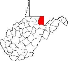 Location in the U.S. state of West Virginia | |
 West Virginia's location in the U.S. | |
| Founded | January 19, 1818 |
| Named for | James Patton Preston |
| Seat | Kingwood |
| Largest city | Kingwood |
| Area | |
| • Total | 651 sq mi (1,686 km2) |
| • Land | 649 sq mi (1,681 km2) |
| • Water | 2.6 sq mi (7 km2), 0.4% |
| Population (est.) | |
| • (2015) | 33,940 |
| • Density | 52/sq mi (20/km2) |
| Congressional district | 1st |
| Time zone | Eastern: UTC−5/−4 |
| Website |
www |
Preston County is a county located in the U.S. state of West Virginia. As of the 2010 census, the population was 33,520.[1] Its county seat is Kingwood.[2] The county was formed from Monongalia County in 1818 and named for Virginia Governor James Patton Preston.[3]
Preston County is part of the Morgantown, WV Metropolitan Statistical Area, and is the southernmost county of the Pittsburgh media market. It is the home of The Buckwheat Festival, a county fair known for making buckwheat cakes.
History
Native Americans lived in and traveled through what became Preston county as they crossed from the Ohio River watershed (which drains into the Mississippi River), into the Chesapeake Bay watershed. Although white traders and explorers also lived in the county after 1736, and one boundary stone (the Fairfax Stone marking the limits of the North Branch of the River) was laid in 1746, white settlers began arriving in 1766. Traveling by foot or horseback, settlers established log cabins after the American Revolutionary War. Further development ensued after 1818, when the National Road was built slightly to the north. When the earliest railroads came in 1851, all land passed into private ownership, population increased 70% in a decade, and industrialization began.[4]
During the American Civil War, more Preston County men enlisted in Union service than with the Confederacy. In part this was explained by the few slaves in the county, almost none outside a half-hour walk from the Clarksburg, West Virginia to Wincester, Virginia road that dated back to the late colonial era. The most slaves in Preston County occurred in 1830, with 125 slaves and 27 free colored persons.[5]
Geography
The U.S. Census Bureau determined the county has a total area of 651 square miles (1,690 km2), of which 649 square miles (1,680 km2) is land and 2.6 square miles (6.7 km2) (0.4%) is water.[6]
In West Virginia’s coldest month of January 1977, Terra Alta in Preston County saw a statewide record snowfall of 104 inches (2.64 m).[7]
Major highways
Adjacent counties
- Fayette County, Pennsylvania (north)
- Garrett County, Maryland (east)
- Grant County (southeast)
- Tucker County (south)
- Barbour County (southwest)
- Taylor County (west)
- Monongalia County (northwest)
National protected area
- Monongahela National Forest (part)
State parks
- Cathedral State Park (also a Registered National Natural Landmark)
- Fairfax Stone State Park
Demographics
| Historical population | |||
|---|---|---|---|
| Census | Pop. | %± | |
| 1820 | 3,422 | — | |
| 1830 | 5,144 | 50.3% | |
| 1840 | 6,866 | 33.5% | |
| 1850 | 11,708 | 70.5% | |
| 1860 | 13,312 | 13.7% | |
| 1870 | 14,555 | 9.3% | |
| 1880 | 19,091 | 31.2% | |
| 1890 | 20,355 | 6.6% | |
| 1900 | 22,727 | 11.7% | |
| 1910 | 26,341 | 15.9% | |
| 1920 | 27,996 | 6.3% | |
| 1930 | 29,043 | 3.7% | |
| 1940 | 30,416 | 4.7% | |
| 1950 | 31,399 | 3.2% | |
| 1960 | 27,233 | −13.3% | |
| 1970 | 25,455 | −6.5% | |
| 1980 | 30,460 | 19.7% | |
| 1990 | 29,037 | −4.7% | |
| 2000 | 29,334 | 1.0% | |
| 2010 | 33,520 | 14.3% | |
| Est. 2016 | 33,758 | [8] | 0.7% |
| U.S. Decennial Census[9] 1790–1960[10] 1900–1990[11] 1990–2000[12] 2010–2015[1] | |||
2010 census
As of the 2010 United States Census, there were 33,520 people, 12,895 households, and 9,038 families residing in the county.[13] The population density was 51.7 inhabitants per square mile (20.0/km2). There were 15,097 housing units at an average density of 23.3 per square mile (9.0/km2).[14] The racial makeup of the county was 97.6% white, 1.1% black or African American, 0.2% American Indian, 0.1% Asian, 0.2% from other races, and 0.8% from two or more races. Those of Hispanic or Latino origin made up 0.7% of the population.[13] In terms of ancestry, 29.4% were German, 14.3% were Irish, 9.5% were American, and 8.9% were English.[15]
Of the 12,895 households, 29.0% had children under the age of 18 living with them, 56.1% were married couples living together, 9.1% had a female householder with no husband present, 29.9% were non-families, and 24.6% of all households were made up of individuals. The average household size was 2.42 and the average family size was 2.84. The median age was 42.0 years.[13]
The age distribution was 19.55% under the age of 18, 7.36% from 18 to 24, 27.58% from 25 to 44, 29.83% from 45 to 64, and 15.68% who were 65 years of age or older. The median age was 42.0 years. For every 100 females, there were 106.63 males. For every 100 females age 18 and over, there were 106.48 males.
The median income for a household in the county was $40,753 and the median income for a family was $46,622. Males had a median income of $38,713 versus $25,808 for females. The per capita income for the county was $19,329. About 10.1% of families and 13.9% of the population were below the poverty line, including 19.0% of those under age 18 and 9.9% of those age 65 or over.[16]
Politics
Whereas most of West Virginia has become a Republican bastion in the twenty-first century after having leaned heavily Democratic between the New Deal and Bill Clinton, Preston County has always been a Republican stronghold, if not quite so rock-ribbed as neighbouring Grant County or Garrett County, Maryland. Those two counties have never voted for a Democrat since being created after the Civil War, whereas Preston County has voted Democratic on one occasion since then, during Lyndon Johnson’s 1964 landslide – although Johnson’s win over Barry Goldwater was much more decisive than his narrow victory in analogous Upshur County, and Bill Clinton came within twenty votes in 1996.
| Year | Republican | Democratic | Third parties |
|---|---|---|---|
| 2016 | 74.7% 9,538 | 19.4% 2,470 | 5.9% 756 |
| 2012 | 70.5% 7,889 | 26.2% 2,931 | 3.3% 363 |
| 2008 | 62.1% 7,325 | 35.7% 4,205 | 2.3% 266 |
| 2004 | 65.9% 7,855 | 33.2% 3,963 | 0.9% 111 |
| 2000 | 63.3% 6,607 | 33.7% 3,515 | 3.0% 317 |
| 1996 | 41.3% 4,257 | 41.1% 4,237 | 17.6% 1,812 |
| 1992 | 42.2% 4,429 | 37.5% 3,933 | 20.3% 2,133 |
| 1988 | 56.9% 5,804 | 42.7% 4,357 | 0.3% 35 |
| 1984 | 63.1% 6,955 | 36.8% 4,054 | 0.2% 22 |
| 1980 | 54.2% 5,828 | 40.2% 4,317 | 5.6% 601 |
| 1976 | 50.6% 5,719 | 49.5% 5,595 | |
| 1972 | 72.4% 7,807 | 27.6% 2,977 | |
| 1968 | 55.2% 5,636 | 39.4% 4,020 | 5.5% 561 |
| 1964 | 39.1% 4,015 | 60.9% 6,264 | |
| 1960 | 62.1% 6,908 | 37.9% 4,221 | |
| 1956 | 70.3% 7,953 | 29.7% 3,365 | |
| 1952 | 65.3% 8,059 | 34.7% 4,278 | |
| 1948 | 62.7% 6,020 | 36.8% 3,527 | 0.5% 49 |
| 1944 | 69.4% 6,785 | 30.6% 2,997 | |
| 1940 | 63.5% 8,213 | 36.5% 4,730 | |
| 1936 | 58.1% 7,553 | 41.6% 5,410 | 0.3% 34 |
| 1932 | 56.1% 6,359 | 42.9% 4,872 | 1.0% 115 |
| 1928 | 76.2% 7,783 | 23.1% 2,355 | 0.8% 78 |
| 1924 | 68.2% 6,396 | 26.1% 2,445 | 5.7% 534 |
| 1920 | 74.7% 6,729 | 23.9% 2,150 | 1.4% 125 |
| 1916 | 68.1% 3,838 | 30.1% 1,694 | 1.9% 105 |
| 1912 | 24.7% 1,461 | 31.2% 1,845 | 44.1% 2,608 |
Communities
City
Towns
Census-designated place
Unincorporated communities
- Afton
- Alpine Lake
- Amboy
- Arthurdale
- Austen
- Borgman
- Bretz
- Bull Run
- Cascade
- Clifton Mills
- Colebank
- Corinth
- Cuzzart
- Denver
- Eglon
- Etam
- Evansville
- Fellowsville
- Gladefarms
- Hazelton
- Hopemont
- Hopewell
- Horse Shoe Run
- Howesville
- Independence
- Israel
- Lenox
- Little Sandy
- Manheim
- Macomber
- Manown
- Marquess
- Mount Olivet
- Mount Vernon
- Orr
- Pisgah
- Pleasantdale
- Preston
- Rockville
- Rodemer
- Rohr
- Ruthbelle
- Saint Joe
- Scotch Hill
- Sell
- Silver Lake
- Sinclair
- Snider
- Stevensburg
- Sugar Valley
- Threefork Bridge
- Turner Douglass
- Valley Point
- Victoria
- West End
- White Oak Springs
- Zevely
See also
References
- 1 2 "State & County QuickFacts". United States Census Bureau. Retrieved January 11, 2014.
- ↑ "Find a County". National Association of Counties. Retrieved 2011-06-07.
- ↑ West Virginia Counties Archived 2001-09-23 at the Wayback Machine.. Wvculture.org. Retrieved on 2013-07-24.
- ↑ Oren Morton, A History of Preston County, part 1 (Kingwood W.Va., Journal Publishing Company 1914) pp. 9-11
- ↑ Morton p. 138
- ↑ "2010 Census Gazetteer Files". United States Census Bureau. August 22, 2012. Retrieved July 30, 2015.
- ↑ West Virginia encyclopedia; The Weather
- ↑ "Population and Housing Unit Estimates". Retrieved June 9, 2017.
- ↑ "U.S. Decennial Census". United States Census Bureau. Retrieved January 11, 2014.
- ↑ "Historical Census Browser". University of Virginia Library. Retrieved January 11, 2014.
- ↑ "Population of Counties by Decennial Census: 1900 to 1990". United States Census Bureau. Retrieved January 11, 2014.
- ↑ "Census 2000 PHC-T-4. Ranking Tables for Counties: 1990 and 2000" (PDF). United States Census Bureau. Retrieved January 11, 2014.
- 1 2 3 "DP-1 Profile of General Population and Housing Characteristics: 2010 Demographic Profile Data". United States Census Bureau. Retrieved 2016-04-03.
- ↑ "Population, Housing Units, Area, and Density: 2010 - County". United States Census Bureau. Retrieved 2016-04-03.
- ↑ "DP02 SELECTED SOCIAL CHARACTERISTICS IN THE UNITED STATES – 2006-2010 American Community Survey 5-Year Estimates". United States Census Bureau. Retrieved 2016-04-03.
- ↑ "DP03 SELECTED ECONOMIC CHARACTERISTICS – 2006-2010 American Community Survey 5-Year Estimates". United States Census Bureau. Retrieved 2016-04-03.
- ↑ Leip, David. "Dave Leip's Atlas of U.S. Presidential Elections". uselectionatlas.org. Retrieved 2018-03-28.
Further reading
- Cox, Connie Loraine, Our Place In History: Southwestern Preston County, West Virginia, Headline Books, Terra Alta, WV, 2005. (Written and oral histories, photographs)
External links
Places adjacent to Preston County, West Virginia | ||||||||||
|---|---|---|---|---|---|---|---|---|---|---|
| ||||||||||
