Budaun
Budaun (also spelled as Badayun, formerly Vodamayuta) is a city and a seat of Budaun district,[1] Uttar Pradesh, India. It is located near the Ganges river[2] in the centre of Western Uttar Pradesh. Budaun was the capital of Delhi Sultanate for four years from 1210 CE to 1214 CE during Sultan Iltutmish rule. It was the most important post of Northern Frontier during Mughal reign. Budaun is a big market, historically famous and religiously important city. It is the heart of Rohilkhand.[3][4] Budaun is 229 km from New Delhi and it takes about 5 to 7 hours to reach the city depending on mode of transport i.e. car or roadways bus service.[5] The town is near the left bank of the river Sot.[6]
Budaun | |
|---|---|
City | |
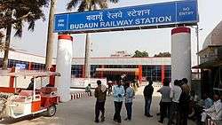 Budaun Junction | |
 Budaun Location in Uttar Pradesh, India | |
| Coordinates: 28.05°N 79.12°E | |
| Country | |
| State | Uttar Pradesh |
| Region | Rohilkhand |
| Division | Bareilly |
| District | Budaun |
| Settled | 905AD (Modern City), 220BC (Ancient City) |
| Government | |
| • Body | Budaun Municipal Corporation |
| • Mayor | Deepmala Goyal |
| • MP | Sangh mitra Maurya |
| • MLA | Mahesh Chandra Gupta |
| Area | |
| • City | 81 km2 (31 sq mi) |
| Elevation | 164 m (538 ft) |
| Population (2011) | |
| • City | 369,221 |
| • Rank | 17 |
| • Density | 5,489/km2 (14,220/sq mi) |
| • Metro | 457,665 (Budaun Metro Area) |
| Demonym(s) | Badayuni |
| Languages | |
| • Official | Hindi, Urdu,, |
| Time zone | UTC+5:30 (IST) |
| PIN | 243601 |
| Telephone code | 05832 |
| ISO 3166 code | IN-UP-BD |
| Vehicle registration | UP-24 |
| Coastline | 0 kilometres (0 mi) |
| Sex ratio | 907 female/1000 male |
| Literacy | 73.00% |
| Civic agency | Budaun Development Authority |
| Governing body | Government of UP Government of India |
| Climate | HS-TH (Köppen) |
| Precipitation | 843 millimetres (33.2 in) |
| Avg. annual temperature | 27.5 °C (81.5 °F) |
| Avg. summer temperature | 39.8 °C (103.6 °F) |
| Avg. winter temperature | 11.5 °C (52.7 °F) |
| Website | http://www.badaun.nic.in/ |
| Also known as 'City of Saints' or 'Madinat ul Awliya', famous for its Pedas, 'Mentha City' of India. | |
Etymology
Prof. Goti John referred this city was named Bedamooth in an ancient inscription based on stone scripts at the Lucknow Meuseum. Later this region was called Panchal. According to the lines on stone scripts there was a village Bhadaunlak near the city. The Muslim historian Roz Khan Lodhi said that at Ashoka The Great built a Buddh Vihar and Quila; he named it BuddhMau (Budaun Fort). According to George Smith, Budaun was named after the Ahir prince Budh.[7][8]
History
According to the (Budaun District, Govt. Of Uttar Pradesh) mythological stories, Budaun was named after Ahir prince Budh.[9] According to tradition, Budaun was founded about 905 AD, and an inscription, probably of the 12th century, gives a list of twelve Rathore kings reigning at Budaun then called Vodamāyuta.[6] Kanauj was conquered after 1085 by Mahmūd, the son of the Ghaznavid Sultān, driving out the Rāshtrakūta chief. This the Rāshtrakūta chief then move their capital to Vodamāyuta, where they ruled until conquered by Qutb-ud-din Aibak.[10]
_(14762905532).jpg)
The first authentic historical event connected with it, however, was its capture by Qutb-ud-din Aibak in 1196, after which it became a very important post on the northern frontier of the Delhi empire. In 1223, a mosque of imposing size, crowned with a dome, was built. In the 13th century two of its governors, Shams-ud-din Iltutmish, the builder of the mosque referred above, and his son Rukn ud din Firuz, attained the imperial throne. In 1571 the town was burnt, and about a hundred years later, under Shah Jahan, the seat of the governorship was transferred to Sahaspur-Bilari. Budaun and its district was ceded to the British government in 1801 by the Nawab of Oudh.[6]
In 1911, Budaun was a town and district of British India, in the Rohilkhand division of the United Provinces. At the time, an American Methodist mission maintained several girls schools and there was a high school for boys.[6]
Politics
Sanghmitra Maurya is the MP of the Budaun Constituency and is the daughter of Swami Prasad Maurya. Budaun has large population of Ahirs which according to British historian Matthew Atmore Sherring came from Hansi and Hisar which is in Haryana.[11][12]
Demographics
As of 2011 census, Budaun City had a population of 369,221 (188,475 male 180,746 female = 1000/907), 39,613 (12.3%) of whom were aged 0–6. The adult literacy rate was 73.%. The widely spoken language in the city is Hindi and Urdu with English being used very rarely, and Punjabi is also a significant language in the city. The sex ratio of Budaun city is 907 per 1000 males. Child sex ratio of girls is 882 per 1000 boys. The area of the city is 81 square km. Budaun Metro Area have a population of around 417000 and an area of 103 km2 (40 sq mi) With Badaun City, it includes Shekhupur, Bahedi, Islamganj, Chandanpur, Salarpur, Salarpur Industrial Estate, Shekhupur Firing Range, Padauna and Khera Buzurg.%.[13][14]
Tourism
Budaun is considered to be of immense religious significance among both Hindus & Muslims. At the first glance, Budaun with its dusty avenues and sleepy streets seems nothing more than a secluded small town. But moving around the city, you come across numerous historical ruins and monuments that reveal many legends from its past. Casting a nostalgic charm, Budaun transports you back to the era of mighty rulers and mystic Sufi saints Nizamuddin Auliya - Sufi saint who once graced the land. Adding to its allure is the serene aura of spirituality that reverberates throughout the town. Situated on the banks of the river Ganga, Budaun is indeed a hidden gem of Uttar Pradesh. Its rugged and rustic setting coupled with a rich culture makes it a delightful destination. With its formidable historical background, there is much to explore [15] in Budaun. It is home to a number of ruins that can be traced back to the Mughal era. The Budaun Fort and the iconic clock tower Ghanta Ghar, are among the prominent attractions. Tombs of significant rulers such as Iltumish and Ala Ud Din Alam Shah, who was the last ruler of the Sayyid dynasty,are also worth visiting. The 13th century Jama Masjid, which was built by Iltumish and the Qadri Dargah are among the popular shrines in Budaun.
Distance
Notable people
- Abd al-Qadir Bada'uni
- Abdul Hamid Qadri Badayuni
- Ada Jafri
- Ale Ahmad Suroor
- Alhaj Shamim Uddin
- Begum Abida Ahmed
- Bekhud Badayuni
- Dilawar Figar
- Fani Badayuni
- Ghulam Mustafa Khan
- Iltutmish
- Inayat Hussain Khan
- Iqbal Hussain Khan Bandanawazi
- Ismat Chughtai
- Jeelani Bano
- Moulvi Fakhrey Alam
- Nakhshabi
- Nissar Hussain Khan
- Nizamuddin Auliya - Sufi saint
- Rashid Khan
- Razia Sultana
- Rukn ud din Firuz
- Saleem Iqbal Shervani
- Shabnam Romani
- Shakeel Badayuni
- Zamir Ali Badayuni
- D. P. Yadav
References
- "Budaun District : Census 2011 data". Indian Census 2011. Retrieved 17 January 2014.
- "Archived copy". Archived from the original on 21 July 2011. Retrieved 21 October 2011.CS1 maint: archived copy as title (link)
- http://indiatoday.intoday.in/story/yadavs-growing-clout-resents-by-both-upper-castes-and-other-backward-castes/1/294220.html
- http://articles.timesofindia.indiatimes.com/2009-05-09/lucknow/28153545_1_sachchar-committee-salim-sherwani-mulayam-singh-yadav
- http://www.mapsofindia.com/distance/new-delhi-to-badaun.html
- Chisholm, Hugh, ed. (1911). . Encyclopædia Britannica. 4 (11th ed.). Cambridge University Press. p. 737.
- George Smith (1882). The student's geography of India: the geography of British India : political and physical. John Murray. pp. 223–. Retrieved 17 February 2012.
- http://www.jagran.com/uttar-pradesh/badaun-shortage-of-milk-in-kilk-prodective-area-10672897.html
- District Budaun Government of Uttar Pradesh https://budaun.nic.in/hi/%e0%a4%9c%e0%a4%bf%e0%a4%b2%e0%a5%87-%e0%a4%95%e0%a5%87-%e0%a4%ae%e0%a4%be%e0%a4%a8%e0%a4%9a%e0%a4%bf%e0%a4%a4%e0%a5%8d%e0%a4%b0/
- Majumdar, Ramesh Chandra (1977). Ancient India. Motilal Banarsidass. p. 315. ISBN 9788120804364. Retrieved 23 May 2017.
- Sherring, Matthew Atmore (1872). Hindu Tribes and Castes. Thacker, Spink & Company. p. 237.
Ahirs.
- Hindu Tribes and Castes, Volume 1 page 334
- "Urban Agglomerations/Cities having population 1 lakh and above" (PDF). Provisional Population Totals, Census of India 2011. Retrieved 7 July 2012.
- http://pib.nic.in/release/release.asp?relid=28770
- https://www.cleartrip.com/india/budaun/
- "Budaun City Population Census 2011". Census 2011 India. Office of the Registrar General and Census Commissioner, India. Retrieved 29 November 2015.
| Wikimedia Commons has media related to Budaun. |
Places adjacent to Budaun | ||||||||||
|---|---|---|---|---|---|---|---|---|---|---|
| ||||||||||