Sant Kabir Nagar district
Sant Kabir Nagar district is one of the 75 districts of Uttar Pradesh state in northern India. Khalilabad city is the district headquarters. Sant Kabir Nagar district is a part of Basti division.
Sant Kabir Nagar district | |
|---|---|
District of Uttar Pradesh | |
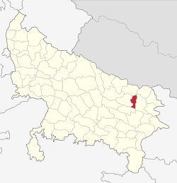 Location of Sant Kabir Nagar district in Uttar Pradesh | |
| Country | India |
| State | Uttar Pradesh |
| Division | Basti |
| Headquarters | Khalilabad, India |
| Tehsils | Khalilabad, Mehdawal, Dhanghata |
| Government | |
| • Lok Sabha constituencies | Sant Kabir Nagar,(Khalilabad, Dhanghata, Alapur, Khajni, Mehdawal) |
| Area | |
| • Total | 1,659.15 km2 (640.60 sq mi) |
| Population (2011) | |
| • Total | 1,715,183 |
| • Density | 1,000/km2 (2,700/sq mi) |
| Demographics | |
| • Literacy | 66.72 per cent |
| • Sex ratio | 969 |
| Time zone | UTC+05:30 (IST) |
| Vehicle registration | UP-58 |
| Major highways | National Highway 27 (India) |
| Website | http://sknagar.nic.in/ |
Economy
In 2006 the Ministry of Panchayati Raj named Sant Kabir Nagar one of the country's 250 most backward districts (out of a total of 640).[1] It is one of the 34 districts in Uttar Pradesh currently receiving funds from the Backward Regions Grant Fund Programme (BRGF).[1]
Demographics
According to the 2011 census Sant Kabir Nagar district has a population of 1,715,183,[2] roughly equal to the nation of The Gambia[3] or the US state of Nebraska.[4] This gives it a ranking of 283rd in India (out of a total of 640).[2] The district has a population density of 1,041 inhabitants per square kilometre (2,700/sq mi).[2] Its population growth rate over the decade 2001-2011 was 20.71%.[2] Sant Kabir Nagar has a sex ratio of 969 females for every 1000 males[2] and a literacy rate of 69.01%.[2]
At the time of the 2011 Census of India, 90.42% of the population in the district spoke Hindi and 9.54% Urdu as their first language.[5]
As per 2001 census, Muslims account for nearly 24% of the districts population, the remaining being Hindus.
| Historical population | ||
|---|---|---|
| Year | Pop. | ±% p.a. |
| 1901 | 486,935 | — |
| 1911 | 482,786 | −0.09% |
| 1921 | 507,791 | +0.51% |
| 1931 | 548,093 | +0.77% |
| 1941 | 576,478 | +0.51% |
| 1951 | 629,746 | +0.89% |
| 1961 | 652,787 | +0.36% |
| 1971 | 752,737 | +1.43% |
| 1981 | 911,052 | +1.93% |
| 1991 | 1,152,116 | +2.38% |
| 2001 | 1,420,226 | +2.11% |
| 2011 | 1,715,183 | +1.90% |
| source:[6] | ||
Notable person
- Sant Kabir Das, poet
- Nagendra Nath Tripathi, politician
References
- Ministry of Panchayati Raj (8 September 2009). "A Note on the Backward Regions Grant Fund Programme" (PDF). National Institute of Rural Development. Archived from the original (PDF) on 5 April 2012. Retrieved 27 September 2011.
- "District Census 2011". Census2011.co.in. 2011. Retrieved 30 September 2011.
- US Directorate of Intelligence. "Country Comparison:Population". Retrieved 1 October 2011.
Gambia, The 1,797,860 July 2011 est.
- "2010 Resident Population Data". U. S. Census Bureau. Retrieved 30 September 2011.
Nebraska 1,826,341
- 2011 Census of India, Population By Mother Tongue
- Decadal Variation In Population Since 1901
External links
| Wikimedia Commons has media related to Sant Kabir Nagar district. |
- Sant Kabir Nagar district website
- Sant Kabir Nagar District Court Website
- Sant Kabir Nagar census 2011 data
Places adjacent to Sant Kabir Nagar district | ||||||||||
|---|---|---|---|---|---|---|---|---|---|---|
| ||||||||||