Kannauj district
Kannauj district is an administrative district of Uttar Pradesh state in northern India, along the river Ganges. The historic town of Kannauj, northwest of Kanpur, is the administrative center. The district was carved out of the Farrukhabad district on 18 September 1997. The native dialect of this district is Kannauji.
Kannauj district | |
|---|---|
District of Uttar Pradesh | |
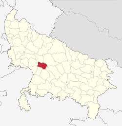 Location of Kannauj district in Uttar Pradesh | |
| Country | India |
| State | Uttar Pradesh |
| Division | Kanpur |
| Headquarters | Kannauj |
| Government | |
| • Lok Sabha constituencies | Kannauj (Lok Sabha constituency) |
| • Vidhan Sabha constituencies | 1. Chhibramau 2. Tirwa 3. Kannauj Member of parliament Subrat Pathak (BJP) |
| Area | |
| • Total | 1,993 km2 (770 sq mi) |
| Population (2011) | |
| • Total | 1,656,616[1] |
| Time zone | UTC+05:30 (IST) |
| Website | http://kannauj.nic.in/ |
Geography
Kannauj is located at 27.07°N 79.92°E. It has an average elevation of 139 metres (456 feet).
The Ganges is the main river of the district at the North East border of the district. Kali river is at the northern border of the district while the Ishan river flows through the District.
The climate of the district is characterized by a hot dry summer and a pleasant cold season. The average rainfall of the District is approximately 80 cm.
The district is bounded by the districts of Farrukhabad to the north, Hardoi to the northeast, Kanpur Nagar to the east, Kanpur Dehat to the southeast, Auraiya to the south, Etawah to the southwest, and Mainpuri to the west. The district is divided into three tehsils and seven development blocks. The district was split from Farrukhabad on 18 September 1997, and is part of Kanpur Division.
Demographics
| Historical population | ||
|---|---|---|
| Year | Pop. | ±% p.a. |
| 1901 | 414,501 | — |
| 1911 | 403,009 | −0.28% |
| 1921 | 383,586 | −0.49% |
| 1931 | 400,836 | +0.44% |
| 1941 | 436,118 | +0.85% |
| 1951 | 498,675 | +1.35% |
| 1961 | 590,595 | +1.71% |
| 1971 | 727,233 | +2.10% |
| 1981 | 917,167 | +2.35% |
| 1991 | 1,155,847 | +2.34% |
| 2001 | 1,388,923 | +1.85% |
| 2011 | 1,656,616 | +1.78% |
| source:[2] | ||
According to the 2011 census Kannauj district has a population of 1,656,616,[1] roughly equal to the nation of Guinea-Bissau[3] or the US state of Idaho.[4] This gives it a ranking of 299th in India (out of a total of 640).[1] The district has a population density of 792 inhabitants per square kilometre (2,050/sq mi) .[1] Its population growth rate over the decade 2001–2011 was 19.37%.[1] Kannauj has a sex ratio of 879 females for every 1000 males,[1] and a literacy rate of 74.01%.[1]
At the time of the 2011 Census of India, 97.08% of the population in the district spoke Hindi and 2.89% Urdu as their first language.[5]
The District's population was 1,388,923 in 2001. Of these, 1,156,951 (or 83.3%) lived in rural areas, while 231,972 (or 16.7%) lived in urban areas.[6]
Historical and Spiritual importance
There are many temples in Kannauj which are very important by both Historical as well as spiritual purposes. In the time of King Harsha it was the kingdom of India.
It is very much famous for Kannauj Perfume also. That is the reason why it is mentioned as the city of perfumes.
Colleges
Medical College
Government Medical College, Kannauj is a government medical college located in Tirwa of Kannauj. It is affiliated to King George's Medical University, Lucknow. In 2012, the institute become recognized for 100 M.B.B.S. seats by Medical Council of India (MCI).
Engineering College
Government Engineering College, Kannauj is a government engineering college in Kannauj. It is a constituent college of Dr. A.P.J. Abdul Kalam Technical University (formerly Uttar Pradesh Technical University) in Lucknow, and has its temporary campus at Harcourt Butler Technical University in Kanpur.
Nearby cities
References
- "District Census 2011". Census2011.co.in. 2011. Retrieved 30 September 2011.
- Decadal Variation In Population Since 1901
- US Directorate of Intelligence. "Country Comparison:Population". Retrieved 1 October 2011.
Guinea-Bissau 1,596,677 July 2011 est.
- "2010 Resident Population Data". U. S. Census Bureau. Archived from the original on 17 August 2011. Retrieved 30 September 2011.
Idaho 1,567,582
- 2011 Census of India, Population By Mother Tongue
- Interactive map, Uttar Pradesh, Census of India 2001. Archived 2010-01-11 at the Wayback Machine
External links
Places adjacent to Kannauj district | |
|---|---|