Dakshin Dinajpur district
Dakshin Dinajpur (Bengali pronunciation: [dokkʰiɳ dinadʒpur]) or South Dinajpur is a district in the Indian state of West Bengal, India. It was created on 1 April 1992 by the division of the erstwhile West Dinajpur District. The Headquarter (sadar) of the district is at Balurghat. It comprises two subdivisions: Balurghat and Gangarampur at Buniadpur . According to the 2011 population, it is the third least populous District of West Bengal (out of 23).[2]
Dakshin Dinajpur district | |
|---|---|
District of West Bengal | |
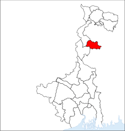 Location of Dakshin Dinajpur district in West Bengal | |
| Country | India |
| State | West Bengal |
| Division | Malda |
| Headquarters | Balurghat |
| Government | |
| • Lok Sabha constituencies | Balurghat |
| • Vidhan Sabha constituencies | Kushmandi, Kumarganj, Balurghat, Tapan, Gangarampur, Harirampur |
| Area | |
| • Total | 2,219 km2 (857 sq mi) |
| Population (2020) | |
| • Total | 1,976,276 |
| • Density | 890/km2 (2,300/sq mi) |
| Demographics | |
| • Literacy | 73.86 per cent[1] |
| • Sex ratio | 950 |
| Time zone | UTC+05:30 (IST) |
| Major highways | NH 512 |
| Website | http://ddinajpur.nic.in/ |
.jpg)
History
The erstwhile Dinajpur District, at the time of the partition of India, was split up into West Dinajpur district and East Dinajpur. The East Dinajpur district, now called Dinajpur, became part of East Pakistan (now Bangladesh). The West Dinajpur district was enlarged in 1956, when States Reorganisation Act recommendations were implemented, with the addition of some areas of Bihar. The district was bifurcated into Uttar Dinajpur and Dakshin Dinajpur on 1 April 1992.[3][4]
Economy
Dakshin Dinajpur is predominantly an agricultural district with a large area of land under cultivation. The district is drained by north-south flowing rivers like Atreyee, Purnabhaba, Tangon and Jamuna River, to give rise to a sizeable, unorganised fishing community.
Dakshin Dinajpur is a "non-large scale industry" but there are a number of medium and small hand loom industries especially Gangarampur block. Internet access is available from most of the cities, even broadband connections are available. There is one State Highway with only 77 km of National Highway No. 512 in the district. A new railway line has been laid between Eklakhi and Balurghat, the district headquarters. Train services were started on 30 December 2004.
In 2006 the Ministry of Panchayati Raj named Dakshin Dinajpur one of the country's 250 most backward districts (out of a total of 640).[5] It is one of the eleven districts in West Bengal currently receiving funds from the Backward Regions Grant Fund Programme (BRGF).[5]
Divisions
Administrative subdivisions
The district comprises two subdivisions: Balurghat and Gangarampurpur at Buniadpur. Balurghat subdivision consists of Balurghat municipality and four community development blocks: Hili, Balurghat, Kumarganj and Tapan. Gangarampur subdivision consists of Gangarampur, Buniadpur municipalities and four community development blocks: Gangarampur, Bansihari, Harirampur and Kushmandi.[6] Balurghat is the district headquarters. There are eight police stations,[7] eight development blocks, Three municipalities, 64 gram panchayats and 2317 villages in this district.[6][8]
Other than municipality area, each subdivision contains community development blocs which are divided into rural areas and census towns.[9]
Balurghat subdivision
- Balurghat: municipality
- Hili (Community development block) consists of rural areas only with 5 gram panchayats.
- Balurghat (Community development block) consists of rural areas only with 11 gram panchayats.
- Kumarganj (Community development block) consists of rural areas only with 8 gram panchayats.
- Tapan (Community development block) consists of rural areas only with 11 gram panchayats.
Gangarampur subdivision at Buniadpur
- Buniadpur : Municipality
- Gangarampur Municipality
- Gangarampur (Community development block) consists of rural areas only with 11 gram panchayats.
- Bansihari (Community development block) consists of rural areas only with 1 BuniadpurMunicipality & 4;gram panchayats.
- Harirampur (Community development block) consists of rural areas only with 6 gram panchayats.
- Kushmandi (Community development block) consists of rural areas only with 8 gram panchayats.
Assembly constituencies
The district is divided into six assembly constituencies:[10]
- Kushmandi (SC) (assembly constituency no. 33),
- Gangarampur (assembly constituency no. 35),
- Tapan (ST) (assembly constituency no. 40,
- Kumarganj (assembly constituency no. 37),
- Balurghat (assembly constituency no. 38).
- Harirampur(assembly constituency no. 42).
Tapan constituency is reserved for Scheduled Tribes (ST) candidates. Kushmandi constituency is reserved for Scheduled Castes (SC) candidates. Along with one assembly constituency from North Dinajpur district, the six assembly constituencies of this district form the Balurghat (Lok Sabha constituency), which is reserved for SC candidates.
Impact of delimitation of constituencies
As per order of the Delimitation Commission in respect of the delimitation of constituencies in the West Bengal, the district was to be divided into six assembly constituencies:[11]
- Kushmandi (SC) (assembly constituency no. 37)
- Kumarganj (assembly constituency no. 38)
- Balurghat (assembly constituency no. 39)
- Tapan (ST) (assembly constituency no. 40)
- Gangarampur (SC) (assembly constituency no. 41)
- Harirampur (assembly constituency no. 42)
Tapan constituency will be reserved for ST candidates. Kushmandi and Gangarampur constituencies will be reserved for SC candidates. Along with one assembly constituency from North Dinajpur district, the six assembly constituencies of this district will form the Balurghat (Lok Sabha constituency).
Demographics
Religions in Dakshin Dinajpur District
| Historical population | ||
|---|---|---|
| Year | Pop. | ±% p.a. |
| 1901 | 340,163 | — |
| 1911 | 363,212 | +0.66% |
| 1921 | 319,170 | −1.28% |
| 1931 | 342,245 | +0.70% |
| 1941 | 383,042 | +1.13% |
| 1951 | 448,275 | +1.59% |
| 1961 | 563,598 | +2.32% |
| 1971 | 772,618 | +3.20% |
| 1981 | 989,294 | +2.50% |
| 1991 | 1,230,608 | +2.21% |
| 2001 | 1,503,178 | +2.02% |
| 2011 | 1,676,276 | +1.10% |
| source:[14] | ||
According to the 2011 census Dakshin Dinajpur district has a population of 1,676,276.[2] roughly equal to the nation of Guinea-Bissau.[15] or the US state of Idaho.[16] This gives it a ranking of 295th in India (out of a total of 640).[2] The district has a population density of 753 inhabitants per square kilometre (1,950/sq mi).[2] Its population growth rate over the decade 2001–2011 was 11.16%.[2] Dakshin Dinajpur has a sex ratio of 954 females for every 1000 males[2] and a literacy rate of 73.86%.[2]
Languages
Bengali is the principal language of the district. The principal communities are Hindus and Muslims, constituting the major portion of the population. Surjapuri one of the minor dialect is also spoken in this district.[17]
Education
Dakshin Dinajpur University will start functioning from next year.It will be at Mahinagar,Balurghat.There is a Government nursing college at Balurghat.There is a Law college and a agriculture college at Balurghat.There are Two Central Government School In the District:1.Central School,Balurghat;2.Jawhar Navoday school,Balurghat. There is one D.A.V group school(Atreyee DAV Public School) and a Techno Group school at Balurghat. There is one Polytecnic college at Gangarampur (Thengapara),one polytechnic at Teor,10 kms from Balurghat and one I.T.I. (Industrial Training Institute) at Balurghat, but no engineering or medical college. There are a few good schools in Balurghat and Gangarampur. There are two CBSE affiliated and one CISCE affiliated school in Balurghat. Of late, The Green View English Academy is the only CISCE affiliated school in the entire district.The Atreyee D.A.V Public School has earned several accolades, giving the entire district an honorable position in the academic map of the country. VVM Junior Level National Champion (2018–19), Saswata Bose, is a student of The ADAVPS. Many government schools exist throughout the district. Balurghat College, Gangarampur College is the most popular college. A government-funded girls' college is in Balurghat. Balurghat has a law college and two B.Ed colleges as well as Gangarampur has six B.Ed colleges. A college of agriculture has been set up under Uttar Banga Krishi Viswavidyalaya at Majhian, 10 km from Balurghat. An agricultural Regional Research Station for Old Alluvial Zone under Uttar Banga Krishi Viswavidyalaya is operating at Majhian. A dental and B.sc nursing college will start functioning at Balurghat from next year..
References
- "District -DO office Literates and Literacy Rates, 2001". Registrar General, India, Ministry of Home Affairs. Retrieved 10 October 2010.
- "District Census 2011". Census2011.co.in. 2011. Retrieved 30 September 2011.
- "Uttar Dinajpur Website". Government of India Portal. Retrieved 10 November 2008.
- "Historical Perspective". Official website of South Dinajpur district from Government of India Portal. Retrieved 10 November 2008.
- Ministry of Panchayati Raj (8 September 2009). "A Note on the Backward Regions Grant Fund Programme" (PDF). National Institute of Rural Development. Archived from the original (PDF) on 5 April 2012. Retrieved 27 September 2011.
- "Directory of District, Sub division, Panchayat Samiti/ Block and Gram Panchayats in West Bengal, March 2008". West Bengal. National Informatics Centre, India. 19 March 2008. Archived from the original on 25 February 2009. Retrieved 8 November 2008.
- "Census of India 2001, Final Population Totals, West Bengal, Rural Frame". West Bengal. Directorate of census operations. Archived from the original on 19 July 2011. Retrieved 9 November 2008.
- "District Profile". Official website of the South Dinajpur district. Retrieved 9 November 2008.
- "Population, Decadal Growth Rate, Density and General Sex Ratio by Residence and Sex, West Bengal/ District/ Sub District, 1991 and 2001". West Bengal. Directorate of census operations. Archived from the original on 19 July 2011. Retrieved 9 November 2008.
- "General election to the Legislative Assembly, 2001 – List of Parliamentary and Assembly Constituencies" (PDF). West Bengal. Election Commission of India. Archived from the original (PDF) on 4 May 2006. Retrieved 18 November 2008.
- "Press Note, Delimitation Commission" (PDF). Assembly Constituencies in West Bengal. Delimitation Commission. Retrieved 18 November 2008.
- http://www.censusindia.gov.in/2011census/C-16.html
- "DISTRIBUTION OF THE 22 SCHEDULED LANGUAGES-INDIA/STATES/UNION TERRITORIES - 2011 CENSUS" (PDF).
- Decadal Variation In Population Since 1901
- US Directorate of Intelligence. "Country Comparison: Population". Retrieved 1 October 2011.
Guinea-Bissau 1,596,677 July 2011 est.
- "2010 Resident Population Data". U. S. Census Bureau. Archived from the original on 19 October 2013. Retrieved 30 September 2011.
Idaho 1,567,582
- Hernández-Campoy, Juan Manuel; Conde-Silvestre, Juan Camilo (15 February 2012). "The Handbook of Historical Sociolinguistics". John Wiley & Sons – via Google Books.
External links
| Wikimedia Commons has media related to Dakshin Dinajpur district. |
Places adjacent to Dakshin Dinajpur district | ||||||||||
|---|---|---|---|---|---|---|---|---|---|---|
| ||||||||||
Cities, towns and locations in Dakshin Dinajpur district | |||||
|---|---|---|---|---|---|
| Cities, municipal and census towns |
| ||||
| Locations other than cities and towns |
| ||||
| Related topics |
| ||||