Mamit district
Mamit district is one of the eleven districts of Mizoram state in India.
Mamit district | |
|---|---|
District of Mizoram | |
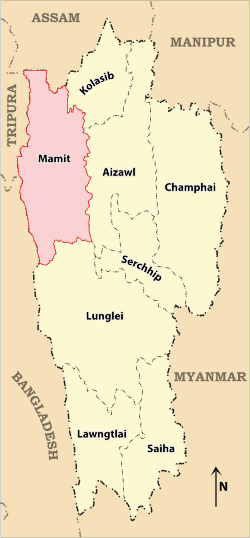 Location of Mamit district in Mizoram | |
| Coordinates (Mamit): 23.925141°N 92.491368°E | |
| Country | India |
| State | Mizoram |
| Headquarters | Mamit |
| Government | |
| • Lok Sabha constituencies | Mizoram |
| • Vidhan Sabha constituencies | 3 |
| Area | |
| • Total | 3,025 km2 (1,168 sq mi) |
| Population (2011) | |
| • Total | 86,364 |
| • Density | 29/km2 (74/sq mi) |
| Demographics | |
| • Literacy | 84.93 |
| • Sex ratio | 927 |
| Time zone | UTC+05:30 (IST) |
| Website | mamit |
Geography
The district is bounded on the north by Hailakandi district of Assam state, on the west by North Tripura district of Tripura state and Bangladesh, on the south by Lunglei district and on the east by Kolasib and Aizawl districts. The district occupies an area of 3025.75 km². Mamit town is the administrative headquarters of the district.[1]
Divisions
The district has 4 R.D. Blocks, Mamit, Reiek, West Phaileng and Zawlnuam. The district has 3 legislative assembly constituencies. These are Hachhek, Dampa and Mamit.
Demographics
According to the 2011 census Mamit district has a population of 86,364, roughly equal to the nation of Andorra.[2] This gives it a ranking of 618th in India (out of a total of 640). The district has a population density of 29 inhabitants per square kilometre (75/sq mi) . Its population growth rate over the decade 2001-2011 was 37.56%. Mamit has a sex ratio of 927 females for every 1000 males, and a literacy rate of 84.93%.[3]
| Historical population | ||
|---|---|---|
| Year | Pop. | ±% p.a. |
| 1971 | 30,311 | — |
| 1981 | 52,255 | +5.60% |
| 1991 | 64,572 | +2.14% |
| 2001 | 62,785 | −0.28% |
| 2011 | 86,364 | +3.24% |
| source:[4] | ||
Flora and fauna
In 1985 Mamit district became home to Dampa Tiger Reserve, which has an area of 500 km².[5]
References
- "District Census 2011". Census2011.co.in. 2011. Retrieved 30 September 2011.
- US Directorate of Intelligence. "Country Comparison:Population". Retrieved 1 October 2011.
198 Andorra 84,825 July 2011 est.
- census2011. "Mamit District : Census 2011 data". census2011.co.in. Retrieved 15 June 2013.
- Decadal Variation In Population Since 1901
- Indian Ministry of Forests and Environment. "Protected areas: Mizoram. certificate". Archived from the original on 23 August 2011. Retrieved 25 September 2011.
External links
Places adjacent to Mamit district | |
|---|---|
| State symbols | |
|---|---|
| Government |
|
| Topics | |
| Districts | |
| Urban Areas | |
| Infrastructure |
|
| Education |
|
| Tourism | |
| Protected areas | |
| Mizo Culture | |