Chitrakoot district
Chitrakoot district is one of the districts of Uttar Pradesh state of India, and Chitrakoot town is the district headquarters. Chitrakoot district is a part of Chitrakoot Division.The district occupies an area of 3,216 km².The district has a population of 991,730 (2011 Census).[1] As of 2011 it is the second least populated district of Uttar Pradesh (out of 75), after Mahoba.[2]
Chitrakoot district | |
|---|---|
District of Uttar Pradesh | |
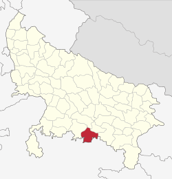 Location of Chitrakoot district in Uttar Pradesh | |
| Country | India |
| State | Uttar Pradesh |
| Division | Chitrakoot |
| Headquarters | Chitrakoot Dham (Karwi) |
| Tehsils | 4 (Karwi, Mau, Manikpur and Rajapur) |
| Government | |
| • Vidhan Sabha constituencies | Chitrakoot, Mau & Manikpur |
| Area | |
| • Total | 3,216 km2 (1,242 sq mi) |
| Population (2011) | |
| • Total | 991,730 |
| • Density | 310/km2 (800/sq mi) |
| • Urban | 96,352 |
| Demographics | |
| • Literacy | 65.05 |
| • Sex ratio | 879 |
| Time zone | UTC+05:30 (IST) |
| Major highways | NH 35 |
| Website | http://chitrakoot.nic.in/ |
History
On 6 May 1997, a new district was carved out from the erstwhile Banda district comprising its Karwi and Mau tehsils. The district was initially named as Chitrakoot district.
Economy
In 2006 the Ministry of Panchayati Raj named Chitrakoot one of the country's 250 most backward districts (out of a total of 640).[3] It is one of the 34 districts in Uttar Pradesh currently receiving funds from the Backward Regions Grant Fund Programme (BRGF).[3] Successive governments have often ignored the district's development and hence has become one of the most remote and cut-off districts in India.
Transportation
Closest Airport to Chitrakoot is in Prayagraj which is 106 kilometers (65.8 miles) away and has flights to major destinations such as Delhi, Bangaluru, Mumbai, Kolkata etc.
Demographics
According to the 2011 census Chitrakoot district has a population of 991,730,[2] roughly equal to the nation of Fiji[5] or the US state of Montana.[6] This gives it a ranking of 448th in India (out of a total of 640).[2] The district has a population density of 315 inhabitants per square kilometre (820/sq mi) .[2] Its population growth rate over the decade 2001-2011 was 29.29%.[2] Chitrakoot has a sex ratio of 879 females for every 1000 males,[2] and a literacy rate of 66.52%.[2]
At the time of the 2011 Census of India, 99.87% of the population in the district spoke Hindi as their first language.[7]
| Historical population | ||
|---|---|---|
| Year | Pop. | ±% p.a. |
| 1901 | 212,242 | — |
| 1911 | 221,166 | +0.41% |
| 1921 | 206,634 | −0.68% |
| 1931 | 219,667 | +0.61% |
| 1941 | 253,728 | +1.45% |
| 1951 | 270,877 | +0.66% |
| 1961 | 322,065 | +1.75% |
| 1971 | 389,516 | +1.92% |
| 1981 | 510,346 | +2.74% |
| 1991 | 624,177 | +2.03% |
| 2001 | 801,957 | +2.54% |
| 2011 | 991,730 | +2.15% |
| source:[8] | ||
Notes
- "Chitrakoot District Census 2011".
- "District Census 2011". Census2011.co.in. 2011. Retrieved 30 September 2011.
- Ministry of Panchayati Raj (8 September 2009). "A Note on the Backward Regions Grant Fund Programme" (PDF). National Institute of Rural Development. Archived from the original (PDF) on 5 April 2012. Retrieved 27 September 2011.
- "Chitrakoot District Religion Data - Census 2011". www.census2011.co.in. Retrieved 19 March 2018.
- US Directorate of Intelligence. "Country Comparison:Population". Retrieved 1 October 2011.
Fiji 883,125 July 2011 est.
- "2010 Resident Population Data". U. S. Census Bureau. Archived from the original on 19 October 2013. Retrieved 2011-09-30.
Montana 989,415
- 2011 Census of India, Population By Mother Tongue
- Decadal Variation In Population Since 1901
- Braj Basi Lal (2011). Excavations at Bharadwaja Ashram: with a note on the exploration at Chitrakuta. Archaeological Survey of India.
External links
- Chitrakoot District on Bundelkhanddarshan.com
- Official website
- Chitrakoot @ Bundelkhand's unofficial web site
- Chitrakoot Information Guide
Places adjacent to Chitrakoot district | ||||||||||
|---|---|---|---|---|---|---|---|---|---|---|
| ||||||||||