Bareilly
Bareilly (/bəˈrɛli/ (![]()
Bareilly | |
|---|---|
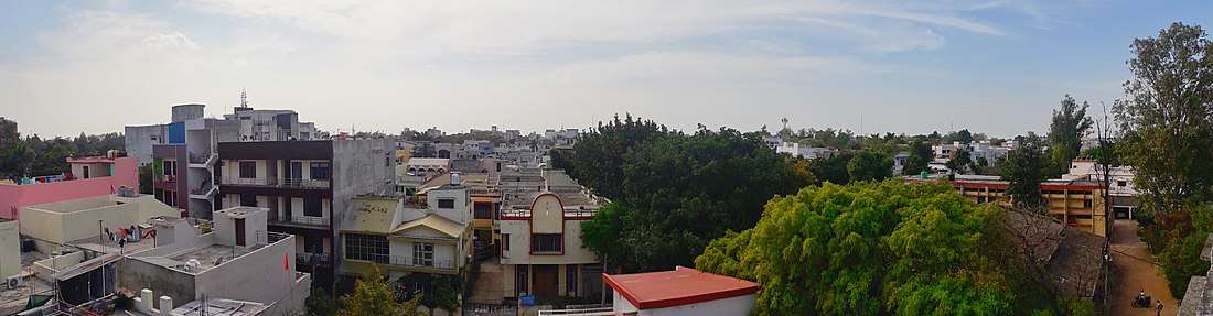
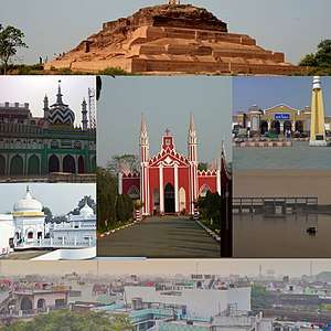 Clockwise from Top: Remains of Ahichchhatra, Bareilly Junction railway station, Ramganga Barrage, Skyline of Bareilly, Biabani Kothi, Dargah-e-Ala Hazrat and The FreeWill Baptist Church | |
| Nicknames: Nath Nagri | |
<mapframe>: The JSON content is not valid GeoJSON+simplestyle
Location within Uttar Pradesh | |
| Coordinates: 28.364°N 79.415°E | |
| Country | India |
| State | Uttar Pradesh |
| District | Bareilly District |
| Government | |
| • MP | Santosh Gangwar (Union Minister) |
| • MLA | Arun Kumar (city) Rajesh Agarwal (cantt) |
| • Mayor | Umesh Gautam (Bharatiya Janta Party |
| Area | |
| • Total | 300 km2 (100 sq mi) |
| Elevation | 268 m (879 ft) |
| Population (2011)[1] | |
| • Total | 903,668 |
| • Density | 3,000/km2 (7,800/sq mi) |
| • Sex ratio | 895 ♀/1,000 ♂ |
| Demonym(s) | Bareillite |
| Language | |
| • Official | Hindi[2] |
| • Additional official | Urdu[2] |
| Time zone | IST |
| PIN codes | 243001 243122 |
| Vehicle registration | UP-25 |
| Website | bareilly.nic.in |


The city is also known by the name Nath Nagri[5] (for the seven Shiva temples located in the Bareilly region – Dhopeshwar Nath, Madhi Nath, Alakha Nath, Tapeshwar Nath, Bankhandi Nath, Pashupati Nath and Trivati Nath) and historically as Sanjashya (where the Buddha descended from Tushita to earth).[6]
The city is a centre for furniture manufacturing and trade in cotton, cereal and sugar. Its status grew with its inclusion in the "counter magnets" list of the National Capital Region (NCR), a list also including Hissar, Patiala, Kota and Gwalior.[7]
History
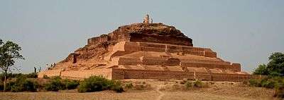
According to the epic Mahābhārata, the Bareilly region (Panchala) is said to be the birthplace of Draupadi, who was also referred to as 'Panchali' (one from the kingdom of Panchāla) by Kṛṣṇā (Lord Krishna). When Yudhishthira becomes the king of Hastinapur at the end of the Mahābhārata, Draupadi becomes his queen. The folklore says that Gautama Buddha had once visited the ancient fortress city of Ahichchhatra in Bareilly.[8] The Jain Tirthankara Parshva is said to have attained Kaivalya at Ahichchhatra.[9]
In a Historic book (Sikar Ka Itihaas) written by Pt. Jhabarmall Sharma It is believed that the descendants of Lord Shriram's son Kusha went from Ayodhya to Rohtas, Narwar, Gwalior and Bareilly respectively their capital. In the 21st generation, Maharaja Nala, Soddevji made Gopachal (Gwalior) the capital. The time of going to Gwalior to Bareilly looks like Vikrama 933.
In the 12th century, the kingdom was under the rule by different clans of Kshatriya Rajputs. Then the region became part of the Muslim Turkic Delhi Sultanate for 325 years before getting absorbed in the emerging Mughal Empire. The foundation of the modern City of Bareilly foundation was laid by Mughal governor Mukrand Rai in 1657 during the rule of Mughal Emperor Aurangzeb.
Later the region became the capital of Rohilkhand region before getting handed over to Nawab Vazir of Awadh and then to East India Company (transferred to the British India) and later becoming an integral part of India. The region has, also, acted as a mint for a major part of its history.
From archaeological point of view the district of Bareilly is very rich. The extensive remains of Ahichchhatra, the Capital town of Northern Panchala have been discovered near Ramnagar village of Aonla Tehsil in the district. It was during the first excavations at Ahichchhatra (1940–44) that the painted grey ware, associated with the advent of the Aryans in the Ganges–Yamuna Valley, was recognised for the first time in the earliest levels of the site. Nearly five thousand coins belonging to periods earlier than that of Guptas have been yielded from Ahichchhatra. It has also been one of the richest sites in India from the point of view of the total yield of terracotta. Some of the masterpieces of Indian terracotta art are from Ahichchhatra. In fact the classification made of the terracotta human figurines from Ahichchhatra on grounds of style and to some extent stratigraphy became a model for determining the stratigraphy of subsequent excavations at other sites in the Ganges Valley. On the basis of the existing material, the archaeology of the region helps us to get an idea of the cultural sequence from the beginning of the 2nd millennium BC up to the 11th century AD. Some ancient mounds in the district have also been discovered by the Deptt. of Ancient History and culture, Rohilkhand University, at Tihar-Khera (Fatehganj West), Pachaumi, Rahtuia, Kadarganj and Sainthal.[9] Apart from this, artefacts of painted grey ware culture of the Iron Age have also been discovered near the city.[10]
Establishment
Bareilly was founded in 1537 by Jagat Singh Katehriya, a Rajput who named it Bareilly after his two sons Bansaldev and Baraldev.[11]
The city was mentioned by the historian Budayuni, who wrote that Husain Quli Khan was appointed the governor of "Bareilly and Sambhal" in 1568. The divisions and revenue of the district "being fixed by Todar Mal" were recorded by Abul Fazl in 1596. The foundation of the modern city of Bareilly was laid by Mughal governor Mukrand Rai in 1657. In 1658, Bareilly became the headquarters of the province of Budaun.[12]
The Mughals encouraged the settlements of loyal Afghans (Pathans) in the Bareilly region to control the rebellious Katehriya Rajputs. After the death of Emperor Aurangzeb, the Afghans began to settle in the villages and assimilated with the local Muslims. These descendants of the these assimilated Afghans are known as Pathans.
After the fall of the Mughal Empire, created anarchy and many Pathans migrated from the Rohilkhand region. Bareilly (like other cities in Uttar Pradesh) experienced economic stagnation and poverty due to the breakdown of trade and security, leading to the migration of Rohilla Muslim Pathans to Suriname and Guyana as indentured labour.[13][14]
British East India Company
Under Barech at the 1761 Third Battle of Panipat, Rohilkhand blocked the expansion of the Maratha Empire into northern India. In 1772 it was invaded by the Marathas, repulsing the invasion with the aid of the Nawab of Awadh. After the war, Nawab Shuja-ud-Daula demanded payment for the nawabs' help from Barech. When his demand was refused, the nawab joined the British (under Governor Warren Hastings and his Commander-in-Chief, Alexander Champion) to invade Rohilkhand. The combined forces of Daula and the Company defeated Barech (who was killed in battle at Miranpur Katra, ending Rohilla rule) in 1774.
Rohilkhand was handed over to Daula, and from 1774 to 1800 the province was ruled by the Nawab of Awadh. By 1801, subsidies due under the treaties to support a British force had fallen into arrears. To pay the debt, Nawab Saadat Ali Khan surrendered Rohilkhand to the East India Company in a treaty signed on 10 November 1801. [15]
During the reign of Shah Alam II, Bareilly was the headquarters of Rohilla Sardar Hafiz Rehmat Khan and many coins were minted. The city was later in the possession of Awadh Nawab Asaf-ud-Daulah, and his coins had Bareilly, Bareilly Aasfabad and the Bareilly kite and fish as identification marks. Coins were then minted by the East India Company.[16]
Modern period
After the Rohilla War, the change in the power structure increased discontent throughout the district. Increased taxation from 1812[17] to 1814 increased resentment of the British: "Business stood still, shops were shut and multitudes assembled near the courthouse to petition for the abolition of the tax." The Magistrate Dembleton, already unpopular, ordered the assessment to be made by a Kotwal. A skirmish between rebels and the sepoys (under Captain Cunningham) cost 300–400 lives. In 1818, Robert Glyn was posted as Acting Judge and Magistrate of Bareilly and the Joint Magistrate of Bulundshahr.[18]
Robert Glyn asked Ghulam Yahya to write an account of "craftsmen, the names of tools of manufacture and production and their dress and manners". The most popular trades in and around Bareilly during the 1820s were manufacturing glass, jewellery, glass and lac bangles and gold and silver thread, crimping, bean drying, wire drawing, charpoy weaving, keeping a grocer's shop and selling kebabs.[12]
Rebellion of 1857
Bareilly was a centre of the Indian Rebellion of 1857. The rebellion began as a mutiny of native soldiers (sepoys), employed by the British East India Company's army, against race- and religion-based injustices and inequities on 10 May 1857 in Meerut. It expanded into other mutinies and civilian rebellions, primarily in the major north-central Indian river valleys; local episodes extended northwest to Peshawar (on the northwest frontier with Afghanistan) and southeast (beyond Delhi). There were riots in many parts of Uttar Pradesh, and Muslims in Bareilly, Bijnor and Moradabad called for the revival of a Muslim kingdom.[19]

The Rohillas actively opposed the British, but were disarmed.[20] Khan Bahadur Khan Rohilla, grandson of Hafiz Rahmat Khan, formed his own government in Bareilly in 1857 and a widespread popular revolt in Awadh, Bundelkhand and Rohilkhand took place. In 1857, Khan Bhadur Khan issued silver coins from Bareilly as an independent ruler.[21] When the rebellion failed, Bareilly was subjugated. Khan Bahadur Khan was sentenced to death, and hanged in the police station on 24 February 1860.
Independence
Bareilly Central Jail housed a number of political prisoners during the British Raj, including Yashpal (who married while imprisoned on 7 August 1936 was the first such ceremony in an Indian jail). The rules were changed, preventing future prison marriages.[22]
Geography
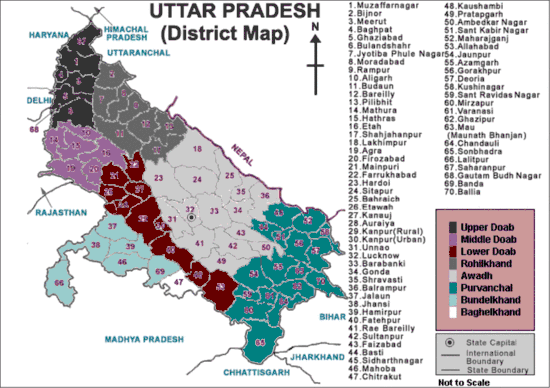
Bareilly is in northern India, at 28°10′N 78°23′E. On its east are Pilibhit and Shahjahanpur, Rampur on the west, Udham Singh Nagar (Uttarakhand) to the north and Badaun to the south. The city is level and well-watered, sloping towards the south. Its soil is fertile, with groves of trees. A rain forest in the north, known as the tarai, contains tigers, bears, deer and wild pigs. The river Sarda (or Gogra) forms the eastern boundary and is the principal waterway.[20] The Ramganga receives most of the drainage from the Kumaon mountains, and the Deoha also receives many small streams. The Gomati (or Gumti) is also nearby.[20]
Climate
Bareilly has a humid subtropical climate (Köppen climate classification: Cfa) with hot summers and cool winters.[23] The average temperature for the year is 25 °C. June, with an average temperature of 32.8 °C is the warmest month, while the coolest month of the year is January, with an average temperature of 15 °C.[23] Bareilly receives 1038.9 mm precipitation for the year on average. The month with the most precipitation on average is July with 307.3 mm of precipitation, while November is the month with the least precipitation on average, with an average of 5.1 mm. There are an average of 37.7 days of precipitation, with the most precipitation occurring in August with 10.3 days and the least precipitation occurring in November with 0.5 days. The summer is noticeably wetter than the winter, although rain falls throughout the year.[23]
| Climate data for Bareilly (1981–2010, extremes 1901–2012) | |||||||||||||
|---|---|---|---|---|---|---|---|---|---|---|---|---|---|
| Month | Jan | Feb | Mar | Apr | May | Jun | Jul | Aug | Sep | Oct | Nov | Dec | Year |
| Record high °C (°F) | 29.4 (84.9) |
34.0 (93.2) |
41.6 (106.9) |
45.5 (113.9) |
46.7 (116.1) |
47.3 (117.1) |
46.0 (114.8) |
40.6 (105.1) |
38.7 (101.7) |
38.3 (100.9) |
36.1 (97.0) |
30.0 (86.0) |
47.3 (117.1) |
| Average high °C (°F) | 20.6 (69.1) |
24.7 (76.5) |
30.5 (86.9) |
37.2 (99.0) |
39.1 (102.4) |
38.2 (100.8) |
34.2 (93.6) |
33.3 (91.9) |
33.0 (91.4) |
32.2 (90.0) |
28.1 (82.6) |
23.0 (73.4) |
31.2 (88.2) |
| Average low °C (°F) | 8.6 (47.5) |
11.4 (52.5) |
15.7 (60.3) |
21.3 (70.3) |
25.1 (77.2) |
26.7 (80.1) |
26.4 (79.5) |
26.0 (78.8) |
24.5 (76.1) |
19.9 (67.8) |
14.3 (57.7) |
9.9 (49.8) |
19.2 (66.6) |
| Record low °C (°F) | 0.6 (33.1) |
0.0 (32.0) |
5.0 (41.0) |
11.1 (52.0) |
16.1 (61.0) |
18.9 (66.0) |
17.4 (63.3) |
20.9 (69.6) |
16.7 (62.1) |
8.9 (48.0) |
5.1 (41.2) |
1.7 (35.1) |
0.0 (32.0) |
| Average rainfall mm (inches) | 18.7 (0.74) |
29.0 (1.14) |
13.5 (0.53) |
12.0 (0.47) |
32.3 (1.27) |
119.4 (4.70) |
335.9 (13.22) |
310.0 (12.20) |
214.4 (8.44) |
35.0 (1.38) |
4.6 (0.18) |
12.2 (0.48) |
1,136.9 (44.76) |
| Average rainy days | 1.4 | 2.1 | 1.8 | 1.0 | 2.3 | 5.6 | 11.9 | 11.9 | 7.4 | 1.3 | 0.4 | 0.9 | 48.0 |
| Average relative humidity (%) (at 17:30 IST) | 65 | 52 | 40 | 27 | 33 | 47 | 70 | 75 | 71 | 60 | 62 | 66 | 56 |
| Source: India Meteorological Department[24][25] | |||||||||||||
Demographics
| Historical Population of Bareilly | ||
|---|---|---|
| Year | Pop. | ±% |
| 1847 | 92,208 | — |
| 1853 | 101,507 | +10.1% |
| 1865 | 105,649 | +4.1% |
| 1872 | 102,982 | −2.5% |
| 1881 | 113,417 | +10.1% |
| 1891 | 121,039 | +6.7% |
| 1901 | 133,167 | +10.0% |
| 1911 | 129,462 | −2.8% |
| 1921 | 129,459 | −0.0% |
| 1931 | 144,031 | +11.3% |
| 1941 | 192,688 | +33.8% |
| 1951 | 208,083 | +8.0% |
| 1961 | 272,828 | +31.1% |
| 1971 | 326,106 | +19.5% |
| 1981 | 449,425 | +37.8% |
| 1991 | 590,661 | +31.4% |
| 2001 | 720,315 | +22.0% |
| 2011 | 903,668 | +25.5% |
| Source: 1847-1865 - Bareilly district Gazetteer 1911[26] 1872-1891 – Imperial Gazetteer of India[27] 1901-2011 - District Census Handbook Bareilly[28]:692 | ||
Accoding to the 2011 Indian Census, Bareilly had a population of 903,668, of which 476,927 were males and 426,741 were females. The sex ratio was 895. Population within the age group of 0 to 6 years was 107,323. The total number of literates in Bareilly was 543,515, which constituted 60.1% of the population, of which male literacy is 66.5% and female literacy is 55.7%. The effective literacy rate of 7+ population of Bareilly was 68.3%, of which male literacy rate was 72.7% and female literacy rate was 63.2%. The Scheduled Castes and Scheduled Tribes had a population of 71,215 and 2,771 respectively. In 2011, Bareilly had a total of 166222 households.[1]
Bareilly has a majority of Hindus, with 58.58% following Hinduism according to the 2011 Indian Census.[29] Islam is the second most followed religion in the city, with about 38.80% followers.[29] The city lends its name to the Barelvi Movement,[30] which follows the Sunni Hanafi school of jurisprudence, and has over 200 million followers in South Asia.[31] Sikhism (0.90% followers), Christianity (0.78% followers), Jainism (0.05% followers) and Buddhism (0.05% followers) are also practised in the city.[29] Apart from that, about 0.03% people follow some other religions, while about 0.81% of the people did not state their religion.[29]
Languages
The official languages are Hindi and Urdu.[2]
Politics
The 16th Lok Sabha Election for the Bareilly MP was won by Santosh Gangwar of the Bharatiya Janta Party. He defeated Praveen Singh Aron by huge margin to retain his stronghold. Bareilly has been a traditional battleground between the INC and the saffron parties. Regional parties such as the Samajwadi Party, led by Veerpal Singh Yadav, and the Bahujan Samaj Party have a limited influence.
Bareilly was a stronghold of the Bharatiya Janata Party (BJP) for 20 years (1989–2009), when both the Member of Parliament (MP) and the Member of the Legislative Assembly (MLA) was from the BJP. The city saw the emergence of Hindu nationalism during the last two decades, accompanied by the growth of Rashtriya Swayamsevak Sangh, Vishva Hindu Parishad and Bajrang Dal in the region.
Santosh Gangwar was a Member of Parliament for Bareilly for 20 years (1989–2009). He was a former Minister of State for Petroleum and Natural Gas, with an additional charge of Parliament Affairs in the 13th Lok Sabha. Before this, Gangwar was Minister of State of Science and Technology with an additional charge of Parliamentary Affairs from October to November 1999 and chief whip of the BJP in the 14th Lok Sabha. He was narrowly defeated in the 15th Lok Sabha elections in 2009.
Economy
Since India began liberalising its economy, Bareilly has experienced rapid growth. Commerce has diversified with mall culture, although the area's rural economy remains agrarian, handicraft (zari-zardosi embroidery work on cloth material), bamboo and cane furniture. The city is equidistant from New Delhi (national capital) and Lucknow, the capital of Uttar Pradesh. This makes Bareilly a nodal point between two major cities of India.
Industries
Bareilly was a flourishing cotton centre in early nineteenth century. There were about 20,000 looms in the city in 1802, with a production value of Rs 30,00,000 per year.[32] Robert Glyn, the then Magistrate of Bareilly asked Ghulam Yahya to write an account of "craftsmen, the names of tools of manufacture and production and their dress and manners". The most popular trades in and around Bareilly during the 1820s were manufacturing glass, jewellery, glass and lac bangles and gold and silver thread, crimping, bean drying, wire drawing, charpoy weaving, keeping a grocer's shop and selling kebabs.[12]

The city witnessed rapid growth in trade and commerce, transport and other socio-economic activities after the construction of Railway lines in the early twentieth century.[33] Several factories, including the National Brewery Company, a match factory, an ice factory and a steam-powered flour mill were established in the city in first decade of the century.[33] The Indian Wood Products Limited was established in Izzatnagar in 1919, where Catechu was produced on a large scale. A number of industries such as the Indian Turpentine & Rosin (founded in 1926) and the Western Indian Match Company (WIMCO; founded in 1937) were also established at C.B. Ganj, located at a distance of 8 km from the city center. HR Sugar Factory was established in Nekpur in 1932. As a result, Bareilly emerged as a major industrial and commercial area of the region by the 1940s, with many banks and educational institutions being established in every corner of the city.[34]
.jpg)
The industrial development of the city continued after the independence of India in 1947 and small scale industries related to khandsari, furniture, engineering and oil extraction began to take shape in Shahamatganj and Nai Basti. Industrial estates were established by the UP State Industrial Development Corporation (UPSIDC) in CB Ganj in 1958, Parsakhera in 1980 and in Bhojipura in 1979.[35] CB Ganj and Ijjat Nagar had by this time established themselves as major industrial and industrial-cum-transport centers of the city respectively, while the Shahamatganj and Qila markets were among the largest in Bareilly and surrounding areas.[34] By the 1960s and 1980s, several markets were built around residential areas located on the Qutubkhana-railway junction road, of which Subhash Market, Chaupula, Punjabi and Kishore Markets were among the prominent ones. According to the 1971 census of India, Bareilly was a City board of Ist category, and was ranked 9th in the state by importance. The economy here relied on the industrial-cum-service sector; A large number of workers were engaged in activities that were closely related either to industry or to tertiary sectors.[36]
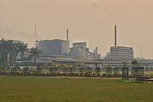
By the end of the 1990s many industries in the city were shut down. The Indian Turpentine & Rosin Factory (ITR) was shut down in April 1998 and the sugar mill of Nekpur ceased production in September 1998.[35] The mill, which was under the control of the UP Sugar Corporation had been awarded a Gold Medal for producing sugar more than the set target in the year 1997 itself.[35] A rubber factory situated in Fatehganj West was also closed on 15 July 1999. The products of the factory were famous all over Asia, and about two thousand people were serving in this factory.[35] The WIMCO factory in CB Ganj, which used to supply matches across the country, was shut down in 2014.[35] Indian Farmers Fertiliser Cooperative (IFFCO) has a large plant at Aonla (30 km). The plant was commissioned in 1988 and expanded in 1996. It produces ammonia and urea.
Agriculture
Bareilly has very productive land (Tarai) for growing Sugarcane, Rice, pulses & wheat.[37] Hindustan Unilever has begun growing rice in Bareilly and the Punjab, but the company desires legal reforms and facility construction.[38]
Electricity
In 2009, Uttar Pradesh Power Corporation Limited (UPPCL) awarded pilot contracts to supply power to nine cities to companies who will collect revenue for the state government. Bareilly, Agra, Kanpur, Moradabad and Gorakhpur will be part of the first phase.[39]
Transport
Roads
New renumbered National Highway
.jpg)
Bareilly lies on the National Highway 30 (New renumbered National Highway system) (NH 30) (according to the new National Highway system in India). The newly numbered highway connects Sitarganj in Udham Singh Nagar district, Uttarakhand with Ibrahimpatnam in Andhra Pradesh. The 2040 km (1267.5 mi) highway starts at the junction of NH 9 at Sitarganj passes through Pilibhit, Bareilly, Shahjahanpur, Sitapur, Lucknow, Raebareli, Allahabad, Rewa, Jabalpur, Raipur, Dhamtari, Keskal, Jagdalpur, Konta, Nellipaka, Bhadrachalam, Kothagudem, Tiruvuru and ends at the junction of NH 65 in Ibrahimpatnam.
City Street Alignment
.png)
.png)
The street system in Bareilly is traditional, with most roads oriented towards different cities. The city centre is the intersection of Nainital Road and Bada Bazaar–Shyam Ganj Road at a street known as Kutubkhana. It is a congested street, and the entry of cars or heavy vehicles is prohibited during the day. The Patel Chowk Choraha–Chaupla and Chowki Chauraha–Chaupla Roads run from Lucknow Road to Delhi Road (Old National Highway 24). Government of Uttar Pradesh has proposed 200 km six lane expressway from Faridpur near Bareilly to Pariyar in Unnao district (near Bithoor) to connect Bareilly with Kanpur and reduce distance between both cities from 10 hours to 3 hours. Nainital Road (including the old National Highway 74 or Pilibhit By-pass Road) and Badaun Road began at Kutubkhana. Heavy traffic is allowed on these roads only from Koharapeer Sabji-Mandi and Chaupla Crossroads.
Arterial streets include:
- Stadium Road (connecting Pilibhit Road (D.D. Puram) to the ShyamGanj crossroad)
- Macnair Road (connecting Nainital Road to Stadium Road)
- Pilibhit By-pass Road, connecting Pilibhit Road to Lucknow Road (Old National Highway 24 or Delhi-Lucknow Highway)
- SH-33 Bareilly to Mathura via Subhash Nagar & ( Vishwanathpuram ), Budaun and Kasganj
- Mini By-Pass, connecting Delhi Road (Old National Highway 24 or Delhi-Lucknow Highway) to Nainital Road
- Shyam Ganj– Patel Chowk Choraha–Chaupla–Quila–C.B. Ganj Road (Old National Highway 24 or Delhi-Lucknow Highway)
- Shyam Ganj–Bareilly Cantt–Chowki Chauraha–Chaupla Road
- I.V.R.I. Road (connecting Nainital Road to Pilibhit Road)
- Civil Lines Road
- Highway connecting Delhi to Lucknow four lane via Bareilly is a 29-kilometre-long (18 mi) highway which bypasses the city crowd of Bareilly, ensuring the smooth running of local traffic.
The inter-city satellite bus stand is just outside the city, at the intersection of Old National Highway 24 (Delhi-Lucknow Highway) and the Pilibhit By-pass Road. The old bus stand in Civil Lines still well-used by state-owned buses to Delhi.
Improvements
As part of the expansion of Old National Highway 24 (connecting Lucknow to New Delhi via Shahjahanpur, Bareilly, Rampur, Moradabad and Ghaziabad) to four lanes, two contracts were awarded on a Design, Build, Finance, Operate and Transfer (DBFOT) basis for the National Highways Authority of India (NHAI). Bareilly Ring Road (Bypass) provides an excellent platform for setting up of industries, MNCs, residential townships, shopping malls, school and colleges, hospitals, airport, railways, etc.
Rail


Bareilly has been connected to the rest of India by rail since the 19th century, and a 1909 map shows that Bareilly was a railway junction during the early 20th century. Six rail lines intersect in the city. In 1890 the Bengal and North Western Railway leased the Tirhoot State Railway to increase the latter's revenue, and the Lucknow-Sitapur-Seramow Provincial State Railway merged with the Bareilly-Pilibheet Provincial State Railway to form the Lucknow-Bareilly Railway on 1 January 1891. The Lucknow-Bareilly Railway was owned by the Government of India, and operated by the Rohilkund and Kumaon Railway.
The Oudh and Tirhut Railway was formed on 1 January 1943 by the merger of the Bengal and North Western Railway, the Tirhut Railway (BNW operated), the Mashrak-Thawe Extension Railway (BNW operated), the Rohilkund and Kumaon Railway and the Lucknow-Bareilly Railway (R&K operated). The Oudh and Tirhut Railway was later renamed the Oudh Tirhut Railway; it merged with the Assam Railway and the Kanpur-Achnera section of the Bombay, Baroda and Central India Railway to form North Eastern Railway (headquartered in Gorakhpur, with a divisional headquarters in Izzatnagar), one of the 16 zones of the Indian Railways.[41][42][43][44]
Six railway stations serve the city:
- Bareilly Junction (broad gauge)
- C.B. Ganj Station (broad gauge)
- Bareilly Cantt (broad gauge)
- Bareilly City Station (broad gauge)
- Izzatnagar Station (broad gauge)
- Bhojipura Station ( broad gauge)
Bareilly is on the Moradabad-Lucknow route. Trains from the north (including Jammu Tawi and Amritsar) and Delhi running east and northeast (to Gorakhpur, Barauni, Howrah, Guwahati and Dibrugarh) pass through Bareilly, and the city is also on the route from Uttarakhand to Agra and Mathura via Budaun. Many trains to railway stations in Uttarakhand pass through Bareilly.
Air
The Indian Air Force has a base at Izzatnagar, on the outskirts of Bareilly on the Nainital Road. A civil enclave has been made on the airbase at Pilibhit Bypass Road near Mayur Van Chetna Kendra.
The Airports Authority of India approved construction of a passenger terminal at the Bareilly civil enclave.[45] 10 hectares (25 acres) of land was bought from local farmers by the district administration for the project.[46] The AAI began the tender process to award construction contracts for the airport in September 2017 and expected the civil enclave to be ready by March 2018, pending Uttar Pradesh government approval.[47] However, the IAF requested changes in the layout of the taxiway connecting the terminal to the runway.[48] After the Ministry of Defence approved the taxiway, passenger service was hoped to begin by February 2019.[49]
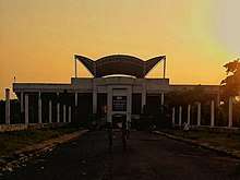
Bareilly Airport was inaugurated by state civil aviation minister Nand Gopal Nandi and Union minister Santosh Gangwar on 10 March 2019 at the civil enclave of Trishul Air Base. The terminal building can handle 75 passengers during the peak hour.[50] Bareilly will be connected to Lucknow and Delhi under the UDAN scheme of central government. Flights from Bareilly to Delhi or Bareilly to Lucknow will start on 20 April 2020. On the directives of AAI and DGCA, the airport will be operating 72-seater flights with ATR aircraft.[51][52]
Education
There are several universities and institutes of higher education in Bareilly. Prominent medical colleges include Indian Veterinary Research Institute established in 1919 known as Mecca-Medina of Veterinary Education Rohilkhand Medical College and Shri Ram Murti Smarak Institute of Medical Sciences.
Defence installations
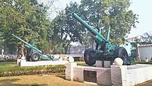
In addition to the air-force base, Bareilly is the regimental centre and a major settlement of the Jat Regiment (one of the longest-serving and most-decorated infantry regiments of the Indian Army.[53] The regiment won 19 battle honours from 1839 to 1947,[54] and five battle honours, eight Mahavir Chakra, eight Kirti Chakra, 32 Shaurya Chakras, 39 Vir Chakras and 170 Sena Medals since independence.[53]
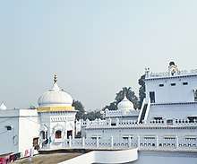
Places of interest
Hindu temples
Sports
Bareilly has three sports stadiums and one cricket academy:
- Dori Lal Agarawal Sports Stadium (city area)
- Major Dhyan Chand Sports Stadium (cantonment area)
- Dr. Chandrakanta Memorial Sports Stadium (Bisalpur Road, Bhuta)
- SRMS Cricket Stadium (Bareilly-Nainital Road, Bhojipura)
Recreation
The city has a combined amusement and water park named Fun City. Phoenix United Mall (Bareily) is another attraction of the city. It is located on Pilibhit Bypass Road at Mahanagar Colony.
Notable people
- Ahmad Raza Khan Barelvi – Islamic scholar
- Akhtar Raza Khan - Islamic scholar
- Anuj Tiwari – Author
- Anwar Jamal – Documentary film maker
- Clayton Robson – Cricketer
- Hamid Raza Khan - Islamic scholar
- Hiba Nawab – Actress
- Kanan Gill – Actor, comedian
- Kavita Seth – Playback singer
- Kritika Kamra - Actress
- Mahmud al-Hasan - Sunni Deobandi Islamic Scholar
- Mustafa Raza Khan Qadri – Islamic scholar
- Paras Arora – Actor
- Priyanka Chopra – Actress
- Priyanka Singh Rawat – Member of Parliament, Barabanki
- Percy Pratt – First-class cricketer
- Disha Patani - Indian Actress
- Rati Agnihotri – Actor
- Santosh Gangwar - Minister of State (Independent Charge) for Labour and Employment
- Shah Niyaz Ahmad- Sufi Mystic and Preacher
- Wasim Barelvi- Urdu Poet
See also
- Bareilly District
- History of Bareilly
- List of Hindu temples in Bareilly
- Neighbourhoods of Bareilly
References
- Notes
- "Census of India: Bareilly". Retrieved 11 October 2019.
- "52nd REPORT OF THE COMMISSIONER FOR LINGUISTIC MINORITIES IN INDIA" (PDF). nclm.nic.in. Ministry of Minority Affairs. Archived from the original (PDF) on 25 May 2017. Retrieved 20 December 2018.
- "Archived copy" (PDF). Archived (PDF) from the original on 14 November 2015. Retrieved 21 April 2017.CS1 maint: archived copy as title (link)
- Jeelani, Mehboob (27 August 2015). "Centre unveils list of 98 smart cities; UP, TN strike it rich". The Hindu. Archived from the original on 26 November 2016. Retrieved 21 April 2017.
- "City to have 1.25 quintal silver Shivling | Bareilly News - Times of India". Archived from the original on 24 September 2016. Retrieved 9 May 2016.
- Shailvee Sharda (21 November 2012). "Maitreya project: UP's loss is advantage Bihar". The Times of India. Archived from the original on 28 September 2013. Retrieved 6 January 2013.
- "Bulandshahr roads lead to Delhi". The Times of India. 7 February 2010. Archived from the original on 28 September 2013. Retrieved 29 June 2013.
- "Archived copy". Archived from the original on 14 July 2007. Retrieved 8 November 2010.CS1 maint: archived copy as title (link)
- history Archived 26 August 2010 at the Wayback Machine
- Artefacts of painted grey ware culture found in Bareilly village
- "Action Plan For The Control of Air Pollution in Bareilly City - IIT Delhi" (PDF).
- "Introduction". Library.upenn.edu. Archived from the original on 8 June 2011. Retrieved 9 January 2011.
- HISTORY OF MY PEOPLE: The Afghan Muslims of Guyana Archived 12 March 2013 at the Wayback Machine
- "The Afghan Muslims of Guyana and Suriname". Guyana.org. Archived from the original on 6 December 2010. Retrieved 9 January 2011.
- "Collect Britain has moved". Collectbritain.co.uk. 30 November 2003. Archived from the original on 14 February 2012. Retrieved 6 January 2013.
- "When Bareilly was in currency". The Times of India. 22 June 2003. Archived from the original on 22 February 2011. Retrieved 27 October 2010.
- Conybeare, p. 677
- "Archived copy". Archived from the original on 12 April 2018. Retrieved 23 April 2017.CS1 maint: archived copy as title (link)
- R. C. Majumdar: Sepoy Mutiny and Revolt of 1857, Firma K. L. Mukhopadhyay, 1963, pp. 2303–31
- Chisholm, Hugh, ed. (1911). . Encyclopædia Britannica. 3 (11th ed.). Cambridge University Press. p. 397.
- "When Bareilly was in currency". The Times of India. 22 June 2003. Archived from the original on 22 February 2011. Retrieved 27 October 2010.
- Friend, Corinne (Fall 1977). "Yashpal: Fighter for Freedom – Writer for Justice". Journal of South Asian Literature. 13 (1): 65–90. JSTOR 40873491. (subscription required)
- "Bareilly, India Köppen Climate Classification (Weatherbase)". Weatherbase. Archived from the original on 30 November 2018. Retrieved 30 November 2018.
- "Station: Bareilly Climatological Table 1981–2010" (PDF). Climatological Normals 1981–2010. India Meteorological Department. January 2015. pp. 103–104. Archived from the original (PDF) on 5 February 2020. Retrieved 27 April 2020.
- "Extremes of Temperature & Rainfall for Indian Stations (Up to 2012)" (PDF). India Meteorological Department. December 2016. p. M213. Archived from the original (PDF) on 5 February 2020. Retrieved 27 April 2020.
- Bareilly: A Gazetteer Vol 13 (1911).
- "Imperial Gazetteer2 of India, Volume 7, page 12 -- Imperial Gazetteer of India -- Digital South Asia Library". dsal.uchicago.edu. Retrieved 18 August 2019.
- District Census Handbook Bareilly Part-A (PDF). Lucknow: Directorate of Census Operaions, Uttar Pradesh.
- "Population By Religious Community - 2011". Retrieved 17 February 2020.
- Usha Sanyal. Generational Changes in the Leadership of the Ahl-e Sunnat Movement in North India during the Twentieth Century. Modern Asian Studies (1998), Cambridge University Press.
- "Barelvi - Oxford Reference". oxfordreference.com. Retrieved 24 September 2014.
- Gommans, Jos J. L. (1995). The Rise of the Indo-Afghan Empire: C. 1710-1780. BRILL. p. 156. ISBN 978-90-04-10109-8. Retrieved 10 February 2020.
- Lal 1987, p. 10
- Lal 1987, p. 11
- "Industries 2019 : पुराने उद्योगों ने तोड़ा दम, साल भर तरसते रहे नए उद्योग". Dainik Jagran (in Hindi). Retrieved 18 February 2020.
- "Local Finance And Urban Economic Development in U. P. — A Case Study of Shahjahanpur And Bareilly" (PDF). p. 178. Retrieved 18 February 2020.
- "Traders may not benefit from wheat export". The Times of India. 18 July 2011. Archived from the original on 15 May 2012. Retrieved 31 July 2011.
- "HLL initiates contract farming for basmati rice". The Times of India. 17 December 2002. Archived from the original on 4 November 2012. Retrieved 27 October 2010.
- "UPPCL invites bids for franchisee system". The Times of India. 4 February 2009. Archived from the original on 28 September 2013. Retrieved 29 June 2013.
- Modi, Ajay (5 February 2009). "Govt launches ethanol blending on pilot basis". Business Standard. Archived from the original on 14 January 2011. Retrieved 9 January 2011.
- Rao 1988, pp. 42–3
- "Northeastern Railway" (PDF). Archived (PDF) from the original on 6 November 2013. Retrieved 11 June 2012.
- Rao 1988, p. 37
- "Chapter 1 – Evolution of Indian Railways-Historical Background". Ministry of Railways website. Archived from the original on 1 June 2009.
- "UP: Bareilly likely to get airport by 2017". Hindustan Times. 6 April 2016. Retrieved 13 April 2020.
- "Civil airport project pending awaiting state govt order". The Times of India. 1 July 2014. Retrieved 13 April 2020.
- "Bareilly airport". CAPA. Centre for Aviation. Archived from the original on 10 November 2017. Retrieved 10 November 2017.
- "Civilian flights from city may be delayed as IAF seeks changes in taxiway plan". The Times of India. 7 November 2017. Retrieved 13 April 2020.
- "Taxiway gets nod, flights to start before Holi: DM". The Times of India. 4 January 2019. Retrieved 13 April 2020.
- "Bareilly airport inaugurated! Flight operations to start soon. Check details". www.timesnownews.com. Retrieved 6 May 2020.
- "SP govt not promoting civil aviation in state: Ajit Singh – The Times of India". The Times of India. 22 December 2012. Archived from the original on 1 October 2013. Retrieved 17 January 2013.
- "Bareilly airport inaugurated! Flight operations to start soon. Check details". Times Now. 11 March 2019. Archived from the original on 4 April 2019. Retrieved 6 April 2019.
- Army's Jat Regiment Best Marching Contingent in Republic Day 2007 Parade Archived 2 February 2007 at the Wayback Machine. India Defence. Retrieved 17 June 2012.
- "BHARAT RAKSHAK MONITOR: Volume 3(4)". Bharat-rakshak.com. Archived from the original on 9 June 2011. Retrieved 9 January 2011.
- Works
- Husain, Iqbal (1994). The Rise and Decline of the Ruhela Chieftaincies in 18th Century India. Delhi: Oxford University Press.CS1 maint: ref=harv (link)
- Rao, M.A. (1988). Indian Railways. New Delhi: National Book Trust. ISBN 8123725892.CS1 maint: ref=harv (link)
- Lal, Hira (1987). City and Urban Fringe: A Case Study of Bareilly. Concept Publishing Company. ISBN 978-81-7022-190-6. Retrieved 18 February 2020.CS1 maint: ref=harv (link)
External links
| Wikimedia Commons has media related to Bareilly. |
| Wikivoyage has a travel guide for Bareilly. |