Bahraich district
Bahraich district is one of the districts of Uttar Pradesh state of India, and Bahraich town is the district headquarters. Bahraich District is a part of Devipatan Division.
Bahraich district | |
|---|---|
District of Uttar Pradesh | |
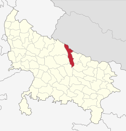 Location of Bahraich district in Uttar Pradesh | |
| Country | India |
| State | Uttar Pradesh |
| Division | Devipatan |
| Headquarters | Bahraich |
| Tehsils | 6 |
| Government | |
| • Lok Sabha constituencies | Bahraich |
| Area | |
| • Total | 4,696.8 km2 (1,813.4 sq mi) |
| Population (2011) | |
| • Total | 3,487,731 |
| • Density | 666/km2 (1,720/sq mi) |
| • Urban | 186,223 |
| Demographics | |
| • Literacy | 49.32 per cent |
| Time zone | UTC+05:30 (IST) |
| Major highways | NH28C, SH96 |
| Average annual precipitation | 1710 mm |
| Website | http://behraich.nic.in |
History
Bahraich was in historic Awadh. The district was part of the Nanpara Taluqdari ruled by a succession of Rajas who owned more than three hundred villages in the district and all the forests. Raja Baldev Singh has built a fort later captured by Sadat Ali. A famous Dargah shareef fair is organised every year at Bahraich in his remembrance.
Geography
Bahraich borders Nepal districts Bardiya to the northwest and Banke to the northeast. The rest of Bahraich is surrounded by following districts in Uttar Pradesh: Lakhimpur and Sitapur on the west, Barabanki to the southwest, Gonda to the southeast, and Shravasti to the east.
Economy
In 2006 the Ministry of Panchayati Raj named Bahraich one of the country's 250 most backward districts (out of a total of 640).[1] It is one of the 34 districts in Uttar Pradesh currently receiving funds from the Backward Regions Grant Fund Programme (BRGF).[1]
Demographics
| Historical population | ||
|---|---|---|
| Year | Pop. | ±% p.a. |
| 1901 | 764,477 | — |
| 1911 | 761,611 | −0.04% |
| 1921 | 774,317 | +0.17% |
| 1931 | 825,923 | +0.65% |
| 1941 | 901,675 | +0.88% |
| 1951 | 978,553 | +0.82% |
| 1961 | 1,098,695 | +1.16% |
| 1971 | 1,282,218 | +1.56% |
| 1981 | 1,672,410 | +2.69% |
| 1991 | 2,090,852 | +2.26% |
| 2001 | 2,701,478 | +2.60% |
| 2011 | 3,487,731 | +2.59% |
| source:[2] | ||
According to the 2011 census Bahraich district has a population of 3,487,731,[3] This gives it a ranking of 89th in India (out of a total of 640).[3] The district has a population density of 706 inhabitants per square kilometre (1,830/sq mi).[3] Its population growth rate over the decade 2001–2011 was 46.08%.[3] Bahraich has a sex ratio of 891 females for every 1000 males,[3] and a literacy rate of 49.32%.
Bahraich is a category "A" district i.e. having socio-economic and basic amenities parameters below the national average.[4]
At the time of the 2011 Census of India, 92.71% of the population in the district spoke Hindi as their first language.[5]
References
- Ministry of Panchayati Raj (8 September 2009). "A Note on the Backward Regions Grant Fund Programme" (PDF). National Institute of Rural Development. Archived from the original (PDF) on 5 April 2012. Retrieved 27 September 2011.
- Decadal Variation In Population Since 1901
- "District Census 2011". Census2011.co.in. 2011. Retrieved 30 September 2011.
- MINUTES OF THE 34th MEETING OF EMPOWERED COMMITTEE TO CONSIDER AND APPROVE REVISED PLAN FOR BALANCE FUND FOR THE DISTRICTS OF GHAZIABAD, BAREILLY, BARABANKI, SIDDHARTH NAGAR, SHAHJANPUR, MORADABAD, MUZAFFAR NAGAR, BAHRAICH AND LUCKNOW (UTTAR PRADESH) UNDER MULTI-SECTORAL DEVELOPMENT PROGRAMME IN MINORITY CONCENTRATION DISTRICTS HELD ON 22nd JULY, 2010 Archived 30 September 2011 at the Wayback Machine. No. 3/64/2010-PP-I, GOVERNMENT OF INDIA, MINISTRY OF MINORITY AFFAIRS
- 2011 Census of India, Population By Mother Tongue
- "Census 2011 Bahraich District". Census 2011. Retrieved 1 July 2017.
External links
| Wikisource has the text of the 1911 Encyclopædia Britannica article Bahraich. |