Malappuram district
Malappuram (/mələppurəm/ (![]()
Malappuram district | |
|---|---|
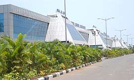 .JPG) .jpeg) 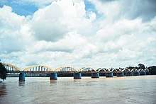 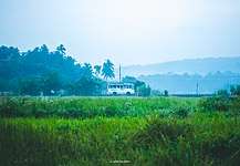 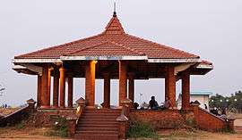 Clockwise from top: Karipur International Airport, Biyyam Kayal Lake, A green bypass at Puthur, Kottakkunnu, Kuttippuram bridge, Cherumb in Karuvarakundu. | |
| Nickname(s): | |
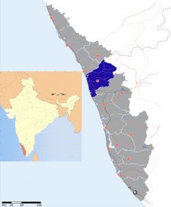 Location of Malappuram district in Kerala | |
| Coordinates: 11°N 76°E | |
| Country | |
| State | Kerala |
| District formation | 16 June 1969 |
| Headquarters | Malappuram |
| Taluks | |
| Government | |
| • District collector | K.Gopalakrishnan, IAS[4] |
| • District Panchayat President | A. P. Unnikrishnan (IUML)[5] |
| • Members of Lok Sabha | |
| • Members of Niyamasabha | 16 |
| Area | |
| • District | 3,554 km2 (1,372 sq mi) |
| Area rank | 3rd |
| Highest elevation (Mukurthi) | 2,594 m (8,510 ft) |
| Population (2011) | |
| • District | 4,112,920[6] |
| • Rank | 1st |
| • Density | 1,157/km2 (3,000/sq mi) |
| • Urban | 44.18%[7] |
| Demography | |
| • Language (2011) | |
| • Religion (2011) |
|
| Human Development | |
| • Sex ratio (2011) | 1098 ♀/1000♂[7] |
| • Literacy (2011) | 93.57%[7] |
| Time zone | UTC+5:30 (IST) |
| ISO 3166 code | IN-KL |
| Vehicle registration |
|
| Website | malappuram |
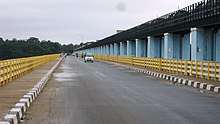
The district was formed by incorporating the southern parts of the erstwhile Kozhikode district and the northern parts of the erstwhile Palakkad district in 1969. The district comprises seven Taluks- Ponnani, Perinthalmanna, Tirur, Eranad, Tirurangadi, Kondotty, and Nilambur. The eastern part of the district is hilly and the western part is a coastal region. The district is divided into 5 sub-micro regions. Four long rivers, a small river, and several tributaries flow through the district. The economy basically depends upon the emigrants. Though the revenue headquarters is Malappuram, the economy is mainly concentrated on the cities of Manjeri, Perinthalmanna, and Tirur. Malayalam is the most spoken language. The religions practiced in the district include Islam, Hinduism, and Christianity.
The district has contributed many writers, and religious and political leaders. During the early medieval period, it was the headquarters of two of the three major kingdoms that ruled Kerala. Perumpadappu in the Ponnani Taluk was the hometown of the Kingdom of Cochin, which is also known as Perumbadappu Swaroopam, and Nediyiruppu in the Kondotty Taluk was the hometown of the Zamorin of Calicut, which is also known as Nediyiruppu Swaroopam.
Etymology
The term, Malappuram, which means "terraced place atop the hills", is derived from the geography of Malappuram, the district headquarters.
History
Ancient period
The Stone Age history of the district is not well-known. However, the remains of some pre-historic symbols like Dolmens, Menhirs, and Rock-cut caves have been found from various places of the district, including Nilambur, Manjeri, etc. Rock-cut caves are seen in the places like Puliyakkode, Thrikkulam, Oorakam, Melmuri, Ponmala, Vallikunnu, and Vengara.[11] The port of Ponnani (probably known as Tyndis in the ancient period) is believed to be a centre of trade with Ancient Rome. During the Sangam period, the region was included in Kudanadu, a province in Ancient Tamilakam. The region was ruled by the ancient Chera dynasty.
Early medieval period
After the ancient Chera Dynasty, a number of dynasties controlled the area, and by the ninth century, the region became under the control of the Kulasekharas of Mahodayapuram. A piece of inscriptional evidence found at the Triprangode Siva Temple indicates that Goda Ravi of Chera Dynasty controlled the present-day district in the early 10th century. Descriptions about the rulers of Eranad region are seen in the Jewish copper plates of Bhaskara Ravi Varman (1000 CE) and in the Viraraghava copper plates of Veera Raghava Chakravarthy (1225 CE).[11] After the disintegration of the Kulasekhara kingdom, a number of city-states emerged, including Valluvanad, Vettattunadu (Tanur), Parappanad and Nediyiruppu (ruled by the Zamorins).[12][13]
Late medieval period
.jpg)
During the 14th century, the Zamorin of Calicut expanded his territories to the district. Tirunavaya, the seat of Mamankam, is located in the present-day Tirur Taluk. Thrikkavil Kovilakam in Ponnani served as a second home of Zamorin. Malappuram was the military headquarters of the Zamorin. The Zamorin earned a greater part of his revenue by taxing the spice trade through his ports. Smaller ports in the kingdom included Puthuppattanam (Kottakkal), Parappanangadi, Tanur, and Ponnani.[14][15] The headquarters of Azhvanchery Thamprakkal was at Athavanad. The Sanskrit works like Kokila Sandeśa (15th-century CE) written by Uddanda Śāstrī, Bhramara Sandesham (17th century CE) by Vasudevan, and Chathaka Sandesha (18th-century CE) have descriptions about Tirunavaya, Puthupatanam (Present-day Kottakkal), and Triprangode.[16] Many medieval Malayalam works also help to trace the history of the district. The works like Kozhikode Granthavari, Mamakam Kilippattu written by Kadanchery Namboodiri in the 17th-century CE, Kandaru Menon Patappattu (1683), and Ramchcha Panicker Pattu contains pieces of information about the Mamankam festival held at the bank of Bharathappuzha in Tirunavaya.[17] Tuhfat Ul Mujahideen written by Zainuddin Makhdoom II in Ponnani during 16th-century CE is the first-ever book fully based on the history of Kerala, written by a Keralite. It is written in Arabic and contains pieces of information about the resistance put up by the navy of Kunjali Marakkar alongside the Zamorin of Calicut from 1498 to 1583 against Portuguese attempts to colonize the Malabar coast.[18][19]
Colonial period
When William Keeling, a sea captain of English East India Company arrived at the Kingdom of Calicut in 1615, he was allowed to start warehouses in the port of Ponnani, through a treaty signed with the then Zamorin of Calicut.[20] By the middle of the seventeenth century, the Dutch had attained the monopoly over the trade on many ports of Kerala. However, some factories of the Ponnani port remained under the control of the English.[11] During the 18th century, the de facto Mysore kingdom rulers Hyder Ali and Tipu Sultan marched into the Zamorin's kingdom. With headquarters at Manjeri, their army was spread all over the district.[20] In 1792, Tipu Sultan was defeated by the English East India Company through Third Anglo-Mysore War, and the Treaty of Seringapatam was agreed. As per this treaty, most of the Malabar region, including the present-day Malappuram district, was integrated into the English East India Company. Hence, the colonial era in the district came into existence.
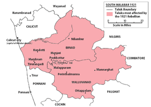
In 1793, the district became a part of the newly formed Malabar Province. The British authority made an arrangement to collect their revenue through the Zamorin. However, a revolt under the leadership of Manjeri Athan Gurukkal took place against this. It was the first rebellion conducted by the Mappilas against the British.[11] In 1801, the East India Company handed over the military administration of Malabar province from the Bombay Presidency to the Madras Presidency. The district was the venue for many of the Mappila revolts (uprisings against the British East India Company in Kerala) between 1792 and 1921. Malappuram has been part of movements such as Khilafat Movement and Malabar rebellion in the early 20th century. Wagon tragedy (1921) is still a saddening memory of the Malabar rebellion. It was the death of 64 prisoners on 20 November 1921.[21] The prisoners had been taken into custody following the Mappila Rebellion in various parts of the district. Their deaths through apparent negligence generated sympathy for the Indian independence movement.
Post-colonial period
The Malabar District remained a part of Madras state for a few years after independence, but on 1 November 1956, it merged with Travancore-Cochin to form the state of Kerala. The newly merged Malabar District was divided into Kannur, Kozhikode and Palakkad in 1957. Large-scale changes in the territorial jurisdiction of the region took place between 1957 and 1969. On 1 January 1957, Tirur Taluk was formed by adjoining the major portions of Eranad Taluk and Ponnani Taluk. Another portion of Ponnani Taluk was transferred to the new Chavakkad Taluk in Thrissur district, and the remainder is the present-day Ponnani Taluk. Perinthalmanna Taluk was formed from the erstwhile Valluvanad Taluk. Of these, Eranad Taluk and Tirur Taluk remained in Kozhikode district and Perinthalmanna Taluk and Ponnani Taluk remained in Palakkad District. The new district of Malappuram was formed with four Taluks (Eranad, Perinthalmanna, Tirur, and Ponnani), four towns, fourteen developmental blocks, and 100 Gram panchayats. The district was formed in order to vanish the backwardness of the region at that time.[22][23] Later, three more Taluks, Tirurangadi, Nilambur, and Kondotty were formed from Tirur and Eranad. In the early years of Communist rule in Kerala, Malappuram experienced land reform under the Land Reform Ordinance. During the 1970s Persian Gulf oil reserves were opened to commercial extraction and thousands of unskilled workers migrated to the Gulf. They sent money home, supporting the rural economy, and by the late 20th century the region attained First World health standards and near-universal literacy.[24]
Geography

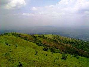
Bounded by the Nilgiri hills on the east, the Arabian Sea on the west, the Wayanad and Kozhikode districts on the north, and the Palakkad and Thrissur districts on the south, Malappuram district possesses a total geographical area of 3,554 sq.km, which ranks third in the state in terms of area. The district possesses 9.15% of the total area of the state. The district is located at 75°E - 77°E longitude and 10°N - 12°N latitude on the geographical map. Similar to the other parts of Kerala, the Malappuram district also has a coastal area (lowland) bounded by the Arabian Sea on the west, a midland at the centre, and a hilly area (highland), bounded by the Western Ghats on the east.
Topography
On the basis of topography, geology, soils, climate, and natural vegetation, the district is divided into 5 sub-micro regions:
- Malappuram coast
- Malappuram undulating plain
- Chaliyar river basin
- Nilambur forested hills
- Perinthalmanna undulating uplands.

Malappuram coast lies all along the coastal tract of Malappuram. It makes its boundaries with Kozhikode coast in the north, Malappuram undulating plain in the east, the Thrissur coast in the south, and the Lakshadweep Sea in the west. The region is drained by the major rivers like Chaliyar, Kadalundi, Ponnani, etc. canals and backwaters. The maximum height is located at the Kalpakanchery village (104 m) of Tirur Taluk. The Malappuram undulating plain lies parallel to the coast. It makes it boundaries with Nadapuram-Mavur undulating plains in the north, Chaliyar river basin and Perinthalmanna undulating uplands in the east, Pattambi undulating plain in the south and Malappuram coast in the west. The Gemini hill (478 m) in Kannamangalam is the highest point and the Vazhayur in the northern part (95 m) is the lowest. Chaliyar river basin entirely lies in the Eranad Taluk. It makes its boundaries by Nilambur forested hills in its north and east, Perinthalmanna undulating uplands in the south and Malappuram undulating plain in its east. Nilambur forested hills make its boundaries with Kozhikode forested hills and Wayanad forested hills in the north, Tamil Nadu in the east, Mannarkad-Palakkad forested hills in the south and the Chaliyar river basin in the west. It is a part of the Western Ghats. Many peaks with over 1000 m height can be seen here. The lowest point is located in Mampad (115 m). Perinthalmanna undulating uplands make its boundaries with Chaliyar river basin in the north, Mannarkad-Palakkad forested hills in the east, Palakkad Gap in the south and Malappuram undulating plain in the west. The maximum height of the region is 610 m. at the Vadakkangara.[25] Eranad and Perinthalmanna Taluks are located in the midland. The vast Nilambur Taluk covers the whole hilly area (highland) where the population is less, but the land area (including a lot of forest area) is more.
Coastline
Ponnani, Tirur, and Tirurangadi Taluks are situated in the most populous coastal region. Malappuram ranks fourth in the length of coastlines among the districts of Kerala having a coastline of 70 km (11.87% of the total coastline of Kerala).[26] Ponnani, Tanur, Parappanangadi, and Kootayi, which lies in the southwest part of the district, are the major fishing centres of the district. Ponnani was one of the major ports in history. The sea coast of the district is filled with marine wealth.[25] Ponnani was the navy capital of the Zamorin of Calicut. It is also a cultural centre of the district. Apart from being a favourite destination of the Arab traders 2000 years ago, Ponnani was also a captivating destination for many Muslim spiritual leaders, who were instrumental in introducing Islam here. The port city is also known as The Little Mecca of Malabar.[27] During the months of February/April, thousands of migratory birds arrive here. Located close to Ponnani is Biyyam Kayal, a placid, green-fringed waterway with a water sports facility. The Conolly Canal meets with the Arabian sea at Puthuponnani. The coastal town of Tanur was the capital of the Kingdom of Vettathunad in the early medieval period, and is known for Keraladeshpuram Temple. Parappanangadi was included in the Parappanad kingdom in the early medieval period.
Rivers
The Chaliyar, the Kadalundi River, the Bharathappuzha, and the Tirur River are the district's major rivers. The Chaliyar has a total length of about 168 km. and a drainage area of 2,818 km2 (1,088 sq mi). It passes through Nilambur, Mampad, Edavanna, Areekode, and Vazhakkad in the district. Karimpuzha, the largest tributary of Chaliyar, also flows through the district. The Kadalundi River passes through Melattur, Pandikkad, Malappuram, Panakkad, Parappur, Kooriyad, and Tirurangadi. It has a length of 130 km. with a catchment area of 1,114 km2 (430 sq mi) and a total run off of 2189 million cubic feet. The Bharathappuzha has a total length of 209 km. It flows through Thootha, Elamkulam, Pulamanthole, and joins the main river at Pallippuram. Then it again reaches the district at Thiruvegappura after flowing through some neighbouring districts. The Tirur River is 48 km long. It joins with the Bharathappuzha near the Ponnani coast. Besides these large rivers, the district also has a small river called Purapparamba River, which is just 8 km long. It is connected to major rivers via Conolly Canal.[28][25]
Climate
The temperature of the district is almost steady throughout the year. It has a tropical climate. It gets significant rainfall in most of the months, with a short dry season. According to Köppen and Geiger, this climate is classified as Am. The average annual temperature in Malappuram is 27.3 °C. In a year, the average rainfall is 2,952 millimetres (116.2 in). Summer usually runs from March until May; the monsoon begins in June and ends in September. Malappuram receives both southwest and northeast monsoons. Winter is from December to February.[29]
| Climate data for Malappuram | |||||||||||||
|---|---|---|---|---|---|---|---|---|---|---|---|---|---|
| Month | Jan | Feb | Mar | Apr | May | Jun | Jul | Aug | Sep | Oct | Nov | Dec | Year |
| Average high °C (°F) | 32.0 (89.6) |
32.9 (91.2) |
34.0 (93.2) |
33.8 (92.8) |
32.7 (90.9) |
29.3 (84.7) |
28.1 (82.6) |
28.7 (83.7) |
29.7 (85.5) |
30.3 (86.5) |
31.1 (88.0) |
31.4 (88.5) |
34.0 (93.2) |
| Average low °C (°F) | 21.8 (71.2) |
22.8 (73.0) |
24.4 (75.9) |
25.4 (77.7) |
25.1 (77.2) |
23.5 (74.3) |
22.8 (73.0) |
23.3 (73.9) |
23.3 (73.9) |
23.4 (74.1) |
23.1 (73.6) |
21.9 (71.4) |
21.8 (71.2) |
| Average precipitation mm (inches) | 1 (0.0) |
9 (0.4) |
16 (0.6) |
101 (4.0) |
253 (10.0) |
666 (26.2) |
830 (32.7) |
398 (15.7) |
233 (9.2) |
281 (11.1) |
140 (5.5) |
24 (0.9) |
2,952 (116.2) |
| Source: [30] | |||||||||||||
Flora and fauna

The district contains a diverse wildlife and a number of small hills, forests, rivers, and streams flowing to the west, backwaters and paddy, arecanut, cashew nut, pepper, ginger, pulses, coconut, banana, tapioca, and rubber plantations. The world's oldest Teak plantation is located at Nilambur in the district. Nilambur is also known for the Teak Museum. Bamboo trees are widely seen near to the Nilambur Teak Plantations. Tirur Vettila, a type of Betel found in Tirur, has obtained GI tag.[31] Out of the 3,554 sq.km area of the district, 1,034 km2 (399 sq mi) (29%) comprises forest area. It may be denser or less dense.[32] The northeast part of the district has a vast forest area of 758.87 km2 (293.00 sq mi). In this, 325.33 km2 (125.61 sq mi) is reserved forests and the rest is vested forests. Of these, 80% is deciduous whereas the rest is evergreen. The forest area is mainly concentrated in the Nilambur Taluk, which shares its boundary with the hilly district of Wayanad, Western Ghats, and the hilly areas (Nilgiris) of Tamil Nadu. The trees like Teak, Rosewood, and Mahogany are seen in this Nilambur forest area. Bamboo hills are widely seen in the forest. The New Amarambalam Reserved Forest has a wide variety of fauna. A variety of animals including elephants, deers, tigers, blue monkeys, bears, boars, rabbits, etc., birds, and reptiles are found in the forests. Forest products like honey, medicinal herbs, and spices are also collected from here. The forests are protected by two divisions- Nilambur north and Nilambur south. About 50 Acre of Mangroves forest is found in Vallikunnu, located in the coastal area of the district.[33]
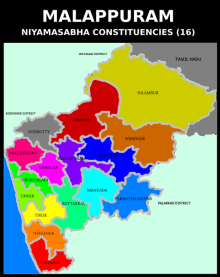
Administration
Malappuram Revenue district has two divisions: Tirur and Perinthalmanna. In these two divisions there are 138 villages included in 7 Taluks. For the sake of rural administration, 94 Gram Panchayats are comprised in 15 Block Panchayats, which together form the Malappuram District Panchayat. Besides this in order to perform urban administration better, 12 municipal towns are there. For the representation of Malappuram in Kerala Niyamasabha, there are 16 Niyamasabha constituencies in the district. These 16 are included in 3 Lok Sabha constituencies.[36] The district is divided into 138 villages which together form 7 taluks.[37]
| Sl.no | Taluk | Area (in sq.km)[38] |
Population (2011)[38] |
Villages[39] |
|---|---|---|---|---|
| 1 | Eranad | 491* | 581,512* | 23 |
| 2 | Nilambur | 1343 | 574,059 | 21 |
| 3 | Perinthalmanna | 506 | 606,396 | 24 |
| 4 | Tirur | 448 | 928,672 | 30 |
| 5 | Tirurangadi | 281* | 631,906* | 17 |
| 6 | Kondotty | 254* | 410,577* | 12 |
| 7 | Ponnani | 200 | 379,798 | 11 |
Politics
Malappuram has the highest number of assembly constituencies in the state - 16.[40] Of these, The Eranad, the Nilambur and the Wandoor Niyamasabha constituencies together form a part of the Wayanad (Lok Sabha constituency), whereas the Tirurangadi, the Tanur, the Tirur, the Kottakkal, the Thavanur and the Ponnani are included in the Ponnani (Lok Sabha constituency). The remaining seven assembly constituencies together form the Malappuram (Lok Sabha constituency).
State legislature
Parliament
| Sl.no | Constituency | MP | Party | Alliance |
|---|---|---|---|---|
| 1 | Wayanad (minor portion) | Rahul Gandhi | INC | UDF |
| 2 | Malappuram | P. K. Kunhalikutty | IUML | UDF |
| 3 | Ponnani (major portion) | E. T. Mohammed Basheer | IUML | UDF |
Law and Order
The judicial headquarters of the district is located at Manjeri. 24 courts are functioning under the Manjeri judicial district including Manjeri, Malappuram, Tirur, Perinthalmanna, Parappanangadi, Ponnani, and Nilambur.[41] The headquarters of Malabar Special Police (formed in 1884), a Paramilitary unit under Kerala Police, is located at Malappuram. Malappuram Police Unit is subdivided into 3 Sub Divisions and 34 Police Stations. The District Police Office, District Special Branch, District Crime Records Bureau, District 'C' Branch, Narcotic Cell, District Police Control Room, Cyber Cell, Women Cell, and Telecommunication Unit are located in Malappuram. The coastal police station is located in Ponnani whereas the District Armed Reserve Camp is situated in Padinhattummuri. Traffic Units of Malappuram police unit are centered at Malappuram, Manjeri, Kondotty, Perinthalmanna, and Tirur.[42]
Economy
The Gross District Value Added (GDVA) of the district in the fiscal year 2018-19 is estimated as ₹ 698.37 billion, and the growth in GDVA, compared to that in the previous year was 11.30%. The Net District Value Added (NDVA) of the district in the year 2018-19 was ₹ 631.90 billion and the annual growth rate in NDVA was 11.59%. Per capita GDVA is estimated to be ₹ 154,463 in the fiscal year. The growth rate of GDVA was 18.12% in the year 2017-18, 9.49% in the year 2016-17, 7.86% in the year 2015-16, 8.83% in the year 2014-15, 14.08% in the year 2013-14, and 9.70% in the year 2012-13. It shows a zigzag trend.[43]
Malappuram's economy basically depends on the emigrants. Malappuram has the highest number of emigrants in the state. According to the 2016 economic review report published by the Government of Kerala, every 54 per 100 households in the district is emigrants.[44] Most of them work in the Middle East. They are the major contributors to the district economy. Though Malappuram has natural resources, the district is one of the industrially backward districts in the state due to the lack of infrastructure. There is no industry functioning under the Central Sector in the district. According to the census 2011, there are 10,629 industrial units registered under SSI/MMSE, and 396 units among these are promoted by the Scheduled castes, 83 by the Scheduled tribes, and the remaining units by the general category. About 1,000 people are aided annually under a self-employment program. There are KINFRA food-processing and IT industrial estates in Kakkancherry,[45] Inkel SME Park at Panakkad for Small and Medium Industries and a rubber plant and industrial estate in Payyanad. MALCOSPIN, The Malappuram Spinning Mills Limited is one of the oldest industrial establishments in the district under state Government. Wood-related industries are common in Kottakkal, Edavanna, Vaniyambalam, Karulai, Nilambur and Mampad. Sawmills, furniture manufacturers and the timber trade are the most important businesses in the district. Employees' State Insurance has its branch office at Malappuram.[25] The headquarters of Kerala Gramin Bank is situated in Malappuram.[46]
Economic minerals
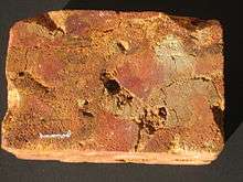
Laterite stone is widely seen in the midland areas of the district. Archean Gneiss is the most seen geological formation of the district. Quartz magnetite, which is abundantly seen in the Porur region is the most economically important mineral found in the district. Quartz gneisses can be seen in the places like Nilambur, Edavanna, and Pandikkad. Garneliforus Quartz can be seen in Manjeri and Kondotty areas. Charnokite rocks are common in some areas of Nilambur and Edavanna. Dykes consisting of Plagioclase, Feldspar, and Pyroxene in typical laterite texture can be seen near Manjeri. Deposits of good quality iron ore have reported from Eranad region of the district. Deposits of lime shells are found in the coastal areas like Ponnani and Kadalundinagaram. The coastal sands of Ponnani and Veliyankode contain a high amount of heavy minerals like Ilmenite and Monazite. Kaolinite is splendid in Perinthalmanna and Ponnani Taluks. Deposits of Ball clay have been found from Thekkummuri village. Parts of Nilambur taluk are included in the hidden Wayanad goldfields. Explorations did in the valleys of Chaliyar in Nilambur has shown reserves of the order of 2.5 million cubic meters of placers with 0.1 gram per cubic meter of gold.[25] Bauxite has discovered from some parts of the district like Kottakkal, Parappil, Oorakam, and Melmuri.[47]
Agriculture
Coconut, palms and Paddy are mainly found in the Malappuram coast. Cashew, Coconut, and Tapioca are seen in the Malappuram undulating plain. Rubber, Cashew, Pepper, and Coconut are the important vegetation found in the Chaliyar river basin. The Nilambur forested hills are the physical division of the district with the cultivation of a wide variety of species. Teak can be seen in this region. Perinthalmanna undulating uplands contain the cultivation of species including Coconut, Palm trees, Pepper, Rubber, and Cashew. The Kadalundi River drains this region. Besides these casual crops, the species like Mango, Jackfruit, Banana, etc. are widely seen in the district.[25] According to the statistics of 2016-17, the gross cropped area of the district is 237,860 hectares, and the net cropped area is 173,178 hectares. The cropping intensity of the district is 137 hectares. The most produced uncountable crop in 2016-17 was Tapioca (185,880 Metric Tonnes), followed by Banana (58,564 MT), and Rubber (40,000 MT). 878 million Coconuts and 19 million jackfruits were produced in 2016-17. However, the land use was maximum for the cultivation of the Coconut (102,836 hectares), followed by the Rubber (42,770 hectares), and the Arecanut (18,379 hectares).[48]
Transportation
Road
There are four KSRTC bus stands in the district- Malappuram, Ponnani, Perinthalmanna, and Edappal. 2 National highways pass through the district- NH 66 and NH 966. NH 66 reaches the district through Ramanattukara and connects the cities/towns including Tirurangadi, Kakkad, Kottakkal, Valanchery, Kuttippuram, and Ponnani and goes out from the district through Chavakkad. The major cities those are connected through NH 966 include Kondotty (Karipur Airport), Malappuram, and Perinthalmanna. The State Highways passing through the district are SH 23, SH 28, SH 34, SH 39, SH 53, Hill Highway, SH 60, SH 62, SH 65, SH 69, SH 70, SH 71, SH 72, and SH 73. The length of road maintained by the Kerala PWD in the district is 2,680 km. In this, roads of 2,305 km are various district roads. The remaining 375 km consists of the State Highways.[49]
Railway
The total length of the railway line in the District is 142 km.[50] The Malappuram City is served by Angadipuram railway station (17 km away), Parappanangadi Railway Station and Tirur Railway Station both (26 km, 40 minute drive away). Other railway stations are Kuttippuram railway station, Tanur railway station, Tirunavaya railway station, and Nilambur Road railway station. The Tirur Railway Station (opened in 1861) is the first railway station in Kerala. However, the Ministry of Railways has included the railway line connecting Kozhikode-Malappuram-Angadipuram in its Vision 2020 as a socially desirable railway line. Multiple surveys have been done on the line already. Indian Railway computerized reservation counter is available at Friends Janasevana Kendram, Down Hill. Reservation for any train can be done from here. The Nilambur–Nanjangud line, which connects Nilambur with the Wayanad district, the Nilgiris district, and the Mysore district is under construction.[51]
Air
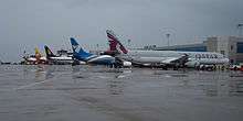
Malappuram is served by the Karipur International Airport (IATA: CCJ, ICAO: VOCL) in Karipur. The airport started operation in April 1988. It has two terminals, one for domestic flights and second for international flights.[52] Domestic flight services are available to major cities like Bangalore, Chennai, Mumbai, Hyderabad, Goa, Kochi, Thiruvananthapuram, Mangalore and Coimbatore while International flight services connects Malappuram with Dubai, Jeddah, Riyadh, Sharjah, Abu Dhabi, Al Ain, Bahrain, Dammam, Doha, Muscat, Salalah and Kuwait. There are direct buses to the airport for transportation. Other than buses, Taxis, Auto Rickshaws available for transportation.
Demography
| Historical population | ||
|---|---|---|
| Year | Pop. | ±% p.a. |
| 1901 | 682,151 | — |
| 1911 | 747,929 | +0.92% |
| 1921 | 764,138 | +0.21% |
| 1931 | 874,504 | +1.36% |
| 1941 | 977,085 | +1.12% |
| 1951 | 1,149,718 | +1.64% |
| 1961 | 1,387,370 | +1.90% |
| 1971 | 1,856,357 | +2.95% |
| 1981 | 2,402,701 | +2.61% |
| 1991 | 3,096,330 | +2.57% |
| 2001 | 3,625,471 | +1.59% |
| 2011 | 4,112,920 | +1.27% |
| source:[53] | ||
In the 2011 census, the district had a population of 4,112,920, which is roughly equal to the population of Croatia. Malappuram is the most populous district of Kerala. As of census 2011, 12.31% of the total population of Kerala resides in Malappuram. It is also the 48th most populous of India's 640 districts, with a population density of 1,157 inhabitants per square kilometre (3,000/sq mi). It's population-growth rate from 2001 to 2011 was 13.39 percent. Malappuram has a sex ratio of 1098 women to 1000 men, and it's literacy rate is 93.57 percent, which is almost equal to the average literacy rate of the state (93.91%). Out of the total Malappuram population for 2011 census, 44.18 percent lives in urban regions of district. Malappuram Urban Agglomeration is the fourth-largest urban agglomeration of Kerala and the 25th largest of India with a total population of 1,698,645.[54] According to a study conducted by The Economist in January 2020, Malappuram is the fastest growing city of the world.[55][56][57] In 2011, Children under 0-6 formed 13.96 percent of Malappuram District compared to 15.21 percent of 2001. Child Sex Ratio as per census 2011 was 965 compared to 960 of census 2001. According to the census 2011, only 0.02% of the total population of the district is houseless.[7]
Religions
The religions practised in the district include Islam, Hinduism, Christianity, and other minor religions.[58] Malappuram is one of the two districts in South India, where the Muslims form a majority, the other being the Lakshadweep district.
Languages
The principal language used in the district is Malayalam. The Mappila dialect of Malayalam is common in the district. Minority Dravidian languages are Allar (around 350 speakers)[59] and Aranadan, kept alive by around 200 speakers.[60] Tamil is also been spoke by a very small fraction of the people. According to the census 2011, the percents of the mother tongue of the total population is as follows:
Education
The district has the highest number of schools in Kerala as per the school statistics of 2019-20. There are 898 Lower primary schools,[61] 363 Upper primary schools,[62] 355 High schools,[63] 248 Higher secondary schools,[64] and 27 Vocational Higher secondary schools[65] in the district. Hence there are 1620 schools in the district.[66] Besides these, there are 120 CBSE schools and 3 ICSE schools in the district. 554 government schools, 810 Aided schools, and 1 unaided school, recognized by the Government of Kerala have been digitalized.[67] In the academic year 2019-20, the total number of students studying in the schools recognized by Government of Kerala is 739,966 - 407,690 in the aided schools, 245,445 in the government schools, and 86,831 in the recognized unaided schools.[68] The district also plays a significant role in the higher education sector of Kerala. The district is home to two of the main universities in the state- the University of Calicut centered at the Thenhipalam which was established in 1968 as the first university in the Malabar region and the second university in Kerala,[69] and the Thunchath Ezhuthachan Malayalam University centered at Tirur which was established in the year 2012.[70] AMU Malappuram Campus, one of the three off-campus centres of Aligarh Muslim University (AMU) is situated in Cherukara, which was established by the AMU in 2010.[71][72] An off-campus of the English and Foreign Languages University functions at the Panakkad.[73]
Healthcare
Modern medicine, Ayurveda, and Homeopathy are available in the district. A general hospital, 3 district hospitals, and 6 Taluk hospitals are functioning under the Government of Kerala. The Government Medical College, Manjeri, established in 2013, is the apex medical college in the district.[74] Besides these, a network of local health centers function under the public sector. It includes 66 Primary Health Centres, 20 All-time functioning primary health centers, 20 Community health centers, and 2 TBC's. 5 Major public health centers, 77 mini public health centers, and 565 sub-centers are there. 3 Leprosy control units, 2 Filaria control units, etc. also function under the public sector. The total bed strength of government hospitals is 1500. Many private hospitals with super-specialty units are also there in the district under Allopathy.[75][76] The Govt Ayurveda Research Institute for Mental Disease at Pottippara near Kottakkal is the only Ayurveda mental hospital in Kerala. Kottakkal is also home to the Arya Vaidya Sala, the renowned Ayurvedic health center. Under the government sector, a district Ayurveda hospital functions in Edarikode. Government Ayurveda hospitals also function in Manjeri, Velimukku, Perinthalmanna, Malappuram, Vengara, Thozhanur, Thiruvali, and Chelembra. Homeo hospitals under public sector functions at Malappuram and Manjeri.[76] Many hospitals function under the private sector.
Culture
The Mappila dance forms like Oppana, Kolkali, Duffmuttu, and Aravana muttu are popular in the district. Moyinkutty Vaidyar, the most renowned Mappila paattu poet was born at Kondotty in the district. He is the only Mahakavi (a title for 'great poet') of Mappila songs. The currently adopted Malayalam alphabet was first accepted by Thunchath Ezhuthachan, who was born in Tirur and is known as the father of modern Malayalam language. The district has also given its own deposits to Kathakali, the classical art form of Kerala, and Ayurveda. Kottakkal Chandrasekharan, Kottakkal Sivaraman, and Kottakkal Madhu were famous Kathakali artists hailed from Kottakkal Natya Sangam established by Vaidyaratnam P. S. Warrier in Kottakkal.
Malappuram was home to many medieval Malayalam poets, including Melpathur Narayana Bhattathiri, Poonthanam Nambudiri and Thunchaththu Ramanujan Ezhuthachan. Among them, Thunchaththu Ramanujan Ezhuthachan is known as the father of modern Malayalam language. During the medieval period, the district was a centre of Vedic as well as Islamic studies. The ancient Kerala school of astronomy and mathematics, though mainly centred in Thrissur, also had scholars coming from Malappuram. The Parameshvara, the Nilakantha Somayaji, the Jyeṣṭhadeva, the Achyutha Pisharadi, and the Melpathur Narayana Bhattathiri, who were the main members of the Kerala School of Astronomy and Mathematics hailed from the Tirur region. The Arabi Malayalam script, otherwise known as the Ponnani script, took it's birth during the late medieval period. The script was widely used in the district in the late 19th and early 20th century CE.
Cuisine
Since the district has a higher population of Mappilas, the Mappila cuisine is common in Malappuram. Mappila cuisine contains a blend of traditional Kerala food items with some of the Arab food items. One of the main elements of this cuisine is Pathiri, a pancake made of rice flour. Variants of Pathiri include Neypathiri (made with ghee), Poricha Pathiri (fried rather than baked), Meen Pathiri (stuffed with fish), and Irachi Pathiri (stuffed with beef). Spices like Black pepper, Cardamom, and Clove are widely used in the cuisine of Malappuram. The main item used in the festivals is the Malabar style of Biryani. Sadhya can also be seen in marriage and festival occasions. Ponnani region of the district has a wide variety of indigenous dishes. Snacks such as Arikadukka, Chattipathiri, Muttamala, Pazham Nirachathu, and Unnakkaya have their own style in Ponnani. Besides these food items, other common traditional items of Kerala can also seen in the cuisine of Malappuram.[77]
Sports
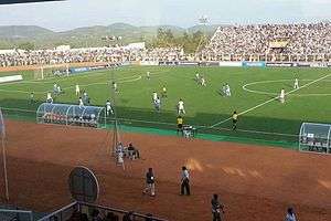
Malappuram is known for its love towards the Football. It is also known as The Mecca of Kerala Football.[1][2] The district has contributed many professional footballers. The Malappuram District Sports Complex & Football Academy is situated at Payyanad in Manjeri. The Kottappadi Football Stadium is a historical football stadium. The other major stadiums include the Rajiv Gandhi Municipal Stadium at Tirur, and the Perinthalmanna Cricket Stadium at Perinthalmanna. A synthetic track is there along with the Tirur Municipal Stadium. The Malabar Premier League was initiated in 2015 to strengthen the football in Malappuram.[78] The Calicut University Synthetic Track at Tenhipalam is the apex synthetic track of the district. It is associated with the C. H. Mohammed Koya Stadium at Tenhipalam.[79] The other major stadiums of the district are at Areekode, Kottakkal, and Ponnani. A football hub to internationalize the eight major football stadiums of the district is proposed.[80] The district has also contributed professional sportsmen in the fields of the cricket and the athletics. The construction works of two new stadium complexes are being processed in Tanur and Nilambur.[81]
Tourism
.jpg)
- Adyanpara Falls- is a cascading waterfall in the Kurumbalangod village of Nilambur taluk.[82]
- Arimbra Hills, also known as 'Mini-Ooty', since it resembles Ooty. It is at a height of 1050 feet above sea level.[83]
- Arya Vaidya Sala - known for its heritage and expertise in the Indian traditional medicine system of Ayurveda.
- Bharathappuzha - The longest river of Kerala. Also known in the names River Ponnani, Nila and Perar.[84]
- Biyyam Kayal- A backwater lake in Ponnani[85]
- Cherumb eco-tourist village - A scenic village in the Karuvarakundu[86]
- Kadalundi Bird Sanctuary - a dwelling of more than a hundred species of native birds and over 60 species of migratory birds[87]
- Keralamkundu waterfalls - It is located 1500 ft above the sea level in Karuvarakundu.[88]
- Kodikuthimala - At Amminikadan hills, Perinthalmanna. Also known as Mini-Ooty, since it resembles Ooty.[89]
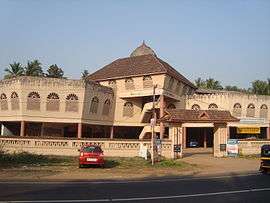
- Kottakkunnu - On the heart of the city of Malappuram. An old fort, a water-park and ancient murals are seen here.[90]
- Nedumkayam Rainforest - A part of the Nilgiri Biosphere Reserve. Known for it's greenery.[91]
- New Amarambalam Reserved Forest - A wildlife sanctuary near to Nilambur.[92]
- Nilambur Kovilakam - The headquarter of the Nilambur royal family.[93]
- Oorakam Hill - A mount near Malappuram.
- Padinjarekara beach - Two rivers (The Tirur River and the Bharathappuzha) joins with the Arabian sea at here.[94]
- Pandallur hills - A scenic view point near Malappuram.
- Tanur beach - A beach at Tanur.
- Teak Museum - The world's first teak plantation in Nilambur.[95]
- Thunchan Parambu - It is the birthplace of Thunchaththu Ezhuthachan, who is known as the father of modern Malayalam language.
- Vakkad beach - It is at between the Tirur and the Ponnani.[96]
Notable people
- Achyutha Pisharadi - a Sanskrit grammarian, astronomer and mathematician.
- Ahmad Kutty - a North American Islamic scholar
- Anas Edathodika - an Indian professional footballer.
- Aneesh G. Menon - is an Indian actor[97][98]
- Ashique Kuruniyan - an Indian professional footballer.
- Azad Moopen - an Indian doctor and philanthropist.[99][100][101][102]
- C. Karunakara Menon - was an Indian journalist and politician.
- Cherukad - a Malayalam playwright, novelist, poet and political activist.
- Damodara - was an astronomer-mathematician.
- E. K. Imbichi Bava - was an Indian politician.
- E. M. S. Namboodiripad - The first Chief Minister of Kerala.[103]
- Edasseri Govindan Nair - was an Indian poet.
- Faisal Kutty - a lawyer, academic, writer, public speaker, and human rights activist.[104]
- Gopinath Muthukad - a magician, and motivational speaker.[105][106]
- Govinda Bhattathiri - was an Indian astrologer and astronomer.
- Iqbal Kuttippuram - an Indian screenwriter and homoeopathic physician.[107]
- K. P. Ramanunni - is a novelist and short-story writer.[108][109]
- K. T. Irfan - an Indian athlete.[110][111][112]
- Kalamandalam Kalyanikutty Amma - a resurrector of Mohiniyattam.
- KM Asif - an Indian cricketer.
- M. K. Vellodi - former Indian diplomat.
- M. M. Akbar - an Islamic scholar, and an expert in comparative religion.[113]
- Mankada Ravi Varma - was an Indian cinematographer and director.[114][115][116]
- Melpathur Narayana Bhattathiri - was a mathematical linguist.
- Moyinkutty Vaidyar - was a Mappila pattu poet.[117]
- Nilambur Ayisha - an actress in Malayalam film industry and drama.
- Nirupama Rao - former foreign secretary of India.[118][119]
- P. Surendran - is a writer, columnist, art critic, and a philanthropist.[120]
- Parameshvara - was a major Indian mathematician and astronomer.
- Poonthanam Nambudiri - was a Malayalam poet.[121]
- Pulikkottil Hyder - was a Mappila pattu poet.[122]
- Shahabaz Aman -[123] an Indian playback singer and composer.[124][125]
- Shanavas K Bavakutty - is an Indian film director.
- Shweta Menon - an Indian model, actress, and television anchor.
- Syed Muhammedali Shihab Thangal - was a religious leader and politician.[126][127][128][129]
- T. M. Nair - Physician.
- Thunchaththu Ezhuthachan- was a Malayalam poet and linguist.[130][131]
- U. Sharaf Ali - a former Indian International football player.[132][133][134]
- Unni Menon - playback singer
- Uroob - was a writer of Malayalam literature.
- V. C. Balakrishna Panicker - an Indian Journalist.
- Vaidyaratnam P. S. Warrier - was an Ayurvedic physician.[135]
- Vallathol Narayana Menon - was a Malayalam poet.[136]
- Variyan Kunnathu Kunjahammed Haji - an Indian Freedom Fighter.[137]
- Zakariya Mohammed - an Indian Film director, screenwriter and actor.[138][139]
Demand of bifurcation
For a few years, the demand of bifurcating the district into two districts by carving out a new one called Tirur district, centered at Tirur is being strengthened.[140] They argue that it is imperative from the development perspective to split the district, with double the population and size of the Alappuzha district, into two. No other district in Kerala has seven Taluks, 94 Village Panchayats, and 12 municipalities together. As for its extent, if one travels from Perumbadappu which borders Thrissur district to Vazhikkadavu bordering Tamil Nadu, normally it takes four hours to cover that distance of 126 km. They also point out that the problems in the health and educational sectors that require solutions are not trivial. The issue was raised again by the IUML MLA KNA Khader in 2019.[140] The demand is to bifurcate the existing Malappuram district into two districts by carving out a new one called Tirur district from it.[140] KC(M) campaigns for a new district centred at Edappal.[141] Some people including Veteran Congress leader Aryadan Muhammad, and IUML district secretary UA Latheef oppose the bifurcation of Malappuram.[142][143]
However, the demand was rejected by the two successive governments who ruled Kerala in 2013 and in 2019.[142][143] But the studies regarding the bifurcation of the district are still in the consideration of the Government of Kerala.
See also
- Malappuram Urban Agglomeration
- Malabar District
- Valluvanad
- Eranad
- Parappanad
References
- "Malabar Premier League to be launched in the Mecca of Kerala football". The Hindu. 3 March 2015. Retrieved 28 November 2019.
- "Football hub proposed in Malappuram, the Mecca of Kerala football". www.deccanchronicle.com. 18 July 2016. Retrieved 28 November 2019.
- "Kerala kids who sacrificed chocolates to buy football flooded with footballs after video goes viral". m.dailyhunt.in. 8 November 2019. Retrieved 28 November 2019.
- "Jaffer Malik,IAS steps down as Malappuram collector; N.Gopalakrishnan,IAS is the new collector". Keralakaumudi dialy. Retrieved 27 May 2020.
- "Malappuram Jilla Panchayath". malappuramdistrictpanchayath.kerala.gov.in. Retrieved 30 November 2019.
- "Malappuram-basic information" (PDF). censusindia.gov.in. Directorate of Census operations, Kerala. pp. 15–16.
- "Census 2011, Malappuram" (PDF). censusindia.gov.in. Retrieved 17 April 2020.
- "Language – Kerala, Districts and Sub-districts". Census of India 2011. Office of the Registrar General.
- "Religion – Kerala, Districts and Sub-districts". Census of India 2011. Office of the Registrar General.
- "Population profile of Kerala". spb.kerala.gov.in. Retrieved 28 November 2019.
- "History of Malappuram" (PDF). censusindia.gov.in. Retrieved 17 April 2020.
- Nair, K. K. (2013). By Sweat and Sword: Trade, Diplomacy and War in Kerala Through the Ages. KK Nair. ISBN 978-81-7304-973-6.
- Ramachandran, C. M. Problems of Higher Education in India: A Case Study. Mittal Publications.
- K. V. Krishna Iyer, Zamorins of Calicut: From the earliest times to AD 1806. Calicut: Norman Printing Bureau, 1938.
- Kunhali. V. "Calicut in History" Publication Division, University of Calicut (Kerala), 2004
- A. Sreedhara Menon. Kerala Charitram. DC Books. pp. 31–32. ISBN 9788126415885. Retrieved 21 April 2020.
- K.P. Padmanabha Menon, History of Kerala, Vol. II, Ernakulam, 1929, Vol. II, (1929)
- AG Noorani "Archived copy". Archived from the original on 21 December 2012. Retrieved 5 January 2013.CS1 maint: archived copy as title (link)
- The 16th Century Mappila Muslims’ Jihad against the Portuguese: Impact of Tuhfat al-Mujahidin fi ba‘d Akhbar al-Burtughaliyin, Jose Abraham, Concordia University, 40th Annual Conference on South Asia, 2011 Center for South Asia University of Wisconsin-Madison http://southasiaconference.wisc.edu/archive/2011/2011-Program.pdf%5B%5D
- "European treaties of Malappuram" (PDF). shodhganga.inflibnet.ac.in. Retrieved 20 April 2020.
- Panikkar, K. N., Against Lord and State: Religion and Peasant Uprisings in Malabar 1836-1921
- "The government of Kerala to form Malappuram district". www.thehindu.com. 4 January 1969. Retrieved 23 June 2020.
- "Formation of the Malappuram district" (PDF). shodhganga.inflibnet.ac.in.
- "Summer Journey 2011". Time. 21 July 2011.
- "Physical divisions of Malappuram" (PDF). censusindia.gov.in. pp. 21–22. Retrieved 18 April 2020.
- "The coastal area of Malappuram". www.kerenvis.nic.in. Retrieved 30 November 2019.
- "Ponnani, the Mecca of Malabar". www.nativeplanet.com. Retrieved 19 April 2020.
- "Rivers in Malappuram district". malappuram.nic.in. Retrieved 23 November 2019.
- "MSN Weather". Archived from the original on 9 October 2009. Retrieved 29 November 2019.
- "Climate of Malappuram". en.climate-data.org. Retrieved 30 November 2019.
- "Tirur Vettila gets GI tag". www.thehindu.com. Retrieved 19 April 2020.
- "Forest area of Malappuram" (PDF). industry.kerala.gov.in. Retrieved 21 April 2020.
- "Flora and fauna of Malappuram". malappuram.nic.in. Retrieved 24 November 2019.
- "Municipalities in Malappuram". malappuram.nic.in. Retrieved 1 December 2019.
- "No. of wards in Malappuram". lsgkerala.gov.in.
- "Administrative divisions of Malappuram district". malappuram.nic.in. Retrieved 23 November 2019.
- "Talukas in Malappuram district". malappuram.nic.in. Retrieved 23 November 2019.
- "Taluk-wise demography of Malappuram" (PDF). censusindia.gov.in. Directorate of Census Operations, Kerala. pp. 161–193. Retrieved 19 April 2020.
- "Villages in Malappuram". malappuram.nic.in. Retrieved 25 November 2019.
- "Niyamasabha constituencies of Malappuram". www.ceo.kerala.gov.in. Retrieved 25 November 2019.
- "Judicial administration of Malappuram". districts.ecourts.gov.in.
- "Malappuram police". malappuram.keralapolice.gov.in.
- "Economy of Malappuram". www.ecostat.kerala.gov.in.
- "Malappuram ranks first in the number of emigrants from Kerala". spb.kerala.gov.in. Retrieved 3 December 2019.
- "KINFRA Techno Industrial Park, Malappuram". kinfra.org.
- "KGB to expand operations in all Panchayats". www.newindianexpress.com. 15 July 2013. Retrieved 25 June 2020.
- "Minerals of Malappuram" (PDF). industry.kerala.gov.in. p. 35. Retrieved 21 April 2020.
- "Agriculture in Malappuram". www.ecostat.kerala.gov.in.
- "Length of PWD Roads in Malappuram". www.kerenvis.nic.in. Retrieved 19 April 2020.
- "Railway in Malappuram" (PDF). industry.kerala.gov.in. p. 45. Retrieved 21 April 2020.
- "Nilambur-Nanjandgud way to be realised". timesofindia.indiatimes.com. 2 September 2016. Retrieved 26 June 2020.
- "Silver jubilee does not bring cheer to Karipur airport users | Kozhikode News - Times of India". The Times of India.
- "Census of India Website : Office of the Registrar General & Census Commissioner, India". www.censusindia.gov.in.
- "The Malappuram Urban Agglomeration" (PDF). www.censusindia.gov.in. Retrieved 25 June 2020.
- "Malappuram, the fastest growing city". www.cnbctv18.com. 9 January 2020. Retrieved 28 June 2020.
- "Malappuram, the fastest growing city of world". scroll.in.
- "Malappuram is world's fastest-growing city; Kozhikode, Kollam also in top 10". www.newindianexpress.com.
- pp. 396, Malayala Manorama Yearbook 2006, Kottayam, 2006 ISSN 0970-9096
- M. Paul Lewis, ed. (2009). "Allar: A language of India". Ethnologue: Languages of the World (16th ed.). Dallas, Texas: SIL International. Retrieved 28 September 2011.
- M. Paul Lewis, ed. (2009). "Aranadan: A language of India". Ethnologue: Languages of the World (16th ed.). Dallas, Texas: SIL International. Retrieved 28 September 2011.
- "LP schools in Malappuram". sametham.kite.kerala.gov.in. Retrieved 17 April 2020.
- "UP schools in Malappuram". sametham.kite.kerala.gov.in. Retrieved 17 April 2020.
- "High schools in Malappuram". sametham.kite.kerala.gov.in. Retrieved 17 April 2020.
- "HSE schools in Malappuram". sametham.kite.kerala.gov.in. Retrieved 17 April 2020.
- "VHSE schools in Malappuram". sametham.kite.kerala.gov.in. Retrieved 17 April 2020.
- "Schools in Malappuram". sametham.kite.kerala.gov.in. Retrieved 17 April 2020.
- "Hi-tech schools in Malappuram". sametham.kite.kerala.gov.in. Retrieved 17 April 2020.
- "Strength of schools in Malappuram". sametham.kite.kerala.gov.in. Retrieved 17 April 2020.
- "The University of Calicut". www.uoc.ac.in.
- "The world's only Malayalam University". malayalamuniversity.edu.in.
- "Aligarh Muslim University Malappuram Off-centre". www.amu.ac.in.
- "Universities in Malappuram district". www.malappuramtourism.org.
- "Eflu to start courses in Malappuram campus on January-31". timesofindia.indiatimes.com. 17 January 2014. Retrieved 24 June 2020.
- "A new government medical college in Kerala after 31 years". The Hindu. 2 September 2013.
- "Healthcare in Malappuram". www.ecostat.kerala.gov.in.
- "Healthcare in Malappuram". malappuram.nic.in.
- "Cuisine of Malappuram". www.malappuramtourism.org. Retrieved 18 April 2020.
- "Malabar Premier League". www.thehindu.com. 3 March 2015. Retrieved 24 June 2020.
- "Tenhipalam Synthetic Track". www.deccanchronicle.com. 2 April 2016. Retrieved 24 June 2020.
- "Football hub proposed in Malappuram". www.deccanchronicle.com. 18 July 2016. Retrieved 24 June 2020.
- "Stadium complexes at Tanur and Nilambur". www.newsexperts.in. 14 February 2019. Retrieved 24 June 2020.
- "Adyanpara Waterfalls". www.keralatourism.org.
- "Arimbra Hills Aka Mini Ooty Of Kerala". Art of Legend India. Archived from the original on 30 May 2015. Retrieved 30 May 2015.
- "Infobox facts". All Kerala River Protection Council. Retrieved 30 January 2006.
- "The Biyyam backwaters in Ponnani". www.nativeplanet.com.
- "Cherumb". www.tripadvisor.in.
- "Birds of Kadalundi))". www.keralatourism.org.
- "Keralamkundu waterfalls". www.keralatourism.org.
- "Kodikuthimala". www.keralatourism.org.
- "Kottakkunnu". www.keralatourism.org.
- "Nedumkayam Rainforest". www.keralatourism.org.
- "BirdLife International (2016) Important Bird and Biodiversity Area factsheet: Amarambalam Wildlife Sanctuary - Nilambur". BirdLife International. Retrieved 27 June 2020.
- "Nilambur Kovilakam". www.keralatourism.org.
- "Padinjarekara Beach". www.keralatourism.org.
- "Teak Museum". www.keralatourism.org.
- "Vakkad beach". www.keralatourism.org.
- "Being the usual and unusual actor: Aneesh G Menon". Deccan Chronicle. 19 September 2017.
- "Length of the character matters to me: Aneesh". The Times of India.
- Jagwani, Lohit (12 February 2014). "We are looking at a turnover of $1B by 2017: Azad Moopen, chairman of Aster DM Healthcare". VC Circle. Retrieved 5 May 2014.
- Padma Awards Announced Ministry of Home Affairs, 25 January 2011
- "Top 100 Indian Leaders in UAE". Forbes. Archived from the original on 5 May 2014. Retrieved 5 May 2014.
- "50 Richest Indians in the GCC". Arabian Business. Retrieved 5 May 2014.
- Singh, Kuldip (1 April 1998). "Obituary: E. M. S. Namboodiripad". The Independent. Retrieved 20 May 2018.
- "VU law professor among world's most influential Muslims". nwitimes.com. 31 December 2012. Retrieved 18 February 2013.
- "Indian magician performs Houdini-like escape". Rediff.com. 14 February 1997. Retrieved 3 May 2017.
- "2011 Yearbook". International Magicians Society. Archived from the original on 20 August 2016. Retrieved 20 August 2016.
- "Archived copy". Archived from the original on 25 July 2011. Retrieved 23 March 2020.CS1 maint: archived copy as title (link)
- "Vayalar award for K.P. Ramanunni". The Hindu. 8 October 2011. Retrieved 12 October 2011.
- "manorama online-english". Archived from the original on 3 April 2012. Retrieved 12 October 2011.
- "Irfan qualifies for Olympics in 20km walk.He completed the walk by touching the finish line at 10th position". dailysports.co. Archived from the original on 29 March 2014. Retrieved 2 July 2012.
- "Khushbir fails after Irfan qualifies for Olympics in 20km walk". Times of India. Retrieved 2 July 2012.
- "Irfan Thodi". The Times of India. Retrieved 19 July 2013.
- "ArabNews, 2 April 2009 Thursday (06 Rabi' al-Thani 1430), Article titled: Interest-free economic system urged".
- S Nanda Kumar. "Directpr's Cut". Deccan Herald. Retrieved 23 November 2010.
- "Painting with light". The Hindu. Chennai, India. 7 September 2007.
- Dore, Shalini (24 November 2010). "Indian cinematographer Varma dies: He worked on Adoor Gopalakrishnan's films". Variety.
- "Mappila songs cultural fountains of a bygone age, says MT". Chennai, India: The Hindu. 31 March 2007. Retrieved 15 August 2009.
- Nirupama Rao takes over as Foreign Secy Press Trust of India / New Delhi, Business Standard, 1 August 2009.
- Nirupama Rao is India's new foreign secretary The Times of India, 1 August 2009."Chokila Iyer was first woman, Indian Foreign Secretary in 2001."
- "Award for Short Stories". www.keralasahityaakademi.org. Archived from the original on 5 July 2017. Retrieved 27 October 2015.
- I K K Menon. FOLK TALES OF KERALA. Publications Division Ministry of Information & Broadcasting Government of India. pp. 194–. ISBN 978-81-230-2188-1.
- "Archived copy". Archived from the original on 29 June 2010. Retrieved 25 November 2010.CS1 maint: archived copy as title (link)
- "Shahabaz Aman: Interview with Shahabaz Aman by Ajith". Shahabazaman4u.blogspot.com. 19 January 2010. Retrieved 9 December 2013.
- ""Shaam-e-Ehsas" Ghazal Nite by Shahabaz Aman". Hello Bahrain. 29 March 2012. Archived from the original on 13 December 2013. Retrieved 9 December 2013.
- "Shahabaz Aman: When I die, I'd rather have people say that Malabar's renowned romantic passed away than just a singer". The Times of India. Retrieved 14 June 2019.
- "President, PM, Sonia pay homage to IUML leader Thangal". The Times Of India. 2 August 2009.
- "Muslim League leader Shihab Thangal dead". The Hindu. Chennai, India. 2 August 2009. Retrieved 2 August 2009.
- "Syed families hold get-together". The Hindu. Chennai, India. 1 May 2006. Retrieved 2 August 2009.
- "President, PM, Sonia pay homage to IUML leader Thangal". The Times of India. 2 August 2009. Retrieved 2 August 2009.
- Lewis, M. Paul, Gary F. Simons, and Charles D. Fennig (eds. "Malayalam" Ethnologue: Languages of the World. 2014: (Dallas, Texas) Web. 29 September 2014.
- K. SANTHOSH. "When Malayalam found its feet" THRISSUR, 17 July 2014 The Hindu
- "Minister convenes high-level meet". The Hindu. 4 July 2009. Retrieved 10 October 2009.
- "Malappuram - The Heartland of Football". IndianFootball.Com. Retrieved 10 October 2009.
- "Department of Physical Education". Calicut University. Archived from the original on 25 July 2008. Retrieved 10 October 2009.
- mail at aryavaidyasala dot com. "ARYA VAIDYA SALA - Kottakkal". aryavaidyasala.com. Retrieved 22 March 2015.
- Zarrilli, Phillip (2004). Kathakali Dance-Drama: Where Gods and Demons Come to Play. Routledge. pp. 30–31. ISBN 9780203197660.
- EncyclopaediaDictionaryIslamMuslimWorld Volume 6. 1988. p. 460.
Contemporary evaluation within India tends to the view that the Malabar Rebellion was a war of liberation, and in 1971 the Kerala Government granted the remaining active participants in the revolt the accolade of Ayagi, "freedom fighter"
- "Aravindan Puraskaram awarded to Zakariya Mohammed - Times of India". The Times of India.
- "Sudani from Nigeria wins audience choice award at Russian film festival". The New Indian Express.
- "The demand for bifurcation of Malappuram". www.thenewsminute.com. 28 August 2019. Retrieved 25 November 2019.
- "KC(M) to raise new Edappal district". timesofindia.indiatimes.com. 17 November 2019. Retrieved 15 June 2020.
- "Pinarayi govt rejects demand for partition of Malappuram". Manoramaonline. Retrieved 25 December 2019.
- "No move to bifurcate of Malappuram district: Oommen Chandy". The Economic Times. 26 June 2013. Retrieved 25 December 2019.
External links
| Wikimedia Commons has media related to Malappuram district. |
| Wikivoyage has a travel guide for Malappuram District. |
Places adjacent to Malappuram district | ||||||||||
|---|---|---|---|---|---|---|---|---|---|---|
| ||||||||||
| Authority control |
|
|---|