Deoria district
Deoria district, one of the districts of eastern Uttar Pradesh, India has its headquarters located at Deoria and is a part of Gorakhpur division. It came into existence on 16 March 1946 from Gorakhpur district.
Deoria District | |
|---|---|
District of Uttar Pradesh | |
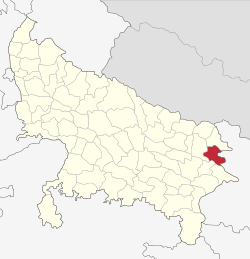 Location of Deoria district in Uttar Pradesh | |
| Country | India |
| State | Uttar Pradesh |
| Division | Gorakhpur |
| Headquarters | Deoria, Uttar Pradesh |
| Government | |
| • Lok Sabha constituencies | Deoria, Salempur, Bansgaon |
| • Vidhan Sabha constituencies | Deoria City, Rampur Karkhana, Barhaj, Rudrapur, Bhatpar Rani, Salempur, Pathardeva. |
| Area | |
| • Total | 2,535 km2 (979 sq mi) |
| Population (2011) | |
| • Total | 3,100,946 |
| • Density | 1,200/km2 (3,200/sq mi) |
| Demographics | |
| • Literacy | 73.53% |
| • Sex ratio | M:F 1000:1013 |
| Time zone | UTC+05:30 (IST) |
| Major highways | NH28, NH 221A, NH 441A |
| Average annual precipitation | 864.38 mm |
| Website | http://deoria.nic.in/ |
District Officers | |
|---|---|
| Government | |
| • D.M. | Amit Kishor |
| • A.D.M(F/R) | Umesh Kumar Mangala |
| • A.D.M(E) | Rakesh Kumar Patel |
| • S.P. | Shripati Mishra |
| • CDO | Shivsharnappa GN |
History
Ancient
The area now known as the Deoria District was once a part of the Kosala Kingdom - a prime centre of ancient Aryan culture surrounded by the Himalayas in the north, the Shyandika river in the south, the Panchala Kingdom in the west and the Magadh Kingdom in Bihar to the east. Apart from the many legends told about this area, archaeological remains, such as statues, coins, bricks, Temples. Most of the People using surname Rao belong to the Kshatria cast in Deoria Dist,.
The ancient history of the district is related with the Ramayana times when the Lord of Kosala, Ram, appointed his elder son Kusha the king of Kushwati, which is present-day Kushinagar. Before the Mahabharata era, this area had been related with Chakravorty Samrat Mahasudtsan Malla and his kingdom. Kushinagar was well developed and prosperous. Close to the border of his kingdom was the thick forested area called the Mahavan. This area was under the control of the Maurya rulers, the Gupta rulers, the Bihar rulers, and then the Garhwal ruler Govinda Chandra from 1114 AD until 1154 AD.
Modern
The Deoria district came into existence on 16 March 1946, being separated from the Gorakhpur District. It is believed that the name Deoria is derived from Devaranya or possibly Devpuria. According to official gazetteers, the district was named "Deoria" after its headquarters in Deoria, and the term Deoria generally means a place where there are temples. The name Deoria probably developed because of the existence of important temples in the area. During Freedom struggle of India the district joined struggle under the leadership of Pandit Bibhuti Mani Tripathi of village Dehrauli, Rudrapur.
Geography
Deoria district is located between 26 ° 6' and 26° 48' north latitude to 83° 23' and 84° 16' east longitude. It is surrounded by Kushinagar district in the north, Gopalganj and Siwan districts of Bihar in the east, Mau and Ballia districts in the south and Gorakhpur district in the west.[1]
Ghaghara, Rapti and Chhoti Gandak are the main rivers in the district.[1]
Deoria district consists of 16 blocks:
- Baitalpur
- Bankata
- Barhaj, Harnoutha & more..
- Bhagalpur
- Bhaluani
- Bhatni
- Bhatpar Rani
- Deoria
- Desai Deoria
- Gauri Bazaar
- Lar
- Pathardeva
- Rampur Karkhana
- Rudrapur
- Salempur
- Tarkulwa
Places adjacent to Deoria district | ||||||||||
|---|---|---|---|---|---|---|---|---|---|---|
| ||||||||||
Demographics
According to the 2011 census Deoria district has a population of 3,100,946.[2] This gives it a ranking of 114th in India (out of a total of 640).[2] The district has a population density of 1,220 inhabitants per square kilometre (3,200/sq mi) .[2] Its population growth rate over the decade 2001-2011 was 14.23%.[2] Deoria has a sex ratio of 1013 females for every 1000 males,[2] and a literacy rate of 73.53%.[2]
| Historical population | ||
|---|---|---|
| Year | Pop. | ±% p.a. |
| 1901 | 749,486 | — |
| 1911 | 816,191 | +0.86% |
| 1921 | 833,199 | +0.21% |
| 1931 | 889,726 | +0.66% |
| 1941 | 992,352 | +1.10% |
| 1951 | 1,059,208 | +0.65% |
| 1961 | 1,190,803 | +1.18% |
| 1971 | 1,410,868 | +1.71% |
| 1981 | 1,749,946 | +2.18% |
| 1991 | 2,184,904 | +2.24% |
| 2001 | 2,714,179 | +2.19% |
| 2011 | 3,100,946 | +1.34% |
| source:[3] | ||
Languages
At the time of the 2011 Census of India, 98.52% of the population in the district spoke Hindi and 1.40% Urdu as their first language.[4]
Vernaculars spoken in Deoria include Bhojpuri language and also spoken Hindi with English language almost 40 000 speakers, written in both the Devanagari and Kaithi .[5]
Notable people
- Lal Khadag Bahadur Malla, Bhojpuri Author
- Moti BA, Bhojpuri Poet, lyricist and Musician.
- Nripendra Misra - Former Principal Secretary to the Prime Minister of India
- Prakash Mani Tripathi - former member of Lok Sabha from Deoria parliamentary constituency.
- Surya Pratap Shahi - Member of 9th, 11th, 13th and 17th Legislative Assembly of Uttar Pradesh. Currently, he is serving as Cabinet Minister in Uttar Pradesh Government with the portfolio of Agriculture, Agriculture Education, and Agriculture Research.
- Sahaj Tripathi - Social Worker
List of Colleges in Deoria District
References
- "Deoria". Deoria district administration. Retrieved 5 August 2010.
- "District Census 2011". Census2011.co.in. 2011. Retrieved 30 September 2011.
- Decadal Variation In Population Since 1901
- 2011 Census of India, Population By Mother Tongue
- M. Paul Lewis, ed. (2009). "Bhojpuri: A language of India". Ethnologue: Languages of the World (16th ed.). Dallas, Texas: SIL International. Retrieved 30 September 2011.