Siddharthnagar district
Siddharthnagar district is one of the 75 districts of the Indian state of Uttar Pradesh.Siddharthnagar is the district headquarters. Siddharthnagar district is a part of Basti division.
Siddharthnagar district | |
|---|---|
District of Uttar Pradesh | |
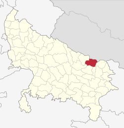 Location of Siddharthnagar district in Uttar Pradesh | |
| Coordinates (Siddharthnagar): 27°0′N 82°45′E - 27°28′N 83°10′E | |
| Country | India |
| State | Uttar Pradesh |
| Division | Basti Division |
| Headquarters | Siddharthnagar |
| Tehsils | 1.Siddharthnagar(Naugarh) 2.Shohratgarh 3.Bansi 4.Itwa 5.Domariyaganj |
| Government | |
| • Lok Sabha constituencies | Domariyaganj |
| Area | |
| • Total | 2,895 km2 (1,118 sq mi) |
| Population (2011) | |
| • Total | 2,559,297 |
| • Density | 882/km2 (2,280/sq mi) |
| Demographics | |
| • Literacy | 59.2% |
| • Sex ratio | 976 |
| Time zone | UTC+05:30 (IST) |
| Vehicle registration | UP-55 |
| Website | http://siddharthnagar.nic.in |
According to the Government of India, Siddharthnagar district is one of the Muslim concentrated districts in India on the basis of the 2001 census data on population diversity, socio-economic indicators and basic amenities indicators.[1]
Divisions
Siddharthnagar district comprises five tehsils:
- Siddharthnagar (Naugarh)
- Shohratgarh
- Bansi
- Itwa
- Domariyaganj
Demographics
According to the 2011 census, Siddharthnagar district has a population of 2,559,297,[2] roughly equal to the nation of Kuwait[3] or the US state of Nevada.[4] This gives it a ranking of 164th in India (out of a total of 640).[2] The district has a population density of 882 inhabitants per square kilometre (2,280/sq mi).[2] Its population growth rate over the decade 2001-2011 was 25.17%.[2] Siddharthnagar has a sex ratio of 970 females for every 1000 males,[2] and a literacy rate of 67.81%.[2]
At the time of the 2011 Census of India, 95.22% of the population in the district spoke Hindi and 4.73% Urdu as their first language.[5]
The minority population is about 27% of the total population of the district. Siddharthnagar is a category "A" district; that is, it has socio-economic and basic amenities parameters below the national average.[6]
| Historical population | ||
|---|---|---|
| Year | Pop. | ±% p.a. |
| 1901 | 701,884 | — |
| 1911 | 695,902 | −0.09% |
| 1921 | 731,947 | +0.51% |
| 1931 | 790,038 | +0.77% |
| 1941 | 830,952 | +0.51% |
| 1951 | 907,736 | +0.89% |
| 1961 | 962,262 | +0.59% |
| 1971 | 1,089,054 | +1.25% |
| 1981 | 1,300,583 | +1.79% |
| 1991 | 1,607,964 | +2.14% |
| 2001 | 2,040,085 | +2.41% |
| 2011 | 2,559,297 | +2.29% |
| source:[7] | ||
History
Some scholars have suggested that modern-day Piprahwa-Ganwaria was the site of the ancient city of Kapilavastu, the capital of the Shakya kingdom,[8][9][10] where Siddhartha Gautama spent the first 29 years of his life, according to Buddhist texts such as the Pāli Canon.[11] Others suggest that the original site of Kapilavastu is located 16 kilometres (9.9 mi) to the northwest, at Tilaurakot, in what is currently Kapilvastu District in Nepal.[8][12][13]
Geography
Siddharthnagar district lies between 27°N to 27°28'N and 82°45'E to 83°10'E. It is part of Purvanchal. The district borders Nepal's Kapilvastu district on the north and Rupandehi district on the northeast. Otherwise, it is surrounded by other districts of Uttar Pradesh: Maharajganj on the east, Basti and Sant Kabir Nagar on the south, and Balrampur on the west. Siddharthnagar's area is 2,895 km2.
Economy
In 2006, the Ministry of Panchayati Raj named Siddharthnagar one of the country's 250 most backward districts (out of a total of 640).[14] It is one of the 34 districts in Uttar Pradesh currently receiving funds from the Backward Regions Grant Fund Programme (BRGF).[14]
Education
University
- Siddharth University is a state university in Kapilvastu, Siddharthnagar, Uttar Pradesh.
Notable people
Notable people from the district include:
- Jagdambika Pal – former chief minister of UP Government and current Member of Parliament for Domariyaganj (Lok Sabha constituency).
- Mata Prasad Pandey – former speaker of UP Assembly MLA for Itwa (Assembly constituency).
- Jai Pratap Singh – Minister of Health Uttar Pradesh MLA for Bansi (Assembly constituency).
- Satish Chandra Dwivedi – Minister of state (Independent charge) MLA for Itwa (Assembly constituency).
- Shyam Dhani, MLA (Kapilvastu)
References
- http://pib.nic.in/release/release.asp?relid=28770
- "District Census 2011". Census2011.co.in. 2011. Retrieved 30 September 2011.
- US Directorate of Intelligence. "Country Comparison:Population". Retrieved 1 October 2011.
Kuwait 2,595,62
- "2010 Resident Population Data". U. S. Census Bureau. Retrieved 30 September 2011.
Nevada 2,700,551
- 2011 Census of India, Population By Mother Tongue
- [Archived 30 September 2011 at the Wayback Machine F. No. 3/64/2010-PP-I, GOVERNMENT OF INDIA, MINISTRY OF MINORITY AFFAIRS
- Decadal Variation In Population Since 1901
- Peppe, WC (July 1898), "The Piprahwa Stupa, containing relics of Buddha", With a note by V.A. Smith. Journal of the Royal Asiatic Society of Great Britain and Ireland (Article XXIII): 573–88, JSTOR 25208010 – via JSTOR (subscription required)
- Bühler, Georg (April 1898), "Preliminary note on a recently discovered Sakya inscription", Journal of the Royal Asiatic Society of Great Britain and Ireland (Correspondence: Note 14): 387–389, JSTOR 25207982 – via JSTOR (subscription required)
- Srivastava, KM (1980), "Archaeological Excavations at Piprāhwā and Ganwaria and the Identification of Kapilavastu", The Journal of the International Association of Buddhist Studies, 13 (1): 103–10
- Trainor, K (2010). "Kapilavastu". In Keown, D; Prebish, CS (eds.). Encyclopedia of Buddhism. Milton Park, UK: Routledge. pp. 436–7. ISBN 978-0-415-55624-8.
- Tuladhar, Swoyambhu D. (November 2002), "The Ancient City of Kapilvastu - Revisited" (PDF), Ancient Nepal (151): 1–7
- Sharda, Shailvee (4 May 2015), "UP's Piprahwa is Buddha's Kapilvastu?", The Times of India
- Ministry of Panchayati Raj (8 September 2009). "A Note on the Backward Regions Grant Fund Programme" (PDF). National Institute of Rural Development. Archived from the original (PDF) on 5 April 2012. Retrieved 27 September 2011.
External links
Places adjacent to Siddharthnagar district | ||||||||||
|---|---|---|---|---|---|---|---|---|---|---|
| ||||||||||