Hathras district
Hathras district (or Mahamaya Nagar district) is a district of Uttar Pradesh state of India.[1] The city of Hathras is the district headquarters. Hathras district is a part of Aligarh division. The district occupies an area of 1,840 square kilometres (710 sq mi) and has a population of 1,564,708 as of the 2011 census.
Hathras district | |
|---|---|
District of Uttar Pradesh | |
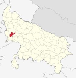 Location of Hathras district in Uttar Pradesh | |
| Country | India |
| State | Uttar Pradesh |
| Division | Aligarh |
| Headquarters | Hathras |
| Government | |
| • Lok Sabha constituencies | Hathras |
| Area | |
| • Total | 1,840 km2 (710 sq mi) |
| Population (2011) | |
| • Total | 1,564,708 |
| • Density | 850/km2 (2,200/sq mi) |
| Demographics | |
| • Literacy | 71.6% |
| • Sex ratio | 871 |
| Time zone | UTC+05:30 (IST) |
| Website | https://hathras.nic.in/ |
History
Hathras district was created on 3 May 1997 by incorporating parts of the Aligarh, Mathura, and Agra districts. It was given the name Hathras district shortly after.
Divisions
The district comprises four tehsils: Hathras, Sadabad, Sikandra Rao, and Sasni, which are further divided into seven blocks: Sasni, Hathras, Mursan, Sadabad, Sahpau, Hasanpur Baru, Sikandra Rao, and Hasayan.
There are three Vidhan Sabha constituencies in this district: Hathras, Sadabad, and Sikandra Rao. All of these are part of Hathras Lok Sabha constituency.
Demographics
According to the 2011 census, Hathras district has a population of 1,564,708,[2] roughly equal to the nation of Gabon.[3] This gives it a ranking of 319th in India (out of a total of 640).[4] The district has an area of 1,840 square kilometres (710 sq mi) and a population density of 850 inhabitants per square kilometre (2,200/sq mi).[4] Its population growth rate over the decade 2001–2011 was 17.12%.[2] Hathras has a sex ratio of 871 females for every 1,000 males,[2] and a literacy rate of 60.2%.[5][6] Hinduism (89.30%) and Islam (10.19%) are the predominant religions followed in the district.[7]
At the time of the 2011 Census of India, 98.72% of the population in the district spoke Hindi and 1.24% Urdu as their first language.[8]
Transport
Four railway stations serve Hathras: Hathras Junction railway station, Hathras Road railway station, Hathras City railway station, and Hathras Kila railway station.
References
- "Important Cabinet Decisions". Information and Public Relations Department. Retrieved 17 January 2013.
- "A-2: DECADAL VARIATION IN POPULATION SINCE 1901" (PDF). www.censusindia.gov.in. 30 May 2014. p. 5. Retrieved 19 October 2019.
- US Directorate of Intelligence. "Country Comparison:Population". Retrieved 1 October 2011.
Gabon 1,576,665
- "A-1 Number Of Villages, Towns, Households, Population And Area" (XLS). www.censusindia.gov.in. 14 June 2018. Retrieved 19 October 2019.
- "Primary Census Abstract Data Tables (India & States/UTs - District Level)" (XLS). www.censusindia.gov.in. 2 February 2018. Retrieved 19 October 2019.
942,572 literate persons
- "(Text version of primary abstract data spreadsheet)". www.censusindia.gov.in. Retrieved 19 October 2019.
- "Religion PCA" (XLS). www.censusindia.gov.in. 29 December 2015. Retrieved 19 October 2019.
1,397,225 Hindu; 159,448 Muslim; 8,035 other
- "C-16 POPULATION BY MOTHER TONGUE" (XLS). www.censusindia.gov.in. 29 June 2018. Retrieved 19 October 2019.
Places adjacent to Hathras district | ||||||||||
|---|---|---|---|---|---|---|---|---|---|---|
| ||||||||||