Fatehpur district
Fatehpur District is one of the 75 districts of the Indian state of Uttar Pradesh. The district covers an area of 4,152 km². The district has a population of 2,632,733 (2011 Census). Fatehpur city is the administrative headquarters of the district. Located on the banks of the sacred rivers Ganges and Yamuna, Fatehpur was mentioned in the puranic literature. The ghats of Bhitaura and Asani were described as sacred in the puranas. Bhitaura, the site of the sage Bhrigu, was an important source of learning. Fatehpur district is a part of Allahabad division.
Fatehpur district | |
|---|---|
District of Uttar Pradesh | |
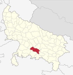 Location of Fatehpur district in Uttar Pradesh | |
| Country | India |
| State | Uttar Pradesh |
| Division | Allahabad |
| Headquarters | Fatehpur |
| Tehsils | Fatehpur, Bindki & Khaga |
| Government | |
| • District collector | Sanjeev Singh Kurmi (IAS) |
| • Lok Sabha constituencies | Fatehpur (Lok Sabha constituency) |
| • Vidhan Sabha constituencies | 1. Jahanabad 2. Bindki 3. Sadar 4. Ayah Shah 5. Husainganj 6. Khaga |
| Area | |
| • Total | 4,152 km2 (1,603 sq mi) |
| Population (2011) | |
| • Total | 2,632,733 |
| • Density | 630/km2 (1,600/sq mi) |
| • Urban | 3,21,993 (12.2%) |
| Demographics | |
| • Literacy | 67.4% |
| • Sex ratio | 901 |
| Time zone | UTC+05:30 (IST) |
| Major highways | NH 19 |
| Website | http://fatehpur.nic.in |
This district is situated between two important cities: Allahabad, (officially known as Prayagraj), and Kanpur of the state Uttar Pradesh. Fatehpur is well connected with those cities by train routes and roads. The distance from Allahabad is 117 km and from Kanpur is 76 km by railway. The north boundary of the district is limited by the river Ganges and its southern boundary is the river Yamuna.
History
In the Vedic era the region of this district was known as "Antardesh", which means the fertile area between two big rivers. Later, it was known as "Madhyadesh" which means the central region. The northern region of the district is influenced by "Avadhi culture", while the southern part shows the effect of the "Bundelkhand". The territory covered by the present-day Fatehpur district was part of Vatsa, which was one among sixteen mahajanapadas described in the Buddhist literature. General Karningham has written about "Bhitaura" and "Asani" places of this district while discussing the heritage of the Vedic Period. There is evidence that the Chinese traveller Xuanzang visited the Asani area within this district.
In village Renh, which is 25 km in the south-west of Fatehpur town, some articles of archaeological interest have been found, which date from 800 B.C. Many artefacts, including coins, bricks and idols of the Maurya period, 'Kushan period & Gupta period have been found throughout the district. Many temples of the Gupta period still exist in village Tenduli, Korari and Sarhan Bujurg which are important archaeological sites. Golden coins of the period of Chandragupta II have been recovered from the village of Bijauli. The bricks used in the fort of Asani are also of the Gupta Period.
Khajuha town, situated on Mughal road is a very old town. Its description has been found in the old Hindu scripture "Brahm Puran", which is 5000 years old.
The district is named after the headquarters town of Fatehpur. The name, according to local tradition, is derived from a battle won by Ibrahim Shah of Jaunpur over Raja Sita Nand of Athgarhia. The belief is based solely on tradition and the name of the conqueror is sometimes given as Jalal-ud-din, the ruler of Bengal. Another derivation of the name is traced to Fateh-mand Khan who is supposed to have founded the town. It is based on a frag-mentary inscription found at Denda Sai, in tahsil Khaga, to the effect that Fatehmand Khan, an officer of Sultan Ala-ud-din, obtained a Farman from him in 1519 A.D. A difficulty, however, arises from the fact that in 1519 A.D. there was no king of the name, Ala-ud-din, and the title of the Sultan must be wrong if the date is correct. Again, Denda Sai is no less than about 48 km. from Fatehpur; and it is seemingly stretching a point too far to connect an inscription found there with the name of the founder of the town of Fatehpur.
In 1561 A.D., the Mughal emperor Humayun passed through this town while invading Jaunpur state. On 5 January 1659 A.D., Mughal emperor Aurangzeb had a fierce battle with his brother prince Shah Shuja (Mughal), and killed him near this place. To celebrate the victory, he constructed a large garden "Badshahi Bagh" and a big lodge having 130 rooms. During the Mughal regime, the control of Fatehpur changed hands between rulers of Jaunpur, Delhi and Kannauj.
In 1801 A.D., this region came under the control of East India Company. On 10 November 1826, Fatehpur has designated as the District headquarters. It has many historic places like Bawni Imli in which English men were allegedly hanged on a tree during excesses in the Great Indian Mutiny. It is situated at Bindki.
In 1966 this was given the status of a sub-division (Paragana), while the headquarters was at Bhitaura, which is now a block office.
Demographics
According to the 2011 census Fatehpur district has a population of 2,632,733[1] roughly equal to the nation of Kuwait[2] or the US state of Nevada.[3] This gives it a ranking of 154th in India (out of a total of 640).[1] The district has a population density of 634 inhabitants per square kilometre (1,640/sq mi) .[1] Its population growth rate over the decade 2001-2011 was 14.05%.[1] Fatehpur has a sex ratio of 901 females for every 1000 males,[1] and a literacy rate of 67.43%.[1]
At the time of the 2011 Census of India, 97.49% of the population in the district spoke Hindi and 2.49% Urdu as their first language.[4]
| Historical population | ||
|---|---|---|
| Year | Pop. | ±% p.a. |
| 1901 | 681,848 | — |
| 1911 | 672,459 | −0.14% |
| 1921 | 648,065 | −0.37% |
| 1931 | 684,218 | +0.54% |
| 1941 | 801,574 | +1.60% |
| 1951 | 902,928 | +1.20% |
| 1961 | 1,066,028 | +1.67% |
| 1971 | 1,278,549 | +1.83% |
| 1981 | 1,572,751 | +2.09% |
| 1991 | 1,899,387 | +1.90% |
| 2001 | 2,308,384 | +1.97% |
| 2011 | 2,632,733 | +1.32% |
| source:[5] | ||
Gateway Of Earth
Fatehpur Best Garden. The green season also known as monsoon is the most beautiful season in India, Monsoon has amazing combination but with the arrival of monsoon season in India most of the garden closed down for tourist but there are few gardens in India remain opens for sometime during the monsoon season as well.
Divisions
The district is divided into 3 sub-districts-
These sub-divisions are further divided into 13 development blocks:-
- Airayan
- Amauli
- Asothar
- Bahua
- Bhitaura
- Devmai
- Dhata
- Haswa
- Hathgam
- Khajuha
- Malwan
- Telyani
- Vijayipur
Korari: is a very important place from the archaeological viewpoint. This place has two brick temples, having amazing carving on the outer faces. The temple is tilted in its own axis about 4°. Every panel has a different design.
Bawan Imali: This monument is the symbol of sacrifices offered by freedom fighters. On 28 April 1858, fifty-two freedom fighters were hanged on an "Imali" tree by the British army. The "Imali" tree still exists, people believe that the growth of the tree has stopped after the massacre. This place is very near to town Khajuha in Bindki Subdivision of the district.
Bhitaura: This block headquarters is situated at the bank of holy river Ganges. This is the place where renowned saint Bhrigu worshipped for a long time that's why called Bhrigu Thaura. Here, the flow of river Ganges is towards the north, which is very important from the religious point of view.
Ghazipur: This is a very large and ancient town which have a lot of historical accounts. Gandhiji, Indira Gandhi, Syam Lal Gupta ‘Parsad’, Hema Malini, Chinese traveller Huan Tsuang, Raj Babbar, Mayawati, Mulayam Singh Yadav, Rajesh Pilot, Sushma Swaraj, Jagdambica pal, etc. visited here. Paina Quila (Fort), Ghazipur Quila (Fort; now it's converted into Police station), Dargah, Tuglaki Maszid (Mosque), Murchaura (Battlefield) are few monuments. Mevati muhalla, Kanchanpur, Puranathana, Premnagar, Subhas Market, Purani bazaar, Chauk, and Dera are areas here.
Notable people
- Sohan Lal Dwivedi, poet born in the Khutila-sijouli village of Bindki sub-division
- Ganesh Shankar Vidyarthi, independence activist, born in Hathgaon
- Niaz Fatehpuri (1884–1966), Urdu writer and poet
- V. P. Singh (1931–2008), the 7th prime minister of India; was elected to Parliament from Fatehpur (Lok Sabha constituency)
- Navneet Kumar. (1997 - ....)
Writer, Social Worker, Marketing Leader
Transport
Roadways
Fatehpur is fairly well connected to other parts of Uttar Pradesh and India with national and state highways. The National Highway 19 (NH19) passes through Fatehpur. Fatehpur is 70 KMS km from Kanpur, 117 km from Allahabad and state capital Lucknow is 137 km away. There are frequent buses to Kanpur, Allahabad, Banda, and Lucknow.
Fatehpur is a historic region in the context of the Great Indian Mutiny of 1857.
Railways
This city is connected with important cities by train. Fatehpur Station is on the main route of New Delhi-Howrah. Trains are available frequently. It has the longest platform of any station on the route from Howrah to Delhi. This fact is disputed as the shortest platforms are Jhansi (not on Delhi-Howrah route) followed by Dehri-on-Son (on Delhi-Howrah route). "As a matter of fact, the longest platform in India is Gorakhpur (Yes, it's longer than Kharagpur)."& The Chauri Chaura goes to Gorakhpur, Uttar Pradesh.
On 10 July 2011, a derailment near Malwan killed 70 passengers, and injured at more than 300.[8]
Air
The nearest airport is Kanpur Airport which is 98 kilometres from Fatehpur.
References
- "District Census 2011". census.gov.in. 2011. Retrieved 30 September 2011.
- US Directorate of Intelligence. "Country Comparison:Population". Retrieved 1 October 2011.
Kuwait 2,595,62
- "2010 Resident Population Data". U. S. Census Bureau. Archived from the original on 19 October 2013. Retrieved 30 September 2011.
Nevada 2,700,551
- 2011 Census of India, Population By Mother Tongue
- Decadal Variation In Population Since 1901
- Ministry of Panchayati Raj (8 September 2009). "A Note on the Backward Regions Grant Fund Programme" (PDF). National Institute of Rural Development. Archived from the original (PDF) on 5 April 2012. Retrieved 27 September 2011.
- "Fatehpur District Population Religion - Uttar Pradesh, Fatehpur Literacy, Sex Ratio - Census India". www.censusindia.co.in. Retrieved 21 February 2019.
- "India Train Crash Death Toll Climbs to 68". The Guardian. Associated Press. 11 July 2011. Retrieved 12 July 2011.
External links
Places adjacent to Fatehpur district | ||||||||||
|---|---|---|---|---|---|---|---|---|---|---|
| ||||||||||