Maharajganj district
Maharajganj district is one of the 75 districts of Uttar Pradesh state in northern India, and the town of Maharajganj is the district headquarter. District is a part Gorakhpur division. It is located in Terai regions of Himalayas, bordering Nepal in North.
Maharajganj district | |
|---|---|
District of Uttar Pradesh | |
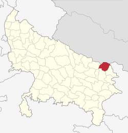 Location of Maharajganj district in Uttar Pradesh | |
| Country | India |
| State | Uttar Pradesh |
| Division | Gorakhpur |
| Headquarters | Mahrajganj, Uttar Pradesh |
| Tehsils | Anand Nagar (Pharenda), Nautanwa, Nichlaul, Maharajganj Sadar |
| Government | |
| • Lok Sabha constituencies | Maharajganj |
| • Vidhan Sabha constituencies | Maharajganj sadar, Siswa Bazar, Anand Nagar (Pharenda), Nautanwa and Paniyara |
| Area | |
| • Total | 2,952 km2 (1,140 sq mi) |
| Population (2011) | |
| • Total | 2,684,703 |
| • Density | 910/km2 (2,400/sq mi) |
| Demographics | |
| • Literacy | 64.3 per cent |
| • Sex ratio | 943 |
| Time zone | UTC+05:30 (IST) |
| Major highways | NH730, NH24, NH730S |
| Website | http://maharajganj.nic.in/ |
Geography
Maharajganj district is bounded by Nepal in the north, the districts of Kushinagar in the east, Gorakhpur to the south and Siddharthnagar and Sant Kabir Nagar in the west. It is part of Gorakhpur Division. The district covers an area of 2,951 km². It has a population of 2,684,703 (2011 Census).[2]
History
| Historical population | ||
|---|---|---|
| Year | Pop. | ±% p.a. |
| 1901 | 496,095 | — |
| 1911 | 540,574 | +0.86% |
| 1921 | 551,476 | +0.20% |
| 1931 | 615,937 | +1.11% |
| 1941 | 681,685 | +1.02% |
| 1951 | 765,432 | +1.17% |
| 1961 | 892,048 | +1.54% |
| 1971 | 1,057,848 | +1.72% |
| 1981 | 1,335,090 | +2.35% |
| 1991 | 1,676,378 | +2.30% |
| 2001 | 2,173,878 | +2.63% |
| 2011 | 2,684,703 | +2.13% |
| source:[3] | ||
The district was carved out from the erstwhile Gorakhpur district on 2 October 1989. It is famous for the ruins of Buddha which are found here and it is expected that if proper excavation is done then many unknown facts about Buddha will be discovered. Religious temples Lehra devi and Itahiya panchmukhi shiv mandir is famous in the region and in Nepal.
Politics
District has one Lok Sabha constituency named as Maharajganj (Uttar Pradesh Lok Sabha constituency).
There are 5 Vidhan Sabha constituencies in the district which are:
Municipal set up
There are 3 nagar palikas in the district:
- Mahrajganj
- Nautanwa
- Siswa Bazar
There are 6 nagar panchayat in the district:
Bridgmanganj and Partawal are newly created.
Economy
In 2006 the Ministry of Panchayati Raj named Maharajganj one of the country's 250 most backward districts (out of a total of 640).[4] It is one of the 34 districts in Uttar Pradesh currently receiving funds from the Backward Regions Grant Fund Programme (BRGF).[4]
Divisions
Maharajganj district comprises 4 tehsils:
- Maharajganj Sadar; 4 community development blocks: Maharajganj, Ghughali, Paniara and Partawal.
- Nautanwa ; comprising 2 community development blocks: Ratanpur and Laxmipur.
- Nichlaul ; 3 community development blocks: Nichlaul, Mithaura and Siswa.
- Pharenda ; 3 community development blocks: Bridgmanganj, Dhani and Pheranda.
There are 1258 villages in the district and 14 police stations. Sonauli and Thoothi bari are the border check points at Nepal border.
Police Stations
- Pharenda (Anand Nagar)
- Nautanwa
- Purandarpur
- Kothibhar (Siswa Bazar)
- Thuthibari Kotwali
- Kolhui
- Bridgmanganj
- Shyamdeurawa
- Parsamalik
- Bargadawa
- Paniyra
- Chauk
- Sonauli Kotwali
- Ghughuli
- Nichlaul
- Kotwali Sadar
- Sohgibarwa
Demographics
According to the 2011 census Maharajganj district has a population of 2,684,703, roughly equal to the nation of Kuwait[5] or the US state of Nevada.[6] This gives it a ranking of 148st in India (out of a total of 640 districts).
Hinduism is practiced by majority of the population around 82% Islam is followed by 17% of the population. Maharajganj district has the highest population of people following Buddhism. This is because of influence of Gautama Buddha in the region as he was born in Lumbini located nearly in Nepal.
The district has a population density of 909 inhabitants per square kilometre (2,350/sq mi) . Its population growth rate over the decade 2001–2011 was 23.50%
Maharajganj has a sex ratio of 943 females for every 1000 males, and a literacy rate of 62.76%.
At the time of the 2011 Census of India, 99.98% of the population in the district spoke Hindi and 0.90% Urdu as their first language.[7]
References
- "District Maharajganj". Retrieved 26 October 2018.
- "Uttar Pradesh". india,gov,in website. Retrieved 7 May 2010.
- Decadal Variation In Population Since 1901
- Ministry of Panchayati Raj (8 September 2009). "A Note on the Backward Regions Grant Fund Programme" (PDF). National Institute of Rural Development. Archived from the original (PDF) on 5 April 2012. Retrieved 27 September 2011.
- US Directorate of Intelligence. "Country Comparison:Population". Retrieved 1 October 2011.
Kuwait 2,595,62
- "2010 Resident Population Data". U.S. Census Bureau. Archived from the original on 19 October 2013. Retrieved 30 September 2011.
Nevada 2,700,551
- 2011 Census of India, Population By Mother Tongue
External links
Places adjacent to Maharajganj district | ||||||||||
|---|---|---|---|---|---|---|---|---|---|---|
| ||||||||||