Kishanganj district
Kishanganj district is one of the thirty-eight districts of Bihar state, India, and Kishanganj town is the administrative headquarters of this district. Kishanganj district is a part of Purnia division.
Kishanganj district | |
|---|---|
District of Bihar | |
 | |
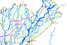
 Location of Kishanganj district in Bihar | |
| Country | India |
| State | Bihar |
| Division | Purnia |
| Headquarters | Kishanganj |
| Government | |
| • Lok Sabha constituencies | Kishanganj |
| • Vidhan Sabha constituencies | Bahdurganj, Thakurganj, Kishanganj, Kochadhaman |
| Area | |
| • Total | 1,884 km2 (727 sq mi) |
| Population (2011) | |
| • Total | 1,690,400 |
| • Density | 900/km2 (2,300/sq mi) |
| Demographics | |
| • Literacy | 57.04 per cent |
| • Sex ratio | 946 |
| Time zone | UTC+05:30 (IST) |
| Major highways | |
| Website | http://kishanganj.bih.nic.in/ |
History
Kishanganj district, which was previously part of Purnia district, is part of the Mithila region.[1] Mithila first gained prominence after being settled by Indo-Aryan peoples who established the Mithila Kingdom (also called Kingdom of the Videhas).[2]
During the late Vedic period (c. 1100–500 BCE), Kingdom of the Videhas became one of the major political and cultural centers of South Asia, along with Kuru and Pañcāla. The kings of the Kingdom of the Videhas were called Janakas.[3] The Mithila Kingdom was later incorporated into the Vajji confederacy, which had its capital in the city of Vaishali, which is also in Mithila.[4] Kishanganj was an old and important Sub-Division of Purnia district. After the long and hard struggle of around seventeen years by the people of Kishanganj including social workers, politicians, journalists, businessmen, farmers, etc., the Kishanganj district was carved out of Purnia district on 14 January 1990.[5]
Geography
Kishanganj district occupies an area of 1,884 square kilometres (727 sq mi),[6] comparatively equivalent to Maui in the United States.[7] Kishanganj district is surrounded by Araria district in the west, Purnia district in the south-west, Uttar Dinajpur district of West Bengal on the east, and Darjeeling district of West Bengal and Nepal on the north. A narrow strip of West Bengal, about 20 km wide separates it from Bangladesh.[8]
Kishanganj district is located between 250 20’ and 260 30’ north latitudes, and 870 7’ and 880 19’ east longitudes.[5]
Economy
In 2006 the Ministry of Panchayati Raj named Kishanganj District as an economically distressed district, one of 250 out of a total of 640 districts.[9] It is one of the 36 districts in Bihar currently receiving funds from the Backward Regions Grant Fund Programme (BRGF).[9]
Agriculture
Kishanganj is the only tea producing district in Bihar.[10]
Sub-divisions
The district comprises only one sub-division, Kishanganj, which is further divided into seven blocks: Bhahadurganj, Dighalbank, Kishanganj, Kochadhaman, Pothia, Terhagachha, Thakurgunj
Education
On 30 January 2014, the foundation stone was laid down of the Kishanganj campus of Aligarh Muslim University by Sonia Gandhi [11]
Demographics
| Historical population | ||
|---|---|---|
| Year | Pop. | ±% p.a. |
| 1901 | 234,482 | — |
| 1911 | 251,966 | +0.72% |
| 1921 | 269,059 | +0.66% |
| 1931 | 291,023 | +0.79% |
| 1941 | 316,813 | +0.85% |
| 1951 | 336,235 | +0.60% |
| 1961 | 459,703 | +3.18% |
| 1971 | 618,773 | +3.02% |
| 1981 | 805,333 | +2.67% |
| 1991 | 984,107 | +2.03% |
| 2001 | 1,296,348 | +2.79% |
| 2011 | 1,690,400 | +2.69% |
| source:[12] | ||
According to the 2011 census Kishanganj district has a population of 1,690,400,[13] roughly equal to the nation of Guinea-Bissau[14] or the US state of Idaho.[15] This gives it a ranking of 293rd in India (out of a total of 640).[13] The district has a population density of 898 inhabitants per square kilometre (2,330/sq mi) .[13] Its population growth rate over the decade 2001-2011 was 30.44%.[13] Kishanganj has a sex ratio of 946 females for every 1,000 males,[13] and a literacy rate of 57.04%.[13]
A vast majority of the people live in the villages. Kishanganj is the only district in Bihar, which is Muslim majority, with Muslims forming about 68 per cent of the population,[13] there are also Hindus of whom are Surajpuris (Rajbanshi ). There also are small Santal pockets.[16][17] Most of the inhabitants of Kishanganj speak Maithili[18] and Surajpuri. Kishanganj district had a literacy rate of 31.02 per cent in 2001, the lowest amongst all the districts of Bihar. The literacy rate of Bihar at 47.53 per cent is amongst the lowest in India, which has a literacy rate of 64.84 per cent. While the male literacy rate in Kishanganj district stood at 42.8 per cent, female literacy at 18.49 per cent was one of the lowest in India.[17][19]
At the time of the 2011 Census of India, 42.61% of the population in the district spoke Surjapuri, 32.62% Urdu, 9.05 Hindi, 6.66% Bengali, 3.45% Santali, 2.63% Maithili and 1.23% Bhojpuri as their first language.[20]
| Decades | 1961-71 | 1971-81 | 1981-91 | 1991-01 | 2001-2011 |
|---|---|---|---|---|---|
| 1 | 2 | 3 | 4 | 5 | 6 |
| Decadal Growth Rate [%] | 24.59 | 30.2 | 18.5 | 30.44 | 30 |
| Year | 1971 | 1981 | 1991 | 2001 | 2011 |
|---|---|---|---|---|---|
| 1 | 2 | 3 | 4 | 5 | 6 |
| Gender Ratio | 926 | 950 | 946 | 936 | 948 |
Administrative units
| Sl. no. | Name of the Blocks | No. of Gram Panchayats |
|---|---|---|
| 1 | Kishanganj | 10 |
| 2 | Bahadurganj | 20 |
| 3 | Thakurganj | 22 |
| 4 | Kochadhaman | 24 |
| 5 | Dighalbank | 16 |
| 6 | Pothiya | 22 |
| 7 | Terhagachh | 24 |
| Total number of Gram Panchayats[23] | 126 | |
- Number of Revenue Division(s)- 1
- Number of Blocks- 7[24]
- Number of Police Stations- 20
- Number of Gram Panchayats- 126
- Number of Census Villages- 771
- Number of Municipalities- 3
- Number of Municipal Corporation- 1[25]
See also - Literacy In Bihar
References
- Thakur, Minni (2010). Women Empowerment Through Panchayati Raj Institutions. ISBN 9788180696800.
- Michael Witzel (1989), Tracing the Vedic dialects in Dialectes dans les litteratures Indo-Aryennes ed. Caillat, Paris, pages 13, 17 116–124, 141–143
- Witzel, M. (1989). "Tracing the Vedic dialects". In Caillat, C. (ed.). Dialectes dans les litteratures Indo-Aryennes. Paris: Fondation Hugot. pp. 141–143.
- Hemchandra, R. (1972). Political History of Ancient India. Calcutta: University of Calcutta.
- "Kishanganj District (Bihar)". Kishanganj district administration. Archived from the original on 2010-11-14. Retrieved 2010-10-08.
- Srivastava, Dayawanti et al. (ed.) (2010). "States and Union Territories: Bihar: Government". India 2010: A Reference Annual (54th ed.). New Delhi, India: Additional Director General, Publications Division, Ministry of Information and Broadcasting (India), Government of India. pp. 1118–1119. ISBN 978-81-230-1617-7.CS1 maint: extra text: authors list (link)
- "Island Directory Tables: Islands by Land Area". United Nations Environment Program. 1998-02-18. Retrieved 2011-10-11.
Maui 1,888km2
- "Kishanganj district map". Maps of India. Retrieved 2010-10-08.
- Ministry of Panchayati Raj (September 8, 2009). "A Note on the Backward Regions Grant Fund Programme" (PDF). National Institute of Rural Development. Archived from the original (PDF) on April 5, 2012. Retrieved September 27, 2011.
- "Kishanganj Judgeship/District Court in India | Official Website of District Court of India". web.archive.org. 2019-07-20. Retrieved 2019-07-20.
- http://timesofindia.indiatimes.com/city/patna/Sonia-to-lay-foundation-of-AMU-Kishanganj-unit-today/articleshow/29571536.cms
- Decadal Variation In Population Since 1901
- "District Census 2011". Census2011.co.in. 2011. Retrieved 2011-09-30.
- US Directorate of Intelligence. "Country Comparison:Population". Retrieved 2011-10-01.
Guinea-Bissau 1,596,677 July 2011 est.
- "2010 Resident Population Data". U. S. Census Bureau. Archived from the original on 2013-10-19. Retrieved 2011-09-30.
Idaho 1,567,582
- "The Socio-Economic and Political Scenario of Kishanganj District". Azad India Foundation. Retrieved 2010-10-08.
- "Kishanganj: Bihar's most backward district in quest for AMU centre". TwoCircles.net. Retrieved 2010-10-08.
- Singh, Premshankar. Maithili Bhasha Sahitya: Beesam Shatabdi. ISBN 9789380538129.
- "District-specific Literates and Literacy Rates, 2001". Registrar General, India, Ministry of Home Affairs. Retrieved 2010-10-05.
- 2011 Census of India, Population By Mother Tongue
- "Kishanganj". Google Docs. Retrieved 2019-11-11.
- "election commission ppt".
- "Blocks". web.archive.org. 2008-05-05. Retrieved 2019-06-28.
- "Blocks in Kishanganj District, Bihar". www.census2011.co.in. Retrieved 2019-05-27.
- "Demography | Welcome to Kishanganj District". Retrieved 2019-05-27.
External links
Places adjacent to Kishanganj district | ||||||||||
|---|---|---|---|---|---|---|---|---|---|---|
| ||||||||||
| State symbols | |
|---|---|
| History |
|
| Administration |
|
| Overviews | |
| Divisions and districts | |
| Cities | |
| Municipal Corporation |
|
| Poltics | |
| Culture |
|