Ambedkar Nagar district
Ambedkar Nagar District is a district in Ayodhya division, Uttar Pradesh, India. This district was created on 29 September 1995 and was named in memory of Bhimrao Ambedkar, who worked for the advancement of the deprived classes, women and other weaker sections of society.
Ambedkar Nagar district | |
|---|---|
District of Uttar Pradesh | |
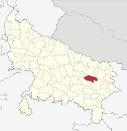 Location of Ambedkar Nagar district in Uttar Pradesh | |
| Country | India |
| State | Uttar Pradesh |
| Division | Ayodhya |
| Headquarters | Akbarpur, Ambedkar Nagar |
| Tehsils | Akbarpur, Tanda, Jalalpur, Allapur, Bhiti |
| Government | |
| • Lok Sabha constituencies | 1. Ambedkar Nagar (Lok Sabha constituency)- Akbarpur, Jalalpur, Katehari, Tanda 2. Sant Kabir Nagar (Lok Sabha constituency)-Rajesultanpur, Allapur |
| • Vidhan Sabha constituencies | 1. Katehari 2. Akbarpur 3. Tanda 4. Jalalpur 5. Alapur |
| Area | |
| • Total | 2,520 km2 (970 sq mi) |
| Population (2011) | |
| • Total | 2,397,888 |
| • Density | 950/km2 (2,500/sq mi) |
| Demographics | |
| • Literacy | 74.37% |
| • Sex ratio | 976 |
| Time zone | UTC+05:30 (IST) |
| Major highways | NH 28, NH 128, NH 233A, NH 233B State Highway 30 |
| Website | http://ambedkarnagar.nic.in/ |
Geography
Ambedkar Nagar district is located on the north-eastern part of Uttar Pradesh. It lies between 26° 09' N to 26° 40' N latitudes and 82° 12' E to 83° 05' E longitudes. It is bounded on the north by Basti and Sant Kabir Nagar districts, on the north-east by Gorakhpur district, on the south by Sultanpur district, on the west by Faizabad district, on the east by Azamgarh district, and on the south east by Shahganj tehsil of Jaunpur district. The total area of the district is 2,520 km². The total length of the district from east to west is approximately 75 km and the breadth from north to south is about 42 km.
The district of Ambedkar Nagar forms a part of the central Ganga basin. The soils of the Ambedkar Nagar district are alluvium.
The Sarayu River is the main river and is located at the northern boundary of the district. The Tanda, Rajesultanpur, Ramnagar and Baskhari blocks are located along this river and use its water for irrigation. Irrigation in the Baskhari block is also from Lake Devhat and the Rajesultanpur Lakes. Lake Darvan provides water in the Katehari block. The Akbarpur, Bhiti, Bhiyaon, and Jalalpur blocks depend upon smaller rivers and seasonal streams. The city of Akbarpur is situated on the banks of the River Tons (Tamasa), which divides the city into the two parts Akbarpur and Shahzadpur, with the latter being the main commercial centre of the city.
Climate
The climate of the district resembles that of eastern Uttar Pradesh. It is characterised by a rhythm of seasons, which are produced by south-west and north-east monsoon. The reversal of winds takes place twice a year. The climate of the district may be classified into three distinct seasons.
- Cold weather season (November to February)
- Hot weather season (March to mid-June)
- Season of rains (mid-June to October)
The cold weather season lasts from November to February. In November, the belt of high pressure extends from north-west India and covers the whole of the Uttar Pradesh. The temperature beings to decline and the maximum and minimum are 32.15 °C and 8.95 °C respectively, in this month. The prevailing winds blow from west to east and are influenced by the pressure distribution and pattern of the Himalayas.
Cities and Towns
Ambedkar Nagar Nagar Panchayat and Nagar Palika
Blocks
- Akbarpur
- Baskhari
- Bhiti
- Bhiyaon
- Jahangirganj
- Jalalpur
- Katehari
- Ramnagar, Alapur
- Rajesultanpur (prospective at 2017)
- Tanda
Economy
Ambedkar Nagar is known for its textile industry, power plant, sugar plant and cement manufacturing plant. Tanda town is well known for its "Tanda Terrycot". The major economic activity of the district is agro-based industries, firms small, power looms and farming. There is a thermal power plant belonging to the NTPC called Tanda thermal power plant at Makhdoom Nagar area near Tanda. Jaypee Group (Jaypee Ayoudha Greeding) has set up a cement manufacturing plant at Naseebjot Village near Tanda. The district has a sugar factory called Akbarpur Sugar Mill, which is situated near Mijhaura, about ten kilometres from the district headquarters. Akbarpur is a very important town and district headquarter of Ambedkar Nagar district with active participation in the production of plastic along with farm based products.
In 2006 the Ministry of Panchayati Raj named Ambedkar Nagar one of the country's 250 most backward districts (out of a total of 640).[3] It is one of the 34 districts in Uttar Pradesh currently receiving funds from the Backward Regions Grant Fund Programme (BRGF).[3]
Demography
| Historical population | ||
|---|---|---|
| Year | Pop. | ±% p.a. |
| 1901 | 641,783 | — |
| 1911 | 604,679 | −0.59% |
| 1921 | 614,107 | +0.15% |
| 1931 | 631,356 | +0.28% |
| 1941 | 691,971 | +0.92% |
| 1951 | 777,416 | +1.17% |
| 1961 | 866,321 | +1.09% |
| 1971 | 1,046,122 | +1.90% |
| 1981 | 1,291,125 | +2.13% |
| 1991 | 1,629,353 | +2.35% |
| 2001 | 2,026,876 | +2.21% |
| 2011 | 2,397,888 | +1.70% |
| source:[4] | ||
According to the 2011 census Ambedkar Nagar district has a population of 2,397,888,[5] This gives it a ranking of 186th in India (out of a total of 640).[5] The district has a population density of 1,021 inhabitants per square kilometre (2,640/sq mi) .[5] Its population growth rate over the decade 2001-2011 was 18.35%.[5] Ambedkar Nagar has a sex ratio of 976 females for every 1000 males,[5] and a literacy rate of 74.37%.[5] The distribution of population in each block is controlled by physical conditions and socio-economic causes. Akbarpur block has the highest share of population (16.56%t) of the study area, followed by Jalalpur (13.80%), Tanda (12.32%), Ramnagar (10.26%), Katehri (10.03%), Bhiyaon (9.78%), Baskhari (9.53%), Jahangirganj (9.17%) and Bhiti (8.55%).
Education
Ambedkar Nagar has Government Engineering College, Government Medical College, Government colleges, schools and government-aided colleges besides the privately managed schools and degree colleges. Notable institutes are BNKB PG College, Manyawar Kanshiram Engineering College of Information Technology, Mahamaya Rajkiya Allopathic Medical College, BBS PG College Rajesultanpur, Ramabai Government Women Post Graduate College, Akbarpur and SLJB PG College, Rajesultanpur, Ambedkar Nagar. Adarsh Janta inter college Tanda Ambedkar Nagar has an Agriculture Engineering College, and a polytechnic institute in the district. There are also industrial training institutes like Pt. S.D. Pandey ITC, Jamunipur, SLJB PG College Rajesultanpur, GGIC Rajesultanpur and DAV College Rajesultanpur. Other higher education institutions include Rajkiya Engineering College, Ambedkar Nagar and Mahamaya Medical College and GSIC Rajesultanpur, ITI College Rajesultanpur, Kanya Inter College (Bhiti), Chandra Private ITI - Dhaurahra Sijhauli Ambedkar Nagar and Sirsiya Group of college Rajesultanpur.
Medical and engineering colleges
- Mahamaya Rajkiya Allopathic Medical College, a government Medical college in Akbarpur
- Rajkiya Engineering College, Ambedkar Nagar, a government Engineering College in Akbarpur
- Mahamaya College of Agricultural Engineering and Technology, a government Agriculture Engineering college in Akbarpur
Notable colleges
- Ramabai Government Women Post Graduate College
- Mahamaya Rajkiya Allopathic Medical College
- Rajkiya Engineering College, Ambedkar Nagar
- Hira Public School, Hanswar Ambedkar Nagar
- BBS PG College Rajesultanpur
- Pt. Ram Lakhan Shukla Rajkeey Post Graduate College Alapur
- SLJB PG College
- Gandhi Smarak Inter College, Rajesultanpur
- Rahul Sankrityayan Inter College Rajesultanpur
- RMRS PG College
- Raj Inter College, Rajesultanpur
- VJV College of Technology, Ramnagar
- Jahangirabad Institute of Technology, Ayodhya
- Gandhi Smarak Inter College, Natthupur Laudhna
Tourism
The shrine of Ashraf Jahangir Semnani[6] is located in Kicchocha Sharif (Kichhauchha Sharif).
Media
Ambedkar Nagar has some active media groups which continuously give news updates on Ambedkar Nagar news in Hindi, including breaking news and current news. These media groups include Amar Ujala,[7] Dainik Jagaran, and Dainik Bhaskar, Hindustan.
Notable people

- Syed Amin Ashraf (1931-2013), Urdu poet and academic at Department of English, Aligarh Muslim University, from Kichaucha Sharif
- Syed Waheed Ashraf, Sufi poet and scholar of Persian and Urdu languages hailing from Kichaucha Sharif in Ambedkar Nagar district
- Mahdi Hasan, anatomist and Padma Shree awardee
- Anwar Jalalpuri (1947 - 2 January 2018) was an Urdu poet from Jalalpur, Ambedkar Nagar, known for translating the Bhagavad Gita from Sanskrit to Urdu.
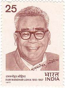
- Ram Manohar Lohia, politician from Akbarpur
- Hari Om Pandey, member of parliament from BJP
- Arunima Sinha, first Indian woman amputee to climb Mount Everest
- Ram Murti Verma, Ex-MLA Akbarpur
- Dilip Verma Kisan Leader
Bus stations
References
- "Ambedkar Nagar district - About". Retrieved 23 May 2019.
- "C-16 Population By Mother Tongue - Uttar Pradesh". censusindia.gov.in. Retrieved 23 September 2019.
- Ministry of Panchayati Raj (8 September 2009). "A Note on the Backward Regions Grant Fund Programme" (PDF). National Institute of Rural Development. Archived from the original (PDF) on 5 April 2012. Retrieved 27 September 2014.
- Decadal Variation In Population Since 1901
- "District Census 2011". Census2011.co.in. 2011. Retrieved 30 September 2011.
- 'Hayate Makhdoom Syed Ashraf Jahangir Semnani(1975), Second Edition(2017) ISBN 978-93-85295-54-6, Maktaba Jamia Ltd, Shamshad Market, Aligarh 202002, India.
- "Hindi Newspapers". Amar Ujala. Retrieved 13 July 2016.