Gajapati district
Gajapati is a district of Odisha, India. It was created from Ganjam District in October, 1992. Gajapati district was named after Maharaja Sri Krushna Chandra Gajapati Narayan Dev, the Raja Sahib of the Paralakhemundi estate (the first Prime Minister of the state), who is remembered for his contribution in the formation of a separate state, and inclusion of the Paralakhemundi estate in Odisha. The district headquarters at Paralakhemundi, formerly a princely estate, has been clustered within a radius of approximately 5 kilometers around the geometric centre of Paralakhemundi. The District is a part of the Red Corridor.[2]
Gajapati | |
|---|---|
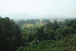 Hills near Parlakhemundi | |
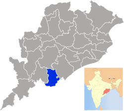 Location in Odisha, India | |
| Coordinates: 18.88°N 84.2°E | |
| Country | |
| State | Odisha |
| Established | October 1992 |
| Named for | Krushna Chandra Gajapati |
| Headquarters | Paralakhemundi |
| Government | |
| • Collector & District Magistrate | Shri Anupam Saha, IAS |
| • Divisional Forest Officer Cum Wildlife Warden | Shri Vivek Kumar, IFS |
| • Superintendent of Police | Ms Sara Sharma, IPS |
| Area | |
| • Total | 3,850 km2 (1,490 sq mi) |
| Population (2011) | |
| • Total | 577,817 |
| • Rank | 28th |
| • Density | 133/km2 (340/sq mi) |
| Languages | |
| • Spoken | Odia[1] |
| Time zone | UTC+5:30 (IST) |
| PIN | 761 xxx |
| Vehicle registration | OD-20 |
| Nearest city | Berhampur |
| Sex ratio | 1042 ♂/♀ |
| Literacy | 54.29% |
| Lok Sabha constituency | Berhampur |
| Vidhan Sabha constituency | 2
|
| Climate | Aw (Köppen) |
| Precipitation | 1,403.3 millimetres (55.25 in) |
| Avg. summer temperature | 45 °C (113 °F) |
| Avg. winter temperature | 16 °C (61 °F) |
| Website | www |
| This article is part of a series on |
| Odisha |
|---|
 |
| Governance |
|
| Topics |
| GI Products |
|
|
Districts Divisions |
|
|
As of 2011 it is the third least populous district of Odisha (out of 30), after Debagarh and Boudh.[3]
History
History of Gajapati district goes back to the Paralakhemundi kingdom. It was part of the Gajapati Kingdom of Odisha. During 12th century CE Parala Khemundi was part of the Khemundi state. During the reign of Mukunda Dev Khemundi was trifurcated creating 3 states Bada Khemundi, Sana Khemundi and Paralakhemundi. After the trifurcation, Subhalinga Bhanu became the ruler of the Paralakhemundi. This line of kings continued to rule Paralakhemundi throughout the Mughal Maratha rule of Odisha. Before the British completed control of Odisha, Parala became a feudal state of British Raj during the reign of Gajapati Jagannatha Narayanadev in 1767. The state had some conflict with the British administrators. The king Gajapati Jagannatha Narayanadev and his son was arrested by the British. The state then came under direct British supervision. There was a revolt among the tribals and Paikas of the state against the King's detention. Due to this, the King was reinstated to his position. [4] Paralakhemundi remained under the administration as a feudatory state until its unification with Odisha.[5] One of the prominent kings of Parala was Krushna Chandra Gajapati. He was an active member of Utkal Sammilani and was instrumental in creating the separate state for Odisha. Finally, with the effort of Maharaja Krushna Chandra Gajapati and Utkal Sammilani, the separate state of United Odisha was formed on 1 April 1936. The state of Paralkhemundi in Vizagapatam district was partitioned into two – with the capital and most of the princely state coming under Orissa and the remaining Telugu-speaking areas remained under Madras Presidency. In 1937, the first Governor of Odisha, Sir John Austin Hubback invited Krushna Chandra Gajapati Dev to form the cabinet. Shri Gajapati was the first Prime Minister of the Odisha state from 1 April 1937 to 18 July 1937. He was the Prime Minister of Odisha for the second time from 24 November 1941 to 30 June 1944.[6][7]
Geography

Gajapati district located at the south-east of Odisha between longitude 84° 32'E and 83° 47'E and latitude 18° 44'N and 19° 39'N. The Mahendratanaya River flows through it. The district borders with Andhra Pradesh in the south, District of Rayagada to west, District of Ganjam to East and District of Kandhamala to the North. The district is located on a hilly terrain of Eastern Ghats. The mountain Mahendragiri, a segment of Eastern Ghats is situated in this district.
The climate is subtropical with high humidity. Summer season is between March to mid-June and is extremely hot with the temperature reaching 46 °C. Winter season is mild and temperature can fall lowest to 9 °C November to February. The rainy season lasts between mid-June to mid-October and it receives approximately 1000 mm of rainfall primarily from the southwest monsoons.[8]
Administration
Gajapati District is sparsely populated and hence consists of only one subdivision, Paralakhemundi. The district is further divided into seven Blocks.
- Gumma
- Kashinagar
- Mohana
- Nuagada
- Paralakhemundi
- R.Udayagiri
- Rayagada
There are 149 Gram Panchayats consisting of 1499 inhabited villages in the district.[9]
The town Paralakhemundi is the District Headquarters and also the largest town of the Gajapati district. Kashinagara is the second largest town of Gajapati district.
Economy
In 2006 the Ministry of Panchayati Raj named Gajapati one of the country's 250 most backward districts (out of a total of 640).[10] It is one of the 19 districts in odisha currently receiving funds from the Backward Regions Grant Fund Programme (BRGF).[10]
Demographics
| Historical population | ||
|---|---|---|
| Year | Pop. | ±% p.a. |
| 1901 | 184,840 | — |
| 1911 | 205,514 | +1.07% |
| 1921 | 198,842 | −0.33% |
| 1931 | 225,161 | +1.25% |
| 1941 | 252,613 | +1.16% |
| 1951 | 262,998 | +0.40% |
| 1961 | 285,069 | +0.81% |
| 1971 | 348,964 | +2.04% |
| 1981 | 402,271 | +1.43% |
| 1991 | 454,708 | +1.23% |
| 2001 | 518,837 | +1.33% |
| 2011 | 577,817 | +1.08% |
| source:[11] | ||
According to the 2011 census Gajapati district has a population of 577,817,[3] roughly equal to the nation of Solomon Islands[12] or the US state of Wyoming.[13] This gives it a ranking of 533rd in India (out of a total of 640).[3]
The district has a population density of 133 inhabitants per square kilometre (340/sq mi) .[3] Its population growth rate over the decade 2001-2011 was 10.99%.[3] Gajapati has a sex ratio of 1042 females for every 1000 males,[3] and a literacy rate of 54.29%.[3]
At the time of the 2011 Census of India, 41.51% of the population in the district spoke Odia, 34.49% Sora, 15.53% Telugu and 5.54% Kui as their first language.[14]
Culture
Mahendragiri
The mountain Mahendragiri, a segment of Eastern Ghats is situated in Paralakhemundi. Legend says that it is the place where lord Parashurama, a Chiranjeevi staying eternally and doing tapasya. Temples built by Pandavas are seen. Main festival here is Shivaratri, the worship of Shiva, the guru or percepter of lord Parashurama.
Education
Colleges
- Centurion School for Rural Enterprise Management
- Jagannath Institute for Technology and Management
- Sanskrit College, Paralakhemundi
- Women's College, Paralakhemundi
- Sri Krushna Chandra Gajapati College.
- Gajapati College of Pharmacy
- Gajapati College of Nursing
- Gajapati School of Nursing
Schools
- Sri Krushna Chandra Gajapati College (SKCG)
- Maha Raja's Boys High School (MRBHS)
- Maha Raja's Girls High School (MRGHS)
- Jawahar Navodaya Vidyalaya (JNV)
- Kendriya Vidyalaya
Politics
The district sends two representatives to state legislature, Odisha Vidhan Sabha. The following is the two Vidhan sabha constituencies[15][16] of Gajapati district and the elected members[17] of those areas.
| No. | Constituency | Reservation | Extent of the Assembly Constituency (Blocks) | Member of Current Assembly | Party |
|---|---|---|---|---|---|
| 136 | Mohana | ST | Mohana, R.Udayagiri, Nuagada, Rayagada | Dasarathi Gamango | Indian National Congress |
| 137 | Parlakhemundi | None | Parlakhemundi (M), Kashinagar (NAC), Guma, Kashinagar, Parlakhemundi | K.Narayan rao | BJP |
The district is part of Berhampur (Lok Sabha constituency).
Media
- MPX TV
- GTV
- CHANNEL 3
References
- https://gajapati.nic.in/demography/
- "83 districts under the Security Related Expenditure Scheme". IntelliBriefs. 2009-12-11. Retrieved 2011-09-17.
- "District Census 2011". Census2011.co.in. 2011. Retrieved 2011-09-30.
- Dāsa, P.; Sahitya Akademi (2002). Bhakta Kavi Gopāla Krishna. Makers of Indian literature (in Latvian). Sahitya Akademi. pp. 97–99. ISBN 978-81-260-1201-5. Retrieved 2019-05-27.
- Acharya, P. (2008). National Movement and Politics in Orissa, 1920-1929. SAGE Series in Modern Indian History. SAGE Publications. p. 1. ISBN 978-81-321-0001-0. Retrieved 2019-05-27.
- Orissa Tourism Development Corporation; Orissa (India). Dept. of Home (1980). The Heritage of Orissa. Produced by Orissa Tourism Development Corporation for the Department of Home, Government of Orissa. p. 87. Retrieved 2019-05-30.
- Devi, B. (1992). Some Aspects of British Administration in Orissa, 1912-1936. Academic Foundation. p. 213. ISBN 978-81-7188-072-0. Retrieved 2019-05-30.
- "Parlakhemundi FD :: Odisha Wildlife Organisation". Welcome. Retrieved 2019-07-11.
- https://gajapati.nic.in/village-panchayats/
- Ministry of Panchayati Raj (September 8, 2009). "A Note on the Backward Regions Grant Fund Programme" (PDF). National Institute of Rural Development. Archived from the original (PDF) on April 5, 2012. Retrieved September 27, 2011.
- Decadal Variation In Population Since 1901
- US Directorate of Intelligence. "Country Comparison:Population". Retrieved 2011-10-01.
Solomon Islands 571,890 July 2011 est.
- "2010 Resident Population Data". U. S. Census Bureau. Archived from the original on 2011-01-01. Retrieved 2011-09-30.
Wyoming 563,626
- 2011 Census of India, Population By Mother Tongue
- Assembly Constituencies and their EXtent
- Seats of Odisha
- "List of Member in Fourteenth Assembly". ws.ori.nic.in. Archived from the original on 2 May 2007. Retrieved 19 February 2013.
MEMBER NAME
External links
| Wikimedia Commons has media related to Gajapati district. |
Places adjacent to Gajapati district | ||||||||||
|---|---|---|---|---|---|---|---|---|---|---|
| ||||||||||
Capital: Bhubaneswar | |||||||
| Governance |
|  | |||||
| Topics | |||||||
| GI products | |||||||
| Districts by division |
| ||||||
| Cities | |||||||