Valderiès
| Valderiès | ||
|---|---|---|
| Commune | ||
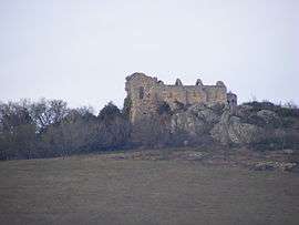 The former abbey | ||
| ||
 Valderiès Location within Occitanie region  Valderiès | ||
| Coordinates: 44°00′46″N 2°14′00″E / 44.0128°N 2.2333°ECoordinates: 44°00′46″N 2°14′00″E / 44.0128°N 2.2333°E | ||
| Country | France | |
| Region | Occitanie | |
| Department | Tarn | |
| Arrondissement | Albi | |
| Canton | Carmaux-1 Le Ségala | |
| Intercommunality | Ségala-Carmausin | |
| Government | ||
| • Mayor (2008–2014) | André Cabot | |
| Area1 | 20.42 km2 (7.88 sq mi) | |
| Population (2006)2 | 891 | |
| • Density | 44/km2 (110/sq mi) | |
| Time zone | UTC+1 (CET) | |
| • Summer (DST) | UTC+2 (CEST) | |
| INSEE/Postal code | 81306 /81350 | |
| Elevation | 216–424 m (709–1,391 ft) | |
|
1 French Land Register data, which excludes lakes, ponds, glaciers > 1 km2 (0.386 sq mi or 247 acres) and river estuaries. 2 Population without double counting: residents of multiple communes (e.g., students and military personnel) only counted once. | ||
.svg.png)
Valderiès is a commune in the Tarn department in southern France.
Geography
The commune is traversed by the Cérou river.
See also
References
| Wikimedia Commons has media related to Valderiès. |
This article is issued from
Wikipedia.
The text is licensed under Creative Commons - Attribution - Sharealike.
Additional terms may apply for the media files.