Saint-Antonin-de-Lacalm
| Saint-Antonin-de-Lacalm | ||
|---|---|---|
| Commune | ||
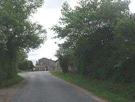 The entrance of Saint-Antonin-de-Lacalm on the road D138 | ||
| ||
 Saint-Antonin-de-Lacalm Location within Occitanie region  Saint-Antonin-de-Lacalm | ||
| Coordinates: 43°47′13″N 2°18′22″E / 43.787°N 2.306°ECoordinates: 43°47′13″N 2°18′22″E / 43.787°N 2.306°E | ||
| Country | France | |
| Region | Occitanie | |
| Department | Tarn | |
| Arrondissement | Albi | |
| Canton | Le Haut Dadou | |
| Intercommunality | Réalmontais | |
| Government | ||
| • Mayor (2014–2020) | Jean-Luc Cantaloube | |
| Area1 | 28.09 km2 (10.85 sq mi) | |
| Population (2006)2 | 237 | |
| • Density | 8.4/km2 (22/sq mi) | |
| Time zone | UTC+1 (CET) | |
| • Summer (DST) | UTC+2 (CEST) | |
| INSEE/Postal code | 81241 /81120 | |
| Elevation |
230–529 m (755–1,736 ft) (avg. 455 m or 1,493 ft) | |
|
1 French Land Register data, which excludes lakes, ponds, glaciers > 1 km2 (0.386 sq mi or 247 acres) and river estuaries. 2 Population without double counting: residents of multiple communes (e.g., students and military personnel) only counted once. | ||
.svg.png)
Saint-Antonin-de-Lacalm (Sant Antonin in Occitan) is a commune in the Tarn department in southern France.
Geography
The commune is traversed by the river Dadou.
Population
| Year | 1962 | 1968 | 1975 | 1982 | 1990 | 1999 | 2006 |
|---|---|---|---|---|---|---|---|
| Population | 316 | 356 | 261 | 255 | 243 | 237 | 233 |
| From the year 1962 on: No double counting—residents of multiple communes (e.g. students and military personnel) are counted only once. | |||||||
See also
References
| Wikimedia Commons has media related to Saint-Antonin-de-Lacalm. |
This article is issued from
Wikipedia.
The text is licensed under Creative Commons - Attribution - Sharealike.
Additional terms may apply for the media files.