Saint-Marcel-Campes
| Saint-Marcel-Campes | |
|---|---|
| Commune | |
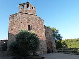 The church of Saint-Michel, in Saint-Marcel-Campes | |
 Saint-Marcel-Campes Location within Occitanie region  Saint-Marcel-Campes | |
| Coordinates: 44°04′52″N 1°59′25″E / 44.0811°N 1.9903°ECoordinates: 44°04′52″N 1°59′25″E / 44.0811°N 1.9903°E | |
| Country | France |
| Region | Occitanie |
| Department | Tarn |
| Arrondissement | Albi |
| Canton | Carmaux-2 Vallée du Cérou |
| Intercommunality | Pays Cordais |
| Government | |
| • Mayor (2008–2014) | Jean-Pierre Marteau |
| Area1 | 22.34 km2 (8.63 sq mi) |
| Population (2006)2 | 241 |
| • Density | 11/km2 (28/sq mi) |
| Time zone | UTC+1 (CET) |
| • Summer (DST) | UTC+2 (CEST) |
| INSEE/Postal code | 81262 /81170 |
| Elevation |
158–448 m (518–1,470 ft) (avg. 400 m or 1,300 ft) |
|
1 French Land Register data, which excludes lakes, ponds, glaciers > 1 km2 (0.386 sq mi or 247 acres) and river estuaries. 2 Population without double counting: residents of multiple communes (e.g., students and military personnel) only counted once. | |
Saint-Marcel-Campes is a commune in the Tarn department in southern France.
Geography
The commune is traversed by the Cérou river.
See also
References
| Wikimedia Commons has media related to Saint-Marcel-Campes. |
This article is issued from
Wikipedia.
The text is licensed under Creative Commons - Attribution - Sharealike.
Additional terms may apply for the media files.