Cérou
| Cérou | |
|---|---|
 | |
| Country | France |
| Physical characteristics | |
| Main source |
near Saint-Jean-Delnous 530 m (1,740 ft) 44°03′21″N 02°28′33″E / 44.05583°N 2.47583°E |
| River mouth |
Aveyron 128 m (420 ft) 44°08′21″N 01°52′32″E / 44.13917°N 1.87556°ECoordinates: 44°08′21″N 01°52′32″E / 44.13917°N 1.87556°E |
| Length | 87.4 km (54.3 mi) |
| Discharge |
|
| Basin features | |
| Progression | Aveyron→ Tarn→ Garonne→ Atlantic Ocean |
| Basin size | 503 km2 (194 sq mi) |
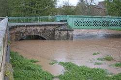
The Cérou (French: le Cérou) is an 87.4 km (54.3 mi) long river in the Aveyron and Tarn départements, southern France. Its source is at Saint-Jean-Delnous, 1.8 km (1.1 mi) northwest of the village. It flows generally west-northwest. It is a left tributary of the Aveyron River into which it flows at Milhars, 1.4 km (0.87 mi) north of the village.
Départements and communes along its course
It flows generally west through the following départements and communes ordered from source to mouth:
- Aveyron: Saint-Jean-Delnous, Lédergues
- Tarn: Lédas-et-Penthiès, Lacapelle-Pinet, Padiès, Crespin, Andouque, Saint-Jean-de-Marcel, Valderiès, Rosières, Carmaux, Saint-Benoît-de-Carmaux, Monestiés, Le Ségur, Salles, Saint-Marcel-Campes, Cordes-sur-Ciel, Les Cabannes, Mouzieys-Panens, Vindrac-Alayrac, Labarthe-Bleys, Marnaves, Milhars
Tributaries
Le Farruel (12.5 km), la Boutescure (15.4 km), le Céroc (17.6 km), le Candou, le Céret (28.5 km), la Zère, l'Aymer (12,2 km), le Bonnan.
Notes
- This article is based on the equivalent article from the French Wikipedia, consulted on January 27th 2009.
References
This article is issued from
Wikipedia.
The text is licensed under Creative Commons - Attribution - Sharealike.
Additional terms may apply for the media files.