Trébas
| Trébas | ||
|---|---|---|
| Commune | ||
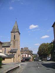 The church in Trébas | ||
| ||
 Trébas Location within Occitanie region  Trébas | ||
| Coordinates: 43°56′40″N 2°29′00″E / 43.9444°N 2.4833°ECoordinates: 43°56′40″N 2°29′00″E / 43.9444°N 2.4833°E | ||
| Country | France | |
| Region | Occitanie | |
| Department | Tarn | |
| Arrondissement | Albi | |
| Canton | Carmaux-1 Le Ségala | |
| Intercommunality | Val 81 | |
| Government | ||
| • Mayor (2014–2020) | Patricia Bousquet | |
| Area1 | 5.67 km2 (2.19 sq mi) | |
| Population (2013)2 | 411 | |
| • Density | 72/km2 (190/sq mi) | |
| Time zone | UTC+1 (CET) | |
| • Summer (DST) | UTC+2 (CEST) | |
| INSEE/Postal code | 81303 /81340 | |
| Elevation |
206–523 m (676–1,716 ft) (avg. 216 m or 709 ft) | |
|
1 French Land Register data, which excludes lakes, ponds, glaciers > 1 km2 (0.386 sq mi or 247 acres) and river estuaries. 2 Population without double counting: residents of multiple communes (e.g., students and military personnel) only counted once. | ||
.svg.png)
Trébas is a commune in the Tarn department and Occitanie region of southern France.
See also
References
| Wikimedia Commons has media related to Trébas. |
This article is issued from
Wikipedia.
The text is licensed under Creative Commons - Attribution - Sharealike.
Additional terms may apply for the media files.