Lautrec
| Lautrec | ||
|---|---|---|
| Commune | ||
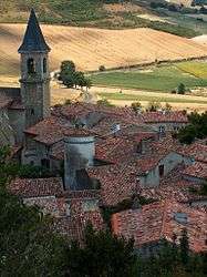 A general view of Lautrec | ||
| ||
 Lautrec Location within Occitanie region  Lautrec | ||
| Coordinates: 43°42′25″N 2°08′23″E / 43.7069°N 2.1397°ECoordinates: 43°42′25″N 2°08′23″E / 43.7069°N 2.1397°E | ||
| Country | France | |
| Region | Occitanie | |
| Department | Tarn | |
| Arrondissement | Castres | |
| Canton | Plaine de l'Agoût | |
| Intercommunality | Lautrecois | |
| Government | ||
| • Mayor (2008–2014) | Laurent Gros | |
| Area1 | 54.64 km2 (21.10 sq mi) | |
| Population (2006)2 | 1,743 | |
| • Density | 32/km2 (83/sq mi) | |
| Time zone | UTC+1 (CET) | |
| • Summer (DST) | UTC+2 (CEST) | |
| INSEE/Postal code | 81139 /81440 | |
| Elevation |
165–360 m (541–1,181 ft) (avg. 292 m or 958 ft) | |
|
1 French Land Register data, which excludes lakes, ponds, glaciers > 1 km2 (0.386 sq mi or 247 acres) and river estuaries. 2 Population without double counting: residents of multiple communes (e.g., students and military personnel) only counted once. | ||
.svg.png)
Lautrec (Occitan: Lautrèc) is a commune in the Tarn department in southern France.
Demography
| Year | 1962 | 1968 | 1975 | 1982 | 1990 | 1999 | 2005 |
|---|---|---|---|---|---|---|---|
| Population | 1344 | 1508 | 1316 | 1503 | 1527 | 1556 | 1673 |
Remarkable sites
Lautrec is listed among "The Most Beautiful Villages of France" as well as a "Remarkable Site for Taste" thanks to its renowned pink garlic. Its remarkable sites include:
- the village itself, with its 14th century market square
- the Saint Remy collegiate church and its sumptuous marble retable
- the 17th century windmill, one of the few still working today in the South of France
- a clog workshop, recreated after the one that existed there until the early 1960s
- the Caussade Gate (13th century)
- the Salette Calvary (altitude 328 m)
- the Roman road
See also
- Famous painter Henri de Toulouse-Lautrec’s family had roots in this village
- Communes of the Tarn department
- Tourism in Tarn
References
- ↑ Lautrec sur le site de l'Insee Archived 2012-11-09 at the Wayback Machine.
| Wikimedia Commons has media related to Lautrec. |
This article is issued from
Wikipedia.
The text is licensed under Creative Commons - Attribution - Sharealike.
Additional terms may apply for the media files.