Saint-André, Tarn
| Saint-André | |
|---|---|
| Commune | |
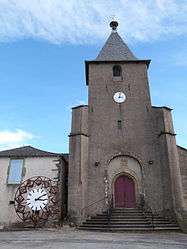 The church in Saint-André | |
 Saint-André Location within Occitanie region  Saint-André | |
| Coordinates: 43°56′02″N 2°27′38″E / 43.9339°N 2.4606°ECoordinates: 43°56′02″N 2°27′38″E / 43.9339°N 2.4606°E | |
| Country | France |
| Region | Occitanie |
| Department | Tarn |
| Arrondissement | Albi |
| Canton | Le Haut Dadou |
| Intercommunality | Monts-d'Alban |
| Government | |
| • Mayor (2008–2014) | Jean-Luc Espitalier |
| Area1 | 7.27 km2 (2.81 sq mi) |
| Population (2006)2 | 107 |
| • Density | 15/km2 (38/sq mi) |
| Time zone | UTC+1 (CET) |
| • Summer (DST) | UTC+2 (CEST) |
| INSEE/Postal code | 81240 /81250 |
| Elevation |
206–563 m (676–1,847 ft) (avg. 427 m or 1,401 ft) |
|
1 French Land Register data, which excludes lakes, ponds, glaciers > 1 km2 (0.386 sq mi or 247 acres) and river estuaries. 2 Population without double counting: residents of multiple communes (e.g., students and military personnel) only counted once. | |
Saint-André is a commune in the Tarn department in southern France.
See also
References
| Wikimedia Commons has media related to Saint-André (Tarn). |
This article is issued from
Wikipedia.
The text is licensed under Creative Commons - Attribution - Sharealike.
Additional terms may apply for the media files.