Barre, Tarn
| Barre | |
|---|---|
| Commune | |
_mairie_ecole.JPG) The town hall and school in Barre | |
 Barre Location within Occitanie region  Barre | |
| Coordinates: 43°45′10″N 2°49′37″E / 43.7528°N 2.8269°ECoordinates: 43°45′10″N 2°49′37″E / 43.7528°N 2.8269°E | |
| Country | France |
| Region | Occitanie |
| Department | Tarn |
| Arrondissement | Castres |
| Canton | Les Hautes Terres d'Oc |
| Intercommunality | Monts de Lacaune |
| Government | |
| • Mayor (2008–2014) | Claude Aninat |
| Area1 | 15.07 km2 (5.82 sq mi) |
| Population (2006)2 | 215 |
| • Density | 14/km2 (37/sq mi) |
| Time zone | UTC+1 (CET) |
| • Summer (DST) | UTC+2 (CEST) |
| INSEE/Postal code | 81023 /81320 |
| Elevation |
857–1,065 m (2,812–3,494 ft) (avg. 930 m or 3,050 ft) |
|
1 French Land Register data, which excludes lakes, ponds, glaciers > 1 km2 (0.386 sq mi or 247 acres) and river estuaries. 2 Population without double counting: residents of multiple communes (e.g., students and military personnel) only counted once. | |
Barre is a commune of the Tarn department of southern France.
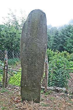
Statue menhir of Cantoul
See also
References
| Wikimedia Commons has media related to Barre (Tarn). |
This article is issued from
Wikipedia.
The text is licensed under Creative Commons - Attribution - Sharealike.
Additional terms may apply for the media files.