Teulat
| Teulat | |
|---|---|
| Commune | |
 | |
 Teulat Location within Occitanie region  Teulat | |
| Coordinates: 43°38′11″N 1°41′58″E / 43.6364°N 1.6994°ECoordinates: 43°38′11″N 1°41′58″E / 43.6364°N 1.6994°E | |
| Country | France |
| Region | Occitanie |
| Department | Tarn |
| Arrondissement | Castres |
| Canton | Lavaur Cocagne |
| Intercommunality | Tarn and Agout |
| Government | |
| • Mayor (2008–2014) | Patrice Chouzy |
| Area1 | 10.07 km2 (3.89 sq mi) |
| Population (2006)2 | 447 |
| • Density | 44/km2 (110/sq mi) |
| Time zone | UTC+1 (CET) |
| • Summer (DST) | UTC+2 (CEST) |
| INSEE/Postal code | 81298 /81500 |
| Elevation |
156–245 m (512–804 ft) (avg. 180 m or 590 ft) |
|
1 French Land Register data, which excludes lakes, ponds, glaciers > 1 km2 (0.386 sq mi or 247 acres) and river estuaries. 2 Population without double counting: residents of multiple communes (e.g., students and military personnel) only counted once. | |
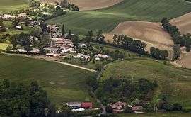
Teulat (Occitan: Teulat, meaning tiled roof) is a commune in the Tarn department in southern France.
Monuments
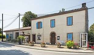 City hall
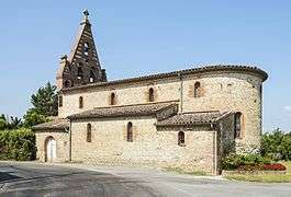 Chapel st.Marint
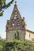 Bell gable
See also
References
| Wikimedia Commons has media related to Teulat. |
This article is issued from
Wikipedia.
The text is licensed under Creative Commons - Attribution - Sharealike.
Additional terms may apply for the media files.