Montredon-Labessonnié
| Montredon-Labessonnié | ||
|---|---|---|
| Commune | ||
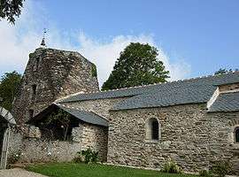 The church in Montredon-Labessonié | ||
| ||
 Montredon-Labessonnié Location within Occitanie region  Montredon-Labessonnié | ||
| Coordinates: 43°43′16″N 2°19′38″E / 43.7211°N 2.3272°ECoordinates: 43°43′16″N 2°19′38″E / 43.7211°N 2.3272°E | ||
| Country | France | |
| Region | Occitanie | |
| Department | Tarn | |
| Arrondissement | Castres | |
| Canton | Le Haut Dadou | |
| Intercommunality | Montredonnais | |
| Government | ||
| • Mayor (2008–2014) | Jean-Paul Chamayou | |
| Area1 | 110.88 km2 (42.81 sq mi) | |
| Population (2006)2 | 2,111 | |
| • Density | 19/km2 (49/sq mi) | |
| Time zone | UTC+1 (CET) | |
| • Summer (DST) | UTC+2 (CEST) | |
| INSEE/Postal code | 81182 /81360 | |
| Elevation |
196–644 m (643–2,113 ft) (avg. 570 m or 1,870 ft) | |
|
1 French Land Register data, which excludes lakes, ponds, glaciers > 1 km2 (0.386 sq mi or 247 acres) and river estuaries. 2 Population without double counting: residents of multiple communes (e.g., students and military personnel) only counted once. | ||
.svg.png)
Montredon-Labessonnie is a commune in the Tarn department in southern France.
The commune has several shops, a planetarium, a cinema, a tourist information centre, a hotel, cafe-bars among other venues. a wide range of houses for rent, for example: La Payrastrie.
The photo of the church is not from this village and is incorrect.
Geography
The commune is traversed by the river Dadou.
See also
References
| Wikimedia Commons has media related to Montredon-Labessonnié. |
This article is issued from
Wikipedia.
The text is licensed under Creative Commons - Attribution - Sharealike.
Additional terms may apply for the media files.