Saint-Benoît-de-Carmaux
| Saint-Benoît-de-Carmaux | ||
|---|---|---|
| Commune | ||
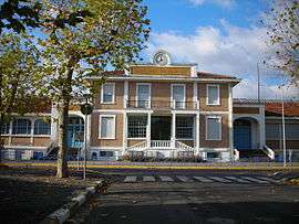 The school in Saint-Benoît-de-Carmaux | ||
| ||
 Saint-Benoît-de-Carmaux Location within Occitanie region  Saint-Benoît-de-Carmaux | ||
| Coordinates: 44°03′11″N 2°07′50″E / 44.0531°N 2.1306°ECoordinates: 44°03′11″N 2°07′50″E / 44.0531°N 2.1306°E | ||
| Country | France | |
| Region | Occitanie | |
| Department | Tarn | |
| Arrondissement | Albi | |
| Canton | Carmaux-2 Vallée du Cérou | |
| Intercommunality | Carmausin | |
| Government | ||
| • Mayor (2009–2014) | Gabriel Miranda | |
| Area1 | 4.49 km2 (1.73 sq mi) | |
| Population (2006)2 | 2,167 | |
| • Density | 480/km2 (1,300/sq mi) | |
| Time zone | UTC+1 (CET) | |
| • Summer (DST) | UTC+2 (CEST) | |
| INSEE/Postal code | 81244 /81400 | |
| Elevation |
217–330 m (712–1,083 ft) (avg. 285 m or 935 ft) | |
|
1 French Land Register data, which excludes lakes, ponds, glaciers > 1 km2 (0.386 sq mi or 247 acres) and river estuaries. 2 Population without double counting: residents of multiple communes (e.g., students and military personnel) only counted once. | ||
.svg.png)
Saint-Benoît-de-Carmaux is a commune in the Tarn department in southern France.
Geography
The commune is traversed by the Cérou river.
See also
References
| Wikimedia Commons has media related to Saint-Benoît-de-Carmaux. |
This article is issued from
Wikipedia.
The text is licensed under Creative Commons - Attribution - Sharealike.
Additional terms may apply for the media files.