Belcastel, Tarn
| Belcastel | ||
|---|---|---|
| Commune | ||
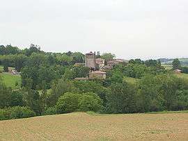 A general view of Belcastel | ||
| ||
 Belcastel Location within Occitanie region  Belcastel | ||
| Coordinates: 43°39′00″N 1°45′25″E / 43.65°N 1.7569°ECoordinates: 43°39′00″N 1°45′25″E / 43.65°N 1.7569°E | ||
| Country | France | |
| Region | Occitanie | |
| Department | Tarn | |
| Arrondissement | Castres | |
| Canton | Lavaur Cocagne | |
| Intercommunality | SESCAL | |
| Area1 | 10.81 km2 (4.17 sq mi) | |
| Population (2006)2 | 196 | |
| • Density | 18/km2 (47/sq mi) | |
| Time zone | UTC+1 (CET) | |
| • Summer (DST) | UTC+2 (CEST) | |
| INSEE/Postal code | 81025 /81500 | |
| Elevation |
173–271 m (568–889 ft) (avg. 210 m or 690 ft) | |
|
1 French Land Register data, which excludes lakes, ponds, glaciers > 1 km2 (0.386 sq mi or 247 acres) and river estuaries. 2 Population without double counting: residents of multiple communes (e.g., students and military personnel) only counted once. | ||
.svg.png)
Belcastel, Tarn (Occitan: Bèl Castèl, meaning beautiful castle) is a commune of the Tarn department of southern France.
See also
References
| Wikimedia Commons has media related to Belcastel (Tarn). |
This article is issued from
Wikipedia.
The text is licensed under Creative Commons - Attribution - Sharealike.
Additional terms may apply for the media files.