Amistad, Texas
| Amistad, Texas | |
|---|---|
| CDP | |
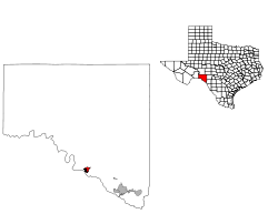
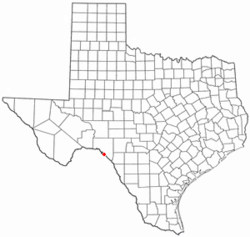 Location of Amistad, Texas | |
 | |
| Coordinates: 29°31′28″N 101°9′11″W / 29.52444°N 101.15306°WCoordinates: 29°31′28″N 101°9′11″W / 29.52444°N 101.15306°W | |
| Country | United States |
| State | Texas |
| County | Val Verde |
| Area | |
| • Total | 1.5 sq mi (3.9 km2) |
| • Land | 1.5 sq mi (3.9 km2) |
| • Water | 0.0 sq mi (0.0 km2) |
| Population (2010) | |
| • Total | 53 |
| • Density | 35/sq mi (14/km2) |
| Time zone | UTC-6 (Central (CST)) |
| • Summer (DST) | UTC-5 (CDT) |
| Zip Code | 78840 |
Amistad is a census-designated place (CDP) in Val Verde County, Texas, United States. The population was 53 at the 2010 census.[1] This CDP was formed prior to the 2010 census from parts of the deleted Box Canyon-Amistad CDP. [2]
Geography
Amistad is located at 29°31′28″N 101°9′11″W / 29.52444°N 101.15306°W (29.5245, -101.1531).[3]
According to the United States Census Bureau, the CDP has a total area of 1.5 square miles (3.9 km2), all of it land.[4]
Education
The area is served by the Comstock Independent School District.
See also
- Box Canyon-Amistad, Texas, name of CDP at 2000 census
References
- ↑ "Profile of General Population and Housing Characteristics: 2010 Demographic Profile Data (DP-1): Amistad CDP, Texas". U.S. Census Bureau, American Factfinder. Archived from the original on September 11, 2013. Retrieved February 1, 2012.
- ↑ "Population and Housing Unit Counts, 2010 Census of Population and Housing" (PDF). Texas: 2010. Retrieved 2017-01-02.
- ↑ "US Gazetteer files: 2010, 2000, and 1990". United States Census Bureau. 2011-02-12. Retrieved 2011-04-23.
- ↑ "Geographic Identifiers: 2010 Demographic Profile Data (G001): Amistad CDP, Texas". U.S. Census Bureau, American Factfinder. Archived from the original on September 11, 2013. Retrieved February 1, 2012.
Municipalities and communities of Val Verde County, Texas, United States | ||
|---|---|---|
| City | 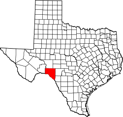 | |
| CDPs | ||
| Unincorporated communities | ||
This article is issued from
Wikipedia.
The text is licensed under Creative Commons - Attribution - Sharealike.
Additional terms may apply for the media files.