Solukhumbu District
| Solukhumbu District सोलुखुम्बु जिल्ला | |
|---|---|
| District | |
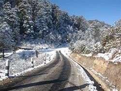 A road section in Solukhumbu. | |
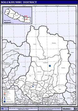
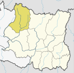 Location of Solukhumbu | |
| Country | Nepal |
| Province | Province No. 1 |
| Established | 1962 |
| Admin HQ. | Salleri |
| Municipality | |
| Government | |
| • Type | Coordination committee |
| • Body | DCC, Solukhumbu |
| Area | |
| • Total | 3,312 km2 (1,279 sq mi) |
| Population (2011) | |
| • Total | 105,886[1] |
| Time zone | UTC+5:45 (NPT) |
| Website |
ddcsolukhumbu |
Solukhumbu District (Nepali: सोलुखुम्बु जिल्ला![]()
The district, with Salleri as its headquarters, covers an area of 3,312 km2 and had a population 107,686 in 2001 and 105,886 in 2011.[1]
Mount Everest is in the northern part of this district, within Sagarmatha National Park.
Indigenous ethnic Kulung and hill caste Chhetri are the main groups living in the mid-hills, while Sherpas occupy the high mountains.
There is a notable hiking trail known as the Solukhumbu Trail.
History
Historically, Solukhumbu was part of Kirata Kingdoms. May be part of Majhkirat. Before unification of Nepal by king of Gorkha, the area of the Solukhumbu district were part of Chaudandi of Majhkirat. In 1773 AD King of Gorkha attacked and absorved it in Nepal.
The Solukhumbu district established in 1962 carving out the old East No. 3 district. Before 1962 present Solukhumbu, Okhaldhunga and some parts of Khotang previously were one district "East No. 3". Solu and Rawa thums carved out from East No. 3 to create Solukhumbu District.
Tourism
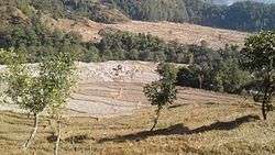
Solukhumbu District is a familiar name in mountain tourism. The main attraction is Mount Everest (8,848m). UNESCO has listed the Sagarmatha National Park as a World Heritage site. Sherpa culture and Tengboche Monastery are unique to this district. The Khumjung village is famous for Sherpa culture. Gokyo valley and Khumbu valley are the major Himalayan valleys famous among the adventure and nature seekers. Gokyo Lake trek, Island peak climbing, solukhumbu, Mera Peak climbing, Mount Everest Exepedition, Amadablam expedition, and Lobuche peak climbing are the popular adventure trips in Solukhumbu district. This district is well known for adventure holidays.
Geography and climate
| Climate Zone[2] | Elevation Range | % of Area |
|---|---|---|
| Upper Tropical | 300 to 1,000 meters 1,000 to 3,300 ft. |
0.7% |
| Subtropical | 1,000 to 2,000 meters 3,300 to 6,600 ft. |
9.3% |
| Temperate | 2,000 to 3,000 meters 6,400 to 9,800 ft. |
20.6% |
| Subalpine | 3,000 to 4,000 meters 9,800 to 13,100 ft. |
16.6% |
| Alpine | 4,000 to 5,000 meters 13,100 to 16,400 ft. |
28.3% |
| Nival | above 5,000 meters | 24.4% |
Divisions
Solukhumbu is divided into total 8 municipalities. 1 municipality Dudhkunda is urban municipality and all other 7 municipalities are rural:
Urban Municipality
Rural
Thulung Dudhkoshi (Nepali: थुलुङ दुधकोशी गाउँपालिका) is a rural municipality (gaunpalika) out of seven rural municipality located in Solukhumbu District of Province No. 1 of Nepal. There are a total of 8 municipalities in Solukhumbu in which 1 is urban and 7 are rural.
According to Ministry of Federal Affairs and Local Development Thulung Dudhkoshi has an area of 144.6 square kilometres (55.8 sq mi) and the total population of the municipality is 19672 as of Census of Nepal 2011.
Nele, Kangel, Panchan, Jubu, Mukli, Deusa and Lokhim which previously were all separate Village development committee merged to form this new local level body. Fulfilling the requirement of the new Constitution of Nepal 2015, Ministry of Federal Affairs and Local Development replaced all old VDCs and Municipalities into 753 new local level body (Municipality).
The rural municipality is divided into total 9 wards and the headquarter of this newly formed rural municipality is situated in Mukli.
- Thulung Dudhkoshi
- Necha Salyan
- Dudhkoshi
- Maha Kulung
- Sotang
- Khumbu Pasang Lhamu
- Likhu Pike[3]
Former VDCs (1990–2016)
There are 35 Village Development Committees in Solukhumbu District:[4]
See also
References
- 1 2 "Districts of Nepal". Statoids.
- ↑ The Map of Potential Vegetation of Nepal - a forestry/agroecological/biodiversity classification system (PDF), Forest & Landscape Development and Environment Series 2-2005 and CFC-TIS Document Series No.110., 2005, ISBN 87-7903-210-9, retrieved Nov 22, 2013
- ↑ "हेर्नुस तपाई कुन गाउँपालिका वा नगरपालिकामा पर्नुभयो ?". nepalipatra.com. Retrieved Jun 11, 2017.
- ↑ "Digital Himalaya: Nepal Census 2001". digitalhimalaya.com. Retrieved Jun 11, 2017.
| Wikimedia Commons has media related to Solukhumbu District. |
Places adjacent to Solukhumbu District | ||||||||||
|---|---|---|---|---|---|---|---|---|---|---|
| ||||||||||
Headquarter: Salleri | ||
| Municipality |
| |
| Rural Municipalities | ||
| Province No. 1 |  | |
|---|---|---|
| Province No. 2 | ||
| Province No. 3 | ||
| Gandaki Pradesh | ||
| Province No. 5 | ||
| Karnali Pradesh | ||
| Sudurpashchim Pradesh | ||
Coordinates: 27°30′N 86°35′E / 27.500°N 86.583°E