Baku, Nepal
| Baku, Nepal बाकु | |
|---|---|
| Village development committee | |
 Baku, Nepal Location in Nepal | |
| Coordinates: 27°32′N 86°44′E / 27.54°N 86.74°ECoordinates: 27°32′N 86°44′E / 27.54°N 86.74°E | |
| Country | Nepal |
| Zone | Sagarmatha Zone |
| District | Solukhumbu District |
| Population (2011) | |
| • Total | 4,844 |
| Time zone | UTC+5:45 (Nepal Time) |
Baku is a village development committee (VDC) in Solukhumbu District in the Sagarmatha Zone of north-eastern Nepal. Baku lies in the Himalaya, 59 km South of Mount Everest and is borderd by the valleys of Dudh Kosi River (West) and Hinku Drangka River (East). At the time of the 1991 Nepal census it had a population of 4159 people living in 777 individual households.[1] At the 2011 census, the population of the VDC Baku was 4844 inhabitants (2380 male) in 963 individual households.[2]
Villages and Hamlets
Baku consists of several settlements and Hamlets.[3] The most important ones are:
- Baku (1,600 m 27°29′52″N 86°42′25″E / 27.497859°N 86.707079°E)
- Sibuje (2,520 m 27°35′05″N 86°46′16″E / 27.584683°N 86.771029°E)
References
- ↑ "Nepal Census 2001". Nepal's Village Development Committees. Digital Himalaya. Archived from the original on 12 October 2008. Retrieved 14 November 2008.
- ↑ "National Population and Housing Census 2011" (PDF). Central Bureau of Statistics. Archived from the original (PDF) on 2013-07-31.
- ↑ "District: Solukhumbu. List of Settlements" (PDF). Index of Geographical names of Nepal. National Geographic Information Infrastructure Programme. www.ngiip.gov.np. Retrieved 2015-09-05.
External links
Headquarter: Salleri | ||
| Municipality | 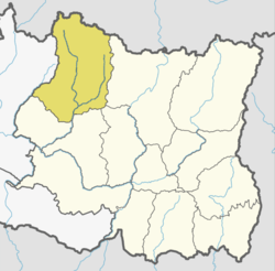 | |
| Rural Municipalities | ||
This article is issued from
Wikipedia.
The text is licensed under Creative Commons - Attribution - Sharealike.
Additional terms may apply for the media files.