Hemnskjela
 Location of the island in Trøndelag | |
 Hemnskjela Location of the island  Hemnskjela Hemnskjela (Norway) | |
| Geography | |
|---|---|
| Location | Trøndelag, Norway |
| Coordinates | 63°29′23″N 9°07′09″E / 63.4898°N 09.1191°ECoordinates: 63°29′23″N 9°07′09″E / 63.4898°N 09.1191°E |
| Area | 4.4 km2 (1.7 sq mi) |
| Length | 2.3 km (1.43 mi) |
| Width | 3.5 km (2.17 mi) |
| Highest elevation | 164 m (538 ft) |
| Highest point | Vettan |
| Administration | |
|
Norway | |
| County | Trøndelag |
| Municipality | Snillfjord |
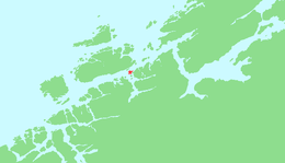
Hemnskjela (sometimes Hemnskjel) is an island in the municipality of Snillfjord in Trøndelag county, Norway. The 4.4-square-kilometre (1.7 sq mi) island is located in the Trondheimsleia strait at the mouth of the Hemnfjorden, just 2 kilometres (1.2 mi) south of the village of Sandstad on the nearby island of Hitra.[1]
The southern entrance to the Hitra Tunnel is located on the island of Hemnskjela. The tunnel connects the village of Sandstad on the island of Hitra to Hemnskjela (underneath the Trondheimsleia). Then, the Hemnskjel bridge connects the island of Hemnskjela to the mainland of Snillfjord. The Terningen Lighthouse lies about 3 kilometres (1.9 mi) west of the island.[1]
See also
References
- 1 2 Haugen, Morten, ed. (2017-07-14). "Hemnskjela". Store norske leksikon (in Norwegian). Kunnskapsforlaget. Retrieved 2018-02-10.
| Authority control |
|---|
This article is issued from
Wikipedia.
The text is licensed under Creative Commons - Attribution - Sharealike.
Additional terms may apply for the media files.