General Luna, Quezon
| General Luna | |
|---|---|
| Municipality | |
| Municipality of General Luna | |
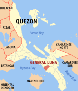 Map of Quezon with General Luna highlighted | |
.svg.png) General Luna Location within the Philippines | |
| Coordinates: 13°41′17″N 122°10′15″E / 13.6881°N 122.1708°ECoordinates: 13°41′17″N 122°10′15″E / 13.6881°N 122.1708°E | |
| Country |
|
| Region | Calabarzon (Region IV-A) |
| Province | Quezon |
| District | 3rd District |
| Founded | November 29, 1929 [1] |
| Named for | General Antonio Luna |
| Barangays | 27 (see Barangays) |
| Government [2] | |
| • Type | Sangguniang Bayan |
| • Mayor | Jose Stevenson M. Sangalang |
| • Electorate | 13,813 voters (2016) |
| Area [3] | |
| • Total | 101.02 km2 (39.00 sq mi) |
| Population (2015 census)[4] | |
| • Total | 26,494 |
| • Density | 260/km2 (680/sq mi) |
| Time zone | UTC+8 (PST) |
| ZIP code | 4310 |
| PSGC | 045616000 |
| IDD : area code | +63 (0)42 |
| Climate type | Tropical rainforest climate |
| Income class | 4th municipal income class |
| Revenue (₱) | 74,330,358.78 (2016) |
| Native languages | Tagalog |
| Website |
www |
General Luna, officially the Municipality of General Luna, (Tagalog: Bayan ng Heneral Luna), is a 4th class municipality in the province of Quezon, Philippines. According to the 2015 census, it has a population of 26,494 people.[4]
Barangays
General Luna is politically subdivided into 27 barangays.
- Bacong Ibaba
- Bacong Ilaya
- Barangay 1 (Poblacion)
- Barangay 2 (Poblacion)
- Barangay 3 (Poblacion)
- Barangay 4 (Poblacion)
- Barangay 5 (Poblacion)
- Barangay 6 (Poblacion)
- Barangay 7 (Poblacion)
- Barangay 8 (Poblacion)
- Barangay 9 (Poblacion)
- Lavides
- Magsaysay
- Malaya
- Nieva
- Recto
- San Ignacio Ibaba
- San Ignacio Ilaya
- San Isidro Ibaba
- San Isidro Ilaya
- San Jose
- San Nicolas
- San Vicente
- Santa Maria Ibaba
- Santa Maria Ilaya
- Sumilang
- Villarica
Demographics
| Population census of General Luna | ||
|---|---|---|
| Year | Pop. | ±% p.a. |
| 1939 | 4,106 | — |
| 1948 | 4,680 | +1.46% |
| 1960 | 8,123 | +4.70% |
| 1970 | 13,966 | +5.56% |
| 1975 | 15,193 | +1.70% |
| 1980 | 16,526 | +1.70% |
| 1990 | 17,997 | +0.86% |
| 1995 | 20,956 | +2.89% |
| 2000 | 21,068 | +0.11% |
| 2007 | 23,379 | +1.45% |
| 2010 | 25,373 | +3.02% |
| 2015 | 26,494 | +0.83% |
| Source: Philippine Statistics Authority[4] [5] [6] [7] | ||
References
- ↑ https://m.facebook.com/story.php?story_fbid=520109065022477&id=255366894830030
- ↑ "Municipality". Quezon City, Philippines: Department of the Interior and Local Government. Retrieved 31 May 2013.
- ↑ "Province: Quezon". PSGC Interactive. Quezon City, Philippines: Philippine Statistics Authority. Retrieved 12 November 2016.
- 1 2 3 Census of Population (2015). "Region IV-A (Calabarzon)". Total Population by Province, City, Municipality and Barangay. PSA. Retrieved 20 June 2016.
- ↑ Census of Population and Housing (2010). "Region IV-A (Calabarzon)". Total Population by Province, City, Municipality and Barangay. NSO. Retrieved 29 June 2016.
- ↑ Censuses of Population (1903–2007). "Region IV-A (Calabarzon)". Table 1. Population Enumerated in Various Censuses by Province/Highly Urbanized City: 1903 to 2007. NSO.
- ↑ "Province of Quezon". Municipality Population Data. Local Water Utilities Administration Research Division. Retrieved 17 December 2016.
External links
- Philippine Standard Geographic Code
- Philippine Census Information
- Local Governance Performance Management System
Places adjacent to General Luna, Quezon | ||||||||||
|---|---|---|---|---|---|---|---|---|---|---|
| ||||||||||
Lucena (capital) | |
| Municipalities |
|
| Component city | |
| Highly urbanized city |
|
This article is issued from
Wikipedia.
The text is licensed under Creative Commons - Attribution - Sharealike.
Additional terms may apply for the media files.