Rodriguez, Rizal
| Rodriguez Montalban | ||
|---|---|---|
| Municipality | ||
| Municipality of Rodriguez | ||
 Downtown area | ||
| ||
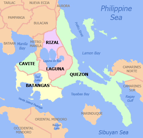
 Map of Rizal with Rodriguez highlighted | ||
.svg.png) Rodriguez Location within the Philippines | ||
| Coordinates: 14°43′N 121°07′E / 14.72°N 121.12°ECoordinates: 14°43′N 121°07′E / 14.72°N 121.12°E | ||
| Country |
| |
| Region | Calabarzon (Region IV-A) | |
| Province | Rizal | |
| District | 2nd District | |
| Founded | 1909 | |
| Renamed | November 12, 1982 | |
| Named for | Eulogio Rodriguez | |
| Barangays | 11 (see Barangays) | |
| Government [1] | ||
| • Type | Sangguniang Bayan | |
| • Mayor | Cecilio C. Hernandez | |
| • Electorate | 186,971 voters (2016) | |
| Area [2] | ||
| • Total | 312.70 km2 (120.73 sq mi) | |
| Population (2015 census)[3] | ||
| • Total | 369,222 | |
| • Rank | 1 out of 1,489 Municipalities | |
| • Density | 1,200/km2 (3,100/sq mi) | |
| Time zone | UTC+8 (PST) | |
| ZIP code | 1860 | |
| PSGC | 045808000 | |
| IDD : area code | +63 (0)2 | |
| Climate type | Tropical monsoon climate | |
| Income class | 1st municipal income class | |
| Revenue (₱) | 532,871,106.64 (2016) | |
| Native languages |
Sinauna language Tagalog Taglish Swardspeak | |
| Website |
www | |

Rodriguez, Rizal (Filipino: Bayan ng Rodriguez), is a 1st class municipality in the province of Rizal, Philippines. It was formerly known as and is still commonly referred to as Montalban. According to the 2015 census, it has a population of 369,222 people[3] making it the most populous municipality in the country.
It is the northernmost town in the province and comes after San Mateo, Rizal, and Quezon City coming from Metro Manila. The town is located on the slopes of the Sierra Madre mountain range and features many resorts; it is the largest town in Rizal province with an area of 312.70 km². It is also widely known as the location of the Legend of Bernardo Carpio.
It borders San Mateo, Rizal and Antipolo City, Rizal on the south, Norzagaray, Bulacan and San Jose Del Monte, Bulacan on the north, Quezon City on the west and General Nakar, Quezon on the east.
Rodriguez is one of the richest municipalities in the Philippines, ranking third in 2016 with an income of ₱ 691 million.[4]
Etymology
The town received its former name from the Spanish term Monte Alba (lit. White Mountain) from the vast amount of white limestone deposits on the hills surrounding the town, hence the name Montalban.
Montalban, a common name for the municipality up to the present, was its official name from its founding in 1909 until 1982 when the Batasang Pambansa officially renamed it to Rodriguez in honor of Eulogio Rodriguez, Sr., a native of the municipality who served as Senate President.
Geography
Rodriguez is a town of mountains. From its north to south, a series of sloping ridges, hills and mountains ranges adorn the town. In fact, around 27% or the town is occupied by mountains and slopes. The town's highest peak is Mt. Irid, towering 1,469 meters above mean and sea level.
The province of Rizal spans for 1,175.8 square kilometers. Rodriguez makes up 26.6% on the entire province of Rizal, housing 11 barangays. The land mass of Rodriguez is big enough to be an ideal place for many purposes, such as agriculture, commerce such as the Avilon Zoo, and hiking and climbing spots of Wawa Gorge, relocation of communities (having a strategic position east of Rizal, and a lot of areas where low-cost housing projects can be put up), subdivision areas for either low-,mid-,high-cost housing, and also for special uses (such as the landfill).
Elevation and slope

The Municipality of Rodriguez is generally very rough in topography, with 83% of its total land area composed of upland areas, hills and mountain ranges. The remaining 17% lowlying terrain and rolling lands are found at the south-western portion of the municipality, along with the northern portions of the Municipality of San Mateo.
This gently rolling to rolling slopes comprises the Marikina River Valley, where water from higher elevations drain towards the Marikina River and its tributaries at the south-western portion of the municipality. Elevations at these western lowlands range from 10 to 30 meter above sea level. The western portion of the flatlands gently rises towards the west, which is part of Quezon City.
The mountainous regions of the Municipality of Rodriguez are found at the central and eastern areas, with sleepy sloping ridges and mountain ranges, traversing north to south. The terrain in these mountain ranges has slopes ranging from 30–50%. Very steep hills and mountains have slopes greater than 50%. Rolling to hilly areas 18–30% in slope can also be found. These high elevations are drained by several major rivers, namely the Tanay, Puray, and Rodriguez Rivers.
Barangays
Rodriguez is politically subdivided into 11 barangays (8 urban, 3 rural) [2] with the barangays of San Isidro and San Jose being two of the most populated barangays in the municipality and in the Philippines.[5]
| Barangay | Population (2015 census)[6] |
|---|---|
| Balite | 9,983 |
| Burgos | 44,100 |
| Geronimo | 5,554 |
| Macabud | 9,707 |
| Manggahan | 13,913 |
| Mascap | 4,699 |
| Puray | 3,921 |
| Rosario | 7,244 |
| San Isidro | 117,277 |
| San Jose | 124,868 |
| San Rafael | 27,956 |
| Rodriguez | 369,222 |
History
Based on different accounts, the town of Montalban had been under the territory of San Mateo since the Spanish period.
San Mateo, with its large size, was partitioned on April 27, 1871 when Captain General Rafeael Isquierdo issued a decree separating the barrios of Balite, Burgos, Marang and Calipahan from San Mateo and formed them into the new municipality of Montalban. The Municipality of Montalban was founded on June 30, 1871 under the "Acta de Erreccion" or Deed of Foundation (From the Executive Summary of Annual Audit Report 2012).
The municipality was incorporated to the newly created Province of Rizal on June 11, 1901 by virtue of Philippine Commission Act No. 137.
Montalban was consolidated with San Mateo by virtue of Philippine Commission Act No. 942 on October 12, 1903. San Mateo served as the seat of government in line with the economic centralization.
Montaban became an independent municipality again by virtue of Executive Order No. 20 series of 1908 on February 29, 1908.
In 1982, Montalban was renamed Rodriguez by the Batasang Pambansa.
Cityhood
As early as 2018, the town’s Sangguniang Bayan approved Resolution No. 60, Series of 2018 requesting the Senate of the Philippines thru its president, Vicente Sotto III and the House of Representatives thru its speaker, Gloria Macapagal Arroyo to co-sponsor a bill for Rodriguez's conversion into a city.
Demographics
| Population census of Rodriguez | ||
|---|---|---|
| Year | Pop. | ±% p.a. |
| 1903 | 3,440 | — |
| 1918 | 5,201 | +2.79% |
| 1939 | 6,402 | +0.99% |
| 1948 | 5,257 | −2.17% |
| 1960 | 9,648 | +5.19% |
| 1970 | 20,882 | +8.02% |
| 1975 | 31,176 | +8.37% |
| 1980 | 41,859 | +6.07% |
| 1990 | 67,074 | +4.83% |
| 1995 | 79,668 | +3.28% |
| 2000 | 115,169 | +8.22% |
| 2007 | 223,594 | +9.58% |
| 2010 | 280,904 | +8.66% |
| 2015 | 369,222 | +5.34% |
| Source: Philippine Statistics Authority[3][7][8][9] | ||

In the 2015 census, the population of Rodriguez, Rizal, was 369,222 people,[3] with a density of 1,200 inhabitants per square kilometre or 3,100 inhabitants per square mile.
Transportation
The main transportation used in the municipality were jeepneys, tricycles, SUVs, and buses. There are jeepneys that ply through the towns of San Mateo, Marikina and Cubao via Marcos Highway in Quezon City, some ply the route that leads to Philcoa in Quezon City via Batasan Road in San Mateo, others connect Rodriguez to Litex Road in Quezon City. The Marikina Auto Line Transport Corporation (MALTC) buses is the only one that regularly travels to farther places like Makati and Parañaque. SUV's ply the routes to Cubao in Quezon City and Sta. Lucia Grand Mall in Cainta.
Formerly there was railway service under the Philippine National Railways that traverses the San Mateo - Marikina - Pasig area and had its terminus at Barangay Balitè behind the Sto. Rosario Parish Church but it had been long dismantled and the railway line converted into roadway that now consists of the road aptly named Daang Bakal.
It is known that 'patok' jeepneys originated from this town way back during the 80's. These jeepneys are known for their notoriety on the road. Despite this, they are popular among the passengers hence the name patók which means 'popular'. They still ply this town up to this day, most plying the Montalban-Cubao route via Marcos Highway. These jeepneys have already spread throughout the Rizal province as well as in Marikina City since then.
Municipal mayors
| No | Entered office | Exited office | Name |
|---|---|---|---|
| 1 | 1909 | 1916 | Eulogio Rodriguez |
| 2 | 1916 | 1919 | Eusebio Manuel |
| 3 | 1919 | 1928 | Gregorio Bautista |
| 4 | 1928 | 1932 | Jose Rodriguez |
| 5 | 1932 | 1936 | Roman Reyes |
| 6 | 1936 | 1940 | Jacinto Bautista |
| 7 | 1941 | 1943 | Francisco Rodriguez |
| 8 | 1943 | 1944 | Federico San Juan |
| 9 | 1945 | 1945 | Gavino Cruz |
| 10 | 1946 | 1947 | Catalino Bautista |
| 11 | 1947 | 1947 | Macario Bautista |
| 12 | 1948 | 1959 | Benigno Liamzon |
| 13 | 1960 | 1960 | Guillermo Cruz Sr. |
| 14 | 1960 | 1984 | Teodoro Rodriguez |
| 15 | 1984 | 1987 | Pablo Adriano |
| 16 | 1988 | 1993 | Angelito Manuel |
| 17 | 1993 | 1995 | Ernesto Villanueva |
| 18 | 1995 | 1998 | Pedro Cuerpo |
| 19 | 1998 | 2001 | Rafaelito San Diego |
| 20 | 2001 | 2010 | Pedro Cuerpo |
| 21 | 2010 | Incumbent | Cecilio Hernandez |
Hospitals
- H Vill Hospital
- N. Medcare Hospital
- St. Mark Hospital
- San Jose Maternity and Lying-in Hospital
- Montalban Infirmary
- Casimiro Ynares Memorial Medical Center
Education
There are numerous elementary and high schools, both public and private, offering primary, secondary and tertiary education in the town of Rodriguez. There are also colleges and institutions that offer graduate and undergraduate programs in town.
Tourism
See also
References
- ↑ "Municipality". Quezon City, Philippines: Department of the Interior and Local Government. Retrieved 31 May 2013.
- 1 2 "Province: Rizal". PSGC Interactive. Quezon City, Philippines: Philippine Statistics Authority. Retrieved 12 November 2016.
- 1 2 3 4 Census of Population (2015). "Region IV-A (Calabarzon)". Total Population by Province, City, Municipality and Barangay. PSA. Retrieved 20 June 2016.
- ↑ Commission On Audit's Annual Financial Report
- ↑ https://psa.gov.ph/content/highlights-philippine-population-2015-census-population
- ↑ Philippine Statistics Authority's 2015 Census of Population
- ↑ Census of Population and Housing (2010). "Region IV-A (Calabarzon)". Total Population by Province, City, Municipality and Barangay. NSO. Retrieved 29 June 2016.
- ↑ Censuses of Population (1903–2007). "Region IV-A (Calabarzon)". Table 1. Population Enumerated in Various Censuses by Province/Highly Urbanized City: 1903 to 2007. NSO.
- ↑ "Province of Rizal". Municipality Population Data. Local Water Utilities Administration Research Division. Retrieved 17 December 2016.
- ↑ http://www.solitarywanderer.com/2012/04/caving-in-wawa-dam-montalban/ Caving in Wawa Dam, Montalban
External links
| Wikimedia Commons has media related to Rodriguez, Rizal. |
- Philippine Standard Geographic Code
- Local Governance Performance Management System
- Caving in Wawa Dam, Montalban
Places adjacent to Rodriguez, Rizal | |
|---|---|