Santo Tomas, Batangas
| Santo Tomas | ||
|---|---|---|
| Municipality | ||
| Municipality of Santo Tomas | ||
 | ||
| ||
 Map of Batangas with Santo Tomas highlighted | ||
.svg.png) Santo Tomas Location within the Philippines | ||
| Coordinates: 14°05′N 121°11′E / 14.08°N 121.18°ECoordinates: 14°05′N 121°11′E / 14.08°N 121.18°E | ||
| Country |
| |
| Region | Calabarzon (Region IV-A) | |
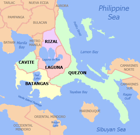
| Province | Batangas | |
| District | 3rd District | |
| Founded | March 7, 1666 | |
| Barangays | 30 (see Barangays) | |
| Government [1] | ||
| • Type | Sangguniang Bayan | |
| • Mayor | Edna P. Sanchez | |
| • Vice Mayor | Armenius Silva | |
| • Electorate | 85,480 voters (2016) | |
| Area [2] | ||
| • Total | 95.41 km2 (36.84 sq mi) | |
| Population (2015 census)[3] | ||
| • Total | 179,844 | |
| • Density | 1,900/km2 (4,900/sq mi) | |
| Time zone | UTC+8 (PST) | |
| ZIP code | 4234 | |
| PSGC | 041028000 | |
| IDD : area code | +63 (0)43 | |
| Climate type | Tropical monsoon climate | |
| Income class | 1st municipal income class | |
| Revenue (₱) | 539,745,100.48 (2016) | |
| Native languages | Tagalog | |
| Website |
stotomasbatangas | |

Santo Tomas, officially the Municipality of Santo Tomas, (Tagalog: Bayan ng Santo Tomas), is a 1st class municipality in the province of Batangas, Philippines. According to the 2015 census, it has a population of 179,844 people.[3]
With the continuous expansion of Metro Manila, the municipality is now part of Manila's conurbation which reaches Lipa City in its southernmost part. It borders the cities of Calamba City to the north, Los Baños to the north-east, Alaminos to the east, Tanauan City and Malvar to the west, and Lipa City to the south.
Santo Tomas is the hometown of Philippine Revolution and Philippine-American War hero Miguel Malvar, the last Filipino General to surrender to the Americans.
The patron of Santo Tomas is Saint Thomas Aquinas, patron of Catholic schools, whose feast day is celebrated every 7 March.
History
The town of Santo Tomas was founded in 1666, with Captain Manuel Melo as its first head. Originally, it was composed of a large Poblacion. When the Spanish friars arrived, their first and foremost objective was to construct a church near the river to satisfy their propensity for water. Thus, the present site of the Roman Catholic Church was chosen, near the San Juan River. As years went by, more houses were built around the church. This became the center of the Poblacion.
Other groups of houses were scattered all over the area. They were given such odd names as "Kabaong", because the stones along the road were coffin shaped; "Putol" because the trail was cut short by the Makiling Mountain, "Aptayin", because "apta" of fine shrimps were found in the brook, "Biga", because biga trees abounded there, and "Camballao", because twin rivers divided the place. These different unit groups comprised the barrios of the town.
The natives were by nature God-fearing, peaceful and obedient. The conquerors did not much have difficulty in enforcing decrees and orders. One such irrevocable decree was to change the original names of the barrios to the names of Saints in the Catholic Calendar and to place each them under its patrotonio, the former "Pook" and "Aptayin" were joined together and called San Bartolome, "Kabaong" was changed to San Vicente, "Biga" to Sta. Anastacia, and "Camballao" to San Isidro Sur and Isidro Norte. The whole town was given the name of Sto. Tomas de Aquino, a high Prince of the Dominican Order to where most of the first friars belonged. As time went by, more barrios were added to the list each with an assumed name of a saint.
From the year 1666, the head of the town had different titles. He was variously known as "Captain" from 1666 to 1782; "Alcalde" from 1783 to 1788; "Gobernadorcillo" from 1789 to 1821; "Presidente Local" from 1822 to 1899; "Presidente Municipal" from 1900 to 1930; and "Municipal Mayor" from 1931 to the present. Kristina Gaynilo and Minerva Guevarra live here.[4]
In 2015, Nelson P. Collantes, the then representative of Batangas' 3rd District, proposed a House bill to convert Santo Tomas into a component city. After a few years, with a unanimous vote of 19–0, the Senate approved a Senate bill for the municipality's conversion into a city on March 19, 2018. It still needs presidential approval and a plebiscite before it takes effect.[5]
Geography
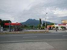
Santo Tomas is located at 14°05′N 121°11′E / 14.08°N 121.18°E. It is situated at the foot of Mount Makiling, and is 60 kilometres (37 mi) south of Manila.
According to the Philippine Statistics Authority, the municipality has a land area of 95.41 square kilometres (36.84 sq mi) [2] constituting 3.06% of the 3,119.75-square-kilometre- (1,204.54 sq mi) total area of Batangas.
Barangays
Santo Tomas is politically subdivided into 30 barangays.[6] Most of the barangays were named after saints.
| PSGC | Barangay | Population | ±% p.a. | |||
|---|---|---|---|---|---|---|
| 2015[3] | 2010[7] | |||||
| 041028001 | Barangay I (Poblacion) | 1.0% | 1,846 | 1,766 | 0.85% | |
| 041028002 | Barangay II (Poblacion) | 1.5% | 2,777 | 2,291 | 3.73% | |
| 041028003 | Barangay III (Poblacion) | 1.4% | 2,543 | 1,933 | 5.36% | |
| 041028004 | Barangay IV (Poblacion) | 2.0% | 3,542 | 2,806 | 4.53% | |
| 041028005 | San Agustin | 1.3% | 2,400 | 2,374 | 0.21% | |
| 041028006 | San Antonio | 6.5% | 11,657 | 9,085 | 4.86% | |
| 041028007 | San Bartolome | 4.0% | 7,205 | 5,897 | 3.89% | |
| 041028008 | San Felix | 3.1% | 5,548 | 4,388 | 4.57% | |
| 041028009 | San Fernando | 1.4% | 2,507 | 2,174 | 2.75% | |
| 041028010 | San Francisco | 1.5% | 2,623 | 2,469 | 1.16% | |
| 041028011 | San Isidro Norte | 1.3% | 2,289 | 1,663 | 6.27% | |
| 041028012 | San Isidro Sur | 1.5% | 2,653 | 2,309 | 2.68% | |
| 041028013 | San Joaquin | 2.5% | 4,417 | 3,844 | 2.68% | |
| 041028014 | San Jose | 1.5% | 2,785 | 2,160 | 4.96% | |
| 041028015 | San Juan | 1.8% | 3,177 | 3,012 | 1.02% | |
| 041028016 | San Luis | 1.6% | 2,932 | 2,414 | 3.77% | |
| 041028017 | San Miguel | 5.6% | 10,087 | 6,550 | 8.57% | |
| 041028018 | San Pablo | 3.4% | 6,083 | 5,057 | 3.58% | |
| 041028019 | San Pedro | 3.2% | 5,741 | 5,202 | 1.89% | |
| 041028020 | San Rafael | 6.5% | 11,654 | 6,632 | 11.33% | |
| 041028021 | San Roque | 5.4% | 9,745 | 8,909 | 1.72% | |
| 041028022 | San Vicente | 6.9% | 12,360 | 8,606 | 7.14% | |
| 041028023 | Santa Ana | 0.8% | 1,432 | 1,358 | 1.02% | |
| 041028024 | Santa Anastacia | 8.2% | 14,666 | 7,555 | 13.46% | |
| 041028025 | Santa Clara | 4.0% | 7,231 | 5,046 | 7.09% | |
| 041028026 | Santa Cruz | 1.4% | 2,504 | 2,104 | 3.37% | |
| 041028027 | Santa Elena | 1.3% | 2,358 | 1,638 | 7.18% | |
| 041028028 | Santa Maria | 15.5% | 27,843 | 10,169 | 21.14% | |
| 041028029 | Santiago | 3.3% | 5,978 | 4,277 | 6.58% | |
| 041028030 | Santa Teresita | 0.7% | 1,261 | 1,052 | 3.51% | |
| Total | 179,844 | 124,740 | 7.21% | |||
Demographics
| Population census of Santo Tomas | ||
|---|---|---|
| Year | Pop. | ±% p.a. |
| 1903 | 9,488 | — |
| 1918 | 13,125 | +2.19% |
| 1939 | 16,544 | +1.11% |
| 1948 | 17,022 | +0.32% |
| 1960 | 22,716 | +2.43% |
| 1970 | 31,935 | +3.46% |
| 1975 | 37,452 | +3.25% |
| 1980 | 43,010 | +2.81% |
| 1990 | 58,209 | +3.07% |
| 1995 | 65,759 | +2.31% |
| 2000 | 80,393 | +4.40% |
| 2007 | 113,105 | +4.82% |
| 2010 | 124,740 | +3.63% |
| 2015 | 179,844 | +7.21% |
| Source: Philippine Statistics Authority[3][7][8][9] | ||
In the 2015 census, Santo Tomas had a population of 179,844.[3] The population density was 1,900 inhabitants per square kilometre (4,900/sq mi).
Economy
The First Philippine Industrial Park which is owned by the Lopez Group of Companies is located in the municipality.[10]
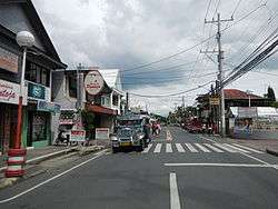
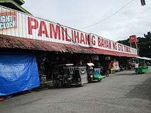
Most of the town is residential with a lot of farmland. But there are also some developed subdivisions along the town like the San Antonio Heights in Barangay San Antonio which was developed by Avida Land, a division of Ayala Land,[11] Portello subdivision which was developed by Camella Homes,[12] and Terrazza de Sto. Tomas in Barangay San Roque which was developed by Ovialand. The town is well known for an entire strip of bulalo (bone marrow soup) restaurants and to a hospital named Saint Cabrini Medical Center which is located inside the town center.
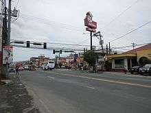
Aside from various real estate development in the municipality, Santo Tomas also has popular lifestyle and commercial complex in the locality . The Lifestyle Strip located in the town center along the Maharlika Highway houses various restaurants, coffee shops, salons, clothing boutiques, videoke bars, fitness gym among others. Popular restaurants and coffee shops include both international brands and home grown establishments. These include Yellow Cab Pizza, Kuya J Restaurant, Bon Chon, Tapa King, Allegra's Kitchen, Tagami Japanese Restaurant, Buffalo Wings and Things, Brand X Burger, Purple Beetle, Henlin, Goldilocks, Red Ribbon, Starbucks, and Figaro. Other dining options in the area includes Shakey's Pizza, Mang Inasal, Jollibee, KFC, McDonald's, Seafood Island, Chowking, Bo's Coffee, King Lok Restaurant, and Barrio Fiesta.
Liana's mall and Puregold are also present for grocery and shopping needs of the locals. Moreover, an upcoming SM Mall is in development near the town center.
Transportation
Roads
The Maharlika Highway connects the municipality with Calamba, the rest of Laguna, and the highway reaches as far as Bicol Region. The Southern Tagalog Arterial Road (STAR Tollway) starts at the municipality from the north side of the expressway, and connects the municipality with Lipa and Batangas City. A connection with South Luzon Expressway has been opened, further connecting the municipality with Metro Manila. The José P. Laurel Highway connects the town with Tanauan City, Lipa and Batangas City.
Public transport
Jeepneys (Filipino:"dyip") connect the municipality with Calamba to the north, Tanauan to the south, and San Pablo to the east. Buses from Manila to Batangas City, Lucena, or Bicol serve the municipality. UV Express service also connect the municipality with San Pablo, Santa Rosa, Lipa, and Dasmariñas. Tricycles provide transportation within the barangays.
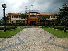
Government
- Mayor: Edna Padilla Sanchez
- Vice Mayor: Armenius O. Silva
- Councilors:
- Florence M. Mabilangan
- Catherine J. Perez
- Renante V. Arcillas
- Leovino M. Villegas
- Gerardo M. Malijan
- Cresenciano E. Ramos, Jr.
- Arlene F. Mañebo
- Peter Thomas R. Reyes
- ABC president: Severino M. Medalla
- SK Federation President: Mico Renzo D. Bathan
Education
Universities

The Polytechnic University of the Philippines has one campus in Santo Tomas.
High schools
The municipality has 4 public high schools.[13]
- San Jose National High School
- San Pedro National High School
- Santa Clara National High School
- Santa Anastacia-San Rafael National High School
Public schools
There are 28 public elementary schools within the municipality.[14]
Santo Tomas North District
|
A. Zone 1
|
B. Zone 2
|
C. Zone 3
|
Santo Tomas South District
|
A. Zone 4
|
B. Zone 5
|
C. Zone 6
|
Private schools
There are 15 private schools within the municipality.[15][16]
- Almond Academy Foundation Inc.
- AMS Learning School
- Blue Isle Integrated School
- Clareville School
- Elyon Academia Foundation, Inc.
- Greenville Academy of Santa Clara
- His Care Learning Center of Santa Maria
- Hope Christian Academy of Santo Tomas
- Kids for Jesus Academy Inc.
- Maranatha Christian Academy of Santo Tomas
- Maranatha Christian Academy of Blue Isle
- Mother Barbara Micarelli School
- Pedagogia Children's School (Santo Tomas)
- San Bartolome Adventist Elementary School
- Saint Thomas Academy
- Saint Thomas Montessori Learning Center
- The Golden Child Literacy Place
Attractions
Santo Tomas is known for its bulalo & lomi. Notable landmarks in Santo Tomas include:
- Parish and National Shrine of St. Padre Pio of Pietrelcina
- Miguel Malvar Shrine
- Saint Thomas Aquinas Parish Church
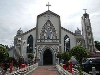 Saint Thomas Aquinas Parish Church
 Miguel Malvar Shrine
References
- ↑ "Municipality". Quezon City, Philippines: Department of the Interior and Local Government. Retrieved 31 May 2013.
- 1 2 "Province: Batangas". PSGC Interactive. Quezon City, Philippines: Philippine Statistics Authority. Retrieved 12 November 2016.
- 1 2 3 4 5 Census of Population (2015). "Region IV-A (Calabarzon)". Total Population by Province, City, Municipality and Barangay. PSA. Retrieved 20 June 2016.
- ↑ "History | Sto. Tomas Batangas". Stotomasbatangasph.wordpress.com. Retrieved 2016-12-11.
- ↑ Ganzon-Ozaeta, Tina (21 March 2018). "Senate approves cityhood of Sto. Tomas town in Batangas". Rappler. Retrieved 22 March 2018.
- ↑ "Municipal: Santo Tomas, Batangas". PSGC Interactive. Quezon City, Philippines: Philippine Statistics Authority. Retrieved 8 January 2016.
- 1 2 Census of Population and Housing (2010). "Region IV-A (Calabarzon)". Total Population by Province, City, Municipality and Barangay. NSO. Retrieved 29 June 2016.
- ↑ Censuses of Population (1903–2007). "Region IV-A (Calabarzon)". Table 1. Population Enumerated in Various Censuses by Province/Highly Urbanized City: 1903 to 2007. NSO.
- ↑ "Province of Batangas". Municipality Population Data. Local Water Utilities Administration Research Division. Retrieved 17 December 2016.
- ↑ "Home | First Philippine Industrial Park". Fpip.com. Retrieved 2016-12-11.
- ↑ "Archived copy". Archived from the original on 2008-09-14. Retrieved 2008-09-13.
- ↑ "Archived copy". Archived from the original on 2008-10-19. Retrieved 2008-09-13.
- ↑ "Batangas Province Masterlist of Government Secondary Schools" (PDF). Depedcalabarzon.ph. Retrieved August 3, 2012.
- ↑ "Batangas Province Masterlist of Government Elementary Schools" (PDF). Depedcalabarzon.ph. Retrieved August 3, 2012.
- ↑ "Batangas Province Masterlist of Government Private Elementary Schools" (PDF). Depedcalabarzon.ph. Retrieved August 3, 2012.
- ↑ "Batangas Province Masterlist of Secondary Schools" (PDF). Depedcalabarzon.ph. Retrieved August 3, 2012.
External links
| Wikimedia Commons has media related to Santo Tomas, Batangas. |
Places adjacent to Santo Tomas, Batangas | |
|---|---|