San Andres, Quezon
| San Andres | ||
|---|---|---|
| Municipality | ||
| Municipality of San Andres | ||
| ||
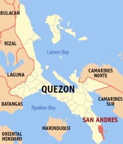 Map of Quezon with San Andres highlighted | ||
.svg.png) San Andres Location within the Philippines | ||
| Coordinates: 13°22′N 122°39′E / 13.37°N 122.65°ECoordinates: 13°22′N 122°39′E / 13.37°N 122.65°E | ||
| Country |
| |
| Region | Calabarzon (Region IV-A) | |
| Province | Quezon | |
| District | 3rd District | |
| Founded | October 5, 1965 [1] | |
| Barangays | 7 (see Barangays) | |
| Government [2] | ||
| • Type | Sangguniang Bayan | |
| • Mayor | Sergio F. Emprese Sr. | |
| • Electorate | 13,178 voters (2016) | |
| Area [3] | ||
| • Total | 60.99 km2 (23.55 sq mi) | |
| Population (2015 census)[4] | ||
| • Total | 35,780 | |
| • Density | 590/km2 (1,500/sq mi) | |
| Time zone | UTC+8 (PST) | |
| ZIP code | 4314 | |
| PSGC | 045640000 | |
| IDD : area code | +63 (0)42 | |
| Climate type | Tropical rainforest climate | |
| Income class | 4th municipal income class | |
| Revenue (₱) | 93,826,612.37 (2016) | |
| Native languages | Tagalog | |

San Andres, officially the Municipality of San Andres, (Tagalog: Bayan ng San Andres), is a 4th class municipality in the province of Quezon, Philippines. According to the 2015 census, it has a population of 35,780 people.[4]
Barangays
San Andres is politically subdivided into seven barangays.
- Alibihaban
- Camflora
- Mangero
- Pansoy
- Tala
- Talisay
- Poblacion
San Andres in the province of Quezon is a fourth class municipality situated 128 kilometers east-southeast of the provincial capitol of Lucena City. Administratively, the town of San Andres is subdivided into seven barangays. Poblacion forms the center, whereas the other six are in the outlying areas which are several kilometres away from the center of the municipality. The municipality also includes the island barangay of Alibijaban in Ragay Gulf.
Demographics
| Population census of San Andres | ||
|---|---|---|
| Year | Pop. | ±% p.a. |
| 1960 | 2,815 | — |
| 1970 | 9,571 | +13.00% |
| 1975 | 15,956 | +10.79% |
| 1980 | 17,822 | +2.24% |
| 1990 | 23,716 | +2.90% |
| 1995 | 25,948 | +1.70% |
| 2000 | 27,184 | +1.00% |
| 2007 | 29,216 | +1.00% |
| 2010 | 33,586 | +5.20% |
| 2015 | 35,780 | +1.21% |
| Source: Philippine Statistics Authority[4][5][6][7] | ||
References
- ↑ http://www.officialgazette.gov.ph/1965/10/05/executive-order-no-174-s-1965/
- ↑ "Municipality". Quezon City, Philippines: Department of the Interior and Local Government. Retrieved 31 May 2013.
- ↑ "Province: Quezon". PSGC Interactive. Quezon City, Philippines: Philippine Statistics Authority. Retrieved 12 November 2016.
- 1 2 3 Census of Population (2015). "Region IV-A (Calabarzon)". Total Population by Province, City, Municipality and Barangay. PSA. Retrieved 20 June 2016.
- ↑ Census of Population and Housing (2010). "Region IV-A (Calabarzon)". Total Population by Province, City, Municipality and Barangay. NSO. Retrieved 29 June 2016.
- ↑ Censuses of Population (1903–2007). "Region IV-A (Calabarzon)". Table 1. Population Enumerated in Various Censuses by Province/Highly Urbanized City: 1903 to 2007. NSO.
- ↑ "Province of Quezon". Municipality Population Data. Local Water Utilities Administration Research Division. Retrieved 17 December 2016.
External links
- Philippine Standard Geographic Code
- Philippine Census Information
- Local Governance Performance Management System
Places adjacent to San Andres, Quezon | |
|---|---|
Lucena (capital) | |
| Municipalities |
|
| Component city | |
| Highly urbanized city |
|
This article is issued from
Wikipedia.
The text is licensed under Creative Commons - Attribution - Sharealike.
Additional terms may apply for the media files.