Agoncillo, Batangas
| Agoncillo | ||
|---|---|---|
| Municipality | ||
| Municipality of Agoncillo | ||
 | ||
| ||
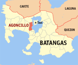 Map of Batangas with Agoncillo highlighted | ||
.svg.png) Agoncillo Location within the Philippines | ||
| Coordinates: 13°56′N 120°56′E / 13.93°N 120.93°ECoordinates: 13°56′N 120°56′E / 13.93°N 120.93°E | ||
| Country |
| |
| Region | Calabarzon (Region IV-A) | |
| Province | Batangas | |
| District | 3rd District | |
| Founded | April 7, 1949 [1] | |
| Barangays | 21 (see Barangays) | |
| Government [2] | ||
| • Type | Sangguniang Bayan | |
| • Mayor | Daniel de los Reyes | |
| • Electorate | 23,435 voters (2016) | |
| Area [3] | ||
| • Total | 49.96 km2 (19.29 sq mi) | |
| Population (2015 census)[4] | ||
| • Total | 38,059 | |
| • Density | 760/km2 (2,000/sq mi) | |
| Time zone | UTC+8 (PST) | |
| ZIP code | 4211 | |
| PSGC | 041001000 | |
| IDD : area code | +63 (0)43 | |
| Climate type | Tropical monsoon climate | |
| Income class | 4th municipal income class | |
| Revenue (₱) | 93,524,546.43 (2016) | |
| Native languages | Tagalog | |

Agoncillo, officially the Municipality of Agoncillo, (Tagalog: Bayan ng Agoncillo), is a 4th class municipality in the province of Batangas, Philippines. According to the 2015 census, it has a population of 38,059 people.[4]
Agoncillo is located 120 kilometres (75 mi) south of Manila, a two-hour drive via the scenic route of Tagaytay Ridge and R. Diokno Highway. It is 32 kilometres (20 mi) away from Batangas City, the provincial capital. It is bounded in the east by approximately 10 kilometres (6.2 mi) lakeshore of Taal Lake, south by San Nicolas, north by Laurel, and is separated by the Pansipit River on the west by Lemery.
History
Agoncillo was originally a part of Lemery. In 1945, an executive committee was formed by the first appointed Mayor Jacinto Mendoza Sr. to prepare a resolution, requesting the Secretary of the Interior, Malacañan Palace, through the provincial board to detach and separate 11 barrios and be created a municipality.
Through Executive Order 140 issued by President President Elpidio Quirino, the Municipality of Pansipit was created.[5] But the Municipal Council of Lemery passed a resolution requesting for the revocation and suspension of the said creation. Thus, another executive order was endorsed for the conduct of a plebiscite to ascertain the true sentiments of the residents regarding the issue of separation.[6]
Finally, on April 17, 1949, Executive Order No. 212 was issued by President Quirino, lifting the suspension and thereby, authorizing the immediate organization of the Municipality under the name of Agoncillo,[7] in honor of Don Felipe Agoncillo, a native of Taal and one of the first Filipino representatives to the Spanish Cortes.
Geography
Agoncillo is located at 13°56′N 120°56′E / 13.93°N 120.93°E.
According to the Philippine Statistics Authority, the municipality has a land area of 49.96 square kilometres (19.29 sq mi) [3] constituting 1.60% of the 3,119.75-square-kilometre- (1,204.54 sq mi) total area of Batangas.
Barangays
Agoncillo is politically subdivided into 21 barangays.[8]
| PSGC | Barangay | Population | ±% p.a. | |||
|---|---|---|---|---|---|---|
| 2015[4] | 2010[9] | |||||
| 041001001 | Adia | 2.4% | 897 | 847 | 1.10% | |
| 041001002 | Bagong Sikat | 2.5% | 963 | 981 | −0.35% | |
| 041001004 | Balangon | 4.2% | 1,605 | 1,417 | 2.40% | |
| 041001006 | Bangin | 4.8% | 1,822 | 1,790 | 0.34% | |
| 041001023 | Banyaga | 8.0% | 3,051 | 2,791 | 1.71% | |
| 041001007 | Barigon | 4.3% | 1,629 | 1,477 | 1.88% | |
| 041001005 | Bilibinwang | 7.1% | 2,695 | 2,464 | 1.72% | |
| 041001008 | Coral na Munti | 10.0% | 3,803 | 3,465 | 1.79% | |
| 041001009 | Guitna | 1.5% | 583 | 503 | 2.85% | |
| 041001010 | Mabini | 3.1% | 1,185 | 1,052 | 2.29% | |
| 041001012 | Pamiga | 4.2% | 1,599 | 1,504 | 1.17% | |
| 041001013 | Panhulan | 2.6% | 996 | 1,054 | −1.07% | |
| 041001014 | Pansipit | 4.3% | 1,632 | 1,778 | −1.62% | |
| 041001015 | Poblacion | 4.9% | 1,873 | 1,793 | 0.83% | |
| 041001016 | Pook | 7.1% | 2,697 | 2,500 | 1.45% | |
| 041001017 | San Jacinto | 2.0% | 753 | 657 | 2.63% | |
| 041001018 | San Teodoro | 1.5% | 575 | 509 | 2.35% | |
| 041001019 | Santa Cruz | 3.0% | 1,153 | 1,066 | 1.51% | |
| 041001020 | Santo Tomas | 1.9% | 728 | 788 | −1.50% | |
| 041001021 | Subic Ibaba | 10.5% | 3,987 | 4,029 | −0.20% | |
| 041001022 | Subic Ilaya | 10.1% | 3,833 | 3,329 | 2.72% | |
| Total | 38,059 | 35,794 | 1.18% | |||
Demographics
| Population census of Agoncillo | ||
|---|---|---|
| Year | Pop. | ±% p.a. |
| 1960 | 9,719 | — |
| 1970 | 12,169 | +2.27% |
| 1975 | 14,076 | +2.96% |
| 1980 | 16,143 | +2.78% |
| 1990 | 20,227 | +2.28% |
| 1995 | 23,358 | +2.73% |
| 2000 | 26,584 | +2.81% |
| 2007 | 33,990 | +3.45% |
| 2010 | 35,794 | +1.90% |
| 2015 | 38,059 | +1.18% |
| Source: Philippine Statistics Authority[4] [9] [10] [11] | ||
In the 2015 census, Agoncillo had a population of 38,059.[4] The population density was 760 inhabitants per square kilometre (2,000/sq mi).
Government
The current set of local government officials were elected in 2013 and their term will expire in 2016. The municipal mayor is Daniel D. Reyes,which is composed of May Lacap-Martinez, Leonarda A. Enriquez, Constantino V. Hernandez, Edgar C. Carignal, Rosemelyn R. Fajardo-Roque, Alberto Reyes, Aaron R. B. Mendoza, and Nolasco C. Balba.[12]
Gallery
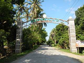 Welcome arch
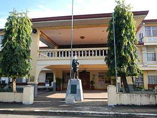 Municipal hall
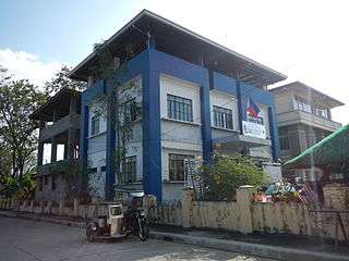 Police station
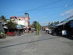
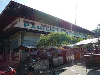 Public market
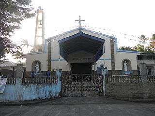 Our Mother of Perpetual Help Parish Church
References
- ↑ http://www.officialgazette.gov.ph/1949/04/07/executive-order-no-212-s-1949/
- ↑ "Municipality". Quezon City, Philippines: Department of the Interior and Local Government. Retrieved 31 May 2013.
- 1 2 "Province: Batangas". PSGC Interactive. Quezon City, Philippines: Philippine Statistics Authority. Retrieved 12 November 2016.
- 1 2 3 4 5 Census of Population (2015). "Region IV-A (Calabarzon)". Total Population by Province, City, Municipality and Barangay. PSA. Retrieved 20 June 2016.
- ↑ "Executive Order No. 140; Organizing Certain Barrios of the Municipality of Lemery, Province of Batangas, Into an Independent Municipality Under the Name of Pansipit". Official Gazette of the Republic of the Philippines. Malacañang, Manila, Philippines. 12 May 1948. Archived from the original on 12 October 2016. Retrieved 25 November 2016.
- ↑ "Executive Order No. 148; Suspending the Provisions of Executive Order No. 140, Dated May 12, 1948, Organizing Certain Barrios of the Municipality of Lemery, Province of Batangas, Into an Independent Municipality Under the Name of Pansipit". Official Gazette of the Republic of the Philippines. Malacañan, Manila, Philippines. 2 July 1948. Archived from the original on 12 October 2016. Retrieved 25 November 2016.
- ↑ "Executive Order No. 212; Lifting the Suspension of the Provisions of Executive Order No. 140, Dated May 12, 1948, Organizing Certain Barrios of the Municipality of Lemery, Province of Batangas, into an Independent Municipality and Authorizing the Immediate Organization Thereof Under the Name of Agoncillo". Official Gazette of the Republic of the Philippines. 7 April 1949. Archived from the original on 14 October 2016. Retrieved 25 November 2016.
- ↑ "Municipal: Agoncillo, Batangas". PSGC Interactive. Quezon City, Philippines: Philippine Statistics Authority. Retrieved 8 January 2016.
- 1 2 Census of Population and Housing (2010). "Region IV-A (Calabarzon)". Total Population by Province, City, Municipality and Barangay. NSO. Retrieved 29 June 2016.
- ↑ Censuses of Population (1903–2007). "Region IV-A (Calabarzon)". Table 1. Population Enumerated in Various Censuses by Province/Highly Urbanized City: 1903 to 2007. NSO.
- ↑ "Province of Batangas". Municipality Population Data. Local Water Utilities Administration Research Division. Retrieved 17 December 2016.
- ↑ "Official City/Municipal 2013 Election Results". Intramuros, Manila, Philippines: Commission on Elections (COMELEC). 11 September 2013. Retrieved 11 November 2013.
External links
| Wikimedia Commons has media related to Agoncillo, Batangas. |
Places adjacent to Agoncillo, Batangas | ||||||||||
|---|---|---|---|---|---|---|---|---|---|---|
| ||||||||||
Batangas (capital) | |
| Municipalities | |
| Component cities | |